Natural landmarks · Northern Ireland
Knocknahunshin
Also known as: Cnoc na hUinseann
In or near Derrygonnelly.
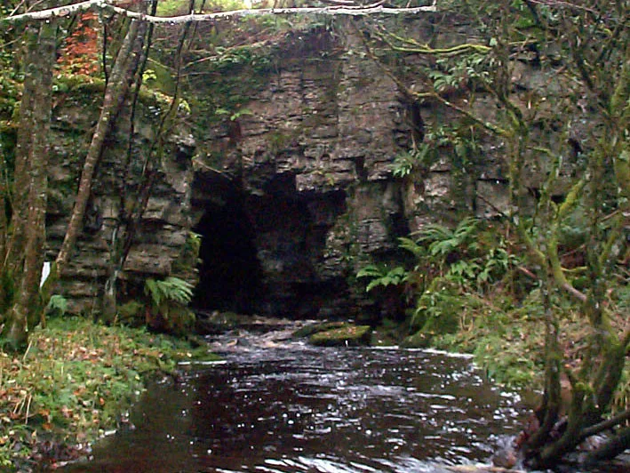
Knocknahunshin in Northern Ireland, United Kingdom.

Dean Molyneaux — CC BY-SA 2.0 via Wikimedia Commons licence
Plan your visit
- Typical visit
- 1 h–2 h
- Free entry
- Dog-friendly
About
Knocknahunshin is a place of interest in Northern Ireland, United Kingdom — drawn from open-data sources for visitor reference. See the linked Wikipedia article for the full description.
Photo gallery
From the Wikipedia article
Knocknahunshin (from Irish Cnoc na hUinseann 'the hill of the ash trees'), is a townland in County Fermanagh, Northern Ireland. It is in the civil parish of Boho, in between the townlands of Glenkeel and Reyfad. Within this area are the sub-townlands of Arduagh, Carricknamulloge (from Irish Carraig na Mullóige), Carricknine, Horse Rock, Legloughra, Owneyglas, Silkins and Sterrickinard. This area is mentioned as far back as 1672 as "K:nahinshina" in the Barony of Magheraboy. Later on, in 1834, it was referred to by its Irish name of Cnoc na h-Uinnsean meaning "ridge of the ash trees".
Excerpt from Wikipedia under CC BY-SA 4.0. See the source article linked in Sources below.
- Coordinates
- 54.3500, -7.7960
- District
- Fermanagh and Omagh
- Postcode
- BT74 5AG
- Parliamentary constituency
- Fermanagh and South Tyrone
Sources
- wikidata: Q4121989 (CC0)
- wikipedia: Knocknahunshin (CC BY-SA 4.0)
Other places nearby
Boho
Natural landmarks · 0.0 km
Boho Caves
Mountains & hills · 0.5 km

Aghaherrish
Natural landmarks · 0.5 km
Drummacoorin
Natural landmarks · 0.7 km

Carn
Natural landmarks · 0.9 km

Kilnamaddoo
Natural landmarks · 1.4 km

Pollnagollum Cave
Caves · 1.8 km

Drumboy
Villages · 1.9 km

Aghahoorin
Natural landmarks · 1.9 km

Ross Lough
Lakes · 2.0 km

Carr
Natural landmarks · 2.6 km

Moylehid
Natural landmarks · 2.6 km
Nearby
📷 4📷 3📷 2Natural landmarks · Northern Ireland
Aghaherrish
Aghaherrish in Northern Ireland, United Kingdom.
📷 3Natural landmarks · Northern Ireland
Drummacoorin
Drummacoorin in Northern Ireland, United Kingdom.
📷 3📷 2Natural landmarks · Northern Ireland
Kilnamaddoo
Kilnamaddoo in Northern Ireland, United Kingdom.
Where to eat & stay near Knocknahunshin
Places to stay
 📷 5
📷 5Caravan parks · Northern Ireland
Rushin House Caravan Park
Rushin House Caravan Park — a caravan park in northern ireland.
 📷 5
📷 5Hotels · Northern Ireland
Lough Erne Golf Resort
Lough Erne Golf Resort — a hotel in northern ireland.
 📷 4
📷 4Caravan parks · Northern Ireland
Riverside Farm, Marina & Caravan Park
Riverside Farm, Marina & Caravan Park — a caravan park in northern ireland.
 📷 5
📷 5Caravan parks · Northern Ireland
Drumhoney Holiday Park
Drumhoney Holiday Park — a caravan park in northern ireland.
 📷 5
📷 5 📷 5
📷 5Caravan parks · Northern Ireland
Clareview Caravan Park
Clareview Caravan Park — a caravan park in northern ireland.
More natural landmarks in this region
 Flagship📷 4
Natural landmarks · Northern Ireland
Lough Erne
Lough Erne — lake in County Fermanagh, Northern Ireland, UK.
 Flagship📷 4
Natural landmarks · Northern Ireland
Lough Neagh
Lough Neagh — large lake in Northern Ireland.
 📷 3
📷 3Natural landmarks · Northern Ireland
Ballysaggart Lough
Ballysaggart Lough — lake in the United Kingdom.
 📷 5
📷 5Natural landmarks · Northern Ireland
Belmore Mountain
Belmore Mountain — mountain in the United Kingdom.
Frequently asked questions
- Where is Knocknahunshin?
- Knocknahunshin is in Northern Ireland, United Kingdom (postcode BT74 5AG).
- What is Knocknahunshin?
- Knocknahunshin in Northern Ireland, United Kingdom.
- How do I get to Knocknahunshin?
- Drivers can use postcode BT74 5AG.
- Is Knocknahunshin free to visit?
- Yes, Knocknahunshin is free to enter.
- How do I get to Knocknahunshin?
- Drivers can navigate to postcode BT74 5AG. It sits within the Fermanagh and South Tyrone parliamentary constituency.