
Forts · South Wales
Morfa Bychan WW2 fortifications
Morfa Bychan WW2 fortifications — Historic fort, dating to 1940.

Alan Bowring — CC BY-SA 2.0 via Wikimedia Commons licence

Plan your visit
- Typical visit
- 45 min–1.5 h
- Nearest railway station
- Whitland · 9.2 km
About
Morfa Bychan WW2 fortifications is a historic fort or fortified site in the United Kingdom. Wikidata describes it as: "Historic fort, dating to 1940.". Coordinates: 51.7393°, -4.5720°.
Photo gallery
Place summary
Morfa Bychan WW2 fortifications are located in South Wales, within the parish of Pendine. These military structures were built during the Second World War to defend the coastline.
AI-generated from the structured facts on this page (operator, designation, listing, era). Not a substitute for visiting.
- Coordinates
- 51.7393, -4.5720
- District
- Carmarthenshire
- Parish
- Pendine
- Postcode
- SA33 4PA
- Parliamentary constituency
- Caerfyrddin
- Nearest railway station
- Whitland — 9.2 km
Sources
- osm: w923073914 (ODbL)
Other places nearby

Gilman Point and Napps Circle
Vineyards · 0.3 km

Thorning Farm Glamping and Camping
Campsites · 0.6 km

Pendine
Villages · 0.9 km

Pendine Sands Holiday Park
Caravan parks · 1.0 km

Amgueddfa Cyflymder - Museum of Land Speed
Museums · 1.2 km

Grove Holiday Park
Caravan parks · 1.3 km

Morfa Bay Adventure Park
Theme parks · 1.3 km

Pendine Sands Holiday Park
Caravan parks · 1.8 km
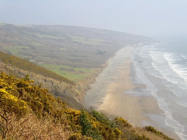
Marros Sands
Beaches · 1.9 km

Marros Beacon
Mountains & hills · 2.1 km

The War Memorial, Marros
Memorials & monuments · 2.2 km

Church of Saint Lawrence
Historic churches · 2.2 km
Nearby
📷 5Vineyards · South Wales
Gilman Point and Napps Circle
Gilman Point and Napps Circle — a UK vineyard in wales south, producing English or Welsh wine from cool-climate grape varieties.
📷 5Campsites · South Wales
Thorning Farm Glamping and Camping
Thorning Farm Glamping and Camping — a campsite in wales south.
📷 5📷 5Caravan parks · South Wales
Pendine Sands Holiday Park
Pendine Sands Holiday Park — a caravan park in wales south. Brand: Parkdean Resorts.
📷 3Museums · South Wales
Amgueddfa Cyflymder - Museum of Land Speed
Amgueddfa Cyflymder - Museum of Land Speed — a museum in wales-south, United Kingdom.
📷 5Where to eat & stay near Morfa Bychan WW2 fortifications
Places to stay
📷 5Campsites · South Wales
Thorning Farm Glamping and Camping
Thorning Farm Glamping and Camping — a campsite in wales south.
📷 5Caravan parks · South Wales
Pendine Sands Holiday Park
Pendine Sands Holiday Park — a caravan park in wales south. Brand: Parkdean Resorts.
📷 5📷 4Caravan parks · South Wales
Pendine Sands Holiday Park
Pendine Sands Holiday Park — a caravan park in wales south.
 📷 3📷 2
Places to eat & drink
 📷 7
📷 7Restaurants · South Wales
The Stone Crab
The Stone Crab — a restaurant in wales south.
 📷 7
📷 7 📷 3
📷 3 📷 3
📷 3More forts in this region
 📷 3
📷 3Forts · South Wales
Battle of Carn Mountain 1081
Battle of Carn Mountain 1081 is a fort in the United Kingdom.
 📷 3
📷 3 📷 3
📷 3 📷 3
📷 3Frequently asked questions
- Where is Morfa Bychan WW2 fortifications?
- Morfa Bychan WW2 fortifications is in South Wales, United Kingdom (postcode SA33 4PA), in the parish of Pendine.
- What is Morfa Bychan WW2 fortifications?
- Morfa Bychan WW2 fortifications — Historic fort, dating to 1940.
- How do I get to Morfa Bychan WW2 fortifications?
- The nearest railway station is Whitland, about 9.2 km away. Drivers can use postcode SA33 4PA.
- How do I get to Morfa Bychan WW2 fortifications?
- Drivers can navigate to postcode SA33 4PA. It sits within the Caerfyrddin parliamentary constituency.