
Towns & cities · East Midlands
Morcott
Morcott — village in Rutland, England, UK.

Wikimedia Commons contributors — see linked file page for photographer and licence licence

Plan your visit
- Typical visit
- 3 h–6 h
- Free entry
- Family-friendly
- Dog-friendly
Getting there & planning your visit
Morcott is located in the West Midlands, with the postcode LE15. Entry to the town is free. There is no nearest railway station mentioned, so please plan your visit accordingly.
About
Morcott is a town, city, village or settlement in the United Kingdom. It covers approximately 2 km². Recent population estimates put it at around 321 people. Address: LE15. Wikidata describes it as: "village in Rutland, England, UK". Coordinates: 52.5970°, -0.6380°.
Photo gallery
From the Wikipedia article
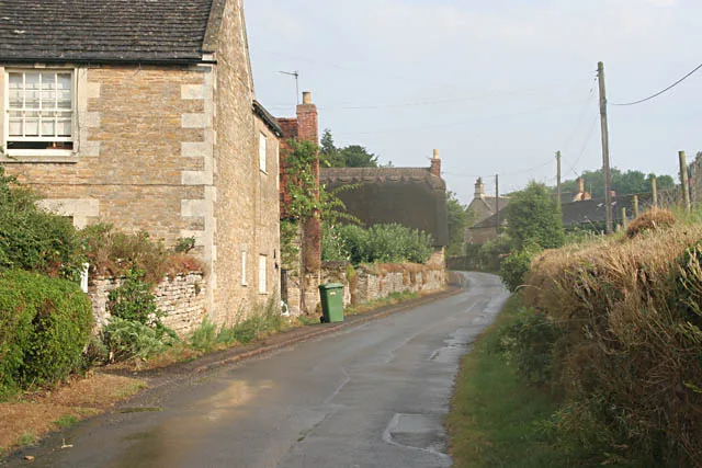
Morcott is a village and civil parish in the county of Rutland in the East Midlands of England. The population at the 2001 census was 329 falling slightly to 321 at the 2011 census. It is located about 7 miles (11 km) south-east of the county town of Oakham on the A47 and A6121 roads. A prominent reconstructed windmill can be seen from both East and West-bound approaches to Morcott along the A47. Rutland County Council designated Morcott a Conservation Area in 1981, one of 34 conservation areas in Rutland which are "of special architectural or historic interest, the character or appearance of which it is desirable to preserve or enhance".
Excerpt from Wikipedia under CC BY-SA 4.0. See the source article linked in Sources below.
Background
History
The village name is an Old English derivation of "a cottage on the moor". The village is recorded as Morcote in the Domesday survey of 1086 and formed part of the king's manor of Barrowden. The village served the manorial interests of several different ownerships but passed to the Fydell Rowley family in the early 19th century. The Church of St Mary is the defining landmark in the village and is regarded as the most complete Norman church in Rutland. The historic origins of the village are associated with agriculture and have resulted in a legacy of good, stone built farmhouses, cottages and outbuildings. Although none of the surviving houses are believed to date from earlier than the 17th…
Architecture
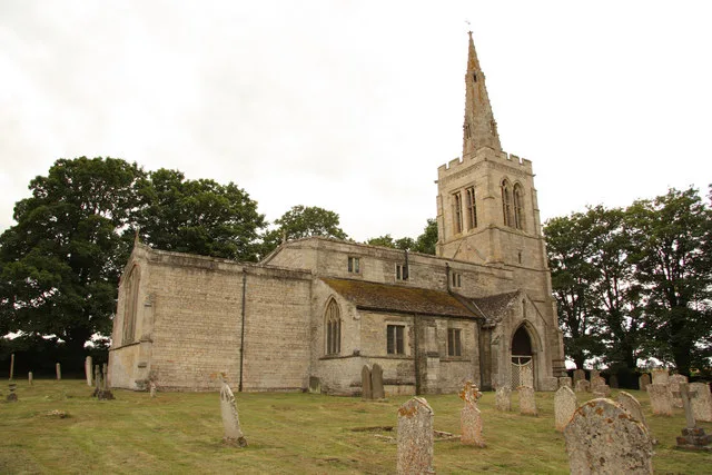
St Mary the Virgin, the parish church, is a Grade I listed building. The Norman church features a 'pancake' window on the west side, and a north arcade considered to be 'the best example of Norman work in the area'. In 2014 Rutland County Council cited additional buildings to those statutorily listed, 'as contributing to the character of the village' in the Morcott Conservation Area Character Appraisal and Management Proposal. but is now again a private house.
Sourced from Wikipedia under CC BY-SA 4.0.
- Coordinates
- 52.5970, -0.6380
- District
- Rutland
- Parish
- Morcott
- Postcode
- LE15
- Parliamentary constituency
- Rutland and Stamford
- Population
- 321
- Official site
- www.visionofbritain.org.uk
Sources
- wikidata: Q1843974 (CC0)
- wikipedia: Morcott (CC BY-SA 4.0)
- commons: St Mary's Church Morecott - geograph.org.uk - 344452.jpg (CC BY-SA 4.0)
Other places nearby

St Mary's Church, Morcott
Historic churches · 0.1 km

Pilton Mound
Castles · 1.6 km

Barrowden Village Sign
Public art & sculpture · 2.0 km

Church of St Mary the Virgin, South Luffenham
Historic churches · 2.1 km

South Luffenham
Historic churches · 2.1 km

South Luffenham Village Sign
Public art & sculpture · 2.2 km
Pilton
Towns & cities · 2.3 km

Church of St Peter
Historic churches · 2.3 km

St Nicholas' Church, Pilton
Historic churches · 2.3 km

Turtle Bridge
Historic bridges · 2.3 km

Barrowden Village Bench Sign
Public art & sculpture · 2.4 km

Bridge Over River Chater
Historic bridges · 2.4 km
Morcott sits in the East Midlands, offering visitors a chance to explore its notable religious and leisure sites. You can visit the Church of St Peter, St John the Baptist's Church in Wakerley, and St Luke's Church in Tixover. For outdoor recreation, the area also features Wakerley Manor and Luffenham Heath Golf Course.
At a glance
- Population
- 321
- Constituency
- Rutland and Stamford
- Top categories near here
Things to see in Morcott
15 attractions within 12 km. Full guide: things to do in Morcott →
📷 4Historic churches · East Midlands
Church of St Peter
Church of St Peter — church in Barrowden, Rutland, United Kingdom.
 📷 5
📷 5Golf courses · East Midlands
Luffenham Heath Golf Course
Luffenham Heath Golf Course is a golf course in the United Kingdom.
 📷 4
📷 4Historic churches · East Midlands
St John the Baptist's Church, Wakerley
St John the Baptist's Church, Wakerley — church in Wakerley, Northamptonshire, England, UK.
 Flagship📷 3
Stately homes · East Midlands
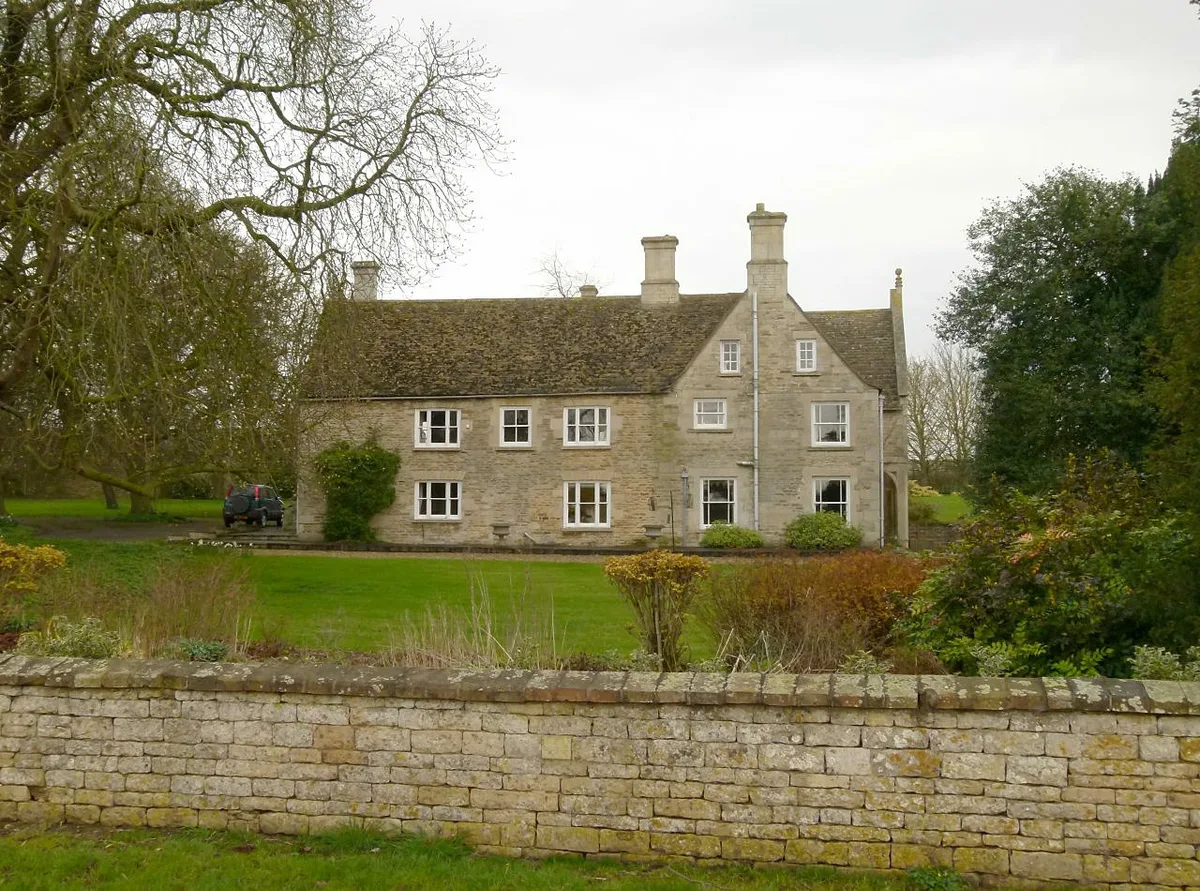
Wakerley Manor
Wakerley Manor — manor house in Wakerley, East Northamptonshire, England, UK.
📷 3Historic bridges · East Midlands
Turtle Bridge
Turtle Bridge — Grade II listed building-listed bridge in england-west-midlands, United Kingdom.
📷 3Public art & sculpture · East Midlands
Barrowden Village Bench Sign
Barrowden Village Bench Sign — a public art in East Midlands, United Kingdom.
📷 3Public art & sculpture · East Midlands
Barrowden Village Sign
Barrowden Village Sign — a public art in East Midlands, United Kingdom.
📷 3Public art & sculpture · East Midlands
South Luffenham Village Sign
South Luffenham Village Sign — a public art in East Midlands, United Kingdom.
 📷 5
📷 5Historic churches · East Midlands
Barrowden
Barrowden is a village in Rutland in the East Midlands of England. The village's name means 'burial-mound hill'. There are a number of barrows in the area. The population of the civil parish was 506
📷 5Historic churches · East Midlands
Church of St Mary the Virgin, South Luffenham
Church of St Mary the Virgin, South Luffenham — a church in england-west-midlands, United Kingdom.
📷 5Historic churches · East Midlands
South Luffenham
South Luffenham — a church in england-west-midlands, United Kingdom.
📷 5Historic churches · East Midlands
St Mary's Church, Morcott
St Mary's Church, Morcott — a church in england-west-midlands, United Kingdom.
 📷 5
📷 5Historic churches · East Midlands
St Luke's Church, Tixover
St Luke's Church, Tixover — a church in england-west-midlands, United Kingdom.
 📷 4
📷 4Mountain bike trails · East Midlands
Wakerly Woods Red Route
Wakerly Woods Red Route — a mtb trail in england west midlands.
 📷 5
📷 5Nearby
📷 5Historic churches · East Midlands
St Mary's Church, Morcott
St Mary's Church, Morcott — a church in england-west-midlands, United Kingdom.
📷 5📷 3Public art & sculpture · East Midlands
Barrowden Village Sign
Barrowden Village Sign — a public art in East Midlands, United Kingdom.
📷 5Historic churches · East Midlands
Church of St Mary the Virgin, South Luffenham
Church of St Mary the Virgin, South Luffenham — a church in england-west-midlands, United Kingdom.
📷 5Historic churches · East Midlands
South Luffenham
South Luffenham — a church in england-west-midlands, United Kingdom.
📷 3Public art & sculpture · East Midlands
South Luffenham Village Sign
South Luffenham Village Sign — a public art in East Midlands, United Kingdom.
Where to eat & stay near Morcott
Places to stay
 📷 5
📷 5Campsites · East Midlands
Wing Hall Camping & Caravan Site
Wing Hall Camping & Caravan Site — a campsite in england west midlands.
 📷 5
📷 5Campsites · East Midlands
Rutland Water Campsite
Rutland Water Campsite — a campsite in england west midlands.
 📷 5
📷 5Campsites · East Midlands
Cuckoo Farm Camp Site
Cuckoo Farm Camp Site — a campsite in england west midlands.
 📷 5
📷 5Campsites · East Midlands
Lyndon Top
Lyndon Top — a campsite in england west midlands.
📷 5Campsites · East Midlands
The Paddock
The Paddock — a campsite in england west midlands.
 📷 5
📷 5Places to eat & drink
 📷 5
📷 5Historic pubs · East Midlands
The White Swan Public House And Attached Carriage Arch
The White Swan Public House And Attached Carriage Arch in England East, United Kingdom.
 📷 5
📷 5Historic pubs · East Midlands
The Hatton Arms Inn
The Hatton Arms Inn in England East, United Kingdom.
 📷 5
📷 5 📷 5
📷 5Historic pubs · East Midlands
The Sun Public House
The Sun Public House in England East Midlands, United Kingdom.
 📷 5
📷 5Historic pubs · East Midlands
The Woolpack Public House
The Woolpack Public House in England East, United Kingdom.
 📷 5
📷 5Historic pubs · East Midlands
The Scotgate Public House
The Scotgate Public House in England East, United Kingdom.
More towns in this region
 📷 5
📷 5 📷 5
📷 5Towns & cities · East Midlands
Marholm
Marholm — village and civil parish in Cambridgeshire, UK.
 📷 5
📷 5Towns & cities · East Midlands
Thornhaugh
Thornhaugh — village and civil parish in Cambridgeshire, UK.
 Flagship📷 4
Towns & cities · East Midlands
Austerfield
Austerfield — village and civil parish in South Yorkshire, England, UK.
Frequently asked questions
- Where is Morcott?
- Morcott is in the East Midlands, United Kingdom (postcode LE15), in the parish of Morcott.
- What is Morcott?
- Morcott — village in Rutland, England, UK.
- How do I get to Morcott?
- Drivers can use postcode LE15.
- Is Morcott free to visit?
- Yes, Morcott is free to enter.
- How do I get to Morcott?
- Drivers can navigate to postcode LE15. It sits within the Rutland and Stamford parliamentary constituency.