
Historic churches · East Midlands
Barrowden
In or near Morcott.
Barrowden is a village in Rutland in the East Midlands of England. The village's name means 'burial-mound hill'. There are a number of barrows in the area. The population of the civil parish was 506

Marathon — CC BY-SA 2.0 via Wikimedia Commons licence

Plan your visit
- Typical visit
- 30 min–1 h
- Free entry
About
Barrowden is a village in Rutland in the East Midlands of England. The village's name means 'burial-mound hill'. There are a number of barrows in the area. The population of the civil parish was 506 at the 2011 census. There is a church, a village hall, a doctor's surgery and pharmacy, a community shop, a mobile library, a recreational field with cricket club and a pub, The Exeter Arms. St Peter's Church, Barrowden is a Grade II* listed building. In an ancient tradition, rushes or hay are laid on the floors of nave and porch for St Peter's Day (29 June). Marianne Mason (1807–1884), a farmer's daughter who taught at the Baptist Sunday school in Barrowden, married Thomas Cook here on 2 March 1833. The Rutland Round and Jurassic Way long-distance paths pass through the village. The village was served by Wakerley and Barrowden railway station from 1873 to 1966. The station was across the River Welland in the neighbouring parish of Wakerley, Northamptonshire. Barrowden is part of Ketton ward on Rutland County Council.
Photo gallery
Official information
Barrowden is a village located in Rutland, known for its historical significance and picturesque surroundings. Visitors can explore the local architecture and enjoy the scenic countryside.
From the Wikipedia article
Barrowden is a village in Rutland in the East Midlands of England.
The village's name means 'burial-mound hill'. There are a number of barrows in the area. The population of the civil parish was 506 at the 2011 census. There is a church, a village hall, a doctor's surgery and pharmacy, a community shop, a mobile library, a recreational field with cricket club and a pub, The Exeter Arms. St Peter's Church, Barrowden is a Grade II* listed building. In an ancient tradition, rushes or hay are laid on the floors of nave and porch for St Peter's Day (29 June). Marianne Mason (1807–1884), a farmer's daughter who taught at the Baptist Sunday school in Barrowden, married Thomas Cook here on 2 March 1833. The Rutland Round and Jurassic Way long-distance paths pass through the village. The village was served by Wakerley and Barrowden railway station from 1873 to 1966. The station was across the River Welland in the neighbouring parish of Wakerley, Northamptonshire. Barrowden is part of Ketton ward on Rutland County Council.
Excerpt from Wikipedia under CC BY-SA 4.0. See the source article linked in Sources below.
- Coordinates
- 52.5900, -0.6040
- District
- Rutland
- Parish
- Barrowden
- Postcode
- LE15 8EL
- Parliamentary constituency
- Rutland and Stamford
- Official site
- www.visionofbritain.org.uk
Sources
- wikipedia: Barrowden (CC BY-SA 4.0)
Other places nearby

Barrowden Village Bench Sign
Public art & sculpture · 0.0 km

Church of St Peter
Historic churches · 0.2 km

Barrowden Village Sign
Public art & sculpture · 0.4 km
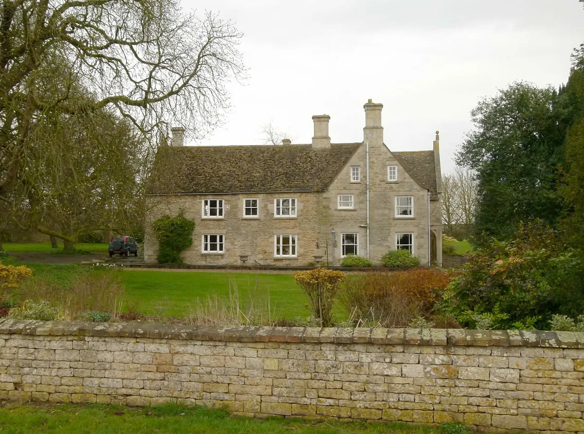
Wakerley Manor
Stately homes · 0.8 km

Wakerley
Villages · 1.0 km
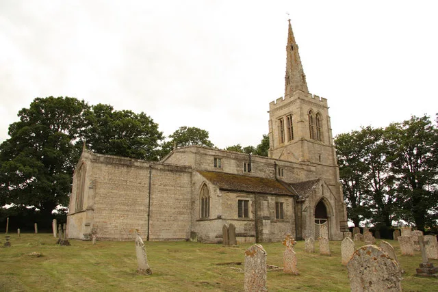
St John the Baptist's Church, Wakerley
Historic churches · 1.3 km

South Luffenham Village Sign
Public art & sculpture · 1.8 km

Church of St Mary the Virgin, South Luffenham
Historic churches · 1.9 km

South Luffenham
Historic churches · 1.9 km

St Mary's Church, Morcott
Historic churches · 2.3 km

St Luke's Church, Tixover
Historic churches · 2.4 km

Turtle Bridge
Historic bridges · 2.4 km
Nearby
📷 3Public art & sculpture · East Midlands
Barrowden Village Bench Sign
Barrowden Village Bench Sign — a public art in england-west-midlands, United Kingdom.
📷 4Historic churches · East Midlands
Church of St Peter
Church of St Peter — church in Barrowden, Rutland, United Kingdom.
📷 3Public art & sculpture · East Midlands
Barrowden Village Sign
Barrowden Village Sign — a public art in england-west-midlands, United Kingdom.
Flagship📷 3Stately homes · East Midlands
Wakerley Manor
Wakerley Manor — manor house in Wakerley, East Northamptonshire, England, UK.
📷 5📷 4Historic churches · East Midlands
St John the Baptist's Church, Wakerley
St John the Baptist's Church, Wakerley — church in Wakerley, Northamptonshire, England, UK.
Where to eat & stay near Barrowden
Places to stay
 📷 5
📷 5Campsites · East Midlands
Cuckoo Farm Camp Site
Cuckoo Farm Camp Site — a campsite in england west midlands.
 📷 5
📷 5Campsites · East Midlands
Rutland Water Campsite
Rutland Water Campsite — a campsite in england west midlands.
 📷 5
📷 5Campsites · East Midlands
Wing Hall Camping & Caravan Site
Wing Hall Camping & Caravan Site — a campsite in england west midlands.
 📷 5
📷 5Campsites · East Midlands
Lyndon Top
Lyndon Top — a campsite in england west midlands.
📷 5Campsites · East Midlands
The Paddock
The Paddock — a campsite in england west midlands.
 📷 5
📷 5Places to eat & drink
 📷 5
📷 5Historic pubs · East Midlands
The White Swan Public House And Attached Carriage Arch
The White Swan Public House And Attached Carriage Arch in England East, United Kingdom.
 📷 5
📷 5Historic pubs · East Midlands
The Hatton Arms Inn
The Hatton Arms Inn in England East, United Kingdom.
 📷 5
📷 5Historic pubs · East Midlands
The Woolpack Public House
The Woolpack Public House in England East, United Kingdom.
 📷 5
📷 5Historic pubs · East Midlands
The Scotgate Public House
The Scotgate Public House in England East, United Kingdom.
 📷 7
📷 7 📷 5
📷 5More places in this region
 📷 5
📷 5Historic churches · East Midlands
All Saints' Church, Stamford
All Saints' Church, Stamford — church in Stamford, Lincolnshire, England, UK.
 📷 5
📷 5Historic churches · East Midlands
Church of All Saints
Church of All Saints — church in Little Casterton, Rutland, United Kingdom.
 📷 5
📷 5Historic churches · East Midlands
Church of All Saints
Church of All Saints — church in Fenland, UK.
 📷 5
📷 5Historic churches · East Midlands
Church of St Leonard
Church of St Leonard — church in Fenland, UK.
Frequently asked questions
- Where is Barrowden?
- Barrowden is in the West Midlands, United Kingdom (postcode LE15 8EL), in the parish of Barrowden.
- What is Barrowden?
- Barrowden is a village in Rutland in the East Midlands of England. The village's name means 'burial-mound hill'. There are a number of barrows in the area. The population of the civil parish was 506
- How do I get to Barrowden?
- Drivers can use postcode LE15 8EL.
- Is Barrowden free to visit?
- Yes, Barrowden is free to enter.
- How do I get to Barrowden?
- Drivers can navigate to postcode LE15 8EL. It sits within the Rutland and Stamford parliamentary constituency.