
Historic houses · North West England
Moot Hall
Moot Hall — house in Brampton, Carlisle, England, UK.

Wikimedia Commons contributors — see linked file page for photographer and licence licence

Plan your visit
- Typical visit
- 1 h–2 h
- Nearest railway station
- Brampton · 2.2 km
- Family-friendly
- Limited wheelchair access
Getting there & planning your visit
Moot Hall is located in the Scottish Lowlands, with the nearest railway station being Brampton, which is 2.2 km away. The postcode for sat-nav is CA8 1RW. Entry has limited wheelchair accessibility.
About
Moot Hall is a historic house in the United Kingdom — typically a country seat, manor, or town house with notable architecture or history. Heritage designation: Grade II* listed building. Wikidata describes it as: "house in Brampton, Carlisle, England, UK". Coordinates: 54.9422°, -2.7340°.
Photo gallery
Protected designations
- Site of Special Scientific Interest: River Eden and Tributaries SSSI
Designations sourced from Natural England open data under OGL v3.
From the Wikipedia article
The Moot Hall is a municipal building in The Market Place in Brampton, Cumbria, England. The building, which is used as a local tourist information office and as a meeting place for Brampton Parish Council, is a Grade II* listed building.
Excerpt from Wikipedia under CC BY-SA 4.0. See the source article linked in Sources below.
Background
History
The first moot hall in the Market Place in Brampton dated back at least to the mid-17th century. Then, in November 1745, the area in front of the moot hall hosted the Army of the Young Pretender, Charles Edward Stuart, as he laid siege to Carlisle Castle during the Jacobite rising. The present building was commissioned by the lord of the manor, Frederick Howard, 5th Earl of Carlisle, whose seat was at Naworth Castle. It was designed in the Vernacular style, built in rubble masonry with a stucco finish and was completed in 1817. The design involved an octagonal structure facing west onto the Market Place. The first floor was faced with a stucco finish and there were quoins at the corners.…
Sourced from Wikipedia under CC BY-SA 4.0.
- Coordinates
- 54.9422, -2.7340
- District
- Cumberland
- Parish
- Brampton
- Postcode
- CA8 1RW
- Parliamentary constituency
- Carlisle
- Established
- 1817
- Nearest railway station
- Brampton — 2.2 km
Sources
- wikidata: Q17541845 (CC0)
- wikipedia: Moot Hall, Brampton (CC BY-SA 4.0)
- commons: Moot Hall, Brampton.jpg (CC BY-SA 4.0)
Other places nearby

White Lion
Hotels · 0.1 km

Scotch Arms Mews
B&Bs · 0.1 km

Brampton, Cumberland
Museums · 0.2 km

Brampton Playhouse
Open-air theatres · 0.2 km
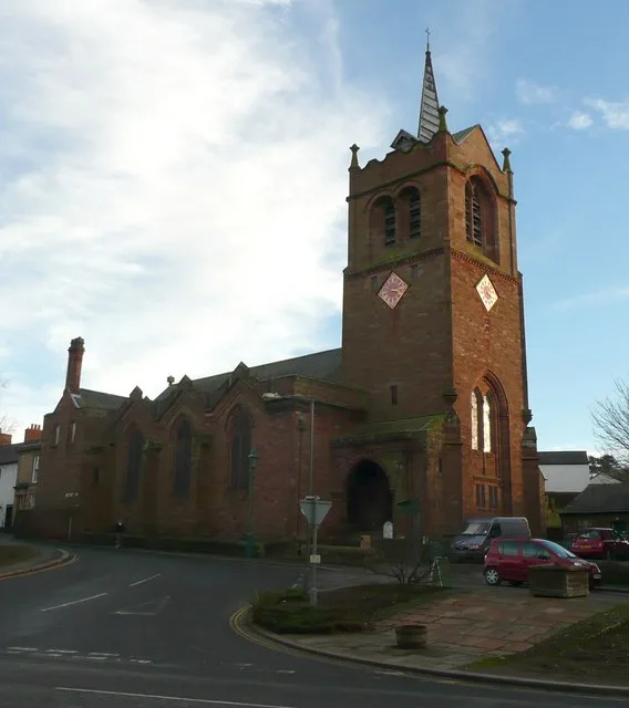
St Martin's Church, Brampton
Historic churches · 0.3 km

Brampton Motte
Castles · 0.3 km
The Mote Castle mound, medieval motte castle and site of late medieval beacon
Literary houses · 0.3 km

7th Earl of Carlisle
Memorials & monuments · 0.3 km
Brampton Motte (Castle)
Castles · 0.3 km
Monument on Brampton Mote
Memorials & monuments · 0.3 km

Irthing Vale Caravan Park
Caravan parks · 0.9 km

Milton
Castles · 2.1 km
Nearby
📷 7📷 7B&Bs · North West England
Scotch Arms Mews
Scotch Arms Mews — a bed-and-breakfast in scotland lowlands.
📷 5Museums · North West England
Brampton, Cumberland
Brampton is a market town and civil parish in the Cumberland unitary authority area of Cumbria, England. It is 9 miles (14 km) east of Carlisle and 2 miles (3.2 km) south of Hadrian's Wall. Historical
📷 5Open-air theatres · North West England
Brampton Playhouse
Brampton Playhouse — a open-air theatre in scotland lowlands.
📷 3Historic churches · North West England
St Martin's Church, Brampton
St Martin's Church, Brampton — church in Brampton, Cumbria, England, UK.
📷 5Where to eat & stay near Moot Hall
Places to stay
📷 7📷 7B&Bs · North West England
Scotch Arms Mews
Scotch Arms Mews — a bed-and-breakfast in scotland lowlands.
📷 5Caravan parks · North West England
Irthing Vale Caravan Park
Irthing Vale Caravan Park — a caravan park in scotland lowlands.
 📷 5
📷 5Campsites · North West England
Talkin Tarn Campsite
Talkin Tarn Campsite — a campsite in scotland lowlands.
 📷 5
📷 5Hostels · North West England
Florrie's On The Wall Bunkhouse and B&B
Florrie's On The Wall Bunkhouse and B&B — a hostel in scotland lowlands.
 📷 5
📷 5Campsites · North West England
Headswood on the Wall
Headswood on the Wall — a campsite in scotland lowlands.
Places to eat & drink
 📷 5
📷 5Historic pubs · North West England
Graham Arms (West Of Gelt Bridge)
Graham Arms (West Of Gelt Bridge) in Scotland Lowlands, United Kingdom.
 📷 4
📷 4Historic pubs · North West England
Hallbankgate
Hallbankgate in England North East, United Kingdom.
 📷 4
📷 4 📷 5
📷 5Historic pubs · North West England
St Nicholas Arms Public House
St Nicholas Arms Public House in Scotland Lowlands, United Kingdom.
 📷 7
📷 7Historic pubs · North West England
The Andalusian
The Andalusian in Scotland Lowlands, United Kingdom.
 📷 4
📷 4Historic pubs · North West England
The Griffin
The Griffin — Historic pub — listed building or notable heritage status.
More historic houses in this region
 📷 3
📷 3Historic houses · North West England
116 Hospital Street, Nantwich
116 Hospital Street, Nantwich — substantial townhouse in Nantwich, Cheshire, England, UK.
 📷 3
📷 3Historic houses · North West England
140–142 Hospital Street, Nantwich
140–142 Hospital Street, Nantwich — grade II listed building in Nantwich, Cheshire East, Cheshire, England, UK.
 📷 3
📷 3Historic houses · North West England
46 High Street, Nantwich
46 High Street, Nantwich — house in Nantwich, Cheshire, England, UK.
 📷 3
📷 3Historic houses · North West England
64, St Ann's Road
64, St Ann's Road — Grade II* listed house in Middlewich, Cheshire East, England, UK.
Frequently asked questions
- Where is Moot Hall?
- Moot Hall is in the Scottish Lowlands, United Kingdom (postcode CA8 1RW), in the parish of Brampton.
- What is Moot Hall?
- Moot Hall — house in Brampton, Carlisle, England, UK.
- How do I get to Moot Hall?
- The nearest railway station is Brampton, about 2.2 km away. Drivers can use postcode CA8 1RW.
- When was Moot Hall built?
- Built or established in 1817.
- Is Moot Hall a listed building?
- Moot Hall is officially recognised as Grade II* listed building listed.
- Is Moot Hall a protected site?
- Yes — Moot Hall is part of the River Eden and Tributaries SSSI Site of Special Scientific Interest.
- How do I get to Moot Hall?
- The nearest railway station is Brampton, about 2.2 km away. Drivers can navigate to postcode CA8 1RW.