
Historic houses · East of England
Moor Hall
In or near Booton.
Moor Hall — house in Salle, Norfolk, England, UK.

Wikimedia Commons contributors — see linked file page for photographer and licence licence

Plan your visit
- Typical visit
- 1 h–2 h
- Nearest railway station
- Aylsham · 9.8 km
- Family-friendly
- Limited wheelchair access
About
Moor Hall is a historic house in Norfolk, the East Midlands. Officially recognised as Grade II* listed building. The site is within the Norfolk Coast National Landscape (AONB), and is a designated Site of Special Scientific Interest. It sits within the Broadland and Fakenham parliamentary constituency. The nearest railway station is Aylsham, about 9.8 km away. Postcode area NR10.
Photo gallery
Protected designations
- Site of Special Scientific Interest: River Wensum SSSI
- Area of Outstanding Natural Beauty: Norfolk Coast
Designations sourced from Natural England open data under OGL v3.
Place summary
Moor Hall is a Grade II* listed historic house located in Salle, Norfolk, in the East Midlands. The building is situated within a Site of Special Scientific Interest (SSSI) along the River Wensum and lies within an Area of Outstanding Natural Beauty (AONB) on the Norfolk Coast.
AI-generated from the structured facts on this page (operator, designation, listing, era). Not a substitute for visiting.
- Coordinates
- 52.7782, 1.1110
- County
- Norfolk
- District
- Broadland
- Parish
- Salle
- Postcode
- NR10 4SB
- Parliamentary constituency
- Broadland and Fakenham
- Nearest railway station
- Aylsham — 9.8 km
Sources
- wikidata: Q17554240 (CC0)
- commons: Moor Hall - geograph.org.uk - 1132899.jpg (CC BY-SA 4.0)
Other places nearby

Salle Village Sign
Public art & sculpture · 1.1 km

Old Hall
Historic houses · 1.3 km

Reepham
Villages · 1.7 km

Reepham Village Sign
Public art & sculpture · 1.7 km

Reepham, Norfolk
Museums · 1.8 km

Booton Common
Forests & woodlands · 2.1 km
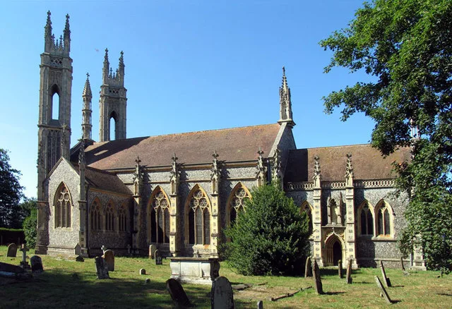
Booton
Towns & cities · 2.1 km

Forwater Road
Historic bridges · 2.4 km
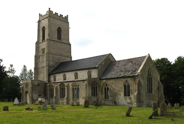
Wood Dalling
Towns & cities · 2.6 km

Wood Dalling Village Sign
Public art & sculpture · 2.6 km

Sall
Villages · 2.9 km
Heydon
Villages · 2.9 km
Nearby
📷 3Public art & sculpture · East of England
Salle Village Sign
Salle Village Sign — a public art in england-east-midlands, United Kingdom.
📷 3📷 5📷 3Public art & sculpture · East of England
Reepham Village Sign
Reepham Village Sign — a public art in england-east-midlands, United Kingdom.
📷 5Museums · East of England
Reepham, Norfolk
Reepham () is a market town and civil parish in the Broadland district of Norfolk, England. The town is on the B1145 road between the Bure and Wensum valleys, and is 12 miles (19 km) northwest of Norw
📷 3Forests & woodlands · East of England
Booton Common
Booton Common is a forest or woodland in the United Kingdom.
Where to eat & stay near Moor Hall
Places to stay
 📷 5
📷 5Campsites · East of England
Whitwell and Reepham Railway Camping
Whitwell and Reepham Railway Camping — a campsite in england east midlands.
 📷 5
📷 5Caravan parks · East of England
Martintole Farm
Martintole Farm — a caravan park in england east midlands.
 📷 5
📷 5Caravan parks · East of England
Charmbeck Park
Charmbeck Park — a caravan park in england east midlands.
📷 5Campsites · East of England
Moat Island Glamping
Moat Island Glamping — a campsite in england east midlands.
 📷 5
📷 5 📷 5
📷 5Places to eat & drink
 📷 5
📷 5 📷 5
📷 5Historic pubs · East of England
Buckinghamshire Arms Public House
Buckinghamshire Arms Public House in England East, United Kingdom.
 📷 5
📷 5Historic pubs · East of England
Saracen's Head
Saracen's Head in England East, United Kingdom.
 📷 5
📷 5Historic pubs · East of England
Black Boys Public House
Black Boys Public House in England East, United Kingdom.
 📷 5
📷 5 📷 7
📷 7Historic pubs · East of England
Recruiting Sergeant Inn
Recruiting Sergeant Inn in England East, United Kingdom.
More historic houses in this region
 📷 5
📷 5Historic houses · East of England
41 and 41a, Broad Street
41 and 41a, Broad Street — Grade II* listed house in Ely, East Cambridgeshire, England, UK.
 📷 5
📷 5Historic houses · East of England
Abbey Gate House
Abbey Gate House — house in St Albans, Hertfordshire, England, UK.
 📷 5
📷 5Historic houses · East of England
Abbey House
Abbey House — house in Cambridge, Cambridgeshire, England, UK.
.jpg?width=1200) 📷 5
📷 5Historic houses · East of England
Amores Including Outbuildings
Amores Including Outbuildings — architectural structure in Hertford, East Hertfordshire, England, UK.
Frequently asked questions
- Where is Moor Hall?
- Moor Hall is in Norfolk, the East Midlands, United Kingdom (postcode NR10 4SB), in the parish of Salle.
- What is Moor Hall?
- Moor Hall — house in Salle, Norfolk, England, UK.
- How do I get to Moor Hall?
- The nearest railway station is Aylsham, about 9.8 km away. Drivers can use postcode NR10 4SB.
- Is Moor Hall a listed building?
- Moor Hall is officially recognised as Grade II* listed building listed.
- Is Moor Hall a protected site?
- Yes — Moor Hall is part of the River Wensum SSSI Site of Special Scientific Interest and the Norfolk Coast National Landscape (AONB).
- How do I get to Moor Hall?
- Drivers can navigate to postcode NR10 4SB. It sits within the Broadland and Fakenham parliamentary constituency.