
Historic houses · South Wales
Monmouth Alms Houses
In or near Wyesham.
Monmouth Alms Houses — a Grade II-listed historic house in wales-south, United Kingdom.

Jaggery — CC BY-SA 2.0 via Wikimedia Commons licence

Plan your visit
- Typical visit
- 1 h–2 h
- Nearest railway station
- Rookwood · 7.5 km
- Family-friendly
- Wheelchair accessible
Getting there & planning your visit
To visit the Monmouth Alms Houses, the nearest railway station is Rookwood, located 7.5 km away. The postcode for sat-nav is NP25 3BX. The site is wheelchair accessible.
About
Monmouth Alms Houses is a Grade II-listed building in wales-south, United Kingdom. Grade II status is conferred by Historic England (or Cadw, Historic Environment Scotland or NIEA equivalents) on buildings of exceptional national interest. See the linked Wikipedia article for full historical and architectural details.
Photo gallery
Official information
Creates Gallery is a fine art gallery located in Monmouth, Wales. Visitors can explore various exhibitions featuring artworks in different styles, including mixed-media landscapes, ceramics, glass, sculpture, and jewellery.
Protected designations
- Site of Special Scientific Interest: River Wye SSSI
- Area of Outstanding Natural Beauty: Wye Valley
Designations sourced from Natural England open data under OGL v3.
From the Wikipedia article
The Monmouth Alms Houses of Monmouth, Wales are funded by the charity established by the haberdasher William Jones before his death in 1615. That charity also established schools in Monmouth and a lectureship in London. The Haberdashers' Company served as trustee of the charity from 1613 until 2011, when the trusteeship was transferred to Bristol Charities. A second charity established through a separate bequest by Jones enabled the building of the Newland Alms Houses in the Forest of Dean. The original Monmouth Alms Houses were constructed in 1614; they were rebuilt in 1842 and 1961. The fourth version of the Monmouth Alms Houses was completed in 2013 and is named 'Cwrt William Jones Almshouses' and is owned and managed by Bristol Charities under the name of 'William Jones Almshouse Charity'. The original alms houses were located on what is now known as Almshouse Street. The most recent houses are located off St James' Square.
Excerpt from Wikipedia under CC BY-SA 4.0. See the source article linked in Sources below.
- Coordinates
- 51.8115, -2.7124
- District
- Monmouthshire
- Parish
- Monmouth
- Postcode
- NP25 3BX
- Parliamentary constituency
- Monmouthshire
- Phone
- +44 7535 160 712
- Established
- 1614
- Nearest railway station
- Rookwood — 7.5 km
- Opening
- Wednesday - Saturday: 11am - 4pm; closed Sunday - Tuesday
Sources
- wikidata: Q6901050 (CC0)
- wikipedia: Monmouth Alms Houses (CC BY-SA 4.0)
Other places nearby
War Memorial at Monmouth Boys School
Memorials & monuments · 0.0 km
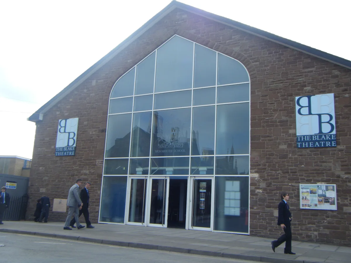
Blake Theatre
Theatres · 0.1 km

Blake Theatre
Open-air theatres · 0.1 km

Haberdashers' Monmouth School
Natural landmarks · 0.1 km

Queens Head
Historic houses · 0.1 km

Queens Head
Historic pubs · 0.1 km

The Grange
Historic houses · 0.1 km

St Mary's Roman Catholic Church
Historic churches · 0.1 km

Druid's Head Inn
Historic pubs · 0.1 km

Monmouth Police Station
Historic houses · 0.1 km
.jpg?width=1200)
Glendower Street Congregational Church
Chapels · 0.1 km
.jpg?width=1200)
St James's English Methodist Church
Chapels · 0.1 km
Nearby
📷 5Memorials & monuments · South Wales
War Memorial at Monmouth Boys School
War Memorial at Monmouth Boys School — Grade II listed building-listed memorial in wales-south, United Kingdom.
📷 3📷 5📷 5Natural landmarks · South Wales
Haberdashers' Monmouth School
Haberdashers' Monmouth School — a school heritage in wales-south, United Kingdom.
📷 4Historic houses · South Wales
Queens Head
Queens Head — a Grade II-listed historic house in wales-south, United Kingdom.
📷 6Historic pubs · South Wales
Queens Head
Queens Head in Wales South, United Kingdom.
Where to eat & stay near Monmouth Alms Houses
Places to stay
 📷 5
📷 5Campsites · South Wales
Monnow Bridge Caravan Site
Monnow Bridge Caravan Site — a campsite in wales south.
 📷 5
📷 5Hotels · South Wales
The Riverside Hotel
The Riverside Hotel — a hotel in wales south.
 📷 5
📷 5Campsites · South Wales
Glen Trothy C. & C. Park
Glen Trothy C. & C. Park — a campsite in wales south.
 📷 5
📷 5Campsites · South Wales
Broadstone Park Camping and Fishery
Broadstone Park Camping and Fishery — a campsite in wales south.
 📷 5
📷 5 📷 5
📷 5Campsites · South Wales
Biblins Youth Campsite
Biblins Youth Campsite — a campsite in wales south.
Places to eat & drink
📷 6Historic pubs · South Wales
Queens Head
Queens Head in Wales South, United Kingdom.
📷 6 📷 5
📷 5 📷 5
📷 5Historic pubs · South Wales
The Punch House
The Punch House — Historic pub — listed building or notable heritage status.
 📷 5
📷 5 📷 5
📷 5More historic houses in this region
 📷 3
📷 3Historic houses · South Wales
Agincourt House
Agincourt House — Grade II* listed building in Monmouth. Building in Monmouth, Wales.
 📷 3
📷 3Historic houses · South Wales
Big House, Landshipping
Big House, Landshipping — house in Martletwy, Pembrokeshire, Wales, UK.
 📷 3
📷 3Historic houses · South Wales
Boverton Place
Boverton Place — building in Llantwit Major, United Kingdom.
 📷 3
📷 3Historic houses · South Wales
Brynderi House
Brynderi House — house in Llantilio Crossenny, Monmouthshire, Wales.
Frequently asked questions
- Where is Monmouth Alms Houses?
- Monmouth Alms Houses is in South Wales, United Kingdom (postcode NP25 3BX), in the parish of Monmouth.
- What is Monmouth Alms Houses?
- Monmouth Alms Houses — a Grade II-listed historic house in wales-south, United Kingdom.
- How do I get to Monmouth Alms Houses?
- The nearest railway station is Rookwood, about 7.5 km away. The nearest town is Wyesham. Drivers can use postcode NP25 3BX.
- When was Monmouth Alms Houses built?
- Built or established in 1614.
- Who owns Monmouth Alms Houses?
- Monmouth Alms Houses is owned by | former_name =.
- Is Monmouth Alms Houses a listed building?
- Monmouth Alms Houses is officially recognised as Grade II listed.
- Is Monmouth Alms Houses a protected site?
- Yes — Monmouth Alms Houses is part of the River Wye SSSI Site of Special Scientific Interest and the Wye Valley National Landscape (AONB).
- How do I get to Monmouth Alms Houses?
- The nearest railway station is Rookwood, about 7.5 km away. Drivers can navigate to postcode NP25 3BX.