
Mountains & hills · South Wales
Moel Penderyn
Also known as: Y Foel Penderyn
In or near Rhigos.
Moel Penderyn — Named summit at 371 m.

Wikimedia Commons contributors — see linked file page for photographer and licence licence

Plan your visit
- Typical visit
- 3 h–8 h
- Best time of year
- Late spring – early autumn (May–Oct)
- Nearest railway station
- Aberdare · 9.1 km
- Free entry
- Dog-friendly
About
Moel Penderyn is a named summit in the United Kingdom. Also known as: Y Foel Penderyn. Wikidata describes it as: "Named summit at 371 m.". Coordinates: 51.7670°, -3.5392°.
Photo gallery
From the Wikipedia article
Moel Penderyn is a hill on the edge of Penderyn village, in the Brecon Beacons National Park in the county borough of Rhondda Cynon Taff, south Wales. It also appeared on older maps as 'Y Foel Penderyn'. Its summit at 371m is marked by a trig point. Moel Penderyn is in the Dyffrynnoedd Nedd a Mellte, a Moel Penderyn biological and geological Site of Special Scientific Interest.
Excerpt from Wikipedia under CC BY-SA 4.0. See the source article linked in Sources below.
Background
Visiting
The hill is open country and therefore available for walkers to wander at will. Additional access is provided by a public bridleway along its southern flanks and a public footpath between Penderyn village and the waterfall of Sgwd yr Eira on its northeastern edge.
Sourced from Wikipedia under CC BY-SA 4.0.
- Coordinates
- 51.7670, -3.5392
- District
- Rhondda Cynon Taf
- Parish
- Hirwaun
- Postcode
- CF44 9JS
- Parliamentary constituency
- Merthyr Tydfil and Aberdare
- Nearest railway station
- Aberdare — 9.1 km
Sources
- osm: n582793916 (ODbL)
- wikipedia: Moel Penderyn (CC BY-SA 4.0)
- commons: Moel Penderyn trig pillar - geograph.org.uk - 453527.jpg (CC BY-SA 4.0)
Other places nearby

Lamb Hotel
Memorials & monuments · 0.9 km

Ogof Afon Hepste
Caves · 1.0 km
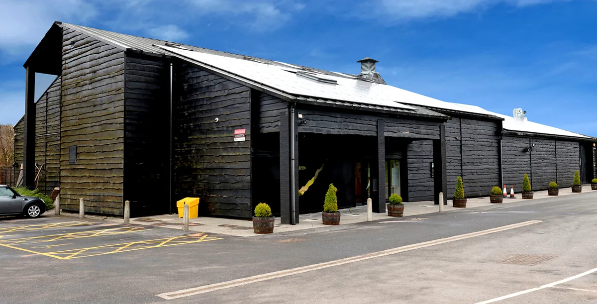
Penderyn Distillery
Distilleries · 1.3 km

Penderyn
Villages · 1.4 km

Sgwd yr Eira
Waterfalls · 1.6 km

Pwll Berw
Waterfalls · 2.3 km

Sgwd Isaf Clun Gwyn
Waterfalls · 2.4 km

Craig y Ddinas
Vineyards · 2.4 km

Twyn-y-Glog
Mountains & hills · 2.5 km

Bwa Maen
Natural landmarks · 2.5 km
Sgydau Sychryd
Waterfalls · 2.6 km

Bryn-y-Gaer Cemetery
Cemeteries · 2.6 km
Nearby
📷 5Memorials & monuments · South Wales
Lamb Hotel
Lamb Hotel — a memorial in wales-south, United Kingdom.
📷 5Caves · South Wales
Ogof Afon Hepste
Ogof Afon Hepste — a cave broad in wales-south, United Kingdom.
📷 3Distilleries · South Wales
Penderyn Distillery
Penderyn Distillery — Whisky/spirit distillery.
📷 5📷 5📷 5Where to eat & stay near Moel Penderyn
Places to stay
 📷 5
📷 5 📷 5
📷 5 📷 5
📷 5Hostels · South Wales
Dare Valley Country Park Accommodation
Dare Valley Country Park Accommodation — a hostel in wales south.
 📷 5
📷 5Caravan parks · South Wales
Grawen Caravan & Camping Park
Grawen Caravan & Camping Park — a caravan park in wales south.
 📷 7
📷 7Hotels · South Wales
Nant Ddu Lodge Hotel
Nant Ddu Lodge Hotel — a hotel in wales south.
📷 5Places to eat & drink
 📷 5
📷 5Restaurants · South Wales
Sultan of Wales
Sultan of Wales — a restaurant in wales south.
 📷 7
📷 7 📷 5
📷 5Historic pubs · South Wales
White Hart
White Hart — Historic pub — listed building or notable heritage status.
 📷 7
📷 7More mountains in this region
 Flagship📷 3
Mountains & hills · South Wales
Milford Haven Waterway
Milford Haven Waterway — ria, or flooded valley, in Pembrokeshire, south-west Wales, UK.
 📷 5
📷 5Mountains & hills · South Wales
Ogof Ffynnon Ddu
Ogof Ffynnon Ddu — cave in the Upper Swansea Valley in South Wales.
 📷 3
📷 3 📷 3
📷 3Frequently asked questions
- Where is Moel Penderyn?
- Moel Penderyn is in South Wales, United Kingdom (postcode CF44 9JS), in the parish of Hirwaun.
- What is Moel Penderyn?
- Moel Penderyn — Named summit at 371 m.
- How do I get to Moel Penderyn?
- The nearest railway station is Aberdare, about 9.1 km away. Drivers can use postcode CF44 9JS.
- Is Moel Penderyn free to visit?
- Yes, Moel Penderyn is free to enter.
- How do I get to Moel Penderyn?
- Drivers can navigate to postcode CF44 9JS. It sits within the Merthyr Tydfil and Aberdare parliamentary constituency.