
Castles · North West England
Moated site of Wolsty Castle
In or near Newton Arlosh.
Moated site of Wolsty Castle — scheduled monument-listed castle in scotland-lowlands, United Kingdom.

Alexander P Kapp — CC BY-SA 2.0 via Wikimedia Commons licence

Plan your visit
- Typical visit
- 1.5 h–3 h
- Nearest railway station
- Sillloth Miniature Railway · 4.5 km
- Free entry
- Family-friendly
- Limited wheelchair access
Getting there & planning your visit
To visit the Moated site of Wolsty Castle, the nearest railway station is Silloth Miniature Railway, located 4.5 km away. The postcode for navigation is CA7 4LW. Accessibility is limited for wheelchair users.
About
Moated site of Wolsty Castle is a scheduled monument-listed castle in scotland-lowlands, United Kingdom, registered on the National Heritage List for England (NHLE entry 1013508). Listed status protects buildings and structures of special architectural or historic interest. See the linked Wikipedia article for further details.
Photo gallery
Heritage listing
Details The monument includes the moated site of Wolsty Castle. It is located on flat land close to the present coastline and approximately 7km west of Holme Cultram Abbey, and includes an island or platform surrounded by a dry moat which in turn is flanked by traces of an outer bank. The island measures c.40m square and contains many earthworks and undulations which indicate a combination of structural foundations of the medieval castle and stone robbing trenches. There are two upstanding blocks of mortared masonry, one on the north and one on the south side of the island and each about 1.5m high, which show that the castle's curtain wall was over 2m thick. The surrounding moat measures 20m-30m wide by 1.5m deep and is flanked by an outer bank 5m-10m wide wide and up to 0.4m high. There are faint traces of an outlet channel at the moat's south east corner. Wolsty Castle was constructed during the first half of the 14th century as protection for Holme Cultram Abbey which had been pillaged by the Scots under Alexander II in 1216 and Robert Bruce in 1322. The castle received a licence to crenellate in 1348 and was occupied by the Chamber family, one of whom, Robert, was the Abbot of Holm Cultram. By 1572 the castle was in decay and documentary sources indicate that the hall, chamber, the evidence house, the kitchen, the peat house, byre and stable were ruinous. Repair work was undertaken during the 1630s but by the latter half of the 17th century the castle had been demolished and its stone taken for reuse in Carlisle. A telegraph pole, and a modern field boundary on the monument's west side are excluded from the scheduling but the ground beneath these features is included. MAP EXTRACT The site of the monument is shown on the attached map extract. Legacy The contents of t
From the Historic England List Entry under OGL v3.
Official information
The moated site of Wolsty Castle is a scheduled monument located in Cumbria, notable for its historical significance as a medieval castle built in the 14th century. It features a dry moat and remains of structural foundations, providing insights into the architectural and social history of the period.
Protected designations
- Site of Special Scientific Interest: Silloth Dunes and Mawbray Bank SSSI
- Site of Special Scientific Interest: Upper Solway Flats & Marshes SSSI
- Area of Outstanding Natural Beauty: Solway Coast
- Ramsar wetland: Upper Solway Flats & Marshes
Designations sourced from Natural England open data under OGL v3.
Place summary
The moated site of Wolsty Castle is located in the Scottish Lowlands. This scheduled monument represents the remains of a castle, highlighting the area's historical significance.
AI-generated from the structured facts on this page (operator, designation, listing, era). Not a substitute for visiting.
- Coordinates
- 54.8422, -3.3954
- District
- Cumberland
- Parish
- Holme Low
- Postcode
- CA7 4LW
- Parliamentary constituency
- Penrith and Solway
- Nearest railway station
- Sillloth Miniature Railway — 4.5 km
- Official site
- historicengland.org.uk
Sources
- wikidata: Q17677056 (CC0)
Other places nearby
Wolsty Castle
Castles · 0.0 km

Wolstey Castle
Castles · 0.0 km

Heather Bank
Caravan parks · 0.8 km

Rowanbank Caravan Park
Caravan parks · 1.3 km

Milefortlet 12
Hill forts · 2.0 km

Stanwix Park holiday Centre
Campsites · 2.2 km

Bibra Roman Fort
Archaeological sites · 2.3 km

North Hill
Mountains & hills · 2.3 km

East Hill
Mountains & hills · 2.5 km

High West Hill
Mountains & hills · 2.5 km
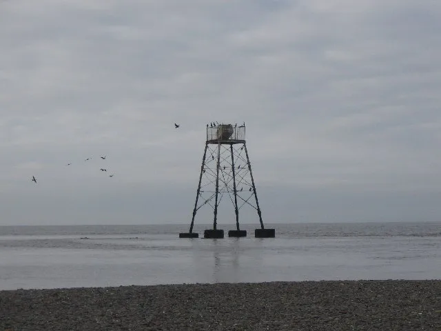
Lees Scar Light
Lighthouses · 2.6 km

Silloth
Museums · 3.1 km
Nearby
📷 3Castles · North West England
Wolsty Castle
Wolsty Castle — a castle in scotland-lowlands, United Kingdom.
📷 5📷 5Caravan parks · North West England
Heather Bank
Heather Bank — a caravan park in scotland lowlands.
📷 5Caravan parks · North West England
Rowanbank Caravan Park
Rowanbank Caravan Park — a caravan park in scotland lowlands.
📷 3Hill forts · North West England
Milefortlet 12
Milefortlet 12 — milefortlet of the Roman Cumbrian Coast defences, in Silloth-on-Solway, Allerdale, England, UK.
📷 5Campsites · North West England
Stanwix Park holiday Centre
Stanwix Park holiday Centre — a campsite in scotland lowlands.
Where to eat & stay near Moated site of Wolsty Castle
Places to stay
📷 5Caravan parks · North West England
Heather Bank
Heather Bank — a caravan park in scotland lowlands.
📷 5Caravan parks · North West England
Rowanbank Caravan Park
Rowanbank Caravan Park — a caravan park in scotland lowlands.
📷 5Campsites · North West England
Stanwix Park holiday Centre
Stanwix Park holiday Centre — a campsite in scotland lowlands.
 📷 5
📷 5Caravan parks · North West England
Tanglewood Caravan park
Tanglewood Caravan park — a caravan park in scotland lowlands.
Caravan parks · North West England
Solway Holiday Village
Solway Holiday Village — a caravan park in england north west.
Caravan parks · North West England
Seacote Caravan Park
Seacote Caravan Park — a caravan park in england north west.
Places to eat & drink
 📷 5
📷 5Historic pubs · North West England
Kings Arms Walter Willsons
Kings Arms Walter Willsons in Scotland Lowlands, United Kingdom.
 📷 7
📷 7Historic pubs · Scottish Lowlands
The Farmers Inn
The Farmers Inn in Scotland Lowlands, United Kingdom.
 📷 7
📷 7Historic pubs · North West England
Queensberry Arms Hotel
Queensberry Arms Hotel in Scotland Lowlands, United Kingdom.
 📷 7
📷 7Historic pubs · North West England
The Pheasant Inn
The Pheasant Inn in Scotland Lowlands, United Kingdom.
 📷 7
📷 7Historic pubs · North West England
The Greyhound Inn
The Greyhound Inn in Scotland Lowlands, United Kingdom.
 📷 4
📷 4Historic pubs · North West England
Oddfellows Arms
Oddfellows Arms — Historic pub — listed building or notable heritage status.
More castles in this region
 📷 3
📷 3Castles · North West England
Manchester Castle
Manchester Castle — medieval fortified manor house in England.
 📷 5
📷 5Castles · North West England
Mow Cop Castle
Mow Cop Castle — folly on the Cheshire and Staffordshire border, England, UK.
 📷 3
📷 3 📷 3
📷 3Castles · North West England
Ullerwood Castle
Ullerwood Castle — castle in Greater Manchester, England.
Frequently asked questions
- Where is Moated site of Wolsty Castle?
- Moated site of Wolsty Castle is in North-West England, United Kingdom (postcode CA7 4LW), in the parish of Holme Low.
- What is Moated site of Wolsty Castle?
- Moated site of Wolsty Castle — scheduled monument-listed castle in scotland-lowlands, United Kingdom.
- How do I get to Moated site of Wolsty Castle?
- The nearest railway station is Sillloth Miniature Railway, about 4.5 km away. The nearest town is Newton Arlosh. Drivers can use postcode CA7 4LW.
- Is Moated site of Wolsty Castle a listed building?
- Moated site of Wolsty Castle is officially recognised as scheduled monument listed.
- Is Moated site of Wolsty Castle a protected site?
- Yes — Moated site of Wolsty Castle is part of the Silloth Dunes and Mawbray Bank SSSI Site of Special Scientific Interest and the Upper Solway Flats & Marshes SSSI Site of Special Scientific Interest.
- Is Moated site of Wolsty Castle free to visit?
- Yes, Moated site of Wolsty Castle is free to enter.
- How do I get to Moated site of Wolsty Castle?
- The nearest railway station is Sillloth Miniature Railway, about 4.5 km away. Drivers can navigate to postcode CA7 4LW.