
Hill forts · North West England
Milefortlet 9
In or near Anthorn.
Milefortlet 9 — milefortlet of the Roman Cumbrian Coast defences.

Alexander P Kapp — CC BY-SA 2.0 via Wikimedia Commons licence

Plan your visit
- Typical visit
- 1 h–2 h
- Nearest railway station
- Sillloth Miniature Railway · 1.7 km
- Free entry
- Dog-friendly
Getting there & planning your visit
To visit Milefortlet 9, the nearest railway station is Silloth Miniature Railway, located 1.7 km away. Entry is free. The postcode for navigation is CA7 4RA.
About
Milefortlet 9 is a hill fort in the United Kingdom. Heritage designation: scheduled monument. Wikidata describes it as: "milefortlet of the Roman Cumbrian Coast defences". Coordinates: 54.8923°, -3.3588°.
Photo gallery
Protected designations
- Site of Special Scientific Interest: Upper Solway Flats & Marshes SSSI
- Area of Outstanding Natural Beauty: Solway Coast
- Ramsar wetland: Upper Solway Flats & Marshes
Designations sourced from Natural England open data under OGL v3.
From the Wikipedia article
Milefortlet 9 (Skinburness) was a Milefortlet of the Roman Cumbrian Coast defences. These milefortlets and intervening stone watchtowers extended from the western end of Hadrian's Wall, along the Cumbrian coast and were linked by a wooden palisade. They were contemporary with defensive structures on Hadrian's Wall. There is little to see on the ground but Milefortlet 9 has been located on aerial photographs.
Excerpt from Wikipedia under CC BY-SA 4.0. See the source article linked in Sources below.
Background
Description
Milefortlet 9 is situated in a field northeast of the village of Skinburness, in the civil parish of Silloth. The outline of the milefortlet was seen on aerial photographs in 1949. A portion of an inscribed Roman altar, dedicated to the Matres was found in the summer of 1866 lying on the seashore close to this site, and is now in the British Museum. The coastline to the north is interrupted by Moricambe Bay, and the next known fort is Milefortlet 5. Milefortlets 8, 7 and 6 were once thought to have been eroded by Moricambe, but there is in fact no evidence that the sites ever existed, and the system to the north is believed to begin again with Milefortlet 5.
Sourced from Wikipedia under CC BY-SA 4.0.
- Coordinates
- 54.8923, -3.3588
- District
- Cumberland
- Parish
- Silloth-on-Solway
- Postcode
- CA7 4RA
- Parliamentary constituency
- Penrith and Solway
- Nearest railway station
- Sillloth Miniature Railway — 1.7 km
Sources
- wikidata: Q16247437 (CC0)
- wikipedia: Milefortlet 9 (CC BY-SA 4.0)
Other places nearby
Milefortlet 9, Skinburness
Archaeological sites · 0.0 km

Skinburness
Villages · 0.5 km
Seacote Caravan Park
Caravan parks · 1.4 km
Solway Holiday Village
Caravan parks · 2.0 km
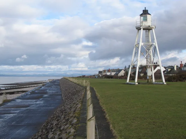
East Cote Light
Lighthouses · 2.0 km

Big Fella
Public art & sculpture · 2.5 km

Palisade ditches, part of Roman frontier defences along Cumbrian coast, Roman camp & road and part of Romano-British field system, 250m north of Silloth Farm
Archaeological sites · 2.6 km

Causewayhead War Memorial
Memorials & monuments · 2.8 km

Silloth
Museums · 3.0 km

Toy Soldier Museum
Museums · 3.0 km

Silloth War Memorial
Memorials & monuments · 3.1 km

Starry Hill
Mountains & hills · 3.1 km
Nearby
📷 3Archaeological sites · North West England
Milefortlet 9, Skinburness
Milefortlet 9, Skinburness — an archaeological site in North West England, United Kingdom.
📷 5Caravan parks · North West England
Seacote Caravan Park
Seacote Caravan Park — a caravan park in england north west.
Caravan parks · North West England
Solway Holiday Village
Solway Holiday Village — a caravan park in england north west.
📷 3Lighthouses · North West England
East Cote Light
East Cote Light — lighthouse in Cumbria, England.
📷 3Public art & sculpture · North West England
Big Fella
Big Fella — a public art in North West England, United Kingdom.
Where to eat & stay near Milefortlet 9
Places to stay
Caravan parks · North West England
Seacote Caravan Park
Seacote Caravan Park — a caravan park in england north west.
Caravan parks · North West England
Solway Holiday Village
Solway Holiday Village — a caravan park in england north west.
 📷 5
📷 5Caravan parks · North West England
Tanglewood Caravan park
Tanglewood Caravan park — a caravan park in scotland lowlands.
 📷 5
📷 5Campsites · North West England
Stanwix Park holiday Centre
Stanwix Park holiday Centre — a campsite in scotland lowlands.
 📷 5
📷 5Caravan parks · North West England
Heather Bank
Heather Bank — a caravan park in scotland lowlands.
 📷 5
📷 5Caravan parks · North West England
Rowanbank Caravan Park
Rowanbank Caravan Park — a caravan park in scotland lowlands.
Places to eat & drink
 📷 7
📷 7Historic pubs · North West England
Queensberry Arms Hotel
Queensberry Arms Hotel in Scotland Lowlands, United Kingdom.
 📷 7
📷 7Historic pubs · Scottish Lowlands
The Farmers Inn
The Farmers Inn in Scotland Lowlands, United Kingdom.
 📷 5
📷 5Historic pubs · North West England
Kings Arms Walter Willsons
Kings Arms Walter Willsons in Scotland Lowlands, United Kingdom.
 📷 7
📷 7Historic pubs · North West England
The Greyhound Inn
The Greyhound Inn in Scotland Lowlands, United Kingdom.
 📷 5📷 5
More places in this region
 📷 5
📷 5Hill forts · North West England
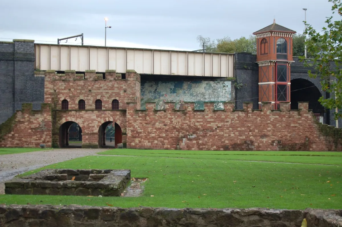
Mamucium
Mamucium — former Roman fort in the Castlefield area of Manchester in North West England.
 📷 3
📷 3Hill forts · North West England
Timperley Hall
Timperley Hall is a hill fort in the United Kingdom.
 📷 3
📷 3Hill forts · North West England
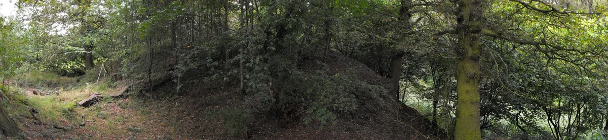
Watch Hill Castle
Watch Hill Castle — medieval castle in Bowdon, Greater Manchester, England, UK.
 📷 5
📷 5Hill forts · North West England
Buckton Castle
Buckton Castle — 12th-century castle in Mossley, Greater Manchester, England, UK.
Frequently asked questions
- Where is Milefortlet 9?
- Milefortlet 9 is in North-West England, United Kingdom (postcode CA7 4RA), in the parish of Silloth-on-Solway.
- What is Milefortlet 9?
- Milefortlet 9 — milefortlet of the Roman Cumbrian Coast defences.
- How do I get to Milefortlet 9?
- The nearest railway station is Sillloth Miniature Railway, about 1.7 km away. The nearest town is Anthorn. Drivers can use postcode CA7 4RA.
- Is Milefortlet 9 a listed building?
- Milefortlet 9 is officially recognised as scheduled monument listed.
- Is Milefortlet 9 a protected site?
- Yes — Milefortlet 9 is part of the Upper Solway Flats & Marshes SSSI Site of Special Scientific Interest and the Solway Coast National Landscape (AONB).
- Is Milefortlet 9 free to visit?
- Yes, Milefortlet 9 is free to enter.
- How do I get to Milefortlet 9?
- The nearest railway station is Sillloth Miniature Railway, about 1.7 km away. Drivers can navigate to postcode CA7 4RA.