Mountains & hills · South Wales
Mendip Hills
Also known as: Bryniau Mendip
In or near Cheddar.
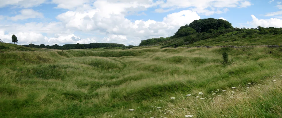
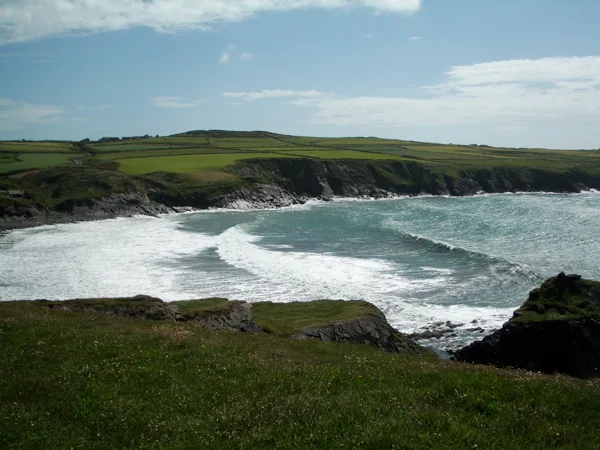
The Mendip Hills (commonly called the Mendips) is a range of limestone hills to the south of Bristol and Bath in Somerset, England. Running from Weston-super-Mare and the Bristol Channel in the west t

C Evans — CC BY-SA 2.0 via Wikimedia Commons licence
Plan your visit
- Typical visit
- 3 h–8 h
- Best time of year
- Late spring – early autumn (May–Oct)
- Free entry
- Dog-friendly
About
The Mendip Hills (commonly called the Mendips) is a range of limestone hills to the south of Bristol and Bath in Somerset, England. Running from Weston-super-Mare and the Bristol Channel in the west to the Frome valley in the east, the hills overlook the Somerset Levels to the south and the Chew Valley and other tributaries of the Avon to the north. The highest point, at 325 metres (1,066 ft) above sea level, is Beacon Batch which is the summit area atop Black Down. The hills gave their name to the former local government district of Mendip, which administered most of the local area until April 2023. The higher, western part of the hills, covering 198 km2 (76 sq mi) has been designated an Area of Outstanding Natural Beauty (AONB), which gives it a level of protection comparable to a national park. The hills are largely formed from Carboniferous Limestone, which is quarried at several sites. Ash–maple woodland, calcareous grassland and mesotrophic grassland which can be found across the Mendip Hills provide nationally important semi-natural habitats. With their temperate climate these support a range of flora and fauna including birds, butterflies and small mammals. The dry stone walls that divide the pasture into fields are of botanical importance as they support important populations of the nationally scarce wall whitlowgrass (Draba muralis). Mendip has seen human activity since Palaeolithic and Mesolithic times with a range of artefacts being recovered from caves.…
Photo gallery
Official information
The Mendip Hills is an Area of Outstanding Natural Beauty located south of Bristol, featuring a diverse limestone landscape with plateaus, wooded combes, and flower-rich valleys. It was designated in 1972 to conserve its natural beauty and is recognized for its scenic views and ecological significance.
Protected designations
- Site of Special Scientific Interest: The Cheddar Complex SSSI
- National Nature Reserve: MENDIP
- Area of Outstanding Natural Beauty: Mendip Hills
Designations sourced from Natural England open data under OGL v3.
From the Wikipedia article
The Mendip Hills (commonly called the Mendips) is a range of limestone hills to the south of Bristol and Bath in Somerset, England. Running from Weston-super-Mare and the Bristol Channel in the west to the Frome valley in the east, the hills overlook the Somerset Levels to the south and the Chew Valley and other tributaries of the Avon to the north. The highest point, at 325 metres (1,066 ft) above sea level, is Beacon Batch which is the summit area atop Black Down. The hills gave their name to the former local government district of Mendip, which administered most of the local area until April 2023. The higher, western part of the hills, covering 198 km2 (76 sq mi) has been designated an Area of Outstanding Natural Beauty (AONB), which gives it a level of protection comparable to a national park. The hills are largely formed from Carboniferous Limestone, which is quarried at several sites. Ash–maple woodland, calcareous grassland and mesotrophic grassland which can be found across the Mendip Hills provide nationally important semi-natural habitats. With their temperate climate these support a range of flora and fauna including birds, butterflies and small mammals. The dry stone walls that divide the pasture into fields are of botanical importance as they support important populations of the nationally scarce wall whitlowgrass (Draba muralis). Mendip has seen human activity since Palaeolithic and Mesolithic times with a range of artefacts being recovered from caves. Neolithic, Iron Age, and Bronze Age features such as barrows are numerous with over 200 scheduled ancient monuments recorded. There is evidence of mining in the Mendips dating back to the late Bronze Age, which increased after the Roman invasion, particularly for lead and silver around Charterhouse. The difficult conditions in the area were noted by William Wilberforce in 1789, which inspired Hannah More to begin her work improving the conditions of the Mendip miners and agricultural workers. In the…
Excerpt from Wikipedia under CC BY-SA 4.0. See the source article linked in Sources below.
Background
History
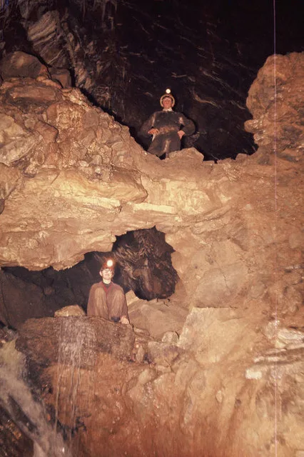
]] Twenty Palaeolithic sites have been identified in the Mendips, of which eleven represent faunal remains and lithic artefacts recovered from caves. The remaining eight sites refer to surface lithic discoveries, and the artefacts found include points, scrapers, and handaxes. Twenty-seven Mesolithic finds are represented by flint and chert lithics. Large numbers of artefacts have been found near Neolithic, Iron Age, and Bronze Age features, such as the barrows and forts around Priddy and at Dolebury Warren. The caves of Cheddar Gorge have yielded many archaeological remains, as flood waters have washed artefacts and bones into the caves and preserved them in silt. The Cheddar Man, Britain's…
Sourced from Wikipedia under CC BY-SA 4.0.
- Coordinates
- 51.3000, -2.7333
- District
- Somerset
- Parish
- Priddy
- Postcode
- BS40 7XS
- Parliamentary constituency
- Wells and Mendip Hills
- Phone
- +44 (0)1761 462338
- Established
- 1972
- Official site
- web.archive.org
Sources
- wikipedia: Mendip Hills (CC BY-SA 4.0)
Other places nearby

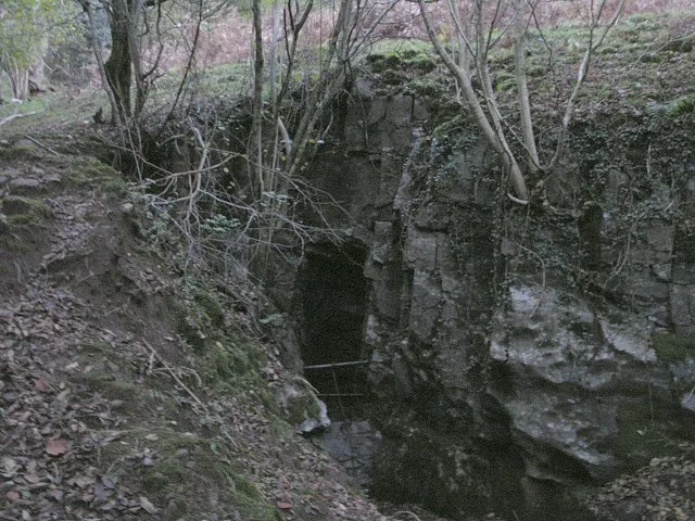
Longwood Swallet
Caves · 0.4 km

Gorsey Bigbury Henge
Archaeological sites · 0.5 km
Rhino Rift
Caves · 0.6 km

Manor Farm Swallet
Caves · 0.9 km

Charterhouse amphitheatre
Open-air theatres · 1.1 km

Charterhouse Cave
Caves · 1.3 km

Town Field rectangular enclosure
Archaeological sites · 1.3 km

Black Rock
Natural landmarks · 1.3 km
Wireless Station
Mountains & hills · 1.3 km
Charterhouse Roman Town
Hill forts · 1.3 km

GB cave
Caves · 1.4 km
GB Cave
Mountains & hills · 1.4 km
Nearby
📷 5Caves · South West England
Longwood Swallet
Longwood Swallet is a cave in the United Kingdom.
📷 3Archaeological sites · South West England
Gorsey Bigbury Henge
Gorsey Bigbury Henge — a archaeological in england-south-west, United Kingdom.
📷 3Caves · South West England
Rhino Rift
Rhino Rift is a cave in the United Kingdom.
📷 5Caves · South West England
Manor Farm Swallet
Manor Farm Swallet is a cave in the United Kingdom.
📷 5Open-air theatres · South Wales
Charterhouse amphitheatre
Charterhouse amphitheatre — a open-air theatre in wales south.
📷 3Where to eat & stay near Mendip Hills
Places to stay
 📷 5
📷 5Campsites · South West England
Owley Woods Glamping
Owley Woods Glamping — a campsite in england south west.
 📷 5
📷 5Hostels · South West England
YHA Cheddar Youth Hostel
YHA Cheddar Youth Hostel — a hostel in england south west. Brand: Youth Hostels Association.
 📷 5
📷 5Campsites · South West England
Cheddar Bridge Touring Park
Cheddar Bridge Touring Park — a campsite in england south west.
 📷 5
📷 5Caravan parks · South West England
Cheddar Woods Resort & Spa
Cheddar Woods Resort & Spa — a caravan park in england south west.
📷 5Caravan parks · South West England
Cheddar Caravan and Motorhome Club Site
Cheddar Caravan and Motorhome Club Site — a caravan park in england south west.
 📷 4
📷 4Campsites · South West England
Petruth Paddocks
Petruth Paddocks — a campsite in england south west.
Places to eat & drink
 📷 5
📷 5 📷 7
📷 7 📷 5
📷 5Restaurants · South West England
Bekynton Brasserie
Bekynton Brasserie — a restaurant in england south west.
 📷 5
📷 5 📷 5
📷 5
More mountains in this region
 Flagship📷 3
Mountains & hills · South Wales
Milford Haven Waterway
Milford Haven Waterway — ria, or flooded valley, in Pembrokeshire, south-west Wales, UK.
 📷 5
📷 5Mountains & hills · South Wales
Ogof Ffynnon Ddu
Ogof Ffynnon Ddu — cave in the Upper Swansea Valley in South Wales.
 📷 3
📷 3 📷 3
📷 3Frequently asked questions
- Where is Mendip Hills?
- Mendip Hills is in South Wales, United Kingdom (postcode BS40 7XS), in the parish of Priddy.
- What is Mendip Hills?
- The Mendip Hills (commonly called the Mendips) is a range of limestone hills to the south of Bristol and Bath in Somerset, England. Running from Weston-super-Mare and the Bristol Channel in the west t
- How do I get to Mendip Hills?
- Drivers can use postcode BS40 7XS.
- When was Mendip Hills built?
- Built or established in 1972.
- Is Mendip Hills a protected site?
- Yes — Mendip Hills is part of the The Cheddar Complex SSSI Site of Special Scientific Interest and the MENDIP National Nature Reserve.
- Is Mendip Hills free to visit?
- Yes, Mendip Hills is free to enter.
- How do I get to Mendip Hills?
- Drivers can navigate to postcode BS40 7XS. It sits within the Wells and Mendip Hills parliamentary constituency.