
Vineyards · South West England
Medieval settlement and associated field systems west of Brook Farm
In or near Upton Scudamore.
Medieval settlement and associated field systems west of Brook Farm — a UK vineyard in england south east, producing English or Welsh wine from cool-climate grape varieties.

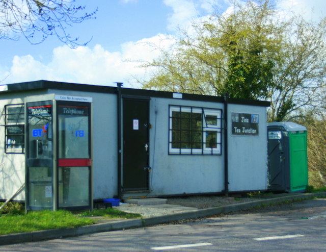
Philip Reed — CC BY-SA 2.0 via Wikimedia Commons licence

Plan your visit
- Typical visit
- 1 h–2 h
- Best time of year
- Late summer & autumn (Aug–Oct)
- Nearest railway station
- Westbury · 0.9 km
About
Medieval settlement and associated field systems west of Brook Farm is one of Britain's growing number of vineyards, located in england south east. UK viticulture has expanded significantly since the 1980s, with English sparkling wines now winning international awards. Most British vineyards offer tours and tastings of their estate-grown wines. human settlement in Dilton Marsh, Wiltshire, England, UK
Photo gallery
Place summary
The Medieval settlement and associated field systems west of Brook Farm is located in South-East England. This site features remnants of historical agricultural practices from the medieval period, providing insight into past land use. Nearby, a vineyard offers a scenic setting for wine production, allowing visitors to experience the region's viticultural heritage. The area combines historical significance with the contemporary practice of winemaking.
AI-generated from the structured facts on this page (operator, designation, listing, era). Not a substitute for visiting.
- Coordinates
- 51.2655, -2.2132
- District
- Wiltshire
- Parish
- Westbury
- Postcode
- BA13 4WD
- Parliamentary constituency
- South West Wiltshire
- Nearest railway station
- Westbury — 0.9 km
Sources
- wikidata: Q17675024 (CC0)
Other places nearby

Westbury Ironstone Quarry
Quarries · 0.9 km

Brokerswood Holiday Park
Campsites · 1.4 km

Westbury, Wiltshire
Museums · 1.7 km

Matravers School
Natural landmarks · 1.9 km
_(geograph_6808156).jpg?width=1200)
Boyer's House
Historic houses · 1.9 km

Dilton Marsh War Memorial
Memorials & monuments · 2.0 km

Dilton Marsh
Villages · 2.0 km

Bank House
Historic houses · 2.1 km

The Phone Box Gallery
Galleries · 2.1 km
_(geograph_6833583).jpg?width=1200)
Albion House
Historic houses · 2.2 km

Vista Cinema
Theatres · 2.2 km

New China Cottage
Restaurants · 2.2 km
Nearby
📷 5Quarries · South West England
Westbury Ironstone Quarry
Westbury Ironstone Quarry — Geological Site of Special Scientific Interest in Wiltshire, England.
📷 5Campsites · South West England
Brokerswood Holiday Park
Brokerswood Holiday Park — a campsite in england south east.
📷 5Museums · South West England
Westbury, Wiltshire
Westbury, Wiltshire — a museum in england-south-east, United Kingdom.
📷 5Natural landmarks · South West England
Matravers School
Matravers School — a school heritage in england-south-east, United Kingdom.
📷 5Historic houses · South West England
Boyer's House
Boyer's House — house in Westbury, Wiltshire, England, UK.
📷 5Memorials & monuments · South West England
Dilton Marsh War Memorial
Dilton Marsh War Memorial — Grade II listed building-listed memorial in england-south-east, United Kingdom.
Where to eat & stay near Medieval settlement and associated field systems west of Brook Farm
Places to stay
📷 5Campsites · South West England
Brokerswood Holiday Park
Brokerswood Holiday Park — a campsite in england south east.
 📷 5
📷 5 📷 7
📷 7 📷 5
📷 5Caravan parks · South West England
Barrow Farm CL
Barrow Farm CL — a caravan park in england south east.
 📷 5
📷 5Campsites · South West England
West Wiltshire Scouts Jubilee Wood Campsite
West Wiltshire Scouts Jubilee Wood Campsite — a campsite in england south east.
 📷 5
📷 5Campsites · South West England
Pitchperfect
Pitchperfect — a campsite in england south east.
Places to eat & drink
📷 6Restaurants · South West England
New China Cottage
New China Cottage — a restaurant in england south east.
 📷 7
📷 7Historic pubs · South West England
The Stallards Public House
The Stallards Public House in England South West, United Kingdom.
 📷 5
📷 5Historic pubs · South West England
The Castle Public House
The Castle Public House in England South West, United Kingdom.
 📷 5
📷 5 📷 5
📷 5Historic pubs · South West England
The Sun Public House
The Sun Public House in England South West, United Kingdom.
 📷 5
📷 5Historic pubs · South West England
Kitchener's Arms
Kitchener's Arms in England South West, United Kingdom.
More places in this region
 📷 5
📷 5Vineyards · South West England
Castle Rings
Castle Rings — a UK vineyard in england south east, producing English or Welsh wine from cool-climate grape varieties.
 📷 5
📷 5Vineyards · South West England
Large univallate hillfort with a bowl barrow and pillow mounds 970m west of The Bungalow
Large univallate hillfort with a bowl barrow and pillow mounds 970m west of The Bungalow — a UK vineyard in england south east, producing English or Welsh wine from cool-climate grape varieties.
 📷 5
📷 5Vineyards · South West England
Hillfort on Banbury Hill
Hillfort on Banbury Hill — a UK vineyard in england south east, producing English or Welsh wine from cool-climate grape varieties.
 📷 5
📷 5Vineyards · South West England
Hillfort, two bowl barrows, medieval strip lynchets and a cross dyke on Cley Hill
Hillfort, two bowl barrows, medieval strip lynchets and a cross dyke on Cley Hill — a UK vineyard in england south east, producing English or Welsh wine from cool-climate grape varieties.
Frequently asked questions
- Where is Medieval settlement and associated field systems west of Brook Farm?
- Medieval settlement and associated field systems west of Brook Farm is in South-West England, United Kingdom (postcode BA13 4WD), in the parish of Westbury.
- What is Medieval settlement and associated field systems west of Brook Farm?
- Medieval settlement and associated field systems west of Brook Farm — a UK vineyard in england south east, producing English or Welsh wine from cool-climate grape varieties.
- How do I get to Medieval settlement and associated field systems west of Brook Farm?
- The nearest railway station is Westbury, about 0.9 km away. The nearest town is Upton Scudamore. Drivers can use postcode BA13 4WD.
- How do I get to Medieval settlement and associated field systems west of Brook Farm?
- The nearest railway station is Westbury, about 0.9 km away. Drivers can navigate to postcode BA13 4WD.