
Castles · East Midlands
Maxey Castle
In or near Marholm.
Maxey Castle — castle, now ruinous, in Maxey, Cambridgeshire, England, UK.

Richard Humphrey — CC BY-SA 2.0 via Wikimedia Commons licence

Plan your visit
- Typical visit
- 1.5 h–3 h
- Family-friendly
- Limited wheelchair access
About
Maxey Castle is a castle in the United Kingdom — fortified architecture from the medieval, Tudor, or Victorian-revival period. Wikidata describes it as: "castle, now ruinous, in Maxey, Cambridgeshire, England, UK". Coordinates: 52.6648°, -0.3304°.
Photo gallery
Heritage listing
Details Maxey Castle is situated at Castle End on the north edge of the village of Maxey. The castle is a later medieval moated site with outworks to the north and north east and an associated fishpond to the south east. The moated site includes a square central island, measuring 50m across, which is surrounded by a wet moat on the south west, north west and north east sides. The remaining side, the south east, has been largely infilled to the level of the external ground surface although the moat ditch will survive as a buried feature. Where the moat is open it is about 16m wide. The ditches have been cleared of silt recently using a machine, and the upcast material dumped on the island; as a result the ditches are now permanently wet. Two duck houses, reached from the island, have been constructed in the moat. There is a counterscarp bank, between 6m and 10m wide, on the north west and north east sides of the moat. On the north east side there is a broad, level terrace, 6m wide, beyond the outer bank. A 10m wide gully leads almost directly north east from the south east corner of the moat. This is thought to be an internal boundary feature. A 5m wide and 0.4m deep leat leads from the south east corner of the moat to a small rectangular fishpond lying adjacent to Mill Road. The pond, which is dry, measures 45m along the north east/south west axis, and 15m acoss the north west-south east axis. It is about 1.5m deep and both the north east end and the north west side are slightly embanked. There is a 5m wide outlet channel at the eastern end of the south east side which drains into the boundary ditch flanking the road. This ditch forms part of the southern boundary ditch of the group of enclosures to the north and north east of the moated site. It is for the most part 4m
From the Historic England List Entry under OGL v3.
From the Wikipedia article
Maxey Castle was a medieval fortified manor house castle in Maxey, Cambridgeshire, England.
Excerpt from Wikipedia under CC BY-SA 4.0. See the source article linked in Sources below.
- Coordinates
- 52.6648, -0.3304
- District
- Peterborough
- Parish
- Maxey
- Postcode
- PE6 9HE
- Parliamentary constituency
- North West Cambridgeshire
- Official site
- gatehouse-gazetteer.info
Sources
- wikidata: Q6795479 (CC0)
- wikipedia: Maxey Castle (CC BY-SA 4.0)
Other places nearby

Mill Race Bridge To Market Deeping Mill
Historic bridges · 1.2 km

Market Deeping
Museums · 1.7 km
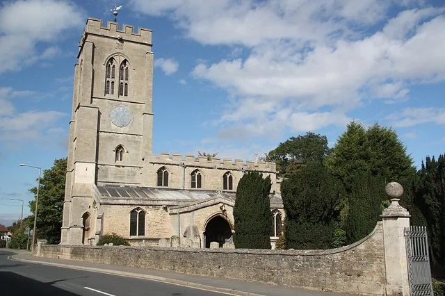
St Guthlac's Church, Market Deeping
Historic churches · 1.7 km

Brian's Tree
Memorials & monuments · 1.9 km

Pair Of Bridges Over River Welland
Historic bridges · 2.0 km

Bridge Over South Drain
Historic bridges · 2.0 km

Bridge Over Mill Stream About 135 Yards East North East Of Lolham Mill
Historic bridges · 2.0 km

Village cross, Towngate
Memorials & monuments · 2.1 km
Bridge Over Ditch About 135 Yards East South East Of Lolham Mill
Historic bridges · 2.1 km

Bridge Over Drain About 420 Yards South South East Of Overdale
Historic bridges · 2.1 km

Deeping Gate Bridge
Historic bridges · 2.2 km

Deeping St James
Historic churches · 2.2 km
Nearby
📷 5Historic bridges · East Midlands
Mill Race Bridge To Market Deeping Mill
Mill Race Bridge To Market Deeping Mill — Grade II listed building-listed bridge in england-london, United Kingdom.
📷 5Museums · East Midlands
Market Deeping
Market Deeping — a museum in england-london, United Kingdom.
📷 5Historic churches · East Midlands
St Guthlac's Church, Market Deeping
St Guthlac's Church, Market Deeping — church in Market Deeping, Lincolnshire, England, UK.
📷 5Memorials & monuments · East Midlands
Brian's Tree
Brian's Tree — a memorial in england-london, United Kingdom.
📷 5Historic bridges · East Midlands
Pair Of Bridges Over River Welland
Pair Of Bridges Over River Welland — Grade II listed building-listed bridge in england-london, United Kingdom.
📷 5Historic bridges · East Midlands
Bridge Over South Drain
Bridge Over South Drain — Grade II listed building-listed bridge in england-london, United Kingdom.
Where to eat & stay near Maxey Castle
Places to stay
 📷 5
📷 5Caravan parks · East Midlands
Cresslands
Cresslands — a caravan park in england east midlands.
 📷 4
📷 4Caravan parks · East Midlands
Home Farm Camping and Caravaning
Home Farm Camping and Caravaning — a caravan park in england east midlands.
 📷 5
📷 5Caravan parks · East Midlands
Windmill Farm Caravan Park
Windmill Farm Caravan Park — a caravan park in england east midlands.
 📷 5
📷 5Campsites · East of England
Sacrewell Farm
Sacrewell Farm — a campsite in england london.
 📷 5
📷 5Hotels · East Midlands
George Hotel, Stamford
The George Hotel is a hotel and former coaching inn on the route of the Great North Road in St Martin's, Stamford, Lincolnshire, England. The hotel itself and numbers 68 and 69 St Martin's, which has
 📷 6
📷 6Places to eat & drink
 📷 5
📷 5Historic pubs · East of England
Blue Bell Public House
Blue Bell Public House in England East, United Kingdom.
 📷 5
📷 5Historic pubs · East of England
The Blue Bell Public House
The Blue Bell Public House in England East, United Kingdom.
 📷 5
📷 5Historic pubs · East of England
Ye Olde White Hart
Ye Olde White Hart in England East, United Kingdom.
 📷 5
📷 5Historic pubs · East Midlands
The O'Briens Arms Public House
The O'Briens Arms Public House in England East, United Kingdom.
 📷 5
📷 5Historic pubs · East Midlands
The Beehive Public House
The Beehive Public House in England East, United Kingdom.
 📷 7
📷 7More castles in this region
 📷 5
📷 5Castles · East Midlands
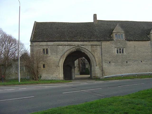
Northborough Manor House
Northborough Manor House — Grade I listed house in Northborough, Peterborough, Cambridgeshire, England, UK.
 📷 5
📷 5Castles · East Midlands
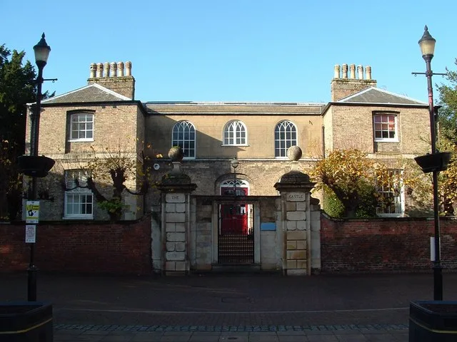
Wisbech Castle
Wisbech Castle — former castle in Wisbech, Cambridgeshire, England.
 📷 5
📷 5Castles · East Midlands
Site of Stamford Castle
Site of Stamford Castle — a castle in england-london, United Kingdom.
 📷 5
📷 5Frequently asked questions
- Where is Maxey Castle?
- Maxey Castle is in London, United Kingdom (postcode PE6 9HE), in the parish of Maxey.
- What is Maxey Castle?
- Maxey Castle — castle, now ruinous, in Maxey, Cambridgeshire, England, UK.
- How do I get to Maxey Castle?
- Drivers can use postcode PE6 9HE.
- Does Maxey Castle charge admission?
- Maxey Castle typically charges admission. Check the official site for current ticket prices and opening hours.
- How do I get to Maxey Castle?
- Drivers can navigate to postcode PE6 9HE. It sits within the North West Cambridgeshire parliamentary constituency.