
Towns & cities · South West England
Marshfield
Marshfield — village and civil parish in Gloucestershire, UK.

Wikimedia Commons contributors — see linked file page for photographer and licence licence

Plan your visit
- Typical visit
- 3 h–6 h
- Nearest railway station
- Bath Spa · 9.8 km
- Free entry
- Family-friendly
- Dog-friendly
Getting there & planning your visit
To visit Marshfield, you can take a train to Bath Spa, which is approximately 9.8 km away. Entry to the town is free.
About
Marshfield is a town, city, village or settlement in the United Kingdom. Recent population estimates put it at around 1,584 people. Address: SN14. Wikidata describes it as: "village and civil parish in Gloucestershire, UK". Coordinates: 51.4620°, -2.3170°.
Photo gallery
See it from the streetimagery from 2018
Imagery © Mapillary contributors, CC BY-SA 4.0
Protected designations
- Area of Outstanding Natural Beauty: Cotswolds
Designations sourced from Natural England open data under OGL v3.
From the Wikipedia article
Marshfield is a village in the local-government area of South Gloucestershire, England, on the borders of the counties of Wiltshire and Somerset. Its toponym derives from the Old English word "march", meaning "a border", hence "Border Field" would be a literal translation. The name has nothing to do with "marsh" in the sense of a bog. The history of the village is reflected in the buildings and their architecture, including the church and the market place. Troops occupied the village in 1643 during the English Civil War. A range of customs and cultural events take place in the village.
Excerpt from Wikipedia under CC BY-SA 4.0. See the source article linked in Sources below.
Background
History
The village is rich in history because of its location in the heart of Cotswold wool country, near to Bath and Bristol. Located within an agricultural area, Marshfield gained market status in 1234. The layout conforms to that of a typical market town with long narrow burgage plot gardens extending back from the narrow frontages, and served by two rear access lanes (Back Lane and Weir Lane). The majority of buildings lining the street are of 18th-century origin although several buildings date from the 17th century. The building style is largely Georgian. The facades of the buildings are unified by the consistent use of local stone and other materials, which adds character to the village.
Description
St Mary's parish church with its tower provides an important focal point that can be observed from numerous points in the village and is a landmark visible from miles around. The church is on the eastern side of the village. A church has stood on that site for more than 1,000 years. The first was dedicated to St Nicholas, and at west Marshfield there was another, of which no traces remain, to St Pancras. It is thought that a field called St Pancras Close marks the site. In Bristol Museum there is an ancient deed of about 1125 confirming to the Abbot of Tewkesbury various tithes and ecclesiastical benefices, among them Marshfield church, at that time very much smaller than the church we see…
Sourced from Wikipedia under CC BY-SA 4.0.
- Coordinates
- 51.4620, -2.3170
- District
- South Gloucestershire
- Parish
- Marshfield
- Postcode
- SN14
- Parliamentary constituency
- Thornbury and Yate
- Population
- 1,584
- Nearest railway station
- Bath Spa — 9.8 km
- Official site
- neighbourhood.statistics.gov.uk
Sources
- wikidata: Q1215860 (CC0)
- wikipedia: Marshfield, Gloucestershire (CC BY-SA 4.0)
- commons: Marshfield school.jpg (CC BY-SA 4.0)
Other places nearby

The Crown And 2 Rear Wings And Outbuilding To Rear
Historic pubs · 0.0 km

Marshfield House
Historic houses · 0.1 km

Bridge 180 Yards To North West Of Ashwicke Hall
Historic bridges · 2.1 km

Garden Walls And Gateways About 15 Metres South Of The Manor House
Holy wells · 3.2 km

The Manor House
Historic houses · 3.2 km
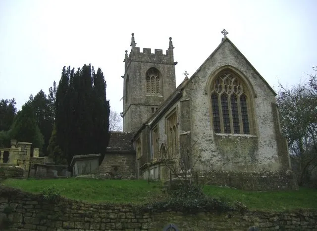
Church of St Catherine, St Catherine
Historic churches · 3.5 km
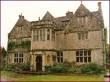
St Catherine's Court
Stately homes · 3.5 km

Tollgate teahouse
Cafés · 3.5 km
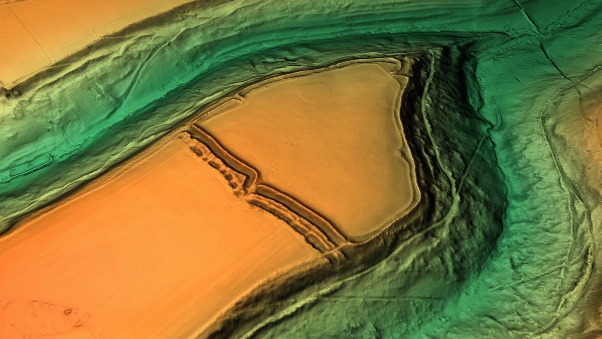
Bury Camp
Hill forts · 3.8 km

Elms Monument In Churchyard About 22 Metres South Of South East Angle Of Tower Of Church Of St James
Memorials & monuments · 3.9 km

I Holborow Monument In Churchyard About 12 Metres South Of Tower Of Church Of St James
Memorials & monuments · 3.9 km
Hooper Monument In Churchyard About 19 Metres South Of Tower Of Church Of St James
Memorials & monuments · 3.9 km
Marshfield is a charming town located in South West England, offering visitors a delightful mix of heritage and scenic beauty. You can explore historic properties like Hamswell House and Bury Manor, or enjoy refreshments at the Tollgate teahouse. The area also features striking landmarks such as the Church of St Catherine and the Sir Bevil Grenville memorial, alongside the panoramic views from Ravens Rock.
At a glance
- Population
- 1,584
- Constituency
- Thornbury and Yate
- Top categories near here
Things to see in Marshfield
34 attractions within 12 km — showing the 24 most editorially-significant. Full guide: things to do in Marshfield →
 📷 5
📷 5Forts · South West England
Battle of Lansdowne 1643
Battle of Lansdowne 1643 is a fort in the United Kingdom.
📷 3Hill forts · South West England
Bury Camp
Bury Camp — site of an Iron Age multivallate hillfort located in Wiltshire, England, UK.
 📷 5
📷 5Historic houses · South West England
Bury Manor
Bury Manor — house in Wick, Gloucestershire, England, UK.
📷 5Historic churches · South West England
Church of St Catherine, St Catherine
Church of St Catherine, St Catherine — church in Bath and North East Somerset, England, UK.
📷 5Holy wells · South West England
Garden Walls And Gateways About 15 Metres South Of The Manor House
Garden Walls And Gateways About 15 Metres South Of The Manor House — Grade I listed wall in South Gloucestershire, England, UK.
.jpg?width=1200) 📷 5
📷 5Historic houses · South West England
Hamswell House
Hamswell House — house in Cold Ashton, South Gloucestershire, England, UK.
📷 5Historic houses · South West England
Marshfield House
Marshfield House — house in Marshfield, South Gloucestershire, England, UK.
 📷 5
📷 5Viewpoints · South West England
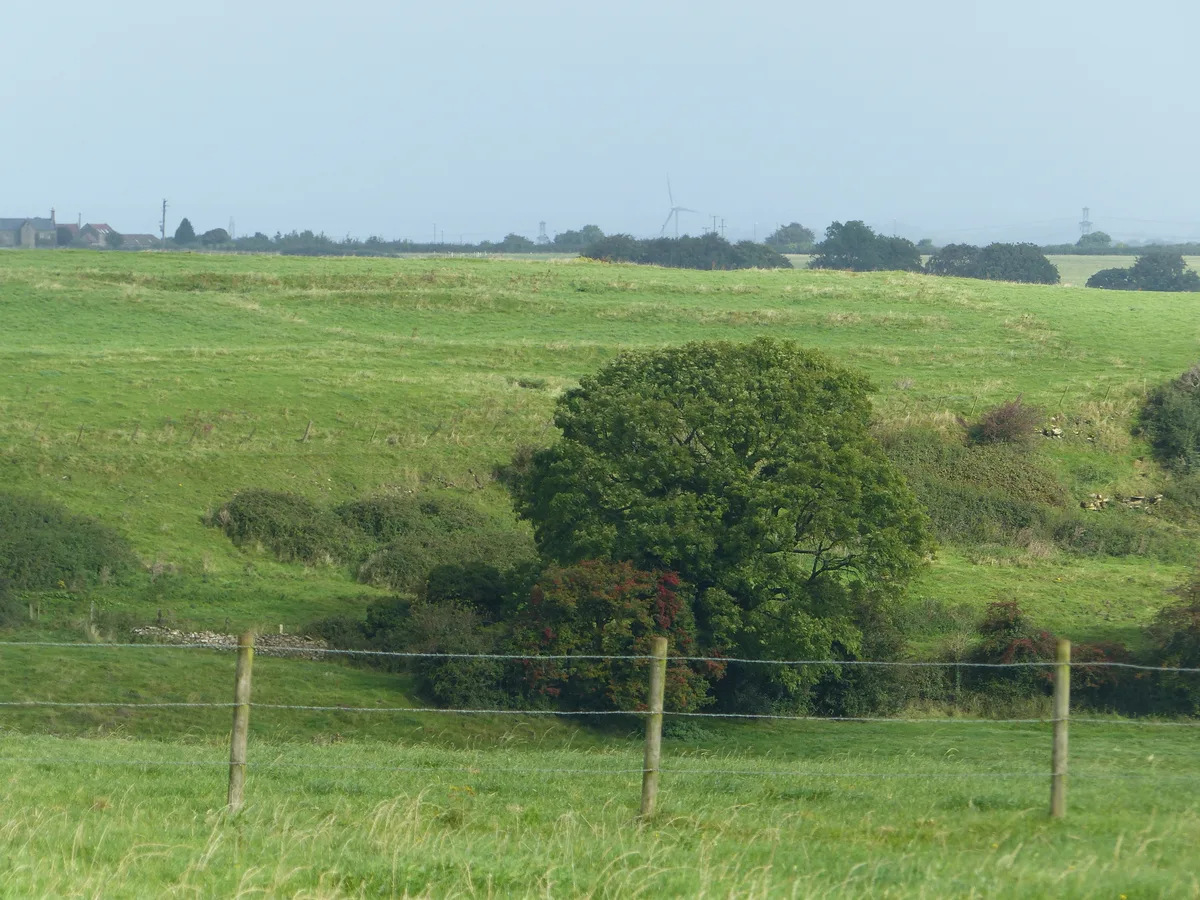
Ravens Rock
Ravens Rock is a viewpoint in the United Kingdom.
 📷 5
📷 5Archaeological sites · South West England
Romano-British settlement E of Sir Bevil Granville's Monument
Romano-British settlement E of Sir Bevil Granville's Monument — archaeological site in Charlcombe, Bath and North East Somerset, England, UK.
 📷 5
📷 5Memorials & monuments · South West England
Sir Bevil Grenville
Sir Bevil Grenville is a memorial in the United Kingdom.
📷 5Stately homes · South West England
St Catherine's Court
St Catherine's Court — Grade I listed manor house in Bath and North East Somerset, England, UK.
📷 5Historic houses · South West England
The Manor House
The Manor House — Grade I listed house in South Gloucestershire, England, UK.
 📷 5📷 5📷 5
Historic churches · South West England
Church of St James, North Wraxall
Church of St James, North Wraxall — Grade I listed building-listed church in england-south-east, United Kingdom.
📷 5Historic bridges · South West England
Bridge 180 Yards To North West Of Ashwicke Hall
Bridge 180 Yards To North West Of Ashwicke Hall — Grade II listed building-listed bridge in england-south-east, United Kingdom.
 📷 5
📷 5Historic bridges · South West England
Boyd Bridge
Boyd Bridge — Grade II listed building-listed bridge in england-south-east, United Kingdom.
📷 5Memorials & monuments · South West England
I Holborow Monument In Churchyard About 12 Metres South Of Tower Of Church Of St James
I Holborow Monument In Churchyard About 12 Metres South Of Tower Of Church Of St James — Grade II listed building-listed memorial in england-south-east, United Kingdom.
📷 5Memorials & monuments · South West England
Skeate Monument And Railings In Churchyard About 14 Metres South South West Of Tower Of Church Of St James
Skeate Monument And Railings In Churchyard About 14 Metres South South West Of Tower Of Church Of St James — Grade II listed building-listed memorial in england-south-east, United Kingdom.
📷 5Memorials & monuments · South West England
D Parker Monument In Churchyard About 14 Metres South Of South East Angle Of Tower Of Church Of St James
D Parker Monument In Churchyard About 14 Metres South Of South East Angle Of Tower Of Church Of St James — Grade II listed building-listed memorial in england-south-east, United Kingdom.
📷 5Memorials & monuments · South West England
R Parker Monument In Churchyard About 16 Metres South Of South East Angle Of Tower Of Church Of St James
R Parker Monument In Churchyard About 16 Metres South Of South East Angle Of Tower Of Church Of St James — Grade II listed building-listed memorial in england-south-east, United Kingdom.
📷 5Memorials & monuments · South West England
Hooper Monument In Churchyard About 19 Metres South Of Tower Of Church Of St James
Hooper Monument In Churchyard About 19 Metres South Of Tower Of Church Of St James — Grade II listed building-listed memorial in england-south-east, United Kingdom.
📷 5Memorials & monuments · South West England
W Holborow Monument In Churchyard About 11 Metres South Of South East Angle Of Tower Of Church Of St James
W Holborow Monument In Churchyard About 11 Metres South Of South East Angle Of Tower Of Church Of St James — Grade II listed building-listed memorial in england-south-east, United Kingdom.
📷 5Memorials & monuments · South West England
N Tayler Monument In Churchyard About 5 Metres South Of Nave South Gable Of Church Of St James
N Tayler Monument In Churchyard About 5 Metres South Of Nave South Gable Of Church Of St James — Grade II listed building-listed memorial in england-south-east, United Kingdom.
Nearby
📷 5Historic pubs · South West England
The Crown And 2 Rear Wings And Outbuilding To Rear
The Crown And 2 Rear Wings And Outbuilding To Rear in England South West, United Kingdom.
📷 5Historic houses · South West England
Marshfield House
Marshfield House — house in Marshfield, South Gloucestershire, England, UK.
📷 5Historic bridges · South West England
Bridge 180 Yards To North West Of Ashwicke Hall
Bridge 180 Yards To North West Of Ashwicke Hall — Grade II listed building-listed bridge in england-south-east, United Kingdom.
📷 5Holy wells · South West England
Garden Walls And Gateways About 15 Metres South Of The Manor House
Garden Walls And Gateways About 15 Metres South Of The Manor House — Grade I listed wall in South Gloucestershire, England, UK.
📷 5Historic houses · South West England
The Manor House
The Manor House — Grade I listed house in South Gloucestershire, England, UK.
📷 5Historic churches · South West England
Church of St Catherine, St Catherine
Church of St Catherine, St Catherine — church in Bath and North East Somerset, England, UK.
Where to eat & stay near Marshfield
Places to stay
 📷 6
📷 6B&Bs · South West England
Dolphin House
Dolphin House — a bed-and-breakfast in england south east.
 📷 5
📷 5Hotels · South West England
Bailbrook House Hotel
Bailbrook House Hotel — a hotel in england south east.
 📷 7📷 7
Hotels · South West England
Bailbrook Lodge Hotel
Bailbrook Lodge Hotel — a hotel in england south east.
 📷 5
📷 5Campsites · South West England
The Blackberries Camping Park
The Blackberries Camping Park — a campsite in england south east.
 📷 5
📷 5Hotels · South West England
The Lansdown Grove Hotel
The Lansdown Grove Hotel — a hotel in england south east.
Places to eat & drink
📷 5Historic pubs · South West England
The Crown And 2 Rear Wings And Outbuilding To Rear
The Crown And 2 Rear Wings And Outbuilding To Rear in England South West, United Kingdom.
📷 6 📷 5
📷 5Historic pubs · South West England
The Fox And Hounds Public House
The Fox And Hounds Public House in England South West, United Kingdom.
 📷 7
📷 7Restaurants · South West England
The Bathampton Mill
The Bathampton Mill — a restaurant in england south east.
 📷 7
📷 7Historic pubs · South West England
The Inn And Public House
The Inn And Public House in England South West, United Kingdom.
 📷 5
📷 5Historic pubs · South West England
The Hare And Hounds
The Hare And Hounds in England South West, United Kingdom.
More towns in this region
 Flagship📷 10
Towns & cities · South West England
Shoscombe
Shoscombe — village and civil parish in Somerset, UK.
 Flagship📷 10
Towns & cities · South West England
Tarrant Keyneston
Tarrant Keyneston — village and civil parish in Dorset, United Kingdom.
 📷 5
📷 5 📷 5
📷 5Towns & cities · South West England
Arne
Arne — village in Purbeck, Dorset, United Kingdom.
Frequently asked questions
- Where is Marshfield?
- Marshfield is in South-West England, United Kingdom (postcode SN14), in the parish of Marshfield.
- What is Marshfield?
- Marshfield — village and civil parish in Gloucestershire, UK.
- How do I get to Marshfield?
- The nearest railway station is Bath Spa, about 9.8 km away. Drivers can use postcode SN14.
- Is Marshfield a protected site?
- Yes — Marshfield is part of the Cotswolds National Landscape (AONB).
- Is Marshfield free to visit?
- Yes, Marshfield is free to enter.
- How do I get to Marshfield?
- Drivers can navigate to postcode SN14. It sits within the Thornbury and Yate parliamentary constituency.