
Stately homes · South West England
Mappercombe Manor House
In or near Bradpole.
Mappercombe Manor House — Grade I listed manor house in Powerstock, Dorset, England, UK.

Wikimedia Commons contributors — see linked file page for photographer and licence licence

Plan your visit
- Typical visit
- 2 h–4 h
- Nearest railway station
- Maiden Newton · 9.2 km
- Family-friendly
- Limited wheelchair access
Getting there & planning your visit
Mappercombe Manor House is located in Dorset, postcode DT6 3SS, and is approximately 9.2 km from the nearest railway station, Maiden Newton. Entry details are not specified, and wheelchair accessibility is limited.
About
Mappercombe Manor House is a historic house in South-West England. Officially recognised as Grade I listed building. The site is within the Dorset National Landscape (AONB). It sits within the West Dorset parliamentary constituency. The nearest railway station is Maiden Newton, about 9.2 km away. Postcode area DT6.
Photo gallery
Heritage listing
Details SY 59 NW POWERSTOCK MAPPERCOMBE 4-12-1951 8/191 Mappercombe Manor House GV I Manor House. Early C17, with C15 south-east corner. Late C17 north- west range. Dressed stone walls. Clay tile roof with stone gable- copings and moulded ogee kneelers. Brick stacks, of c.1900, just below ridge, left of centre, main range, behind ridge on south range, north-west range front eaves and rear eaves. C15 part, one bay, 2 storeys. Ground 3-light mullion (ovolo). Trefoil-headed lancet over. Gable-wall has a 2-light trefoil-headed window with a label and carved head-stops. South range: 2 storeys and basements. 3 windows, 4-, 5-, 4-light stone mullions (ovolos). Stone plat-band and individual cornice-labels to ground floor windows. First floor windows without labels. Entrance originally at centre of this range. North- west range joined to front block by a 2 bay rear wing. North West range: 2 storeys, 5 windows, white limestone mullions (ovolos) with separate classical cornices over. Doorway , approximately at centre with moulded stone jambs and very depressed-arch head. Sundial with ram's head and swag above doorway. North block of house is early C20. 2 storeys and attics. 3 windows. Tall C20 brick stacks. Present entrance porch on east side, Cl9, with a 4-centred entrance and blocked bull's eye. Plank door. Interior: west room of the south range, C17 plaster frieze of running vine-ornament. Stone fireplace with architrave, pulvinated frieze, cornice and a blank shield in the middle of the frieze. Room above has a similar plaster frieze. Upper room in small South east wing (?chapel), recess with a trefoiled head in the south wall. North-west range, reset C17 overmantel of 4 panelled bays with enriched divisions, panels have painted shields-of-arms. Source: R.C.H.M. Dorset I, p 1
From the Historic England List Entry under OGL v3.
Protected designations
- Area of Outstanding Natural Beauty: Dorset
Designations sourced from Natural England open data under OGL v3.
Place summary
Mappercombe Manor House is a Grade I listed stately home located in Powerstock, South-West England. The building is situated within an Area of Outstanding Natural Beauty (AONB) in Dorset.
AI-generated from the structured facts on this page (operator, designation, listing, era). Not a substitute for visiting.
- Coordinates
- 50.7536, -2.6931
- District
- Dorset
- Parish
- Powerstock
- Postcode
- DT6 3SS
- Parliamentary constituency
- West Dorset
- Nearest railway station
- Maiden Newton — 9.2 km
Sources
- wikidata: Q17532916 (CC0)
- commons: Mappercombe Manor House - geograph.org.uk - 1239605.jpg (CC BY-SA 4.0)
Other places nearby

Mappercombe Manor
Castles · 0.0 km

Powerstock Castle
Literary houses · 1.2 km

Parish Church of St Mary, Powerstock
Historic churches · 1.2 km

Obelisk 10 Metres East Of Parish Church (Burts Of Mappercombe)
Forts · 1.2 km

Powerstock
Castles · 1.2 km

Way's Hill
Mountains & hills · 1.4 km

Road Bridge Over River Asker
Historic bridges · 1.9 km

Loders
Villages · 1.9 km

Loders Arms Inn
Historic pubs · 2.0 km

Parish Church of St Mary Magdelene
Historic churches · 2.2 km

Mangerton Mill
Natural landmarks · 2.4 km

Mangerton Hill
Mountains & hills · 2.8 km
Nearby
📷 5📷 5Literary houses · South West England
Powerstock Castle
Powerstock Castle — a literary house museum in england south west.
📷 3Historic churches · South West England
Parish Church of St Mary, Powerstock
Parish Church of St Mary, Powerstock — Grade I listed building-listed church in england-south-west, United Kingdom.
📷 5Forts · South West England
Obelisk 10 Metres East Of Parish Church (Burts Of Mappercombe)
Obelisk 10 Metres East Of Parish Church (Burts Of Mappercombe) — a martello broad in england-south-west, United Kingdom.
📷 5Castles · South West England
Powerstock
Powerstock — a castle in england-south-west, United Kingdom.
📷 5Mountains & hills · South West England
Way's Hill
Way's Hill — a hill or mountain in england south west.
Where to eat & stay near Mappercombe Manor House
Places to stay
 📷 5
📷 5Hotels · South West England
The Bull Hotel
The Bull Hotel — a hotel in england south west.
 📷 5
📷 5Campsites · South West England
Graston Farm Campsite
Graston Farm Campsite — a campsite in england south west.
 📷 5
📷 5Caravan parks · South West England
Washingpool Caravan Site
Washingpool Caravan Site — a caravan park in england south west.
📷 5Campsites · South West England
Greenacres Campsite.
Greenacres Campsite. — a campsite in england south west.
 📷 5
📷 5Caravan parks · South West England
Graston Copse Holiday Park
Graston Copse Holiday Park — a caravan park in england south west.
 📷 5
📷 5Hotels · South West England
Hooke Court
Hooke Court — a hotel in england south west.
Places to eat & drink
📷 5Historic pubs · South West England
Loders Arms Inn
Loders Arms Inn in England South West, United Kingdom.
 📷 5
📷 5 📷 7
📷 7Historic pubs · South West England
Three Mariners Public House
Three Mariners Public House in England South West, United Kingdom.
 📷 5
📷 5Historic pubs · South West England
The Tiger Public House
The Tiger Public House in England South West, United Kingdom.
 📷 5
📷 5Historic pubs · South West England
10 North Street
10 North Street in England South West, United Kingdom.
 📷 7
📷 7Historic pubs · South West England
Greyhound Hotel
Greyhound Hotel in England South West, United Kingdom.
More places in this region
 Flagship📷 9
Stately homes · South West England
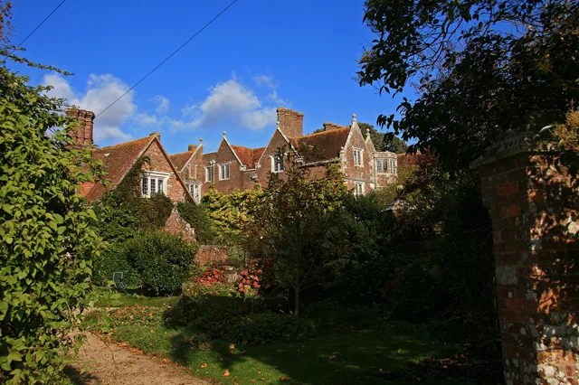
Anderson Manor
Anderson Manor — Grade I listed manor house in Anderson, Dorset, England, UK.
 Flagship📷 10
Stately homes · South West England
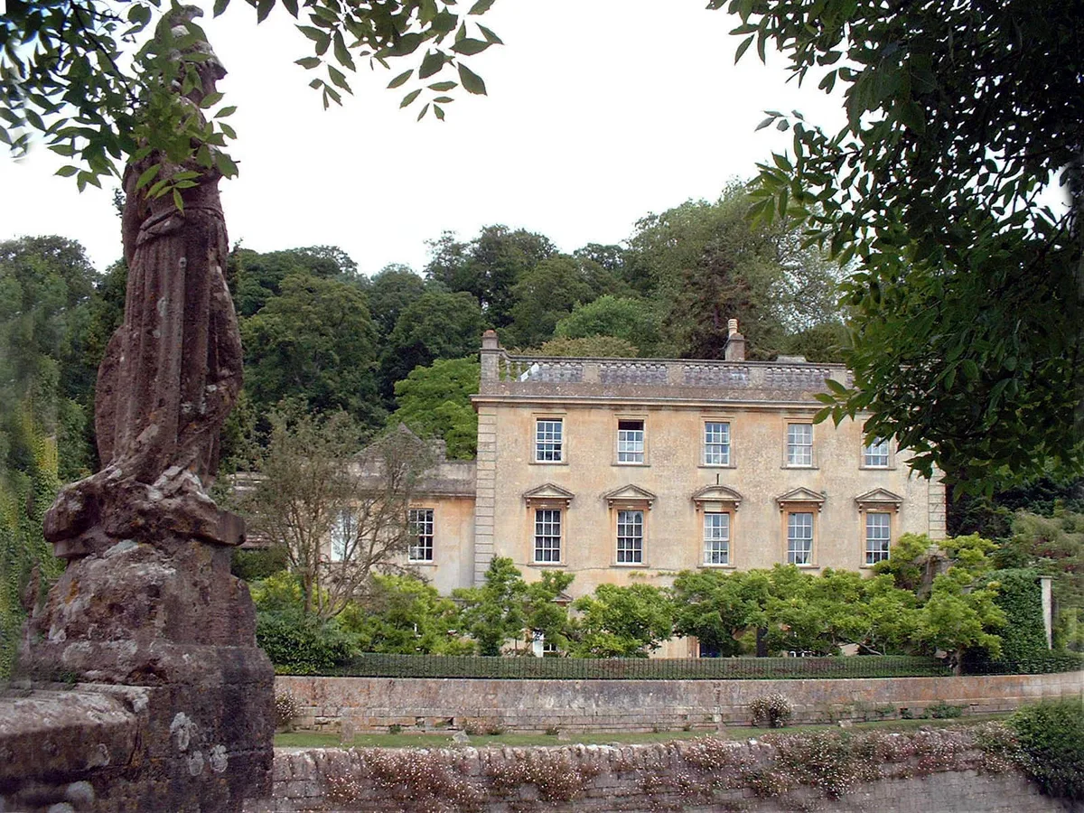
Iford Manor
Iford Manor — manor house in Somerset/Wiltshire, UK.
 Flagship📷 10
Stately homes · South West England
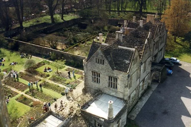
Mells Manor
Mells Manor — Grade I listed house in Mells, Somerset, England, UK.
 Flagship📷 5
Stately homes · South West England
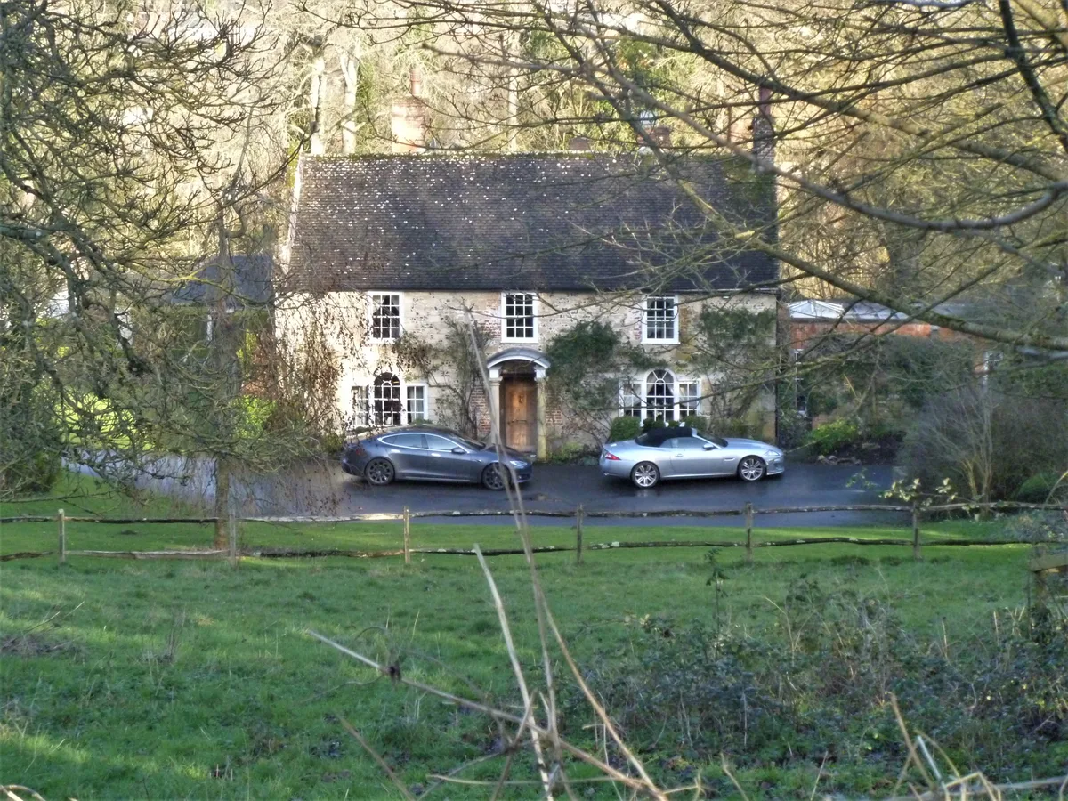
Addestone Manor
Addestone Manor — manor house in Shrewton, Wiltshire, England, UK.
Frequently asked questions
- Where is Mappercombe Manor House?
- Mappercombe Manor House is in South-West England, United Kingdom (postcode DT6 3SS), in the parish of Powerstock.
- What is Mappercombe Manor House?
- Mappercombe Manor House — Grade I listed manor house in Powerstock, Dorset, England, UK.
- How do I get to Mappercombe Manor House?
- The nearest railway station is Maiden Newton, about 9.2 km away. Drivers can use postcode DT6 3SS.
- Is Mappercombe Manor House a listed building?
- Mappercombe Manor House is officially recognised as Grade I listed building listed.
- Is Mappercombe Manor House a protected site?
- Yes — Mappercombe Manor House is part of the Dorset National Landscape (AONB).
- How do I get to Mappercombe Manor House?
- Drivers can navigate to postcode DT6 3SS. It sits within the West Dorset parliamentary constituency.