
Castles · Yorkshire & the Humber
Malton Castle Marker
In or near Westow.
Malton Castle Marker — Public artwork (sculpture) by Pete Coates.
.jpg?width=1200)
Wikimedia Commons contributors — see linked file page for photographer and licence licence
.jpg)
Plan your visit
- Typical visit
- 1.5 h–3 h
- Nearest railway station
- Malton · 0.4 km
- Free entry
- Family-friendly
- Limited wheelchair access
Getting there & planning your visit
Malton Castle Marker is located at postcode YO17 7DZ and is approximately 0.4 km from Malton railway station. Entry is free, but wheelchair accessibility is limited.
About
Malton Castle Marker is a place of interest in the United Kingdom. Wikidata describes it as: "Public artwork (sculpture) by Pete Coates.". Coordinates: 54.1339°, -0.7933°.
Photo gallery
360° view
Imagery © Mapillary contributors, CC BY-SA 4.0
Official information
Malton Castle Marker is the site of archaeological excavations revealing parts of the Roman fort's vicus, including a mosaic and various buildings from the 1st to the 4th century. Visitors can explore the remains of workshops, roads, and a significant structure with a hypocaust system.
Protected designations
- Site of Special Scientific Interest: River Derwent SSSI
Designations sourced from Natural England open data under OGL v3.
From the Wikipedia article
Malton Castle was a castle in Malton, North Yorkshire, England. A wooden motte and bailey castle was built by William Tyson, lord of Alnwick in the 11th century, on the site of the Roman fort of Derventio Brigantum. The castle was given to Eustace Fitz John, who rebuilt it in stone. Eustace negotiated the delivery of the castle to King David I of Scotland in 1138. The Scots garrisoned the castle, however it was captured later the same year. King Richard I of England visited the castle in 1189 and King Edward II of England in 1307. When Eustace de Vesci rebelled against King John in 1212, he gave orders to destroy (slight) de Vesci's castles at Malton and Alnwick. The castle was held against King John of England, during the First Barons' War. After the battle of Old Byland the castle was captured and destroyed by King Robert I of Scotland in 1322. The castle was not repaired and fell into ruins. Only the former gatehouse and some short sections of original medieval curtain wall still exist. The gatehouse is now used as a hotel. A house was built on the site in 1569 by Ralph, Lord Eure, which came to be inherited by two sisters of the Eure family, Margaret and Mary. In 1674 they fell out over ownership and took their argument to the County Sheriff, who destroyed the house and put the stones into two equal piles for the sisters to share. The site is now a scheduled monument.
Excerpt from Wikipedia under CC BY-SA 4.0. See the source article linked in Sources below.
- Coordinates
- 54.1339, -0.7933
- District
- North Yorkshire
- Parish
- Malton
- Postcode
- YO17 7DZ
- Parliamentary constituency
- Thirsk and Malton
- Nearest railway station
- Malton — 0.4 km
- Official site
- www.pastscape.org.uk
Sources
- osm: n5868857303 (ODbL)
- wikipedia: Malton Castle (CC BY-SA 4.0)
- commons: The Old Lodge, Malton (geograph 3239729).jpg (CC BY-SA 4.0)
Other places nearby

Site of Malton Castle
Castles · 0.1 km
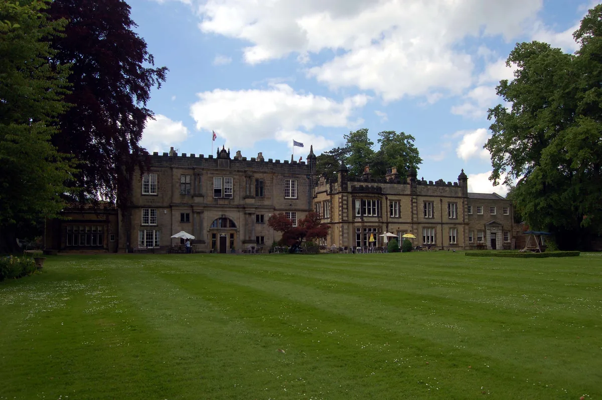
Malton Castle
Castles · 0.1 km

Malton Bridge
Historic bridges · 0.2 km

The Old Lodge
Manor houses · 0.2 km

The New Globe Public House
Historic pubs · 0.2 km
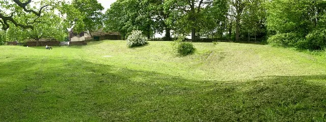
Derventio Brigantum
Archaeological sites · 0.3 km

Derventio
Archaeological sites · 0.3 km

Malton railway station
Heritage railway stations · 0.3 km

Malton Palace CInema
Cinemas · 0.4 km

Dickens Museum & Scrooges Counting House
Museums · 0.4 km

The Milton Rooms
Theatres · 0.4 km

The Cross Keys Public House
Historic pubs · 0.4 km
Nearby
📷 3Castles · Yorkshire & the Humber
Site of Malton Castle
Site of Malton Castle — scheduled monument-listed castle in england-yorkshire, United Kingdom.
📷 3Castles · Yorkshire & the Humber
Malton Castle
Malton Castle — former castle in North Yorkshire, England, UK.
📷 3Historic bridges · Yorkshire & the Humber
Malton Bridge
Malton Bridge is a historic bridge in the United Kingdom.
📷 3Manor houses · Yorkshire & the Humber
The Old Lodge
The Old Lodge — a manor in england-yorkshire, United Kingdom.
📷 5Historic pubs · Yorkshire & the Humber
The New Globe Public House
The New Globe Public House in England Yorkshire, United Kingdom.
📷 3Archaeological sites · Yorkshire & the Humber
Derventio Brigantum
Derventio Brigantum — Roman fort located at present-day Malton, North Yorkshire, England, UK.
Where to eat & stay near Malton Castle Marker
Places to stay
 📷 5
📷 5Campsites · Yorkshire & the Humber
Thornthorpe Caravan & Camping Site
Thornthorpe Caravan & Camping Site — a campsite in england yorkshire.
 📷 5
📷 5Caravan parks · Yorkshire & the Humber
Brickyard Lakes Country Park
Brickyard Lakes Country Park — a caravan park in england yorkshire.
 📷 5
📷 5 📷 5
📷 5Caravan parks · Yorkshire & the Humber
Hill Top Farm Caravans
Hill Top Farm Caravans — a caravan park in england yorkshire.
 📷 5
📷 5Caravan parks · Yorkshire & the Humber
Castle Howard Lakeside Touring Site
Castle Howard Lakeside Touring Site — a caravan park in england yorkshire.
 📷 5
📷 5Places to eat & drink
📷 5Historic pubs · Yorkshire & the Humber
The New Globe Public House
The New Globe Public House in England Yorkshire, United Kingdom.
📷 7Historic pubs · Yorkshire & the Humber
The Cross Keys Public House
The Cross Keys Public House in England Yorkshire, United Kingdom.
 📷 5
📷 5Historic pubs · Yorkshire & the Humber
The Golden Lion Public House
The Golden Lion Public House in England Yorkshire, United Kingdom.
 📷 7
📷 7Historic pubs · Yorkshire & the Humber
The Blue Ball Public House And Attached Outbuildings At Rear
The Blue Ball Public House And Attached Outbuildings At Rear in England Yorkshire, United Kingdom.
 📷 5
📷 5Historic pubs · Yorkshire & the Humber
The Spotted Cow Public House
The Spotted Cow Public House in England Yorkshire, United Kingdom.
 📷 5
📷 5More castles in this region
 📷 5
📷 5Castles · Yorkshire & the Humber
Ashton-under-Lyne
Ashton-under-Lyne, also known simply as Ashton, is a market town in Tameside, Greater Manchester, United Kingdom. The population was 48,604 at the 2021 census. Historically a part of Lancashire, it is
 📷 5
📷 5Castles · Yorkshire & the Humber
Audenshaw
Audenshaw is a town in Tameside, Greater Manchester, England, 4.9 miles (7.9 km) east of Manchester. Historically part of Lancashire, in 2011 it had a population of 11,419. The name derives from Aldwi
 📷 5
📷 5Castles · Yorkshire & the Humber
Bramhall
Bramhall is a large village in the Metropolitan Borough of Stockport, Greater Manchester, England. It was formerly a civil parish in Cheshire. At the 2021 census, the built-up area, as defined by the
 📷 5
📷 5Castles · Yorkshire & the Humber
Bredbury
Bredbury is a town in the Metropolitan Borough of Stockport, Greater Manchester, England; it lies 8 miles (12.9 km) south-east of Manchester, 2 miles (3.2 km) east of Stockport and 3 miles (4.8 km) so
Frequently asked questions
- Where is Malton Castle Marker?
- Malton Castle Marker is in Yorkshire, United Kingdom (postcode YO17 7DZ), in the parish of Malton.
- What is Malton Castle Marker?
- Malton Castle Marker — Public artwork (sculpture) by Pete Coates.
- How do I get to Malton Castle Marker?
- The nearest railway station is Malton, about 0.4 km away. Drivers can use postcode YO17 7DZ.
- Is Malton Castle Marker a protected site?
- Yes — Malton Castle Marker is part of the River Derwent SSSI Site of Special Scientific Interest.
- Does Malton Castle Marker charge admission?
- Malton Castle Marker typically charges admission. Check the official site for current ticket prices and opening hours.
- How do I get to Malton Castle Marker?
- The nearest railway station is Malton, about 0.4 km away. Drivers can navigate to postcode YO17 7DZ.