
Historic churches · South West England
Maker, Cornwall
In or near Trematon.
Maker (Cornish: Magor) is a village between Cawsand and Rame Head, Rame Peninsula, Cornwall, England, United Kingdom. The name means a ruin or old wall in Cornish, possibly because the church was bui

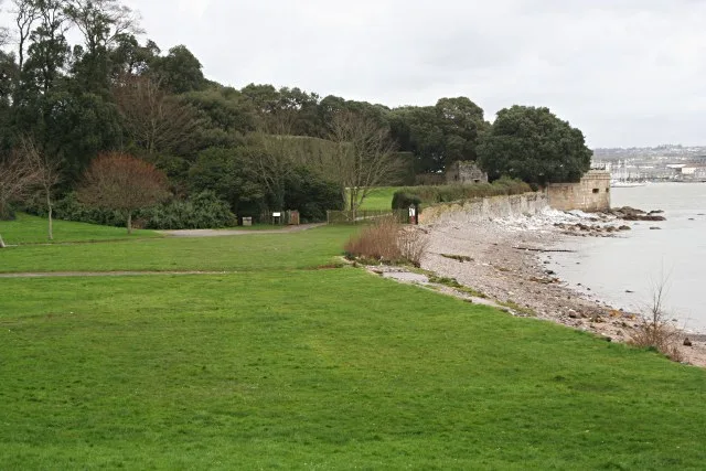
Derek Harper — CC BY-SA 2.0 via Wikimedia Commons licence

Plan your visit
- Typical visit
- 30 min–1 h
- Nearest railway station
- Devonport · 4.0 km
- Free entry
Getting there & planning your visit
To visit Maker in Cornwall, the nearest railway station is Devonport, located 4 km away. The postcode for navigation is PL10 1HR, and entry to the church is free.
About
Maker (Cornish: Magor) is a village between Cawsand and Rame Head, Rame Peninsula, Cornwall, England, United Kingdom. The name means a ruin or old wall in Cornish, possibly because the church was built from the ruins of West Stonehouse in Cremyll. This origin of the name is unlikely, as Maker is first referred to in 705AD, which predates the construction of the church. Another supposition is that the "old walls" are those of a (now lost) Roman-British villa. However, another Celtic name is Egloshayle, (not to be confused with Egloshayle on the River Camel) which means, "the church on the estuary". The village and its neighbour Rame are in the civil parish of Maker-with-Rame and the parliamentary constituency of South East Cornwall. The parish had a population of 1,020 at the 2011 census.
Photo gallery
See it from the streetimagery from 2023
Imagery © Mapillary contributors, CC BY-SA 4.0
Protected designations
- Site of Special Scientific Interest: Plymouth Sound Shores and Cliffs SSSI
- Area of Outstanding Natural Beauty: Cornwall
Designations sourced from Natural England open data under OGL v3.
From the Wikipedia article
Maker (Cornish: Magor) is a village between Cawsand and Rame Head, Rame Peninsula, Cornwall, England, United Kingdom. The name means a ruin or old wall in Cornish, possibly because the church was built from the ruins of West Stonehouse in Cremyll. This origin of the name is unlikely, as Maker is first referred to in 705AD, which predates the construction of the church. Another supposition is that the "old walls" are those of a (now lost) Roman-British villa. However, another Celtic name is Egloshayle, (not to be confused with Egloshayle on the River Camel) which means, "the church on the estuary". The village and its neighbour Rame are in the civil parish of Maker-with-Rame and the parliamentary constituency of South East Cornwall. The parish had a population of 1,020 at the 2011 census.
Excerpt from Wikipedia under CC BY-SA 4.0. See the source article linked in Sources below.
Background
History
In the late 7th Century the West Saxons and native Britons had engaged in a series of battles near the River Parrett. Around this time Aldhelm wrote a letter to King Geraint of Dumnonia describing him as 'Lord of the Western Kingdom' suggesting that all of Devon and Cornwall still retained a single ruler. The letter is fairly confrontational in places, and its purpose is to encourage Geraint to get the Briton church to accept the Roman calculation of Easter and Tonsure. Bede notes that Aldhelm's efforts were successful and, in 705, King Geraint of Dumnonia gave the promontory on the Cornish side of the mouth of the River Tamar to Sherborne Abbey, where Aldhelm was the Bishop. The Normans…
Sourced from Wikipedia under CC BY-SA 4.0.
- Coordinates
- 50.3451, -4.1911
- District
- Cornwall
- Parish
- Maker-with-Rame
- Postcode
- PL10 1HR
- Parliamentary constituency
- South East Cornwall
- Nearest railway station
- Devonport — 4 km
Sources
- wikipedia: Maker, Cornwall (CC BY-SA 4.0)
Other places nearby
Friary Manor
Manor houses · 0.0 km

Church of St Mary and St Julian, Maker
Historic churches · 0.5 km

Maker Heights
Mountains & hills · 0.6 km
Maker Camping
Campsites · 0.7 km

Scouts
Campsites · 0.8 km
Mount Edgcumbe Country Park
Gardens · 1.0 km

Southdown Quays
Marinas · 1.1 km

Empacombe Windmill
Windmills · 1.1 km

Maker-with-Rame
Historic churches · 1.2 km

Empacombe Quay
Marinas · 1.2 km

Picklecombe Seat
Follies · 1.3 km

Picklecombe Fort
Historic houses · 1.4 km
Nearby
📷 3Manor houses · South West England
Friary Manor
Friary Manor — Grade II listed building-listed manor in england-south-west, United Kingdom.
📷 4Historic churches · South West England
Church of St Mary and St Julian, Maker
Church of St Mary and St Julian, Maker — Grade I listed building-listed church in england-south-west, United Kingdom.
📷 5Mountains & hills · South West England
Maker Heights
Maker Heights — a hill or mountain in england south west.
📷 5📷 5Flagship📷 10Gardens · South West England
Mount Edgcumbe Country Park
Mount Edgcumbe Country Park — country park in Maker-with-Rame, Cornwall, England, UK.
Where to eat & stay near Maker, Cornwall
Places to stay
📷 5📷 5 📷 5
📷 5Campsites · South West England
Whitsand Bay Holiday Park
Whitsand Bay Holiday Park — a campsite in england south west.
 📷 5
📷 5Hostels · South West England
Plymouth Backpackers
Plymouth Backpackers — a hostel in england south west.
 📷 5
📷 5Hotels · South West England
Moxy Hotel
Moxy Hotel — a hotel in england south west.
 📷 7
📷 7Places to eat & drink
 📷 3
📷 3Historic pubs · South West England
The Devonport Inn
The Devonport Inn — Historic pub — listed building or notable heritage status.
 📷 5
📷 5Cafés · South West England
The Orangery
The Orangery — a café in england south west.
 📷 7
📷 7Historic pubs · South West England
The Lugger Public House
The Lugger Public House in England South West, United Kingdom.
 📷 5
📷 5Historic pubs · South West England
The Western Public House
The Western Public House in England South West, United Kingdom.
 📷 7
📷 7 📷 5
📷 5Historic pubs · South West England
The Bank Public House
The Bank Public House in England South West, United Kingdom.
More places in this region
 📷 5
📷 5Historic churches · South West England
Abbey Church of St Gregory the Great, Downside Abbey
Abbey Church of St Gregory the Great, Downside Abbey — church in Stratton-on-the-Fosse, Somerset, England, UK.
 📷 5
📷 5Historic churches · South West England
All Saints Church
All Saints Church — Grade I listed church in Woolley, Somerset, England, UK.
 📷 5
📷 5Historic churches · South West England
All Saints Church, Hampreston
All Saints Church, Hampreston — church in Hampreston, Dorset, England, UK.
 📷 5
📷 5Historic churches · South West England
All Saints Church, Nether Cerne
All Saints Church, Nether Cerne — church in Nether Cerne, Dorset, England, UK.
Frequently asked questions
- Where is Maker, Cornwall?
- Maker, Cornwall is in South-West England, United Kingdom (postcode PL10 1HR), in the parish of Maker-with-Rame.
- What is Maker, Cornwall?
- Maker (Cornish: Magor) is a village between Cawsand and Rame Head, Rame Peninsula, Cornwall, England, United Kingdom. The name means a ruin or old wall in Cornish, possibly because the church was bui
- How do I get to Maker, Cornwall?
- The nearest railway station is Devonport, about 4.0 km away. Drivers can use postcode PL10 1HR.
- Is Maker, Cornwall a protected site?
- Yes — Maker, Cornwall is part of the Plymouth Sound Shores and Cliffs SSSI Site of Special Scientific Interest and the Cornwall National Landscape (AONB).
- Is Maker, Cornwall free to visit?
- Yes, Maker, Cornwall is free to enter.
- How do I get to Maker, Cornwall?
- The nearest railway station is Devonport, about 4.0 km away. Drivers can navigate to postcode PL10 1HR.