
Manor houses · South West England
Friary Manor
In or near Trematon.
Friary Manor — Grade II listed building-listed manor in england-south-west, United Kingdom.

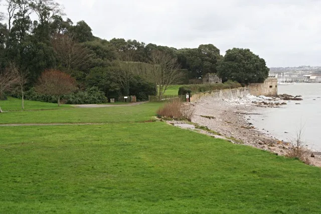
Derek Harper — CC BY-SA 2.0 via Wikimedia Commons licence

Plan your visit
- Typical visit
- 1 h–2 h
- Nearest railway station
- Devonport · 4.0 km
- Limited wheelchair access
Getting there & planning your visit
To visit Friary Manor, the nearest railway station is Devonport, located 4 km away. The postcode for sat-nav is PL10 1HR. Please note that wheelchair accessibility is limited.
About
Friary Manor is a Grade II listed building-listed manor in england-south-west, United Kingdom, registered on the National Heritage List for England (NHLE entry 1329098). Listed status protects buildings and structures of special architectural or historic interest. See the linked Wikipedia article for further details.
Photo gallery
See it from the streetimagery from 2023
Imagery © Mapillary contributors, CC BY-SA 4.0
Heritage listing
Details SX 45 SW MAKER-WITH-RAME 6/65 Friary Manor 14.5.86 GV II Vicarage for Church of St. Mary and St. Julian (q.v.), now house and restaurant. Probably C17 origin, enlarged and remodelled 1724, remodelled late C19 with C20 alterations. Rubble, slate-hung and painted front. Slate roof hipped over main range and front wings, with stacks to sides between front and rear ranges. Originally a rectangular plan house, early plan completely altered. In 1724, the house was remodelled, with a front parallel range with projecting wings to front right and left; central entrance hall with stair hall to rear constructed within the early rear range, with principal rooms to right and left, including front wings with a small square room in each. The rear range was used as service rooms, and is connected to a l½ storey outhouse enclosing the rear yard, with walls to sides. 2 storeys and attic, 1:3:1 bays. At first floor, the central range has 12-pane sashes with thin glazing bars and segmental heads, wings have ground and first floor sashes, 8-pane replacements to left and ground floor right, 12-pane sash at first floor right. Ground floor of central bays concealed by late C19/early C20 conservatory with pitched roof, cental panelled and glazed door to house with overlight. Attic storey has 2 segmental-headed dormers, each with 12-pane sash and glazed cheeks. Right side slate-hung, with mid C19 canted bay at ground floor right, with 12-pane sash to front and sidelights, cornice on consoles, 12-pane sash at first floor. Rear range to right has first floor 12-pane sash with segmental head, 2 small C19 sashes, 16-pane sash with segmental head; at ground floor a 12-pane sash with sidelights, pointed arched door to kitchen and 2-light window. At left side, the front range is slate-hung, wit
From the Historic England List Entry under OGL v3.
Protected designations
- Site of Special Scientific Interest: Plymouth Sound Shores and Cliffs SSSI
- Area of Outstanding Natural Beauty: Cornwall
Designations sourced from Natural England open data under OGL v3.
Place summary
Friary Manor is a Grade II listed building located in South-West England. This manor exemplifies architectural significance and historical value, contributing to the region's heritage.
AI-generated from the structured facts on this page (operator, designation, listing, era). Not a substitute for visiting.
- Coordinates
- 50.3454, -4.1907
- District
- Cornwall
- Parish
- Maker-with-Rame
- Postcode
- PL10 1HR
- Parliamentary constituency
- South East Cornwall
- Nearest railway station
- Devonport — 4 km
- Official site
- www.bigreddirectory.com
Sources
- wikidata: Q26614400 (CC0)
Other places nearby
Maker, Cornwall
Historic churches · 0.0 km

Church of St Mary and St Julian, Maker
Historic churches · 0.5 km

Maker Heights
Mountains & hills · 0.7 km

Scouts
Campsites · 0.8 km
Maker Camping
Campsites · 0.8 km
Mount Edgcumbe Country Park
Gardens · 1.0 km

Southdown Quays
Marinas · 1.0 km

Empacombe Windmill
Windmills · 1.1 km

Empacombe Quay
Marinas · 1.2 km

Picklecombe Seat
Follies · 1.2 km

Maker-with-Rame
Historic churches · 1.2 km

Mount Edgcumbe House Archway
Follies · 1.3 km
Nearby
📷 5Historic churches · South West England
Maker, Cornwall
Maker (Cornish: Magor) is a village between Cawsand and Rame Head, Rame Peninsula, Cornwall, England, United Kingdom. The name means a ruin or old wall in Cornish, possibly because the church was bui
📷 4Historic churches · South West England
Church of St Mary and St Julian, Maker
Church of St Mary and St Julian, Maker — Grade I listed building-listed church in england-south-west, United Kingdom.
📷 5Mountains & hills · South West England
Maker Heights
Maker Heights — a hill or mountain in england south west.
📷 5📷 5Flagship📷 10Gardens · South West England
Mount Edgcumbe Country Park
Mount Edgcumbe Country Park — country park in Maker-with-Rame, Cornwall, England, UK.
Where to eat & stay near Friary Manor
Places to stay
📷 5📷 5 📷 5
📷 5Campsites · South West England
Whitsand Bay Holiday Park
Whitsand Bay Holiday Park — a campsite in england south west.
 📷 5
📷 5Hostels · South West England
Plymouth Backpackers
Plymouth Backpackers — a hostel in england south west.
 📷 5
📷 5Hotels · South West England
Moxy Hotel
Moxy Hotel — a hotel in england south west.
 📷 7
📷 7Places to eat & drink
 📷 3
📷 3Historic pubs · South West England
The Devonport Inn
The Devonport Inn — Historic pub — listed building or notable heritage status.
 📷 5
📷 5Cafés · South West England
The Orangery
The Orangery — a café in england south west.
 📷 7
📷 7Historic pubs · South West England
The Lugger Public House
The Lugger Public House in England South West, United Kingdom.
 📷 5
📷 5Historic pubs · South West England
The Western Public House
The Western Public House in England South West, United Kingdom.
 📷 7
📷 7 📷 5
📷 5Historic pubs · South West England
The Bank Public House
The Bank Public House in England South West, United Kingdom.
More places in this region
 📷 5
📷 5Manor houses · South West England
Westwood Manor, National Trust
Westwood Manor, National Trust — a manor in england-south-east, United Kingdom.
 📷 5
📷 5Manor houses · South West England
Great Chalfield Manor
Great Chalfield Manor — a manor in england-south-east, United Kingdom.
 📷 5
📷 5Manor houses · South West England
Wolfeton House
Wolfeton House — a manor in england-south-east, United Kingdom.
 📷 5
📷 5Frequently asked questions
- Where is Friary Manor?
- Friary Manor is in South-West England, United Kingdom (postcode PL10 1HR), in the parish of Maker-with-Rame.
- What is Friary Manor?
- Friary Manor — Grade II listed building-listed manor in england-south-west, United Kingdom.
- How do I get to Friary Manor?
- The nearest railway station is Devonport, about 4.0 km away. Drivers can use postcode PL10 1HR.
- Is Friary Manor a listed building?
- Friary Manor is officially recognised as Grade II listed building listed.
- Is Friary Manor a protected site?
- Yes — Friary Manor is part of the Plymouth Sound Shores and Cliffs SSSI Site of Special Scientific Interest and the Cornwall National Landscape (AONB).
- How do I get to Friary Manor?
- The nearest railway station is Devonport, about 4.0 km away. Drivers can navigate to postcode PL10 1HR.