Islands · Northern Ireland
Mahee Island
Mahee Island is a island in the United Kingdom.
_-_geograph.org.uk_-_319080.jpg?width=1200)
Wikimedia Commons licence
Plan your visit
- Typical visit
- 4 h–12 h
- Free entry
- Dog-friendly
About
Mahee Island is a island in the United Kingdom. Coordinates: 54.5000°, -5.6333°. This entry is part of The Great Britain Guide, a free, ad-free, open-data tourist directory.
Photo gallery
Place summary
Mahee Island is an island located in Northern Ireland, in the postcode area BT23. It is situated in Strangford Lough and is notable for its natural beauty and historical significance.
AI-generated from the structured facts on this page (operator, designation, listing, era). Not a substitute for visiting.
- Coordinates
- 54.5000, -5.6333
- District
- Ards and North Down
- Postcode
- BT23 6EP
- Parliamentary constituency
- Strangford
Sources
- wikidata: Q1627162 (CC0)
- wikipedia: Mahee Island (CC BY-SA 4.0)
Other places nearby
Loading nearby places…
Nearby
 📷 3
📷 3Archaeological sites · Northern Ireland
Tide Mill
Tide Mill — a archaeological in northern-ireland, United Kingdom.
📷 3Abbeys & priories · Northern Ireland
Nendrum Monastery mill
Nendrum Monastery mill in Northern Ireland, United Kingdom.
 Flagship📷 4
Abbeys & priories · Northern Ireland
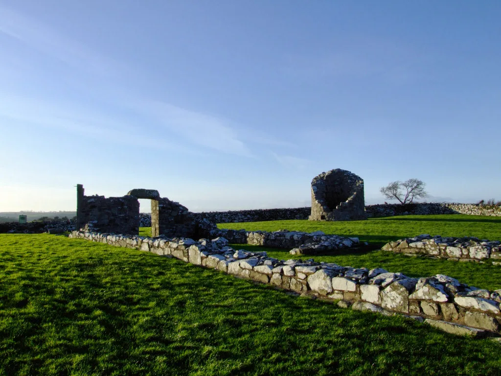
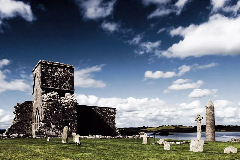
Nendrum Monastery
Nendrum Monastery — Christian monastery on Mahee Island in Strangford Lough, County Down, Northern Ireland.
 📷 5
📷 5Castles · Northern Ireland
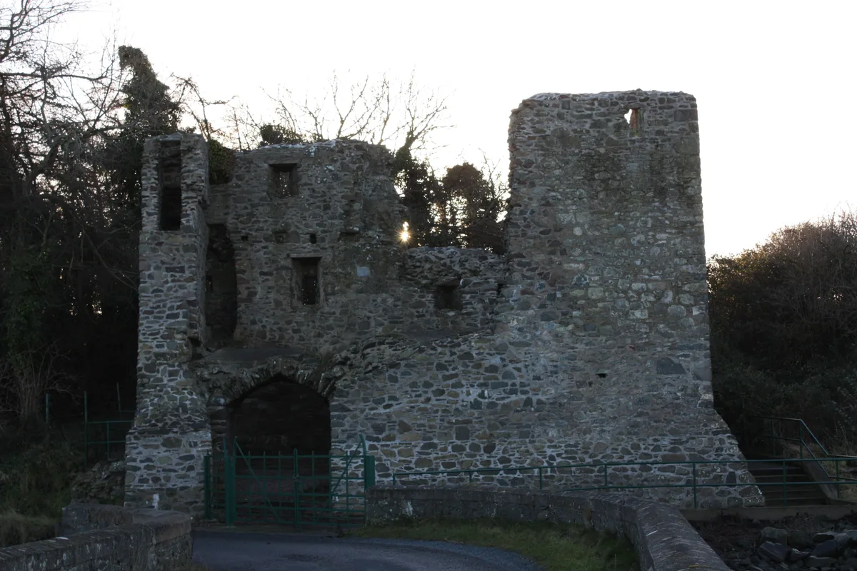
Mahee Castle
Mahee Castle is a castle in the United Kingdom.
 📷 3
📷 3Castles · Northern Ireland
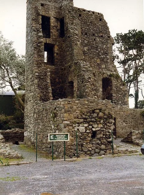
Sketrick Castle (ruin)
Sketrick Castle (ruin) — a castle in northern-ireland, United Kingdom.
 📷 3
📷 3Castles · Northern Ireland
Sketrick Castle
Sketrick Castle — castle in Killinchy, County Down, Northern Ireland.
More places in this region
 Flagship📷 3
Islands · Northern Ireland
Derrywarragh Island
Derrywarragh Island — island in County Armagh, Northern Ireland, United Kingdom.
 Flagship📷 5
Islands · Northern Ireland
Devenish Island
Devenish Island — island in Lower Lough Erne, Northern Ireland.
 Flagship📷 3
Islands · Northern Ireland
Rathlin Island
Rathlin Island — island in County Antrim, Northern Ireland, UK.
 Flagship📷 5
Islands · Northern Ireland
Sanda Island
Sanda Island — a small island in Argyll and Bute, Scotland, UK.
Frequently asked questions
- Where is Mahee Island?
- Mahee Island is in Northern Ireland, United Kingdom (postcode BT23 6EP).
- Is Mahee Island free to visit?
- Yes, Mahee Island is free to enter.
- How do I get to Mahee Island?
- Drivers can navigate to postcode BT23 6EP. It sits within the Strangford parliamentary constituency.