
Museums · South East England
Lymington
In or near Boldre.
Lymington is a port town on the west bank of the Lymington River on the Solent, in the New Forest district of Hampshire, England. The town faces Yarmouth, Isle of Wight, to which there is a car ferry

Mike Faherty — CC BY-SA 2.0 via Wikimedia Commons licence

Plan your visit
- Typical visit
- 1.5 h–3 h
- Best time of year
- Year-round
- Nearest railway station
- Lymington Town · 1.5 km
- Family-friendly
- Limited wheelchair access
Getting there & planning your visit
To visit the Lymington museum, the nearest railway station is Lymington Town, located 1.5 km away. The postcode for the museum is SO41 8NR. Please note that wheelchair accessibility is limited.
About
Lymington is a port town on the west bank of the Lymington River on the Solent, in the New Forest district of Hampshire, England. The town faces Yarmouth, Isle of Wight, to which there is a car ferry service operated by Wightlink. It is within the civil parish of Lymington and Pennington. The town has a large tourist industry, based on proximity to the New Forest and its harbour. It is a major yachting centre with three marinas. In 2021 it had a population of 14,858.
Photo gallery
Protected designations
- Site of Special Scientific Interest: Hurst Castle and Lymington River Estuary SSSI
- Area of Outstanding Natural Beauty: Isle Of Wight
- Ramsar wetland: Solent & Southampton Water
Designations sourced from Natural England open data under OGL v3.
From the Wikipedia article
Lymington is a port town on the west bank of the Lymington River on the Solent, in the New Forest district of Hampshire, England. The town faces Yarmouth, Isle of Wight, to which there is a car ferry service operated by Wightlink. It is within the civil parish of Lymington and Pennington. The town has a large tourist industry, based on proximity to the New Forest and its harbour. It is a major yachting centre with three marinas. In 2021 it had a population of 14,858.
Excerpt from Wikipedia under CC BY-SA 4.0. See the source article linked in Sources below.
Background
History
The earliest settlement in the Lymington area was around the Iron Age hill fort known today as Buckland Rings. The hill and ditches of the fort survive, and archaeological excavation of part of the walls was carried out in 1935. The fort has been dated to around the 6th century BC. There is another supposed Iron Age site at nearby Ampress Hole. However, evidence of later settlement there (as opposed to occupation) is sparse before Domesday (1086). Lymington itself began as an Anglo-Saxon village. The Jutes arrived in the area from the Isle of Wight in the 6th century and founded a settlement called Limentun. The Old English word tun means a farm or hamlet whilst limen is derived from the…
Sourced from Wikipedia under CC BY-SA 4.0.
- Coordinates
- 50.7500, -1.5500
- County
- Hampshire
- District
- New Forest
- Parish
- Lymington and Pennington
- Postcode
- SO41 8NR
- Parliamentary constituency
- New Forest West
- Nearest railway station
- Lymington Town — 1.5 km
Sources
- wikipedia: Lymington (CC BY-SA 4.0)
Other places nearby

The Sail Inn
Historic pubs · 0.9 km
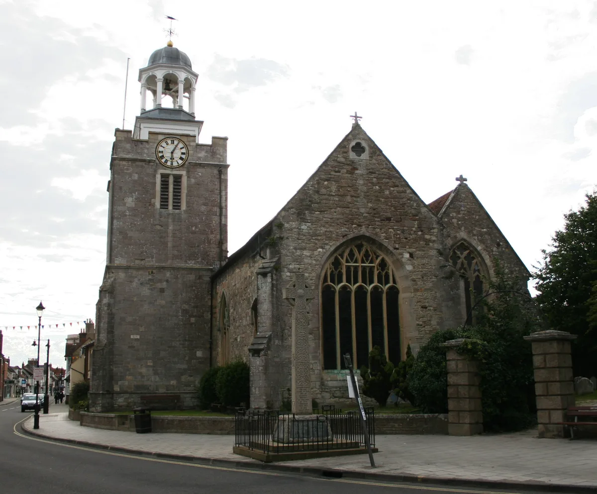
Church of St. Thomas the Apostle
Historic churches · 0.9 km

Lymington War Memorial with Enclosing Railings
Memorials & monuments · 0.9 km

Pennington War Memorial
Memorials & monuments · 1.1 km

Saint Barbe Museum and Art Gallery
Museums · 1.1 km
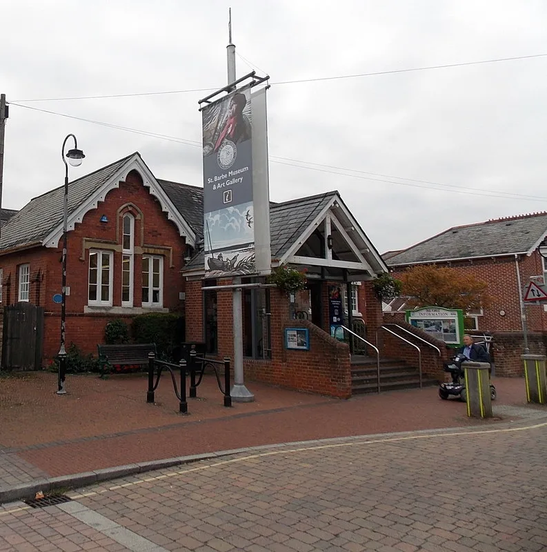
St Barbe Museum and Art Gallery
Museums · 1.1 km

St Barbe Museum & Art Gallery
Museums · 1.1 km

The Malt Cinema
Cinemas · 1.2 km
Lymington Community Centre
Theatres · 1.2 km

Pennington House
Manor houses · 1.3 km

Stephen Lees Gallery
Galleries · 1.3 km

Lymington Yacht Haven
Harbours & ports · 1.5 km
Nearby
📷 7📷 5Historic churches · South East England
Church of St. Thomas the Apostle
Church of St. Thomas the Apostle — grade II listed church in Lymington, United Kingdom.
📷 5Memorials & monuments · South East England
Lymington War Memorial with Enclosing Railings
Lymington War Memorial with Enclosing Railings — Grade II listed building-listed memorial in england-south-east, United Kingdom.
📷 5Memorials & monuments · South East England
Pennington War Memorial
Pennington War Memorial — Grade II listed building-listed memorial in england-south-east, United Kingdom.
📷 5Museums · South East England
Saint Barbe Museum and Art Gallery
Saint Barbe Museum and Art Gallery — a museum in england-south-east, United Kingdom.
📷 5Museums · South East England
St Barbe Museum and Art Gallery
St Barbe Museum and Art Gallery — museum in Lymington, United Kingdom.
Where to eat & stay near Lymington
Places to stay
 📷 5
📷 5Caravan parks · South East England
Hurst View
Hurst View — a caravan park in england south east.
 📷 5
📷 5 📷 5
📷 5Hotels · South East England
Macdonald Elmers Court Hotel & Resort
Macdonald Elmers Court Hotel & Resort — a hotel in england south east.
 📷 5
📷 5Caravan parks · South East England
Lytton Lawn Touring Park
Lytton Lawn Touring Park — a caravan park in england south east.
📷 5Campsites · South East England
Muddy Creek Farm
Muddy Creek Farm — a campsite in england south east.
Places to eat & drink
📷 7 📷 7
📷 7Historic pubs · South East England
Walhampton Arms, formerly farm building range at Home Farm
Walhampton Arms, formerly farm building range at Home Farm in England South East, United Kingdom.
 📷 5
📷 5Historic pubs · South East England
The Beach House
The Beach House in England South East, United Kingdom.
 📷 7
📷 7Historic pubs · South East England
The Hobler Public House
The Hobler Public House in England South East, United Kingdom.
 📷 5
📷 5Historic pubs · South East England
Forest Heath Hotel
Forest Heath Hotel in England South West, United Kingdom.
 📷 7
📷 7More museums in this region
 📷 5
📷 5Museums · South East England
Coldrum Long Barrow
Coldrum Long Barrow — neolithic chambered long barrow near Trottiscliffe, Kent, England, UK.
 📷 5
📷 5Museums · South East England
Guildford House
Guildford House — house in Guildford, Surrey, England, UK.
 📷 5
📷 5Museums · South East England
Huguenot Museum
Huguenot Museum — museum in Rochester, England, UK.
 📷 5
📷 5Museums · South East England
Medway megaliths
Medway megaliths — group of long barrows in Kent, England.
Frequently asked questions
- Where is Lymington?
- Lymington is in Hampshire, South-East England, United Kingdom (postcode SO41 8NR), in the parish of Lymington and Pennington.
- What is Lymington?
- Lymington is a port town on the west bank of the Lymington River on the Solent, in the New Forest district of Hampshire, England. The town faces Yarmouth, Isle of Wight, to which there is a car ferry
- How do I get to Lymington?
- The nearest railway station is Lymington Town, about 1.5 km away. The nearest town is Boldre. Drivers can use postcode SO41 8NR.
- Is Lymington a protected site?
- Yes — Lymington is part of the Hurst Castle and Lymington River Estuary SSSI Site of Special Scientific Interest and the Isle Of Wight National Landscape (AONB).
- How do I get to Lymington?
- The nearest railway station is Lymington Town, about 1.5 km away. Drivers can navigate to postcode SO41 8NR.