
Islands · South West England
Lundy
Also known as: Ynys Wair
Lundy — largest island in the Bristol Channel.

Wikimedia Commons contributors — see linked file page for photographer and licence licence

Plan your visit
- Typical visit
- 4 h–12 h
- Free entry
- Dog-friendly
Getting there & planning your visit
Lundy is an island located in South West England, in the Torridge district of Devon. The postcode for Lundy is EX39 2LY. Entry to the island is free.
About
Lundy is a island in the United Kingdom. It covers approximately 4 km². Recent population estimates put it at around 28 people. Heritage designation: Site of Special Scientific Interest. Owned by William Hudson Heaven. Wikidata describes it as: "largest island in the Bristol Channel". Coordinates: 51.1800°, -4.6700°.
Photo gallery
Summary from the official site
Lundy is a unique granite island located off the coast of North Devon, known for its peaceful and unspoiled environment. Visitors can enjoy a range of activities, including staying in holiday properties, camping, and exploring the island's natural beauty and wildlife.
Read more on the official property page.
Protected designations
- Site of Special Scientific Interest: Lundy SSSI
Designations sourced from Natural England open data under OGL v3.
From the Wikipedia article
Lundy is an English island in the Bristol Channel. It forms part of the district of Torridge in the county of Devon. About 5 km (3 mi) long and 1 km (0.625 mi) wide, Lundy has had a long and turbulent history, frequently changing hands between the British crown and various usurpers. In the 1920s, the island's owner, Martin Harman, tried to issue his own coinage and was fined. In 1941, two German Heinkel He 111 bombers crash landed on the island, and their crews were captured. In 1969, Lundy was purchased by British millionaire Jack Hayward, who donated it to the National Trust. It is now managed by the Landmark Trust, a conservation charity that derives its income from day trips and holiday lettings, most visitors arriving by boat from Bideford or Ilfracombe. A local tourist curiosity is the special "Puffin" postage stamp, a category known by philatelists as "local carriage labels", a collector's item. The de Marisco family were the first known tyrannical owners of Lundy in the 12th century. They recognized the island as an impregnable stronghold and held it despite the crown granting it twice to the Knights Templar. As a steep, rocky island, often shrouded by fog, Lundy has been the scene of many shipwrecks, and the remains of its old lighthouse installations are of both historic and scientific interest. Its present-day lighthouses, one of which is solar-powered, are fully automated. Lundy has a rich bird life, as it lies on major migration routes, and hosts many vagrant as well as indigenous species. It also boasts a variety of marine habitats, with rare seaweeds, sponges and corals. In 2010, the island became Britain's first Marine Conservation Zone.
Excerpt from Wikipedia under CC BY-SA 4.0. See the source article linked in Sources below.
Background
History
Lundy has evidence of visitation or occupation from the Mesolithic period onward, with Neolithic flintwork, Bronze Age burial mounds, four inscribed gravestones from the early medieval period, and an early medieval monastery (possibly dedicated to St Elen or St Helen).
Sourced from Wikipedia under CC BY-SA 4.0.
- Coordinates
- 51.1800, -4.6700
- County
- Devon
- District
- Torridge
- Parish
- Area not comprised in any Parish-Lundy Island
- Postcode
- EX39 2LY
- Parliamentary constituency
- Torridge and Tavistock
- Population
- 28
- Official site
- www.lundyisland.co.uk
Sources
- wikidata: Q324812 (CC0)
- wikipedia: Lundy (CC BY-SA 4.0)
- commons: The Jetty, Lundy.jpg (CC BY-SA 4.0)
Featured in this guide
Other places nearby

Heinkel Bomber Remains
Archaeological sites · 0.1 km

Medieval settlement immediately south of Halfway Wall, Lundy
Vineyards · 0.2 km

John Pennington Harman Memorial
Memorials & monuments · 0.5 km

Old Hospital (ruins)
Historic houses · 0.6 km

Tibbett's Hill
Mountains & hills · 0.7 km

Quarry Beach
Beaches · 0.7 km

Standing stone 220m south of Quarterwall Cottages, Lundy
Windmills · 1.0 km

Gunhouse
Historic houses · 1.1 km

Standing stone and cairn 310m north of The Old Lighthouse, Lundy
Windmills · 1.1 km

Widows Tenement
Archaeological sites · 1.2 km

Widows Tenement
Archaeological sites · 1.2 km
Standing stone 320m north west of The Old Lighthouse, Lundy
Windmills · 1.2 km
Nearby
📷 3Archaeological sites · South West England
Heinkel Bomber Remains
Heinkel Bomber Remains — an archaeological site in South West England, United Kingdom.
📷 5Vineyards · South West England
Medieval settlement immediately south of Halfway Wall, Lundy
Medieval settlement immediately south of Halfway Wall, Lundy — a UK vineyard in england south west, producing English or Welsh wine from cool-climate grape varieties.
📷 3Memorials & monuments · South West England
John Pennington Harman Memorial
John Pennington Harman Memorial — a memorial in South West England, United Kingdom.
📷 3Historic houses · South West England
Old Hospital (ruins)
Old Hospital (ruins) — a historic house in South West England, United Kingdom.
📷 5Mountains & hills · South West England
Tibbett's Hill
Tibbett's Hill — mountain in england south west. Elevation: 138 m.
📷 5Where to eat & stay near Lundy
Places to stay
 📷 5
📷 5Campsites · South West England
Camping Field
Camping Field — a campsite in england south west.
 📷 5
📷 5Hotels · South West England
Hartland Quay Hotel
Hartland Quay Hotel — a hotel in england south west.
 📷 5
📷 5Campsites · South West England
Camping and caravan site
Camping and caravan site — a campsite in england south west.
 📷 5
📷 5Campsites · South West England
Stroke Barton Campsite
Stroke Barton Campsite — a campsite in england south west.
Places to eat & drink
 📷 7
📷 7More places in this region
 Flagship📷 10
Islands · South West England
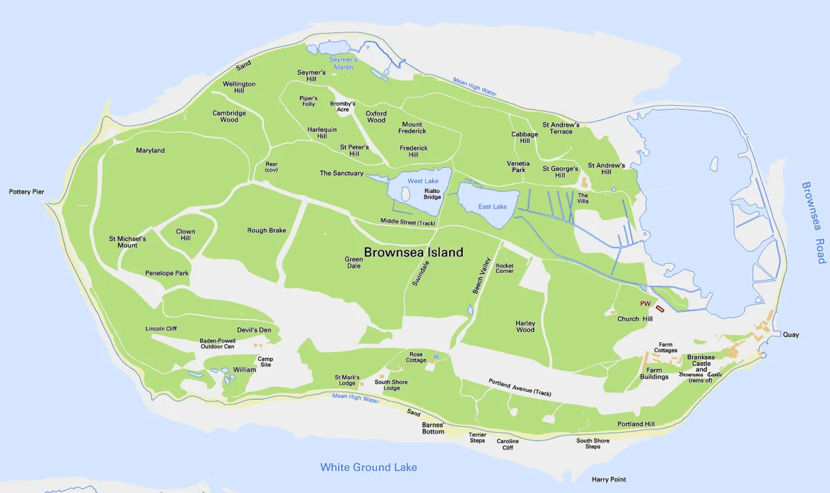
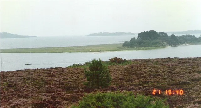
Brownsea Island
Brownsea Island — island in Poole Harbour, Dorset, England, UK.
 Flagship📷 10
 📷 5
📷 5 📷 4
📷 4Frequently asked questions
- Where is Lundy?
- Lundy is in Devon, South-West England, United Kingdom (postcode EX39 2LY), in the parish of Area not comprised in any Parish-Lundy Island.
- What is Lundy?
- Lundy — largest island in the Bristol Channel.
- How do I get to Lundy?
- Drivers can use postcode EX39 2LY.
- Who owns Lundy?
- Lundy is owned by William Hudson Heaven.
- Is Lundy a listed building?
- Lundy is officially recognised as Site of Special Scientific Interest listed.
- Is Lundy a protected site?
- Yes — Lundy is part of the Lundy SSSI Site of Special Scientific Interest.
- Is Lundy free to visit?
- Yes, Lundy is free to enter.
- How do I get to Lundy?
- Drivers can navigate to postcode EX39 2LY. It sits within the Torridge and Tavistock parliamentary constituency.