
Islands · South West England
Long Island
In or near Arne.
Long Island — island in Dorset, England.

Wikimedia Commons contributors — see linked file page for photographer and licence licence

Plan your visit
- Typical visit
- 4 h–12 h
- Nearest railway station
- Hamworthy · 3.9 km
- Free entry
- Dog-friendly
Getting there & planning your visit
To visit Long Island, the nearest railway station is Hamworthy, located 3.9 km away. The postcode for sat-nav is BH20 5BL. Entry to the island is free.
About
Long Island is a island in the United Kingdom. Wikidata describes it as: "island in Dorset, England". Coordinates: 50.6906°, -2.0177°.
Photo gallery
Protected designations
- Site of Special Scientific Interest: Poole Harbour SSSI
- National Nature Reserve: PURBECK HEATHS
- Area of Outstanding Natural Beauty: Dorset
- Ramsar wetland: Poole Harbour
Designations sourced from Natural England open data under OGL v3.
From the Wikipedia article
Long Island is an uninhabited island in Poole Harbour in the English county of Dorset. It lies just off the shore of the Arne Peninsular in the south-west of the harbour, and is separated from the nearby, and inhabited, Round Island by a narrow channel only a few feet wide. The island covers approximately 30 acres at low tide, reducing to only 9.5 acres (38,000 m2) at high tide. Long Island lies within the civil parish of Corfe Castle. The parish forms part of the Dorset unitary authority area. Long Island had been privately owned by the Rempstone Estate for over 250 years but in 2007 it was closed to the public and put up for sale with offers invited in excess of £1 million. The sale was initially delayed by a rights of way application made by pleasure boat owners who feared the new landlords would deny public access to the island. However the application was dismissed by Dorset County Council in 2009 and the island was sold in 2010 for an estimated £3 million to a local property developer. 1955 the island was leased by Guy Sydenham who used clay from the island to make Pottery. By 1968 he had moved to Green Island. On 24 August 1943, a Royal Air Force Consolidated Catalina (FP287) was on a training flight & was landing at Poole Seaplane Base. The aircraft overshot the landing path during the second flare then attempted a go-ground, soon after crashed into sea next to the island. Eight of the twelve crew died in the crash.
Excerpt from Wikipedia under CC BY-SA 4.0. See the source article linked in Sources below.
- Coordinates
- 50.6906, -2.0177
- District
- Dorset
- Parish
- Arne
- Postcode
- BH20 5BL
- Parliamentary constituency
- Mid Dorset and North Poole
- Nearest railway station
- Hamworthy — 3.9 km
Sources
- wikidata: Q6672643 (CC0)
- wikipedia: Long Island (Dorset) (CC BY-SA 4.0)
- commons: Long Island across Wych Channel - geograph.org.uk - 449745.jpg (CC BY-SA 4.0)
Featured in this guide
Other places nearby

Round Island
Islands · 0.5 km

Shipstal Beach
Beaches · 0.7 km

Shipstal Hill
Viewpoints · 0.8 km

William Stanley Orchard
Memorials & monuments · 0.8 km

Arne
Towns & cities · 1.6 km

Poole Harbour
Harbours & ports · 1.6 km

Ladybird Spider
Public art & sculpture · 1.7 km

Arne Hill Heavy Anti-Aircraft Battery
Historic houses · 1.7 km

Arne Hill Heavy Anti-Aircraft Battery
Archaeological sites · 1.7 km
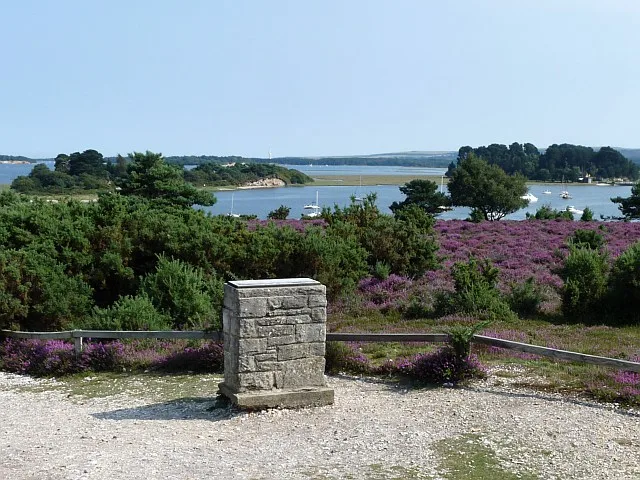
Arne RSPB reserve
Wildlife reserves · 1.8 km

Poole Harbour Trails - Arne
Mountain bike trails · 2.0 km

Arne Hill
Mountains & hills · 2.0 km
Nearby
📷 5📷 5📷 5Viewpoints · South West England
Shipstal Hill
Shipstal Hill is a viewpoint in the United Kingdom.
📷 5Memorials & monuments · South West England
William Stanley Orchard
William Stanley Orchard — a memorial in england-south-east, United Kingdom.
📷 5Towns & cities · South West England
Arne
Arne — village in Purbeck, Dorset, United Kingdom.
📷 5Where to eat & stay near Long Island
Places to stay
 📷 5
📷 5Campsites · South West England
Baden Powell Outdoor Centre
Baden Powell Outdoor Centre — a campsite in england south east.
 📷 5
📷 5Hotels · South West England
The Antelope
The Antelope — a hotel in england south east.
 📷 5
📷 5 📷 5
📷 5Campsites · South West England
Burnbake Campsite
Burnbake Campsite — a campsite in england south east.
 📷 5
📷 5Hotels · South West England
The Haven Hotel
The Haven Hotel — a hotel in england south east.
 📷 5
📷 5Campsites · South West England
Ridge Farm
Ridge Farm — a campsite in england south east.
Places to eat & drink
 📷 5
📷 5Restaurants · South West England
Custom House
Custom House — a restaurant in england south east.
 📷 5
📷 5Historic pubs · South West England
Portsmouth Hoy Public House
Portsmouth Hoy Public House in England South West, United Kingdom.
 📷 5
📷 5Restaurants · South West England
Guildhall Tavern
Guildhall Tavern — a restaurant in england south east.
 📷 6
📷 6 📷 5
📷 5Historic pubs · South West England
The Brewers Arms Public House
The Brewers Arms Public House in England South West, United Kingdom.
 📷 5
📷 5Cafés · South West England
Café Villano
Café Villano — a café in england south east. Cuisine: coffee shop;sandwich;ice cream;regional.
More places in this region
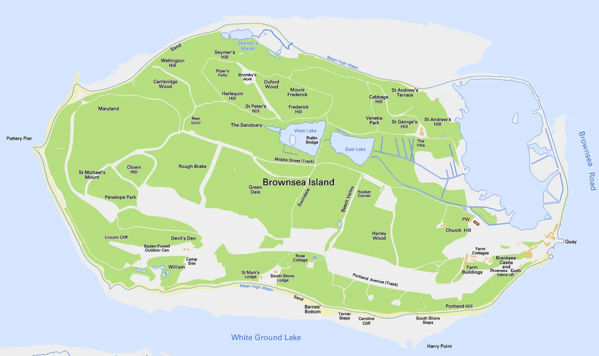 Flagship📷 10
Islands · South West England
Brownsea Island
Brownsea Island — island in Poole Harbour, Dorset, England, UK.
 📷 5
📷 5 📷 4
📷 4 📷 5
📷 5Islands · South West England
Green Island
Green Island — island in Poole Harbour, Dorset, England.
Frequently asked questions
- Where is Long Island?
- Long Island is in South-West England, United Kingdom (postcode BH20 5BL), in the parish of Arne.
- What is Long Island?
- Long Island — island in Dorset, England.
- How do I get to Long Island?
- The nearest railway station is Hamworthy, about 3.9 km away. The nearest town is Arne. Drivers can use postcode BH20 5BL.
- Is Long Island a protected site?
- Yes — Long Island is part of the Poole Harbour SSSI Site of Special Scientific Interest and the PURBECK HEATHS National Nature Reserve.
- Is Long Island free to visit?
- Yes, Long Island is free to enter.
- How do I get to Long Island?
- The nearest railway station is Hamworthy, about 3.9 km away. Drivers can navigate to postcode BH20 5BL.