
Historic bridges · North West England
Loyn Bridge
Also known as: Loyne Bridge;Gressingham Bridge
In or near Wennington.
Loyn Bridge is a historic bridge in the United Kingdom.

Wikimedia Commons contributors — see linked file page for photographer and licence licence

Plan your visit
- Typical visit
- 15 min–30 min
- Nearest railway station
- Wennington · 3.5 km
- Free entry
- Dog-friendly
Getting there & planning your visit
To visit Loyn Bridge, the nearest railway station is Wennington, located 3.5 km away. The postcode for sat-nav is LA2 8LL, and entry to the bridge is free.
About
Loyn Bridge is a named historic bridge in the United Kingdom. OpenStreetMap heritage rating: 2/5. Also known as: Loyne Bridge;Gressingham Bridge. Coordinates: 54.1217°, -2.6416°.
Photo gallery
Heritage listing
Loyn Bridge (or Loyne Bridge) crosses the River Lune, carrying a minor road between the villages of Hornby and Gressingham in Lancashire, England. The present bridge replaces an older bridge, which is thought to have been constructed with timber decking between stone piers. There is evidence that the river was forded here before a bridge was built. The date of the building of the present bridge is unknown; it is considered to have been after 1591, when the previous bridge was described as being "in a dangerous condition". A date of 1684 has been suggested, but petitions regarding the bridge put before the Quarter Sessions between 1650 and 1750 make no mention of a new bridge between these dates.
From the Historic England List Entry under OGL v3.
Protected designations
- Area of Outstanding Natural Beauty: Forest Of Bowland
Designations sourced from Natural England open data under OGL v3.
From the Wikipedia article
Loyn Bridge (or Loyne Bridge) crosses the River Lune, carrying a minor road between the villages of Hornby and Gressingham in Lancashire, England. The present bridge replaces an older bridge, which is thought to have been constructed with timber decking between stone piers. There is evidence that the river was forded here before a bridge was built. The date of the building of the present bridge is unknown; it is considered to have been after 1591, when the previous bridge was described as being "in a dangerous condition". A date of 1684 has been suggested, but petitions regarding the bridge put before the Quarter Sessions between 1650 and 1750 make no mention of a new bridge between these dates. The bridge was paid for by the County of Lancashire, and later the responsibility for maintenance and repairs was transferred to the Lonsdale Hundred. The bridge is constructed in sandstone blocks, and consists of three segmental arches with triangular cutwaters containing refuges for pedestrians. The arches measure 53 feet (16.2 m), 62 feet 6 inches (19.1 m) and 52 feet (15.8 m) respectively. The carriageway is 12 feet (3.7 m) wide, and the maximum width of the bridge at the points of the piers is 33 feet 6 inches (10.2 m). It is described as being "surprisingly impressive for a route that has little significance nowadays". When the bridge was surveyed in 1998, it was found to be adequate to carry vehicles of 40 tonnes. It is recorded in the National Heritage List for England as a designated Grade II* listed building, and is a scheduled monument. Loyn Bridge was damaged during Storm Desmond on 5 December 2015. Further damage due to debris caused the bridge to be closed for an extended period. Extensive temporary protection for the bridge and bank were required, along with infill in the bridge piers. The bridge finally reopened on 22 April 2016. Even after the bridge repairs, significant damage to the hedges and fences along the road between the bridge and Gressingham is…
Excerpt from Wikipedia under CC BY-SA 4.0. See the source article linked in Sources below.
- Coordinates
- 54.1217, -2.6416
- County
- Lancashire
- District
- Lancaster
- Parish
- Hornby-with-Farleton
- Postcode
- LA2 8LL
- Parliamentary constituency
- Morecambe and Lunesdale
- Nearest railway station
- Wennington — 3.5 km
- Opening
- | traffic =
Sources
- osm: w1269168023 (ODbL)
- wikipedia: Loyn Bridge (CC BY-SA 4.0)
- commons: Loyn Bridge in winter - geograph.org.uk - 1663214.jpg (CC BY-SA 4.0)
Other places nearby

Castle Stede
Forts · 0.1 km

Castle Stede
Literary houses · 0.1 km
Castlestede
Castles · 0.2 km
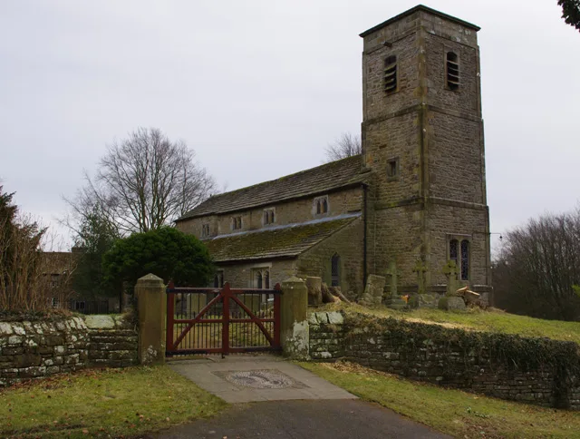
St John the Evangelist's Church, Gressingham
Historic churches · 0.9 km

Windy Bank
Mountains & hills · 1.0 km

Hornby
Villages · 1.0 km
.jpg?width=1200)
Hornby Priory
Abbeys & priories · 1.0 km

Gressingham
Villages · 1.1 km

Hornby-with-Farleton War Memorial
Memorials & monuments · 1.2 km

St Margaret's Church
Historic churches · 1.2 km

Sandbeds Caravan Site
Caravan parks · 1.2 km

Hornby-with-Farleton
Castles · 1.2 km
Nearby
📷 3📷 5Literary houses · North West England
Castle Stede
Castle Stede — a literary house museum in england north west.
📷 5📷 3Historic churches · North West England
St John the Evangelist's Church, Gressingham
St John the Evangelist's Church, Gressingham — Grade I listed church in Gressingham, Lancaster, Lancashire, England, UK.
📷 5Mountains & hills · North West England
Windy Bank
Windy Bank — a hill or mountain in england north west.
📷 5Where to eat & stay near Loyn Bridge
Places to stay
📷 5Caravan parks · North West England
Sandbeds Caravan Site
Sandbeds Caravan Site — a caravan park in england north west.
 📷 5
📷 5Campsites · North West England
Bridge House Farm Campsite
Bridge House Farm Campsite — a campsite in england north west.
 📷 5
📷 5Campsites · North West England
Redwell Fisheries
Redwell Fisheries — a campsite in england north west.
 📷 5
📷 5Campsites · North West England
Box Tree Farm Glamping
Box Tree Farm Glamping — a campsite in england north west.
 📷 5
📷 5Caravan parks · North West England
McCarthy Caravan Park
McCarthy Caravan Park — a caravan park in england north west.
 📷 5
📷 5Caravan parks · North West England
Old Hall Caravan Park
Old Hall Caravan Park — a caravan park in england north west.
Places to eat & drink
 📷 3
📷 3Historic pubs · North West England
The Eagles Head
The Eagles Head — Historic pub — listed building or notable heritage status.
 📷 5
📷 5 📷 5
📷 5Historic pubs · North West England
Punch Bowl Hotel
Punch Bowl Hotel in England North West, United Kingdom.
 📷 5
📷 5Historic pubs · North West England
Horse And Farrier Inn
Horse And Farrier Inn in England North West, United Kingdom.
 📷 5
📷 5.jpg?width=1200) 📷 4
📷 4Historic pubs · North West England
The Bobbin
The Bobbin — Historic pub — listed building or notable heritage status.
More bridges in this region
 📷 3
📷 3Historic bridges · North West England
Albert Bridge
Albert Bridge is a historic bridge in the United Kingdom.
 📷 3
📷 3Historic bridges · North West England
Arpley New Bridge
Arpley New Bridge is a historic bridge in the United Kingdom.
 📷 3
📷 3Historic bridges · North West England
Arpley Railway Bridge
Arpley Railway Bridge is a historic bridge in the United Kingdom.
 📷 5
📷 5Historic bridges · North West England
Barton Road Bridge
Barton Road Bridge is a historic bridge in the United Kingdom.
Frequently asked questions
- Where is Loyn Bridge?
- Loyn Bridge is in Lancashire, North-West England, United Kingdom (postcode LA2 8LL), in the parish of Hornby-with-Farleton.
- What is Loyn Bridge?
- Loyn Bridge is a historic bridge in the United Kingdom.
- How do I get to Loyn Bridge?
- The nearest railway station is Wennington, about 3.5 km away. Drivers can use postcode LA2 8LL.
- Who owns Loyn Bridge?
- Loyn Bridge is owned by | maint =.
- Is Loyn Bridge a listed building?
- Loyn Bridge is officially recognised as scheduled monument listed.
- Is Loyn Bridge a protected site?
- Yes — Loyn Bridge is part of the Forest Of Bowland National Landscape (AONB).
- Is Loyn Bridge free to visit?
- Yes, Loyn Bridge is free to enter.
- How do I get to Loyn Bridge?
- The nearest railway station is Wennington, about 3.5 km away. Drivers can navigate to postcode LA2 8LL.