
Castles · South Wales
Locking Castle
In or near Kewstoke.
Locking Castle — castle in Locking, North Somerset, England, UK.

Wikimedia Commons contributors — see linked file page for photographer and licence licence

Plan your visit
- Typical visit
- 1.5 h–3 h
- Nearest railway station
- Worle · 1.6 km
- Family-friendly
- Limited wheelchair access
Getting there & planning your visit
To visit Locking Castle, the nearest railway station is Worle, located 1.6 km away. The postcode for sat-nav is BS24 7DG. Accessibility is limited for wheelchair users.
About
Locking Castle is a castle in the United Kingdom — fortified architecture from the medieval, Tudor, or Victorian-revival period. Wikidata describes it as: "castle in Locking, North Somerset, England, UK". Coordinates: 51.3434°, -2.9147°.
Photo gallery
Heritage listing
Locking Castle was a castle that once stood on Carberry Hill near the site of RAF Locking in Locking in the North Somerset district of Somerset, England. It has been scheduled as an ancient monument. It was a motte and bailey on Carberry Hill. Excavations in 1902 identified the remains of a small stone chamber surrounded by a ditch. Fragments of pottery and the remains of a sword were also found. A coin from the period of Edward IV was also uncovered. Around the site of the castle is a 60 metres (200 ft) long bank which is around 1.5 metres (4 ft 11 in) high and a ditch. An area west of the inner bailey has been identified as a possible pillow mound. The origin of the castle is unclear. It may have been part of the manor of Kewstoke or alternatively Hutton.
From the Historic England List Entry under OGL v3.
Protected designations
- Site of Special Scientific Interest: Severn Estuary SSSI
- Area of Outstanding Natural Beauty: Mendip Hills
- Ramsar wetland: Severn Estuary
Designations sourced from Natural England open data under OGL v3.
From the Wikipedia article
Locking Castle was a castle that once stood on Carberry Hill near the site of RAF Locking in Locking in the North Somerset district of Somerset, England. It has been scheduled as an ancient monument. It was a motte and bailey on Carberry Hill. Excavations in 1902 identified the remains of a small stone chamber surrounded by a ditch. Fragments of pottery and the remains of a sword were also found. A coin from the period of Edward IV was also uncovered. Around the site of the castle is a 60 metres (200 ft) long bank which is around 1.5 metres (4 ft 11 in) high and a ditch. An area west of the inner bailey has been identified as a possible pillow mound. The origin of the castle is unclear. It may have been part of the manor of Kewstoke or alternatively Hutton. The two manors were combined and given by Henry I to Geoffrey de Dun. In 1214 Locking was given to Woodspring Priory and would have ceased to have military significance.
Excerpt from Wikipedia under CC BY-SA 4.0. See the source article linked in Sources below.
- Coordinates
- 51.3434, -2.9147
- District
- North Somerset
- Parish
- Locking
- Postcode
- BS24 7DG
- Parliamentary constituency
- Weston-super-Mare
- Nearest railway station
- Worle — 1.6 km
Sources
- wikidata: Q6665656 (CC0)
- wikipedia: Locking Castle (CC BY-SA 4.0)
- commons: Locking Castle Golf Course - geograph.org.uk - 84446.jpg (CC BY-SA 4.0)
Other places nearby

Motte and bailey castle and associated earthworks south of Locking Head Farm
Literary houses · 0.0 km

Locking Head Castle
Castles · 0.0 km

RAFLAA Monument
Memorials & monuments · 1.0 km

Locking
Villages · 1.1 km

Westland 30-200
Museums · 1.1 km
Westland 30-100
Museums · 1.1 km
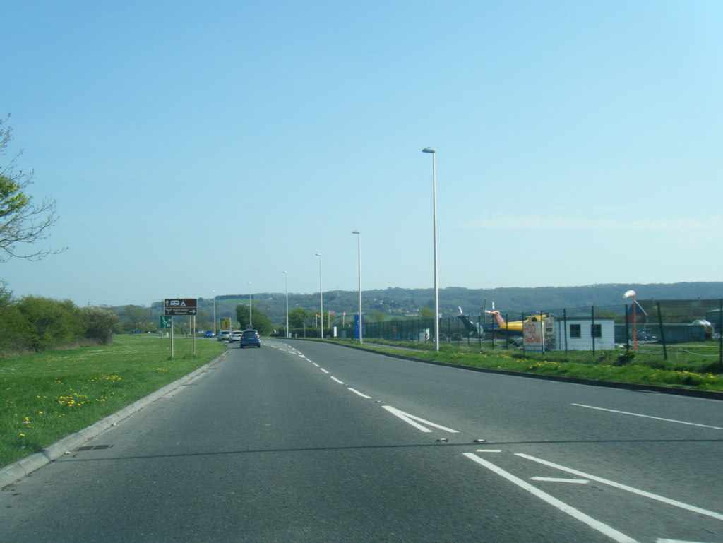
EH Industries EH101 Heliliner
Museums · 1.2 km

The Helicopter Museum
Museums · 1.2 km

Willow Down Caravan Park
Caravan parks · 1.3 km

The Landing Light
Restaurants · 1.3 km

Living Sculpture
Public art & sculpture · 1.4 km

Locking, Somerset
Castles · 1.4 km
Nearby
📷 5Literary houses · South Wales
Motte and bailey castle and associated earthworks south of Locking Head Farm
Motte and bailey castle and associated earthworks south of Locking Head Farm — a literary house museum in wales south.
📷 3Castles · South Wales
Locking Head Castle
Locking Head Castle — a castle in South Wales, United Kingdom.
📷 3Memorials & monuments · South Wales
RAFLAA Monument
RAFLAA Monument — a memorial in South Wales, United Kingdom.
📷 5📷 5📷 5Where to eat & stay near Locking Castle
Places to stay
📷 5Caravan parks · South Wales
Willow Down Caravan Park
Willow Down Caravan Park — a caravan park in wales south.
 📷 3
📷 3Caravan parks · South Wales
West End Farm Caravan Park
West End Farm Caravan Park — a caravan park in wales south.
 📷 5
📷 5Caravan parks · South Wales
Myrtle Farm Touring Park
Myrtle Farm Touring Park — a caravan park in wales south.
 📷 5
📷 5Caravan parks · South Wales
Summer Lane Parkhomes
Summer Lane Parkhomes — a caravan park in wales south.
 📷 4
📷 4Campsites · South Wales
Stonebridge Farm Campsite
Stonebridge Farm Campsite — a campsite in wales south.
 📷 5
📷 5Caravan parks · South Wales
Meadow Lee Caravan Park
Meadow Lee Caravan Park — a caravan park in wales south.
Places to eat & drink
📷 5 📷 5
📷 5Restaurants · South Wales
Muffins Tea Room & Brasserie
Muffins Tea Room & Brasserie — a restaurant in wales south.
 📷 5
📷 5Restaurants · South Wales
The Pavilion
The Pavilion — a restaurant in wales south.
 📷 5
📷 5 📷 5
📷 5 📷 5
📷 5More castles in this region
 📷 5
📷 5Castles · South Wales
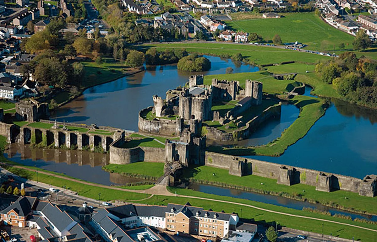
Caerphilly Castle
Caerphilly Castle — castle in Caerphilly, Wales.
 📷 3
📷 3Castles · South Wales
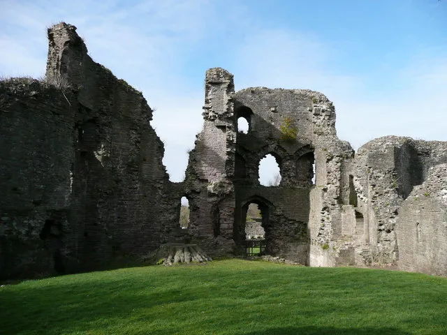
Abergavenny Castle
Abergavenny Castle — Grade I listed building in Abergavenny. Ruined castle in the market town of Abergavenny, Monmouthshire, Wales.
 📷 3
📷 3 📷 3
📷 3Frequently asked questions
- Where is Locking Castle?
- Locking Castle is in South Wales, United Kingdom (postcode BS24 7DG), in the parish of Locking.
- What is Locking Castle?
- Locking Castle — castle in Locking, North Somerset, England, UK.
- How do I get to Locking Castle?
- The nearest railway station is Worle, about 1.6 km away. The nearest town is Kewstoke. Drivers can use postcode BS24 7DG.
- Who owns Locking Castle?
- Locking Castle is owned by | open_to_public =.
- Is Locking Castle a protected site?
- Yes — Locking Castle is part of the Severn Estuary SSSI Site of Special Scientific Interest and the Mendip Hills National Landscape (AONB).
- Does Locking Castle charge admission?
- Locking Castle typically charges admission. Check the official site for current ticket prices and opening hours.
- How do I get to Locking Castle?
- The nearest railway station is Worle, about 1.6 km away. Drivers can navigate to postcode BS24 7DG.