
Reservoirs & lochs · Scottish Highlands
Lochalsh
In or near Achintee.
Lochalsh in Scotland Islands, United Kingdom.

Wikimedia Commons licence
Plan your visit
- Typical visit
- 1 h–2.5 h
- Nearest railway station
- Attadale · 5.3 km
- Free entry
- Dog-friendly
Getting there & planning your visit
To visit Lochalsh in the Scottish Highlands, the nearest railway station is Attadale, located 5.3 km away. Admission is free.
About
Lochalsh is a place of interest in Scotland Islands, United Kingdom — drawn from open-data sources for visitor reference. See the linked Wikipedia article for the full description.
Photo gallery
From the Wikipedia article
Lochalsh is a district of mainland Scotland that is currently part of the Highland council area. The Lochalsh district covers all of the mainland either side of Loch Alsh - and of Loch Duich - between Loch Carron and Loch Hourn, ie. from Stromeferry in the north on Loch Carron down to Corran on Loch Hourn (past Arnisdale at the south end of the road from Glenelg) and as (south-)west as Kintail. It was sometimes more narrowly defined as just being the hilly peninsula that lies between Loch Carron and Loch Alsh. The main settlement is Kyle of Lochalsh, located at the entrance to Loch Alsh, opposite the village of Kyleakin on the adjacent island of Skye. A ferry used to connect the two settlements but was replaced by the Skye Bridge in 1995. The earliest known inhabitants were Picts, but in the late 6th century Loch Alsh became part of the Gaelic island kingdom of Dál Riata. Between the 8th and 13th centuries the area was disputed between the kingdoms of Norway and Alba and often ruled by independent lords. Although nominally subject to the Kingdom of Scotland after 1266 AD, the history of the region until the failed rebellion of Bonnie Prince Charlie in 1745 is one of obscure struggles between the local clans and against the central government. To prevent further feuds and rebellions, in 1746 the government enacted laws designed to break the bond between the clan leaders and their people. An indirect result was gradual conversion of the land from crofting to more profitable and less labour-intensive sheep farming. These Highland Clearances and the subsequent Highland Potato Famine of 1846–52 forced many of the people to emigrate. Today, the area is thinly populated with an economy based mainly on tourism.
Excerpt from Wikipedia under CC BY-SA 4.0. See the source article linked in Sources below.
Background
History
The fleet of Haakon IV of Norway anchored in Loch Alsh in 1263 during the Scottish–Norwegian War en route to the Battle of Largs. Kyleakin may take its name from this event. Eilean Donan castle at Dornie was founded in the thirteenth century, and became a stronghold of Clan Mackenzie and their allies Clan MacLennan and Clan Macrae. In the early eighteenth century the Mackenzies' involvement in the Jacobite rebellions led in 1719 to the castle's destruction by government ships. Lieutenant-Colonel John Macrae-Gilstrap's twentieth-century reconstruction of the ruins produced the present buildings. Eilean Donan retained a large degree of independence for centuries. Often the MacDonald Lord of…
Description
The Jacobite risings resulted in laws that prohibited possession of swords and the wearing of tartans or kilts, ended the feudal bond of military service and removed the virtually sovereign power the chiefs had over their clan. The clan leaders became no more than wealthy landowners. Increasing demand in Britain for cattle and sheep, and the creation of new breeds of sheep which could be reared in the mountainous country, allowed higher rents to meet the costs of an aristocratic lifestyle. As a result, many families living on a subsistence level were displaced, emigrating in large numbers to Canada and elsewhere. Unrest was suppressed by troops where needed. The highland clearances…
Sourced from Wikipedia under CC BY-SA 4.0.
- Coordinates
- 57.3487, -5.4294
- Nearest railway station
- Attadale — 5.3 km
Sources
Other places nearby

Carn Allt na Bradh
Mountains & hills · 2.0 km

Carn na h-Onaich
Mountains & hills · 2.2 km

Carn nan Iomairean
Mountains & hills · 2.7 km
Càrn nan Iomairean
Mountains & hills · 2.7 km
Creag Dharach
Mountains & hills · 2.9 km

Sgurr na Cloiche
Mountains & hills · 3.2 km

Sgurr na Cloiche
Mountains & hills · 3.3 km

Killilan
Mountains & hills · 3.7 km

Aonach Beag
Mountains & hills · 4.0 km

Creag Mhòr
Mountains & hills · 4.1 km

Creag Mhor
Mountains & hills · 4.1 km

Sallachy
Reservoirs & lochs · 4.2 km
Nearby
📷 5Mountains & hills · Scottish Highlands
Carn Allt na Bradh
Carn Allt na Bradh — a hill or mountain in scotland highlands.
📷 5Mountains & hills · Scottish Highlands
Carn na h-Onaich
Carn na h-Onaich — a hill or mountain in scotland highlands.
📷 5Mountains & hills · Scottish Highlands
Carn nan Iomairean
Carn nan Iomairean — a hill or mountain in scotland highlands.
📷 5Mountains & hills · Scottish Highlands
Càrn nan Iomairean
Càrn nan Iomairean — mountain in scotland highlands. Elevation: 486 m.
📷 5Mountains & hills · Scottish Highlands
Creag Dharach
Creag Dharach — a hill or mountain in scotland highlands.
📷 2Mountains & hills · Scottish Highlands
Sgurr na Cloiche
Sgurr na Cloiche — a mountain in scotland-highlands, United Kingdom.
Where to eat & stay near Lochalsh
Places to stay
 📷 5
📷 5Hostels · Scottish Highlands
The Byre
The Byre — a hostel in scotland highlands.
 📷 7
📷 7Hotels · Scottish Highlands
Pathend Bed and Breakfast
Pathend Bed and Breakfast — a hotel in scotland highlands.
📷 5Campsites · Scottish Highlands
The Wee Campsite
The Wee Campsite — a campsite in scotland highlands.
 📷 5
📷 5Campsites · Scottish Highlands
Dornie Wigwams
Dornie Wigwams — a campsite in scotland highlands.
 📷 5
📷 5Campsites · Scottish Highlands
Ardelve Caravan And Camping Park
Ardelve Caravan And Camping Park — a campsite in scotland highlands.
 📷 5
📷 5More places in this region
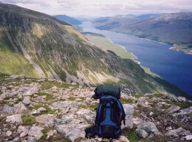 Flagship📷 3
Reservoirs & lochs · Scottish Highlands
Loch Ericht
Loch Ericht — lake in Perth and Kinross, and Highland, Scotland, UK, outflows to River Ericht.
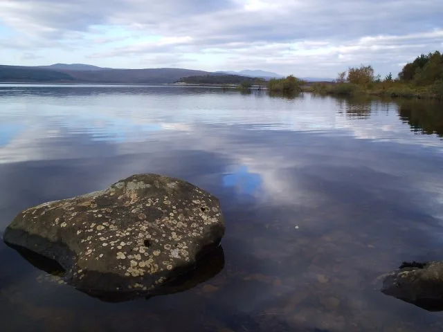 Flagship📷 3
Reservoirs & lochs · Scottish Highlands
Loch Shin
Loch Shin — reservoir in Highland, Scotland, UK, outflows to the River Shin.
 📷 4
📷 4Reservoirs & lochs · Scottish Highlands
Backwater Reservoir
Backwater Reservoir — lake in Angus, Scotland, UK.
 📷 3
📷 3Reservoirs & lochs · Scottish Highlands
Blackwater Reservoir
Blackwater Reservoir — reservoir in Highland, Scotland, UK, outflows to the River Leven.
Frequently asked questions
- Where is Lochalsh?
- Lochalsh is in the Scottish Highlands, United Kingdom.
- What is Lochalsh?
- Lochalsh in Scotland Islands, United Kingdom.
- How do I get to Lochalsh?
- The nearest railway station is Attadale, about 5.3 km away. Its coordinates are 57.3487°, -5.4294°.
- Is Lochalsh free to visit?
- Yes, Lochalsh is free to enter.
- How do I get to Lochalsh?
- The nearest railway station is Attadale, about 5.3 km away.