Mountains & hills · North Wales
Llechog
In or near Q1638504.
Llechog — Named summit at 720 m.

Wikimedia Commons contributors — see linked file page for photographer and licence licence
Plan your visit
- Typical visit
- 3 h–8 h
- Best time of year
- Late spring – early autumn (May–Oct)
- Nearest railway station
- Rocky Valley Halt · 0.1 km
- Free entry
- Dog-friendly
Getting there & planning your visit
You can reach Llechog by taking a train to Rocky Valley Halt, which is just 0.1 km away. Admission to the mountain is free.
About
Llechog is a named summit in the United Kingdom. Wikidata describes it as: "Named summit at 720 m.". Coordinates: 53.0899°, -4.0828°.
Photo gallery
From the Wikipedia article
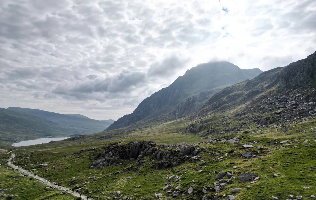
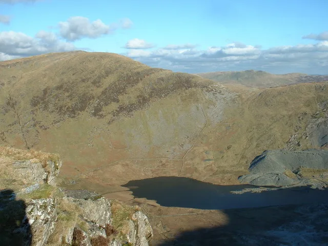
Llechog is a top of Garnedd Ugain on the Snowdon massif in Wales. It is the top of a long crest of cliffs that start in Llanberis and finishes on Garnedd Ugain. The nearby Clogwyn Station is a stop of the Snowdon mountain railway. The summit is a rocky peak sitting out from cliffs which fall steeply down to the Nant Peris valley. The viewpoint is commanding, where the full prominence of Glyder Fawr, Y Garn, Elidir Fawr and Crib Goch can be admired. A second top of the same name can also be found about 1/2 mile to the south-west of Snowdon summit, overlooking Cwm Clogwyn.
Excerpt from Wikipedia under CC BY-SA 4.0. See the source article linked in Sources below.
- Coordinates
- 53.0899, -4.0828
- District
- Gwynedd
- Parish
- Llanberis
- Postcode
- LL55 4UL
- Parliamentary constituency
- Dwyfor Meirionnydd
- Nearest railway station
- Rocky Valley Halt — 0.1 km
Sources
- osm: n2075081387 (ODbL)
- wikipedia: Llechog (CC BY-SA 4.0)
- commons: Snowdon Railway winding down - geograph.org.uk - 625728.jpg (CC BY-SA 4.0)
Other places nearby

Clogwyn Coch Copper Mines
Archaeological sites · 1.1 km

Cwm Brwynog Deserted Rural Settlement
Vineyards · 1.3 km
Tryfan
Mountains & hills · 1.4 km

Clogwyn Du'r Arddu West Buttress
Climbing & bouldering crags · 1.4 km

St Peris's Church, Nant Peris, Llanberis
Historic churches · 1.5 km

Clogwyn Du'r Arddu Far West Buttress
Climbing & bouldering crags · 1.6 km

Gallt-y-Llan quarry
Quarries · 1.6 km

Garnedd Ugain
Mountains & hills · 1.7 km
Carnedd Ugain
Natural landmarks · 1.7 km

Clogwyn y Person
Mountains & hills · 1.7 km

Pritchard's Campsite
Campsites · 1.7 km

Dinas Mot
Climbing & bouldering crags · 1.8 km
Nearby
📷 3Archaeological sites · North Wales
Clogwyn Coch Copper Mines
Clogwyn Coch Copper Mines — a archaeological in wales-north, United Kingdom.
📷 5Vineyards · North Wales
Cwm Brwynog Deserted Rural Settlement
Cwm Brwynog Deserted Rural Settlement — a UK vineyard in wales north, producing English or Welsh wine from cool-climate grape varieties.
📷 4📷 5Climbing & bouldering crags · North Wales
Clogwyn Du'r Arddu West Buttress
Clogwyn Du'r Arddu West Buttress — a climbing crag in wales north.
📷 5Historic churches · North Wales
St Peris's Church, Nant Peris, Llanberis
St Peris's Church, Nant Peris, Llanberis — Grade II* listed building-listed church in wales-north, United Kingdom.
📷 5Climbing & bouldering crags · North Wales
Clogwyn Du'r Arddu Far West Buttress
Clogwyn Du'r Arddu Far West Buttress — a climbing crag in wales north.
Where to eat & stay near Llechog
Places to stay
📷 5 📷 5
📷 5 📷 5
📷 5 📷 5
📷 5Hotels · North Wales
The Legacy Royal Victoria Hotel
The Legacy Royal Victoria Hotel — a hotel in wales north.
 📷 5
📷 5 📷 5
📷 5Hostels · North Wales
Snowdon Pen-y-Pass Youth Hostel
Snowdon Pen-y-Pass Youth Hostel — a hostel in wales north.
Places to eat & drink
 📷 5
📷 5 📷 7
📷 7Restaurants · North Wales
Tafarn Tryfan
Tafarn Tryfan — a restaurant in wales north.
 📷 6
📷 6 📷 5
📷 5 📷 5
📷 5 📷 5
📷 5More mountains in this region
 📷 5
📷 5Mountains & hills · North Wales
Cemlyn Bay and lagoon
Cemlyn Bay and lagoon — Site of Special Scientific Interest in Wales.
 📷 3
📷 3Mountains & hills · North Wales
Aberffraw Bay
Aberffraw Bay — bay on the west coast of Anglesey, in Wales, UK.
 📷 3
📷 3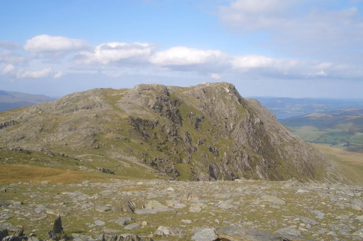 📷 3
📷 3Mountains & hills · North Wales
Aran Benllyn
Aran Benllyn — Named summit at 884 m.
Frequently asked questions
- Where is Llechog?
- Llechog is in North Wales, United Kingdom (postcode LL55 4UL), in the parish of Llanberis.
- What is Llechog?
- Llechog — Named summit at 720 m.
- How do I get to Llechog?
- The nearest railway station is Rocky Valley Halt, about 0.1 km away. Drivers can use postcode LL55 4UL.
- Is Llechog free to visit?
- Yes, Llechog is free to enter.
- How do I get to Llechog?
- The nearest railway station is Rocky Valley Halt, about 0.1 km away. Drivers can navigate to postcode LL55 4UL.