
Other places · Mid Wales
Llanfihangel y Creuddyn
In or near Llanilar.
Llanfihangel y Creuddyn in Wales Mid, United Kingdom.

John Lord — CC BY-SA 2.0 via Wikimedia Commons licence

Plan your visit
- Typical visit
- 1 h–2 h
- Nearest railway station
- Nantyronen · 1.9 km
Getting there & planning your visit
To visit Llanfihangel y Creuddyn, the nearest railway station is Nantyronen, located 1.9 km away. The postcode for the area is SY23 4LB. Entry details are not specified, so please check in advance for any potential fees or accessibility information.
About
Llanfihangel y Creuddyn is a place of interest in Wales Mid, United Kingdom — drawn from open-data sources for visitor reference. See the linked Wikipedia article for the full description.
Photo gallery
From the Wikipedia article
Llanfihangel y Creuddyn (Welsh: [ɬanvɪˈhaŋɛl ɨ ˈkrɛɨðɨn] ) is an ancient parish in the upper division of the hundred of Ilar, Ceredigion, West Wales, 7 miles south east from Aberystwyth, on the road to Rhayader, comprising the chapelry of Eglwys Newydd, or Llanfihangel y Creuddyn Uchaf, and the township of Llanfihangel y Creuddyn Isaf. It was also known as Lower Llanfihangel y Creuddyn, Lower Llanfihangel y Croyddin and Lower Llanfihangel y Croyddyn. This parish is situated on the rivers Ystwyth, Mynach and Rheidol and intersected by various other streams. An ancient parish was a village or group of villages or hamlets and the adjacent lands. Originally they held ecclesiastical functions, but from the sixteenth century onwards they also acquired civil roles. The parish may have been established as an ecclesiastical parish. Originally a medieval administrative unit, after 1597 ecclesiastical units acquired civil functions with the Elizabethan Poor Laws, which made the parishes responsible for welfare. The civil function was exercised through vestry meetings which administered the Poor Law and were responsible for local roads and bridges.
Excerpt from Wikipedia under CC BY-SA 4.0. See the source article linked in Sources below.
Background
History
The lands of the parish were part of the Cistercian Abbey of Strata Florida originally established in 1164. After the Dissolution of the monasteries by Henry VIII (1536–1540) during the English Reformation, their holdings were divided and awarded to new tenants at the direction of the 1st Earl of Essex. Some of the Strata Florida lands were granted to the Herbert family, who came to Cardiganshire during the reign of Elizabeth I. One, Sir Richard Herbert of Pengelly and Cwmystwyth was High Sheriff of Cardiganshire from 22 November 1542. A rent roll dated 1540 for the granges of Mefenydd, Cwmystwyth and Hafodwen (‘newe leases’) reveals that W[illia]m Herbert and Morgan Herbert were tenants of…
Visiting
Trawsgoed is the modern community name. Llanfihangel translates as the church of St. Michael (). The parish lies within the Cistercian Way. The area is now sparsely populated with only a few towns and villages such as Ysbyty Ystwyth, Cwmystwyth, Pont-rhyd-y-groes, Llanilar and Llanfair. In the past area was relatively densely populated due to its mineral wealth. Silver, lead and zinc have been mined in the valley since Roman times, an activity that reached its peak in the 18th century. The largest of the very many mines was Cwmystwyth Mines. Within the boundaries of the parish lies the village of Llanfihangel-y-Creuddyn, the Hafod Estate and Devil's Bridge. The linguistic (Welsh language…
Sourced from Wikipedia under CC BY-SA 4.0.
- Coordinates
- 52.3699, -3.9618
- District
- Ceredigion
- Parish
- Trawsgoed
- Postcode
- SY23 4LB
- Parliamentary constituency
- Ceredigion Preseli
- Nearest railway station
- Nantyronen — 1.9 km
Sources
- wikidata: Q6661372 (CC0)
- wikipedia: Llanfihangel y Creuddyn (CC BY-SA 4.0)
Other places nearby

Creuddyn
Hill forts · 0.2 km

Melin Ucheldre
Watermills · 0.7 km
Llanfihangel-y-creuddyn
Villages · 0.9 km

Derwen Bedwen
Historic houses · 0.9 km

Banc-y-môr
Other places · 1.0 km

Allt Goch
Mountains & hills · 1.1 km

Pisgah
Mountains & hills · 1.8 km

Nantyronen railway station
Heritage railway stations · 2.0 km
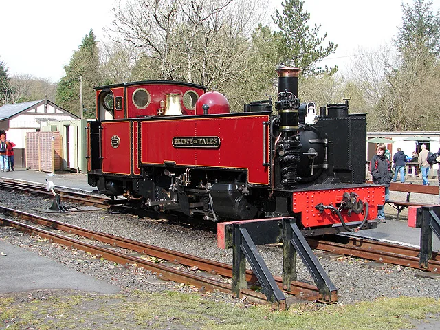
Vale of Rheidol Railway
Heritage railways · 2.0 km

Tŷ'n y Fron
Historic houses · 2.0 km

Abermagwr Roman Villa
Roman villas · 2.3 km

Pant-y-crug
Other places · 2.3 km
Nearby
📷 4📷 5📷 5📷 3Historic houses · Mid Wales
Derwen Bedwen
Derwen Bedwen — a historic house in wales-mid, United Kingdom.
📷 3📷 5Where to eat & stay near Llanfihangel y Creuddyn
Places to stay
 📷 5
📷 5Caravan parks · Mid Wales
Maes Bangor Caravan Park
Maes Bangor Caravan Park — a caravan park in wales mid.
 📷 5
📷 5 📷 5
📷 5 📷 7
📷 7 📷 5
📷 5 📷 5
📷 5Caravan parks · Mid Wales
Woodlands Caravan Park Devils Bridge
Woodlands Caravan Park Devils Bridge — a caravan park in wales mid.
Places to eat & drink
 📷 5
📷 5Cafés · Mid Wales
Llywernog Silver Lead Mine
Llywernog Silver Lead Mine — a café in wales mid.
 📷 5
📷 5 📷 4
📷 4 📷 7
📷 7 📷 3
📷 3Historic pubs · Mid Wales
The Commercial Inn
The Commercial Inn — Historic pub — listed building or notable heritage status.
 📷 3
📷 3Historic pubs · Mid Wales
Black Lion
Black Lion — Historic pub — listed building or notable heritage status.
More places in this region
 📷 5
📷 5 📷 3
📷 3Other places · Mid Wales
Sheep Music
Sheep Music is a three-day world music festival which takes place during July each year in Presteigne. It has 22 years of history, starting as a party on The Warden in 1991. Since moving to its curren
 📷 2
📷 2 📷 4
📷 4Frequently asked questions
- Where is Llanfihangel y Creuddyn?
- Llanfihangel y Creuddyn is in Mid Wales, United Kingdom (postcode SY23 4LB), in the parish of Trawsgoed.
- What is Llanfihangel y Creuddyn?
- Llanfihangel y Creuddyn in Wales Mid, United Kingdom.
- How do I get to Llanfihangel y Creuddyn?
- The nearest railway station is Nantyronen, about 1.9 km away. Drivers can use postcode SY23 4LB.
- How do I get to Llanfihangel y Creuddyn?
- The nearest railway station is Nantyronen, about 1.9 km away. Drivers can navigate to postcode SY23 4LB.