
Villages · East of England
Little Chesterford
In or near Great Chesterford.
Little Chesterford — a village in england london.

Peter Stack — CC BY-SA 2.0 via Wikimedia Commons licence
Plan your visit
- Typical visit
- 1 h–2 h
- Nearest railway station
- Great Chesterford · 1.4 km
About
A British village — settlements of this size traditionally cluster a green, parish church, pub and post office around historic land routes.
Photo gallery
Place summary
Little Chesterford is a village located in the London region. It is characterised by its rural setting and small community atmosphere. The village features traditional architecture and local amenities that cater to residents and visitors alike. Its location provides easy access to surrounding areas, making it a quiet retreat from the bustle of city life.
AI-generated from the structured facts on this page (operator, designation, listing, era). Not a substitute for visiting.
- Coordinates
- 52.0539, 0.2105
- County
- Essex
- District
- Uttlesford
- Parish
- Little Chesterford
- Postcode
- CB10 1TU
- Parliamentary constituency
- North West Essex
- Nearest railway station
- Great Chesterford — 1.4 km
Sources
- manual: geonames-2644351 (CC BY 4.0)
Other places nearby
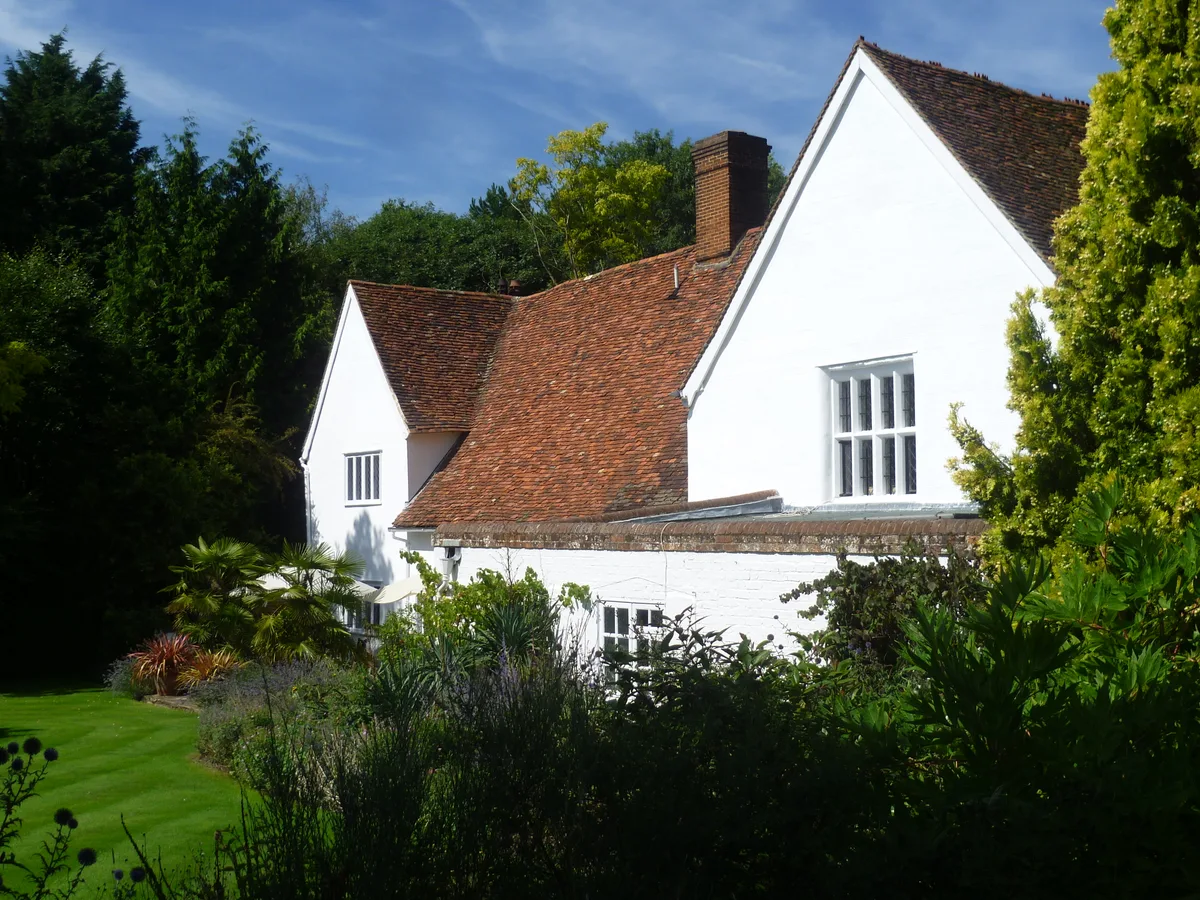
The Manor
Stately homes · 0.2 km

Bridge Over The River Cam
Historic bridges · 0.3 km

Bethnal Green and King's Lynn Line
Historic bridges · 0.7 km

Great Chesterford
Towns & cities · 1.4 km

Crown House
Hotels · 1.5 km

Bethnal Green and King's Lynn Line
Historic bridges · 1.7 km

Emanuel Wood
Vineyards · 1.9 km

Bethnal Green and King's Lynn Line
Historic bridges · 2.0 km

Old Carpenters Arms
Historic pubs · 2.2 km

Littlebury
Villages · 2.2 km
.jpg?width=1200)
Littlebury
Towns & cities · 2.4 km

Ashwell House
Campsites · 2.6 km
Nearby
📷 5Stately homes · East of England
The Manor
The Manor — Grade I listed manor house in Uttlesford, United Kingdom.
📷 5Historic bridges · East of England
Bridge Over The River Cam
Bridge Over The River Cam — Grade II listed building-listed bridge in england-london, United Kingdom.
📷 5Historic bridges · East of England
Bethnal Green and King's Lynn Line
Bethnal Green and King's Lynn Line is a historic bridge in the United Kingdom.
📷 5Towns & cities · East of England
Great Chesterford
Great Chesterford — village in Essex, England, UK.
📷 7Hotels · East of England
Crown House
Crown House — a hotel in england london.
📷 5Historic bridges · East of England
Bethnal Green and King's Lynn Line
Bethnal Green and King's Lynn Line is a historic bridge in the United Kingdom.
Where to eat & stay near Little Chesterford
Places to stay
📷 7Hotels · East of England
Crown House
Crown House — a hotel in england london.
📷 5Campsites · East of England
Ashwell House
Ashwell House — a campsite in england london.
 📷 7
📷 7 📷 5
📷 5 📷 5
📷 5 📷 5
📷 5Caravan parks · East of England
Apple Acre Caravan Park
Apple Acre Caravan Park — a caravan park in england london.
Places to eat & drink
📷 7Historic pubs · East of England
Old Carpenters Arms
Old Carpenters Arms in England East, United Kingdom.
 📷 7
📷 7 📷 5
📷 5Historic pubs · East of England
The Victory Public House
The Victory Public House in England East, United Kingdom.
 📷 5
📷 5Historic pubs · East of England
The Kings Head Inn
The Kings Head Inn in England East, United Kingdom.
 📷 5
📷 5 📷 5
📷 5Historic pubs · East of England
Woodman Public House
Woodman Public House in England East, United Kingdom.
More places in this region


Frequently asked questions
- Where is Little Chesterford?
- Little Chesterford is in Essex, London, United Kingdom (postcode CB10 1TU), in the parish of Little Chesterford.
- What is Little Chesterford?
- Little Chesterford — a village in england london.
- How do I get to Little Chesterford?
- The nearest railway station is Great Chesterford, about 1.4 km away. Drivers can use postcode CB10 1TU.
- How do I get to Little Chesterford?
- The nearest railway station is Great Chesterford, about 1.4 km away. Drivers can navigate to postcode CB10 1TU.