
Towns & cities · East of England
Great Chesterford
Great Chesterford — village in Essex, England, UK.

Wikimedia Commons contributors — see linked file page for photographer and licence licence

Plan your visit
- Typical visit
- 3 h–6 h
- Nearest railway station
- Great Chesterford · 0.9 km
- Free entry
- Family-friendly
- Dog-friendly
Getting there & planning your visit
Great Chesterford is accessible via the nearest railway station, which is Great Chesterford, located 0.9 km away. Entry to the town is free. The postcode for sat-nav is CB10.
About
Great Chesterford is a town, city, village or settlement in the United Kingdom. Recent population estimates put it at around 1,424 people. Address: CB10. Wikidata describes it as: "village in Essex, England, UK". Coordinates: 52.0660°, 0.2030°.
Photo gallery
From the Wikipedia article
Great Chesterford is a village and civil parish in the Uttlesford district of Essex, England. The village is 3 miles (5 km) north-west of Saffron Walden, its post town, 10 miles (16 km) south from Cambridge and about 25 miles (40 km) northwest from the city and Essex county town of Chelmsford. At the 2021 census the parish had a population of 1,775. The Icknield Way Path passes through the village on its 110 miles (180 km) route between Ivinghoe Beacon in Buckinghamshire and Knettishall Heath in Suffolk. The Icknield Way Trail, a route for walkers, horse riders and cyclists also passes through.
Excerpt from Wikipedia under CC BY-SA 4.0. See the source article linked in Sources below.
Background
History
Great Chesterford is an ancient village with many listed buildings situated on the banks of the River Cam, or Granta, on the boundary of Essex and Cambridgeshire. The land around Great Chesterford has been inhabited for centuries, and there have been many archaeological finds e.g. Bronze Age beakers, Belgic pottery and jewellery, and many Roman artefacts which can be found in both Saffron Walden and Cambridge museums. In the 1st century AD, a Romano-British civil settlement was established near the river, occupying an important site en route between London, Cambridge and Newmarket. They erected many buildings, including a tax office, and a temple which was excavated to the east of the town…
Sourced from Wikipedia under CC BY-SA 4.0.
- Coordinates
- 52.0660, 0.2030
- County
- Essex
- District
- Uttlesford
- Parish
- Great Chesterford
- Postcode
- CB10
- Parliamentary constituency
- North West Essex
- Population
- 1,424
- Nearest railway station
- Great Chesterford — 0.9 km
Sources
- wikidata: Q1020030 (CC0)
- wikipedia: Great Chesterford (CC BY-SA 4.0)
- commons: Great Chesterford Church - geograph.org.uk - 117405.jpg (CC BY-SA 4.0)
Other places nearby

Crown House
Hotels · 0.6 km

Bethnal Green and King's Lynn Line
Historic bridges · 1.0 km

Bethnal Green and King's Lynn Line
Historic bridges · 1.1 km

Bridge Over The River Cam
Historic bridges · 1.3 km

Bethnal Green and King's Lynn Line
Historic bridges · 1.3 km

Little Chesterford
Villages · 1.4 km
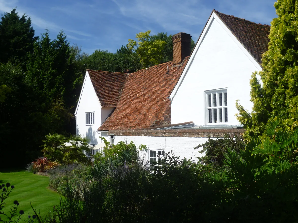
The Manor
Stately homes · 1.5 km

Bethnal Green and King's Lynn Line
Historic bridges · 1.6 km

Ickleton War Memorial
Memorials & monuments · 1.7 km

Parish Church of St Mary Magdalen
Historic churches · 1.8 km

Ickleton
Villages · 1.9 km
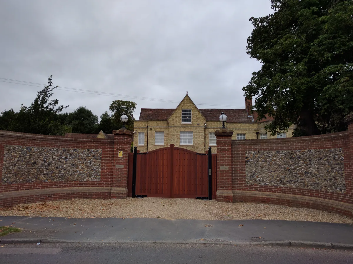
Caldress Manor
Stately homes · 1.9 km
Great Chesterford is a village in Essex, located in the London region, with a population of 1,424. Our guide lists nearby attractions within reach.
At a glance
- Population
- 1,424
- Administrative county
- Essex
- Constituency
- North West Essex
- Top categories near here
Things to see in Great Chesterford
12 attractions within 12 km. Full guide: things to do in Great Chesterford →
📷 5Historic bridges · East of England
Bethnal Green and King's Lynn Line
Bethnal Green and King's Lynn Line is a historic bridge in the United Kingdom.
📷 5Historic bridges · East of England
Bethnal Green and King's Lynn Line
Bethnal Green and King's Lynn Line is a historic bridge in the United Kingdom.
📷 5Historic bridges · East of England
Bethnal Green and King's Lynn Line
Bethnal Green and King's Lynn Line is a historic bridge in the United Kingdom.
📷 5Historic bridges · East of England
Bethnal Green and King's Lynn Line
Bethnal Green and King's Lynn Line is a historic bridge in the United Kingdom.
Flagship📷 5Stately homes · East of England
Caldress Manor
Caldress Manor — manor house in Ickleton, South Cambridgeshire, England, UK.
📷 5Stately homes · East of England
The Manor
The Manor — Grade I listed manor house in Uttlesford, United Kingdom.
Flagship📷 5Historic churches · East of England
Parish Church of St Mary Magdalen
Parish Church of St Mary Magdalen — a Grade I-listed church in england-london, United Kingdom.
📷 5Historic bridges · East of England
Bridge Over The River Cam
Bridge Over The River Cam — Grade II listed building-listed bridge in england-london, United Kingdom.
📷 5Memorials & monuments · East of England
Ickleton War Memorial
Ickleton War Memorial — Grade II listed building-listed memorial in england-london, United Kingdom.
📷 7Hotels · East of England
Crown House
Crown House — a hotel in england london.
📷 5📷 5Nearby
📷 7Hotels · East of England
Crown House
Crown House — a hotel in england london.
📷 5Historic bridges · East of England
Bethnal Green and King's Lynn Line
Bethnal Green and King's Lynn Line is a historic bridge in the United Kingdom.
📷 5Historic bridges · East of England
Bethnal Green and King's Lynn Line
Bethnal Green and King's Lynn Line is a historic bridge in the United Kingdom.
📷 5Historic bridges · East of England
Bridge Over The River Cam
Bridge Over The River Cam — Grade II listed building-listed bridge in england-london, United Kingdom.
📷 5Historic bridges · East of England
Bethnal Green and King's Lynn Line
Bethnal Green and King's Lynn Line is a historic bridge in the United Kingdom.
📷 5Where to eat & stay near Great Chesterford
Places to stay
📷 7Hotels · East of England
Crown House
Crown House — a hotel in england london.
 📷 5
📷 5Campsites · East of England
Ashwell House
Ashwell House — a campsite in england london.
 📷 7
📷 7 📷 5
📷 5 📷 5📷 5
Places to eat & drink
 📷 7
📷 7Historic pubs · East of England
Old Carpenters Arms
Old Carpenters Arms in England East, United Kingdom.
 📷 7
📷 7 📷 5
📷 5Historic pubs · East of England
The Kings Head Inn
The Kings Head Inn in England East, United Kingdom.
 📷 5
📷 5Historic pubs · East of England
The Victory Public House
The Victory Public House in England East, United Kingdom.
 📷 5
📷 5 📷 5
📷 5Historic pubs · East of England
Tickells Arms Public House
Tickells Arms Public House in England East, United Kingdom.
More towns in this region
 Flagship📷 10
 Flagship📷 10
Towns & cities · East of England
Cambridge
Cambridge — city in Cambridgeshire, England.
 Flagship📷 10
Towns & cities · East of England
Chelmsford
Chelmsford — city in Essex, United Kingdom.
 Flagship📷 10
Towns & cities · East of England
Colney Heath
Colney Heath — village and civil parish in St Albans, Hertfordshire, England, UK.
Frequently asked questions
- Where is Great Chesterford?
- Great Chesterford is in Essex, London, United Kingdom (postcode CB10), in the parish of Great Chesterford.
- What is Great Chesterford?
- Great Chesterford — village in Essex, England, UK.
- How do I get to Great Chesterford?
- The nearest railway station is Great Chesterford, about 0.9 km away. Drivers can use postcode CB10.
- Is Great Chesterford free to visit?
- Yes, Great Chesterford is free to enter.
- How do I get to Great Chesterford?
- The nearest railway station is Great Chesterford, about 0.9 km away. Drivers can navigate to postcode CB10.