
Memorials & monuments · Yorkshire & the Humber
Leaning Stoop
In or near Denton.
Leaning Stoop — a memorial in england-yorkshire, United Kingdom.

Milestone Society — CC BY-SA 2.0 via Wikimedia Commons licence

Plan your visit
- Typical visit
- 15 min–45 min
- Nearest railway station
- Ilkley · 3.1 km
- Free entry
- Dog-friendly
Getting there & planning your visit
To visit Leaning Stoop, the nearest railway station is Ilkley, located 3.1 km away. Entry to the memorial is free.
About
Leaning Stoop is a memorial located in england-yorkshire, United Kingdom. Sourced from OpenStreetMap (ODbL licence); see local listings for visitor information, opening hours and admission details.
Photo gallery
Protected designations
- Site of Special Scientific Interest: South Pennine Moors SSSI
- National Nature Reserve: BRADFORD PENNINE GATEWAY
Designations sourced from Natural England open data under OGL v3.
From the Wikipedia article
In computer programming, leaning toothpick syndrome (LTS) is the situation in which a quoted expression becomes visually confusing because it contains a large number of escape characters to avoid delimiter collision (i.e., to avoid ambiguous, non-deterministic interpretations in the program). Escape characters are usually backslashes (\), but can be other character types as well. An example of LTS would be /^\\\/\\+\/\\?\/\\$/. Leaning Toothpick Syndrome is named as such due to the visual appearance of each backslash (or forward slash, another common escape character) resembling a leaning toothpick, combined with LTS-suffering strings containing a large number of the tilted slashes. LTS appears in many programming languages and in many situations, including in patterns that match Uniform Resource Identifiers (URIs), programs that manipulate files and their contents, and programs that output quoted text (i.e., text that either contains quote characters, is surrounded by quote characters, or both). Many quines fall into the latter category. The official Perl documentation introduced the term to wider usage; there, the phrase is used to describe regular expressions that match Unix-style paths, in which the elements are separated by slashes /. The slash is also used as the default regular expression delimiter; so to be used literally in the expression, it must be escaped with a backslash \, leading to frequent escaped slashes represented as \/. If doubled, as in URLs, this yields \/\/ for an escaped //. A similar phenomenon occurs for MS-DOS and Windows paths, where the backslash is used as a path separator, such as in C:\Users\Amy\Desktop\Q1-report.pdf, rather than a Unix-style /home/Amy/Desktop/Q1-report.pdf with forward slashes. As a result of using \ for paths instead of /, Windows typically requires extra escape characters when compared to Unix-style paths. Therefore, Windows paths are more likely to cause frustration to programmers.
Excerpt from Wikipedia under CC BY-SA 4.0. See the source article linked in Sources below.
- Coordinates
- 53.8970, -1.8134
- Nearest railway station
- Ilkley — 3.1 km
Sources
- osm: node/4167459794 (ODbL)
- wikipedia: Leaning toothpick syndrome (CC BY-SA 4.0)
Other places nearby
Ashlar Chair
Memorials & monuments · 0.4 km

Benson and Bobby
Memorials & monuments · 0.6 km
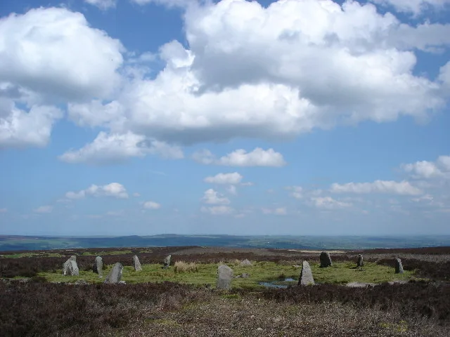
Twelve Apostles of Ilkley Moor
Hill forts · 0.6 km

Lanshaw Lad
Memorials & monuments · 0.6 km

Lanshaw Delves
Archaeological sites · 1.0 km

Laid Stoop
Memorials & monuments · 1.1 km

Ilkley Moor
Mountains & hills · 1.1 km
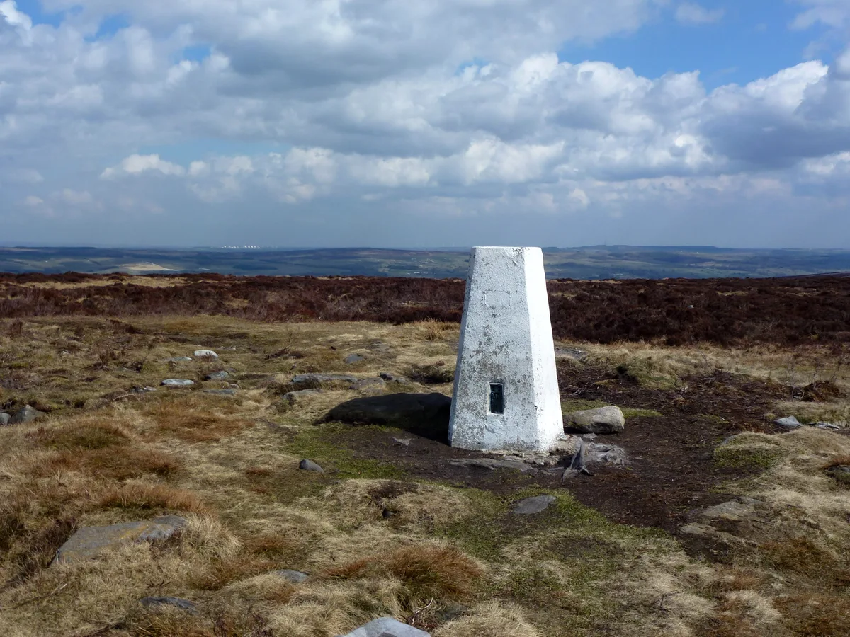
Rombald's Moor
Mountains & hills · 1.1 km
Lanshaw Lass
Memorials & monuments · 1.2 km

Grubstones
Hill forts · 1.3 km

Grubstones Circle
Archaeological sites · 1.3 km

Puddle Stone
Public art & sculpture · 1.4 km
Nearby
📷 3Memorials & monuments · Yorkshire & the Humber
Ashlar Chair
Ashlar Chair — a memorial in england-yorkshire, United Kingdom.
📷 3Memorials & monuments · Yorkshire & the Humber
Benson and Bobby
Benson and Bobby — a memorial in england-yorkshire, United Kingdom.
📷 5Hill forts · Yorkshire & the Humber
Twelve Apostles of Ilkley Moor
Twelve Apostles of Ilkley Moor — Stone circle in West Yorkshire, England, UK.
📷 3Memorials & monuments · Yorkshire & the Humber
Lanshaw Lad
Lanshaw Lad — a memorial in england-yorkshire, United Kingdom.
📷 3Archaeological sites · Yorkshire & the Humber
Lanshaw Delves
Lanshaw Delves — a archaeological in england-yorkshire, United Kingdom.
📷 3Memorials & monuments · Yorkshire & the Humber
Laid Stoop
Laid Stoop — a memorial in england-yorkshire, United Kingdom.
Where to eat & stay near Leaning Stoop
Places to stay
 📷 5
📷 5Hotels · Yorkshire & the Humber
Craiglands Hotel
Craiglands Hotel — a hotel in england yorkshire.
 📷 5
📷 5Campsites · Yorkshire & the Humber
Robin Hole Camping Site
Robin Hole Camping Site — a campsite in england yorkshire.
 📷 5
📷 5 📷 5
📷 5Caravan parks · Yorkshire & the Humber
Moor Valley Caravan Park
Moor Valley Caravan Park — a caravan park in england yorkshire.
 📷 5
📷 5Campsites · Yorkshire & the Humber
Curly Hill Campsite & Centre
Curly Hill Campsite & Centre — a campsite in england yorkshire.
 📷 5
📷 5Caravan parks · Yorkshire & the Humber
Dobrudden Farm Caravan Park
Dobrudden Farm Caravan Park — a caravan park in england yorkshire.
Places to eat & drink
 📷 5
📷 5Cafés · Yorkshire & the Humber
White Wells
White Wells — a café in england yorkshire.
 📷 5
📷 5Restaurants · Yorkshire & the Humber
The Box Tree
The Box Tree — a restaurant in england yorkshire.
 📷 5
📷 5Historic pubs · Yorkshire & the Humber
Airedale Heifer Public House And Attached Barn
Airedale Heifer Public House And Attached Barn in England Yorkshire, United Kingdom.
 📷 5
📷 5Historic pubs · Yorkshire & the Humber
Old White Horse Inn
Old White Horse Inn in England Yorkshire, United Kingdom.
 📷 5
📷 5Historic pubs · Yorkshire & the Humber
White Cross Hotel
White Cross Hotel in England Yorkshire, United Kingdom.
 📷 5
📷 5More memorials in this region
 📷 3
📷 3Memorials & monuments · Yorkshire & the Humber
Disley War Memorial
Disley War Memorial — War memorial, dating to 1920.
 📷 3
📷 3Memorials & monuments · Yorkshire & the Humber
Hyde war memorial
Hyde war memorial is a memorial in the United Kingdom.
 📷 3
📷 3Memorials & monuments · Yorkshire & the Humber
Audenshaw War Memorial
Audenshaw War Memorial — Grade II listed building-listed memorial in england-west-midlands, United Kingdom.
 📷 3
📷 3Memorials & monuments · Yorkshire & the Humber
War memorial to front of Church of St Paul
War memorial to front of Church of St Paul — Grade II listed building-listed memorial in england-west-midlands, United Kingdom.
Frequently asked questions
- Where is Leaning Stoop?
- Leaning Stoop is in Yorkshire, United Kingdom.
- What is Leaning Stoop?
- Leaning Stoop — a memorial in england-yorkshire, United Kingdom.
- How do I get to Leaning Stoop?
- The nearest railway station is Ilkley, about 3.1 km away. Its coordinates are 53.8970°, -1.8134°.
- Is Leaning Stoop a protected site?
- Yes — Leaning Stoop is part of the South Pennine Moors SSSI Site of Special Scientific Interest and the BRADFORD PENNINE GATEWAY National Nature Reserve.
- Is Leaning Stoop free to visit?
- Yes, Leaning Stoop is free to enter.
- How do I get to Leaning Stoop?
- The nearest railway station is Ilkley, about 3.1 km away.