
Mountains & hills · South East England
Langdon Bay, Kent
In or near Martin Mill.
Langdon Bay, Kent — bay in Kent, England.

Wikimedia Commons contributors — see linked file page for photographer and licence licence

Plan your visit
- Typical visit
- 3 h–8 h
- Best time of year
- Late spring – early autumn (May–Oct)
- Nearest railway station
- Dover Priory · 3.3 km
- Free entry
- Dog-friendly
Getting there & planning your visit
To visit Langdon Bay in Kent, the nearest railway station is Dover Priory, located 3.3 km away. The postcode for sat-nav is CT15 5NA, and entry is free.
About
Langdon Bay, Kent is a named summit in the United Kingdom. Part of English Channel. Wikidata describes it as: "bay in Kent, England". Coordinates: 51.1336°, 1.3510°.
Photo gallery
360° viewimagery from 2019
Imagery © Mapillary contributors, CC BY-SA 4.0
Protected designations
- Site of Special Scientific Interest: Dover to Kingsdown Cliffs SSSI
- Area of Outstanding Natural Beauty: Kent Downs
Designations sourced from Natural England open data under OGL v3.
From the Wikipedia article
Langdon Bay is a bay in east Kent, England. It is two miles east of the town of Dover, and is named after the nearby villages of Langdon, East Langdon and West Langdon. The cliffs around it are known as the Langdon Cliffs. A prominent zig-zag path down the cliff-face is visible from the sea and connects with the National Trust path by means of a step ladder. An additional means of exit from the beach being a return on foot to St Margaret's Bay. At the far western end is a restricted area of the Port of Dover, and occasionally walkers will be escorted out by the Dover Port Police.
Excerpt from Wikipedia under CC BY-SA 4.0. See the source article linked in Sources below.
Background
History
The bay is known for the Langdon Bay Hoard – a collection of Bronze Age metal objects found nearby in 1974. This includes bronze axes of a French type and is thought to represent the cargo of a boat that was caught in a storm just after leaving the English coast, either jettisoned to lighten and save the boat or sunk with it (if there was a wreck, it is now lost). This demonstrates that cross-channel trade was already occurring in the Bronze Age, if not earlier. The hoard is owned by the British Museum, but is on long-term loan and display in Dover Museum in Market Square, Dover. Three searchlight batteries – known as the Langdon Lights – were built into the base of the bay's cliffs during…
Sourced from Wikipedia under CC BY-SA 4.0.
- Coordinates
- 51.1336, 1.3510
- County
- Kent
- District
- Dover
- Parish
- St. Margaret's at Cliffe
- Postcode
- CT15 5NA
- Parliamentary constituency
- Dover and Deal
- Nearest railway station
- Dover Priory — 3.3 km
Sources
- wikidata: Q6485798 (CC0)
- wikipedia: Langdon Bay (Kent) (CC BY-SA 4.0)
- commons: View from the footpath above Langdon Bay - geograph.org.uk - 743074.jpg (CC BY-SA 4.0)
Other places nearby

Langdon Beach
Beaches · 0.0 km

SS Falcon
Museums · 0.0 km

Langdon Bay
Natural landmarks · 0.3 km

Crab Bay
Natural landmarks · 0.3 km

Fan Bay
Natural landmarks · 0.6 km

Fan Bay Deep Shelter
Natural landmarks · 0.7 km
Fan Bay Sound Mirrors
Natural landmarks · 0.7 km

White Cliffs of Dover
Natural landmarks · 0.8 km

The White Cliffs of Dover
Natural landmarks · 0.9 km

National Trust White Cliffs of Dover
Natural landmarks · 1.0 km
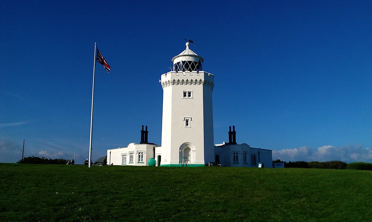
South Foreland Upper Lighthouse
Lighthouses · 1.6 km

South Foreland Lighthouse
Lighthouses · 1.6 km
Nearby
📷 5📷 5📷 5Natural landmarks · South East England
Langdon Bay
Langdon Bay — a natural feature in england south east.
📷 5📷 5📷 5Natural landmarks · South East England
Fan Bay Deep Shelter
Fan Bay Deep Shelter — a other in england-south-east, United Kingdom.
Where to eat & stay near Langdon Bay, Kent
Places to stay
 📷 5
📷 5Caravan parks · South East England
St Margarets Bay Holiday Park
St Margarets Bay Holiday Park — a caravan park in england south east. Brand: Parkdean Resorts.
 📷 5
📷 5 📷 5
📷 5 📷 5
📷 5Campsites · South East England
Hawthorn Farm (Keat farm)
Hawthorn Farm (Keat farm) — a campsite in england south east.
 📷 5
📷 5Campsites · South East England
Kingsdown International Camping Centre
Kingsdown International Camping Centre — a campsite in england south east.
 📷 5
📷 5Places to eat & drink
 📷 7
📷 7Restaurants · South East England
The Swingate Inn, Namaste Curry House
The Swingate Inn, Namaste Curry House — a restaurant in england south east. Cuisine: indian.
 📷 7
📷 7 📷 7
📷 7Restaurants · South East England
81 Beach Street
81 Beach Street — a restaurant in england south east.
 📷 5
📷 5Historic pubs · South East England
The Martello Public House
The Martello Public House in England South East, United Kingdom.
 📷 5
📷 5Historic pubs · South East England
The Samuel Peto
The Samuel Peto in England South East, United Kingdom.
 📷 5
📷 5Historic pubs · South East England
The Black Pig Inn
The Black Pig Inn in England South East, United Kingdom.
More mountains in this region
 📷 5
📷 5 📷 5
📷 5Mountains & hills · South East England
Reigate Caves
Reigate Caves is a mountain or hill in the United Kingdom.
 📷 5
📷 5Mountains & hills · South East England
North Downs
North Downs — a hill or mountain in england london.
 📷 5
📷 5Mountains & hills · South East England
Blue Bell Hill
Blue Bell Hill — a hill or mountain in england london.
Frequently asked questions
- Where is Langdon Bay, Kent?
- Langdon Bay, Kent is in Kent, South-East England, United Kingdom (postcode CT15 5NA), in the parish of St. Margaret's at Cliffe.
- What is Langdon Bay, Kent?
- Langdon Bay, Kent — bay in Kent, England.
- How do I get to Langdon Bay, Kent?
- The nearest railway station is Dover Priory, about 3.3 km away. The nearest town is Martin Mill. Drivers can use postcode CT15 5NA.
- Is Langdon Bay, Kent a protected site?
- Yes — Langdon Bay, Kent is part of the Dover to Kingsdown Cliffs SSSI Site of Special Scientific Interest and the Kent Downs National Landscape (AONB).
- Is Langdon Bay, Kent free to visit?
- Yes, Langdon Bay, Kent is free to enter.
- How do I get to Langdon Bay, Kent?
- The nearest railway station is Dover Priory, about 3.3 km away. Drivers can navigate to postcode CT15 5NA.