
Public art & sculpture · South East England
Landings
In or near Pevensey.
Landings — a public art in england-south-east, United Kingdom.

Ian Capper — CC BY-SA 2.0 via Wikimedia Commons licence

Plan your visit
- Typical visit
- 1 h–2 h
- Nearest railway station
- Pevensey Bay · 0.7 km
- Free entry
- Dog-friendly
Getting there & planning your visit
To visit Landings, the nearest railway station is Pevensey Bay, located 0.7 km away. The postcode for sat-nav is BN24 5LG, and entry is free. The site is accessible to visitors.
About
Landings is a public art located in england-south-east, United Kingdom. Sourced from OpenStreetMap (ODbL licence); see local listings for visitor information, opening hours and admission details.
Photo gallery
Protected designations
- Site of Special Scientific Interest: Pevensey Levels SSSI
- Ramsar wetland: Pevensey Levels
Designations sourced from Natural England open data under OGL v3.
From the Wikipedia article
The Landings at Cape Torokina (1–3 November 1943), also known as Operation Cherryblossom, took place at the beginning of the Bougainville campaign in World War II. The amphibious landings were carried out by elements of the United States Marine Corps in November 1943 on Bougainville Island in the South Pacific, as part of Allied efforts to advance towards the main Japanese base around Rabaul under Operation Cartwheel. Coming in the wake of Allied successes at Guadalcanal and in the central Solomons, the landings were intended to secure a beachhead with the purpose of establishing several bases from which to project air and naval power closer towards Rabaul, in an effort to neutralize the large Japanese force that had been established there. In the months leading up to the operation, Japanese airpower on Bougainville was degraded by Allied air strikes, while small parties of Allied reconnaissance forces landed around Bougainville and the surrounding islands to gather intelligence. On 1 November, a landing force based around the US 3rd Marine Division, reinforced with various supporting elements, landed at Empress Augusta Bay, on the western side of Bougainville. Situated well away from the main Japanese troop concentrations, the landing was met with only limited resistance on the ground. Japanese aircraft from Rabaul attempted to interdict the landing force, but their attacks proved ineffective and they were largely fought off by US and New Zealand fighters. By the end of the first day, a small perimeter had been established and the majority of the first wave of transports had unloaded their stores over the beachhead. A strong Japanese naval force was dispatched in response from Rabaul in an effort to disrupt the landing operations and, overnight on 1/2 November, clashed with a force of US cruisers and destroyers during the Battle of Empress Augusta Bay. Heavy losses resulted for the Japanese and the force eventually returned to Rabaul. Meanwhile, on the second day, the remaining stores and equipment were unloaded from the transports. Over the course of the two days following the landing, the US troops ashore consolidated their beachhead and began patrolling operations as they worked to secure the perimeter. This was firmly established by 3 November, when Torokina Island was occupied. In the aftermath, the US perimeter was slowly expanded and further echelons arrived to unload stores as base development operations began. By late November, an airstrip had been established inside the perimeter. This became fully operational in early December. Throughout the remainder of 1943, the perimeter was expanded further, allowing the establishment of several more airfields. These later played a key role in the neutralization of Rabaul from the air. Throughout 1944 and 1945, follow-on forces from the US Army and then the Australian Army arrived as the Allies conducted operations to secure the rest of the island. This was only partially completed by the time the war came to an end in August 1945.
Excerpt from Wikipedia under CC BY-SA 4.0. See the source article linked in Sources below.
Background
History
Geographically part of the Solomon Islands, but administratively part of the Territory of New Guinea at the time of the battle, Bougainville lies at the northwestern end of the Solomon Islands chain. Roughly shaped like a fiddle, the island is 125 mi long and, at its widest point, 38 mi across. It is dominated by thick jungle and large mountain peaks in its interior, with narrow beaches around the west coast. Situated south-east of New Britain, Bougainville offered the Allies another step in their advance through the Solomons towards the main Japanese base that had been established around Rabaul. The reduction and isolation of this base was a key Allied objective of the Operation Cartwheel.…
Sourced from Wikipedia under CC BY-SA 4.0.
- Coordinates
- 50.8200, 0.3346
- County
- East Sussex
- District
- Wealden
- Parish
- Pevensey
- Postcode
- BN24 5LG
- Parliamentary constituency
- Bexhill and Battle
- Nearest railway station
- Pevensey Bay — 0.7 km
Sources
- osm: node/11409428131 (ODbL)
- wikipedia: Landings at Cape Torokina (CC BY-SA 4.0)
Other places nearby

1066 Country Walk
Military museums · 0.1 km

Pevensey Cannon
Memorials & monuments · 0.1 km

Pevensey Court House
Museums · 0.1 km
Pevensey Courthouse Museum
Museums · 0.1 km

Pevensey Roman Fort
Archaeological sites · 0.1 km
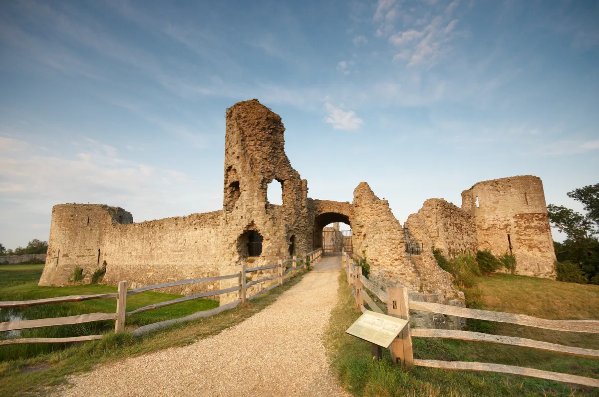
Pevensey Castle
Castles · 0.1 km
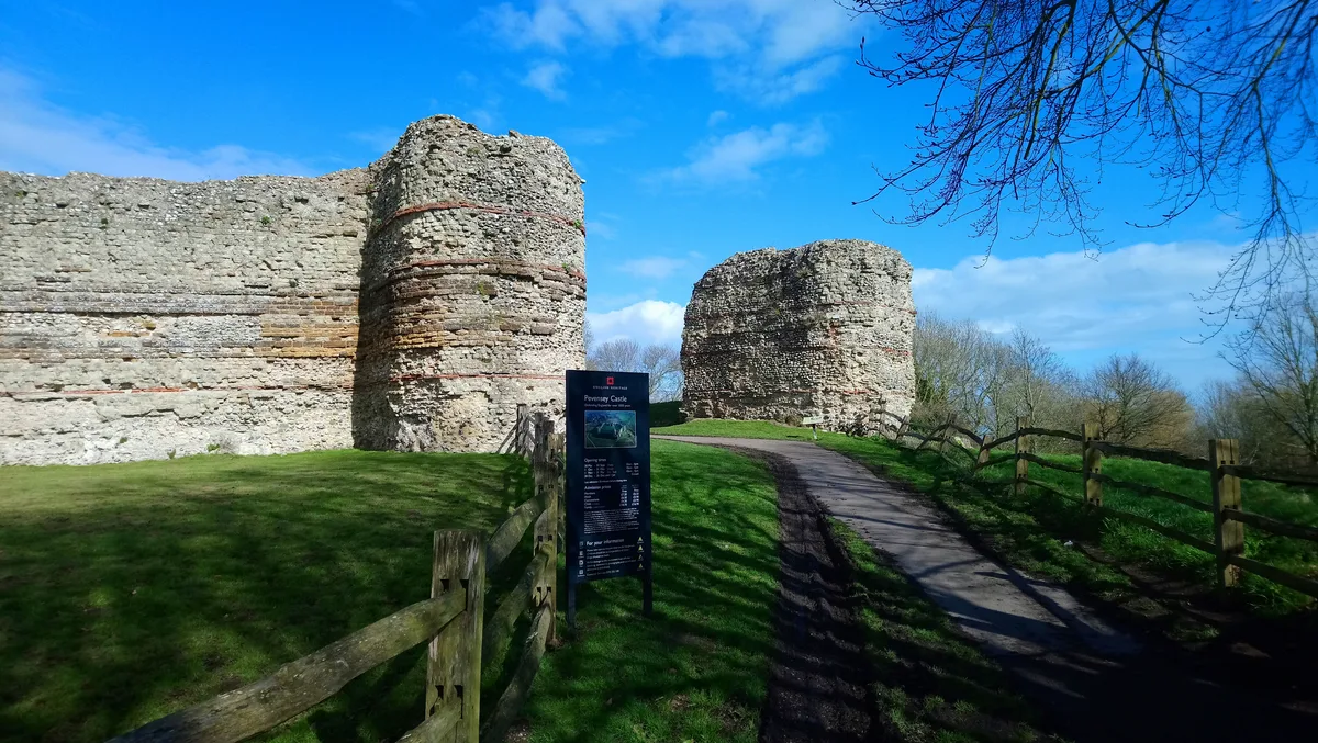
Castrum Anderitum
Hill forts · 0.1 km
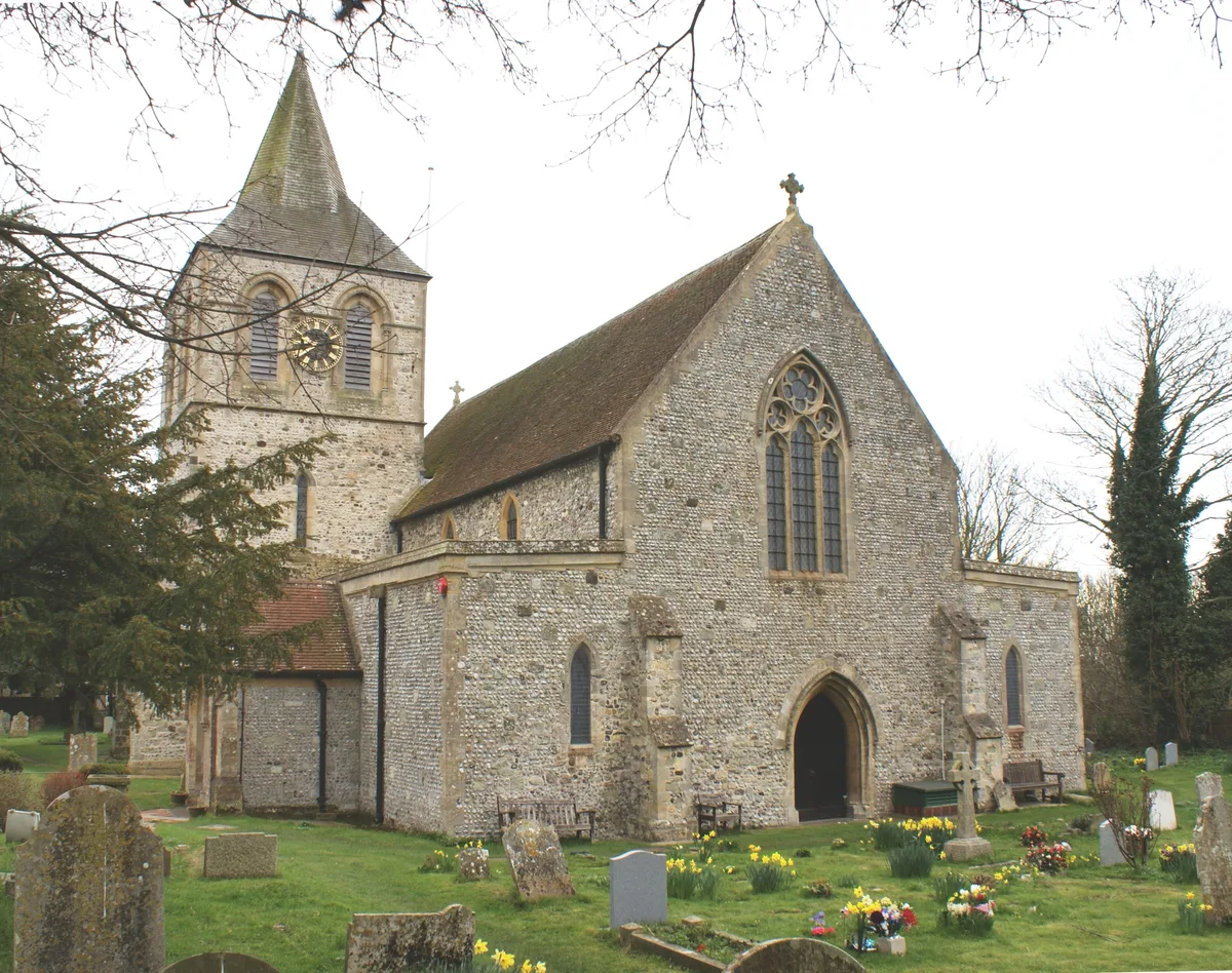
St. Nicolas Church, Pevensey
Historic churches · 0.2 km

Tudor Artillery Battery
Archaeological sites · 0.2 km
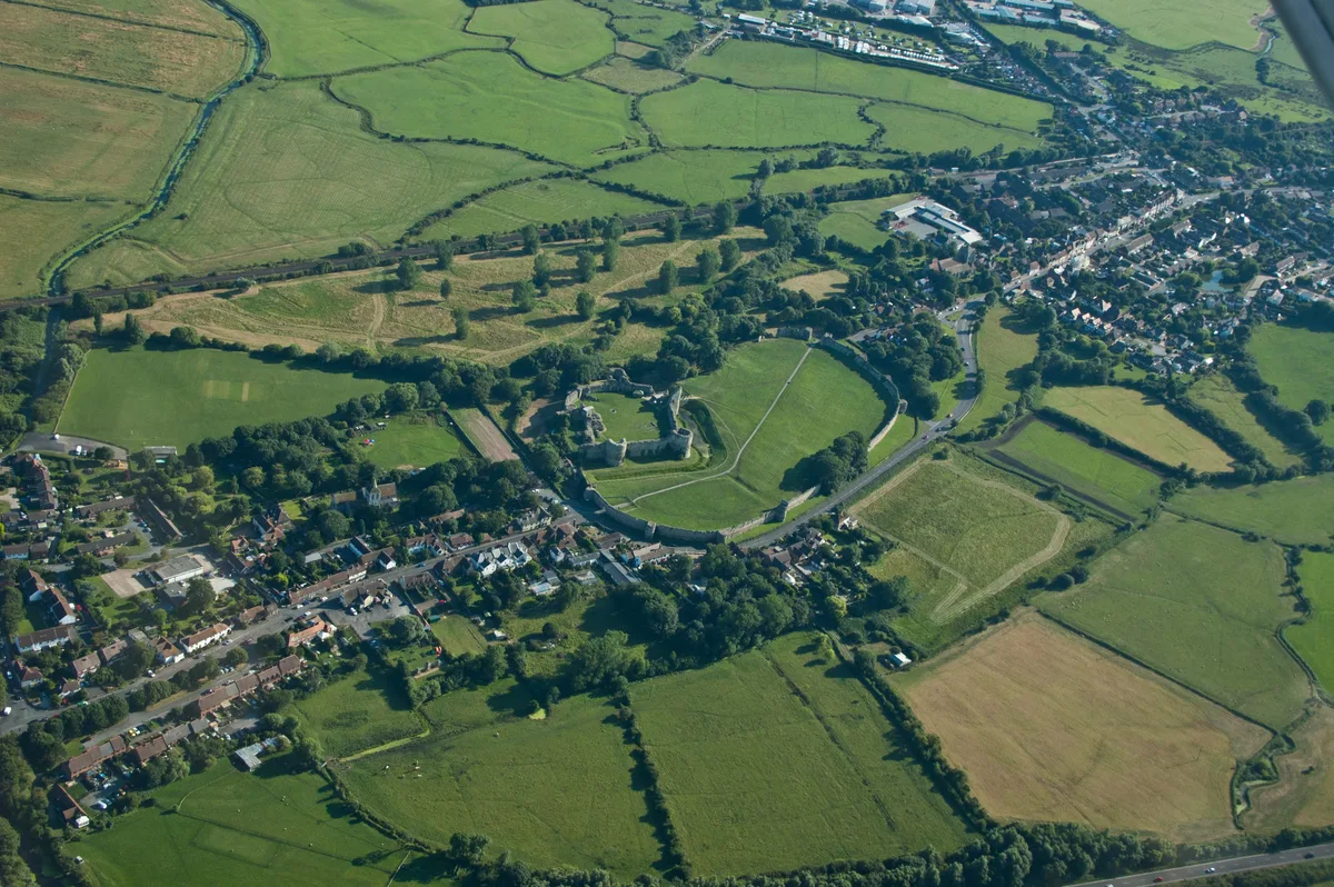
Pevensey
Towns & cities · 0.2 km

Pevensey Bridge
Historic bridges · 0.4 km
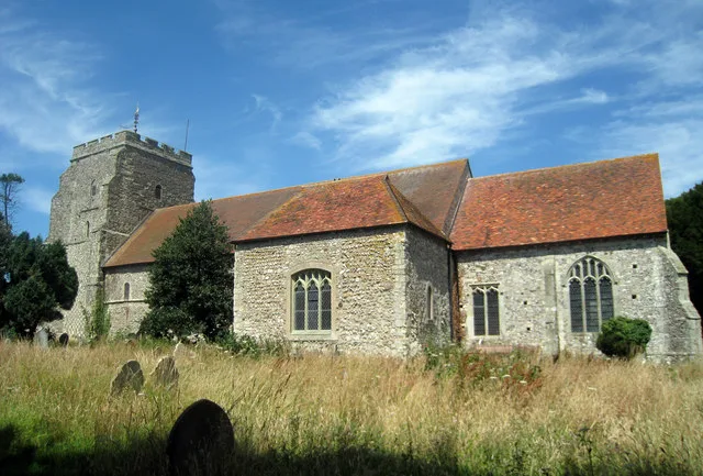
St Mary's Church, Westham
Historic churches · 0.5 km
Nearby
📷 5Military museums · South East England
1066 Country Walk
1066 Country Walk — a military museum in england south east.
📷 5Memorials & monuments · South East England
Pevensey Cannon
Pevensey Cannon — a memorial in england-south-east, United Kingdom.
📷 5Museums · South East England
Pevensey Court House
Pevensey Court House — a museum in england-south-east, United Kingdom.
📷 5Museums · South East England
Pevensey Courthouse Museum
Pevensey Courthouse Museum — a museum in england-south-east, United Kingdom.
📷 5Archaeological sites · South East England
Pevensey Roman Fort
Pevensey Roman Fort — a archaeological in england-south-east, United Kingdom.
📷 5Castles · South East England
Pevensey Castle
Pevensey Castle — medieval castle in a former Roman fort at Pevensey in East Sussex, England, UK.
Where to eat & stay near Landings
Places to stay
 📷 5
📷 5Caravan parks · South East England
Pevensey Bay Holiday Park
Pevensey Bay Holiday Park — a caravan park in england south east.
 📷 5
📷 5Caravan parks · South East England
Castle View Caravan Site
Castle View Caravan Site — a caravan park in england south east.
 📷 5
📷 5Caravan parks · South East England
Grey Tower Caravan Park
Grey Tower Caravan Park — a caravan park in england south east.
 📷 5
📷 5 📷 5
📷 5Caravan parks · South East England
Normans Bay Camping and Caravanning Club
Normans Bay Camping and Caravanning Club — a caravan park in england south east.
 📷 5
📷 5Caravan parks · South East England
Normans Bay Caravan Park
Normans Bay Caravan Park — a caravan park in england south east.
Places to eat & drink
 📷 7
📷 7Historic pubs · South East England
The Bulls Head Inn
The Bulls Head Inn in England South East, United Kingdom.
 📷 5
📷 5 📷 5
📷 5Historic pubs · South East England
The George Hotel
The George Hotel in England South East, United Kingdom.
 📷 7
📷 7 📷 5
📷 5Historic pubs · South East England
The Red Lion Inn
The Red Lion Inn in England South East, United Kingdom.
 📷 7
📷 7Restaurants · South East England
The Sundial Restaurant
The Sundial Restaurant — a restaurant in england south east.
More places in this region
 📷 5
📷 5Public art & sculpture · South East England
The Jurors
The Jurors — Public artwork (installation) by Hew Locke.
 📷 5
📷 5Public art & sculpture · South East England
The Woking Martian
The Woking Martian — a public art in england-london, United Kingdom.
 📷 5
📷 5Public art & sculpture · South East England
The Golf Ball
The Golf Ball — a public art in england-london, United Kingdom.
 📷 5
📷 5Public art & sculpture · South East England
Memorial to Alan Turing
Memorial to Alan Turing — a public art in england-london, United Kingdom.
Frequently asked questions
- Where is Landings?
- Landings is in East Sussex, South-East England, United Kingdom (postcode BN24 5LG), in the parish of Pevensey.
- What is Landings?
- Landings — a public art in england-south-east, United Kingdom.
- How do I get to Landings?
- The nearest railway station is Pevensey Bay, about 0.7 km away. Drivers can use postcode BN24 5LG.
- Is Landings a protected site?
- Yes — Landings is part of the Pevensey Levels SSSI Site of Special Scientific Interest and the Pevensey Levels Ramsar wetland.
- Is Landings free to visit?
- Yes, Landings is free to enter.
- How do I get to Landings?
- The nearest railway station is Pevensey Bay, about 0.7 km away. Drivers can navigate to postcode BN24 5LG.