
Forts · East of England
Landguard Fort
In or near Little Oakley.
Landguard Fort is a fort in the United Kingdom.

Wikimedia Commons contributors — see linked file page for photographer and licence licence

Plan your visit
- Typical visit
- 45 min–1.5 h
- Nearest railway station
- Harwich Town · 2.5 km
- Free entry
- Family-friendly
- Wheelchair accessible
About
Landguard Fort is a historic fort or fortified site in the United Kingdom. Records date its origin to 1540. Address: Viewpoint Road, Felixstowe, IP11 3TW. Admission charged. Coordinates: 51.9384°, 1.3211°.
Photo gallery
Official information
Landguard Fort is a historic military site located in Felixstowe, Suffolk, that played a significant role in defending Harwich Harbour. Visitors can explore its maze of rooms, passageways, and outdoor batteries, as well as enjoy views from the Harwich Bastion. The fort also features exhibitions on its military and maritime heritage.
Protected designations
- Site of Special Scientific Interest: Landguard Common SSSI
- Area of Outstanding Natural Beauty: Suffolk Coast & Heaths
Designations sourced from Natural England open data under OGL v3.
From the Wikipedia article
Landguard Fort is a fort at the mouth of the River Orwell outside Felixstowe, Suffolk, designed to guard the mouth of the river. It is now managed by the charity English Heritage and is open to the public.
Excerpt from Wikipedia under CC BY-SA 4.0. See the source article linked in Sources below.
Background
History
Originally known as Langer Fort, the first fortifications from 1540 were a few earthworks and blockhouse, but it was King James I who ordered, from 1621, the construction of a square fort with bulwarks at each corner. In 1667, the Dutch, under Michiel de Ruyter, landed a force of 2,000 men on Felixstowe beach in front of (what is now called) Undercliff Road East and advanced on to the fort, but were repulsed by Nathaniel Darrel and his garrison of 400 musketeers of the Duke of York & Albany's Maritime Regiment (the first Royal Marines) and 100 artillerymen with 54 cannons. The fort was considered part of Essex in the 18th and 19th centuries; births and deaths within the garrison were…
Sourced from Wikipedia under CC BY-SA 4.0.
- Coordinates
- 51.9384, 1.3211
- County
- Suffolk
- District
- East Suffolk
- Parish
- Felixstowe
- Postcode
- IP11 3TW
- Parliamentary constituency
- Suffolk Coastal
- Established
- 1540
- Nearest railway station
- Harwich Town — 2.5 km
- Official site
- www.english-heritage.org.uk
Sources
- osm: w32007009 (ODbL)
- wikipedia: Landguard Fort (CC BY-SA 4.0)
- commons: Felixstowe - Landguard Fort.jpg (CC BY-SA 4.0)
Other places nearby
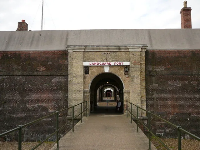
Landguard Fort
Castles · 0.1 km

Felixstowe Museum
Museums · 0.1 km

Suffolk Sands Holiday Park
Caravan parks · 1.1 km

Harwich Harbor
Harbours & ports · 1.3 km

Flood Memorial
Memorials & monuments · 1.9 km

Port of Felixstowe
Marinas · 1.9 km

Felixstowe Sunday Market
Farmers’ markets · 2.0 km

Felixstowe Beach Caravan Park
Caravan parks · 2.0 km

Maritime Museum
Museums · 2.1 km
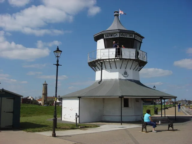
Harwich Low Lighthouse
Lighthouses · 2.1 km
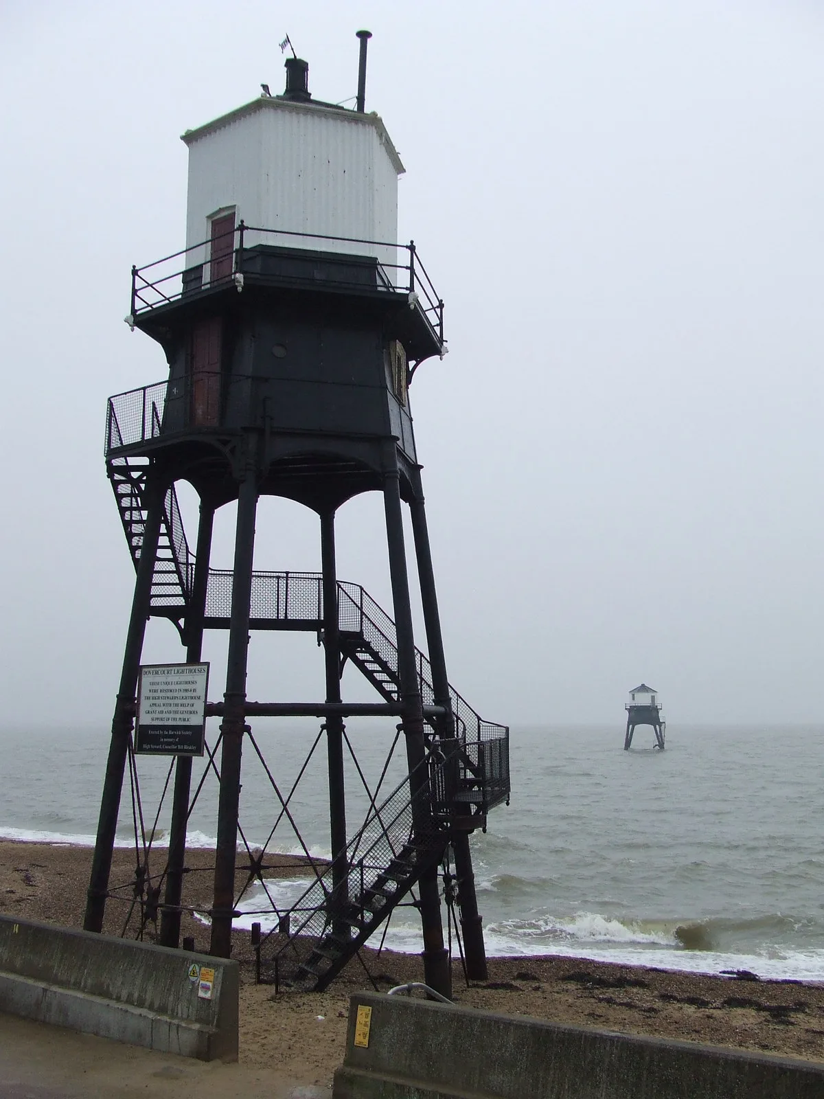
Dovercourt Lighthouses
Lighthouses · 2.2 km

Beacon Hill Fort
Forts · 2.2 km
Nearby
📷 3Castles · East of England
Landguard Fort
Landguard Fort — fort in England, Britain.
📷 3Museums · East of England
Felixstowe Museum
Felixstowe Museum — a museum in england-east, United Kingdom.
📷 5Caravan parks · East of England
Suffolk Sands Holiday Park
Suffolk Sands Holiday Park — a caravan park in england east.
📷 5📷 3Memorials & monuments · East of England
Flood Memorial
Flood Memorial — a memorial in england-east, United Kingdom.
📷 5Marinas · East of England
Port of Felixstowe
Port of Felixstowe — a marina in england east.
Where to eat & stay near Landguard Fort
Places to stay
📷 5Caravan parks · East of England
Suffolk Sands Holiday Park
Suffolk Sands Holiday Park — a caravan park in england east.
📷 5Caravan parks · East of England
Felixstowe Beach Caravan Park
Felixstowe Beach Caravan Park — a caravan park in england east.
 📷 5
📷 5Caravan parks · East of England
Peewit Caravan Park
Peewit Caravan Park — a caravan park in england east.
 📷 5
📷 5 📷 5
📷 5 📷 7
📷 7Hotels · East of England
The Bottle Kiln
The Bottle Kiln — a hotel in england east.
Places to eat & drink
 📷 5
📷 5 📷 5
📷 5Historic pubs · East of England
The British Flag Public House
The British Flag Public House in England East, United Kingdom.
📷 5Restaurants · East of England
Thai Up at the Quay
Thai Up at the Quay — a restaurant in england east.
 📷 5
📷 5 📷 5
📷 5Historic pubs · East of England
The Trafalgar Public House
The Trafalgar Public House in England East, United Kingdom.
 📷 6
📷 6Historic pubs · East of England
The Three Mariners, Trimley St Mary
The Three Mariners, Trimley St Mary in England East, United Kingdom.
Other forts from this era
 📷 5
📷 5Forts · East of England
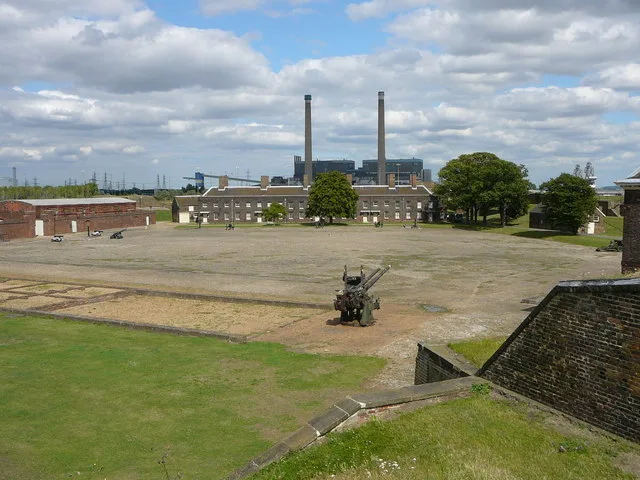
Tilbury Fort
Tilbury Fort is a fort in the United Kingdom.
More forts in this region
 📷 5
📷 5 📷 5
📷 5Forts · East of England
Wallbury Fort
Wallbury Fort is a fort in the United Kingdom.
 📷 5
📷 5Forts · East of England
The maze and monument on Hilton Green
The maze and monument on Hilton Green — a martello broad in england-london, United Kingdom.
 📷 5
📷 5Forts · East of England
Obelisk at site of Republic Cottage, Stocks Bridge
Obelisk at site of Republic Cottage, Stocks Bridge — a martello broad in england-london, United Kingdom.
Frequently asked questions
- Where is Landguard Fort?
- Landguard Fort is in Suffolk, East of England, United Kingdom (postcode IP11 3TW), in the parish of Felixstowe.
- What is Landguard Fort?
- Landguard Fort is a fort in the United Kingdom.
- How do I get to Landguard Fort?
- The nearest railway station is Harwich Town, about 2.5 km away. Drivers can use postcode IP11 3TW.
- When was Landguard Fort built?
- Built or established in 1540.
- Is Landguard Fort a protected site?
- Yes — Landguard Fort is part of the Landguard Common SSSI Site of Special Scientific Interest and the Suffolk Coast & Heaths National Landscape (AONB).
- How do I get to Landguard Fort?
- The nearest railway station is Harwich Town, about 2.5 km away. Drivers can navigate to postcode IP11 3TW.