
Towns & cities · North East England
Knock
Knock — village in Cumbria, United Kingdom.
.jpg?width=1200)
Wikimedia Commons contributors — see linked file page for photographer and licence licence
.jpg)
Plan your visit
- Typical visit
- 3 h–6 h
- Nearest railway station
- Appleby · 6.3 km
- Free entry
- Family-friendly
- Dog-friendly
About
Knock is a town, city, village or settlement in the United Kingdom. Address: CA16. Wikidata describes it as: "village in Cumbria, United Kingdom". Coordinates: 54.6372°, -2.4962°.
Photo gallery
Protected designations
- Site of Special Scientific Interest: River Eden and Tributaries SSSI
- National Nature Reserve: MOOR HOUSE-UPPER TEESDALE
- Area of Outstanding Natural Beauty: North Pennines
Designations sourced from Natural England open data under OGL v3.
From the Wikipedia article
Knock is a small village in the Westmorland and Furness district of Cumbria, England, and 1.9 km northwest of the larger village of Dufton and 3.1 km south of the village of Milburn. It lies midway between Cross Fell to the north and the town of Appleby-in-Westmorland to the south. Knock is situated 1 km east of the small hamlet and farm, Knock Cross.
Excerpt from Wikipedia under CC BY-SA 4.0. See the source article linked in Sources below.
Background
History
The place-name 'Knock' is first attested in a Yorkshire charter from between 1150 and 1162, where it appears as Chonoc-salchild. It appears as Knok in an Inquisition post mortem of 1323. The name means 'hillock', from the Brittonic *cnuc, Old Irish cnocc or Irish cnoc; an apparent reference to the nearby Knock Pike, which is 1,306 feet high, and can be seen in the photo to the right. Circa 1870, it had a population of 197 as recorded in the Imperial Gazetteer of England and Wales. Knock is also shown on Thomas Jefferys's 1770 map of Westmorland. Knock once had a Methodist chapel, but that was closed and the chapel at Dufton was renamed "Dufton with Knock Methodist Church". The former chapel…
Sourced from Wikipedia under CC BY-SA 4.0.
- Coordinates
- 54.6372, -2.4962
- District
- Westmorland and Furness
- Parish
- Long Marton
- Postcode
- CA16
- Parliamentary constituency
- Westmorland and Lonsdale
- Nearest railway station
- Appleby — 6.3 km
Sources
- wikidata: Q592786 (CC0)
- wikipedia: Knock, Cumbria (CC BY-SA 4.0)
- commons: Road junction at the western end of Knock village (geograph 4573723).jpg (CC BY-SA 4.0)
Other places nearby

Silverband Caravan Park
Caravan parks · 0.8 km

St Cuthbert's Church, Dufton
Historic churches · 0.9 km

Knock Pike
Mountains & hills · 1.3 km
Knock Pike
Mountains & hills · 1.3 km

Dufton Pike
Mountains & hills · 1.9 km
Dufton Pike
Natural landmarks · 2.0 km

Dufton Youth Hostel
Hostels · 2.1 km

Dufton
Towns & cities · 2.1 km

Grandie Caravan Park
Caravan parks · 2.3 km

Knock
Villages · 2.4 km

Brow Farm
B&Bs · 2.5 km

Brownber Hill
Mountains & hills · 2.6 km
Knock is a town in North East England offering scenic outdoor experiences. Visitors can explore the area around Little Dun Fell and Great Dun Fell. The region also features Knock Fell and the River Tees memorial for those seeking natural landmarks.
At a glance
- Constituency
- Westmorland and Lonsdale
- Top categories near here
Things to see in Knock
22 attractions within 12 km. Full guide: things to do in Knock →
 📷 4
📷 4Memorials & monuments · North East England
River Tees
River Tees in England North East, United Kingdom.
 📷 3
📷 3Natural landmarks · North East England
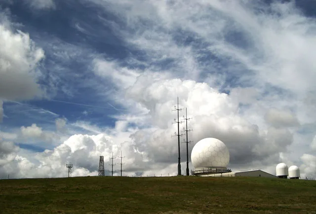
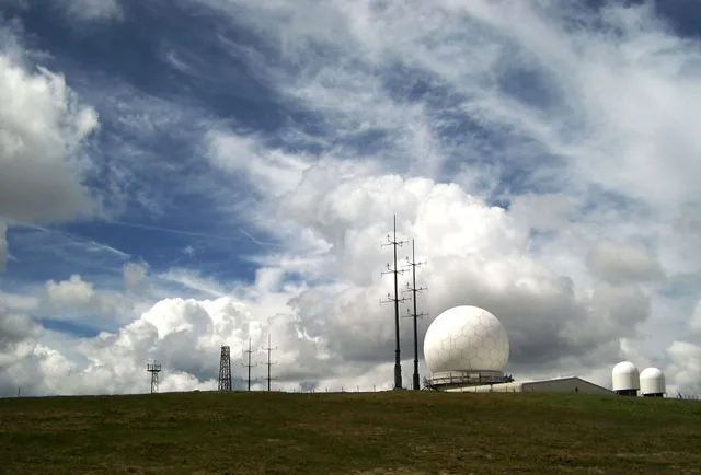
Great Dun Fell
Great Dun Fell — mountain in Cumbria, United Kingdom.
 📷 3
📷 3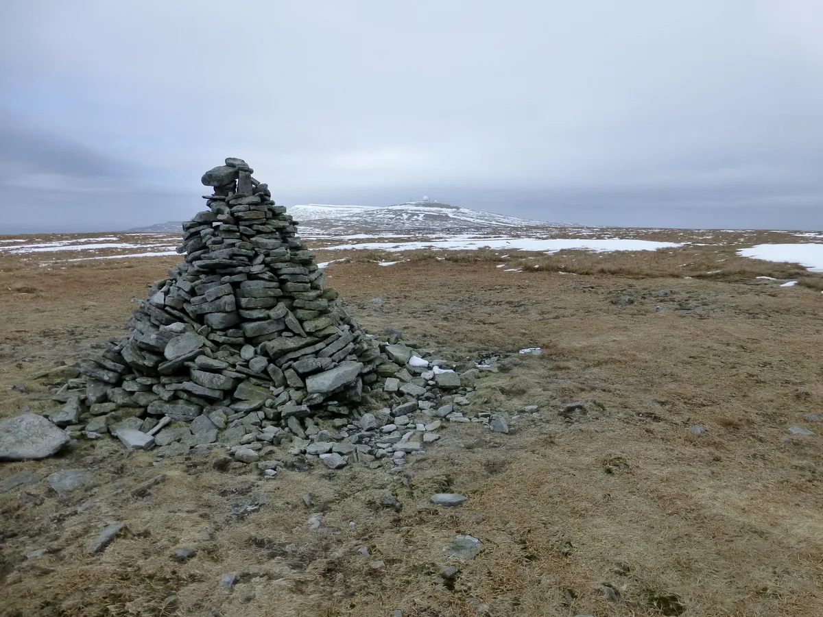 📷 3
📷 3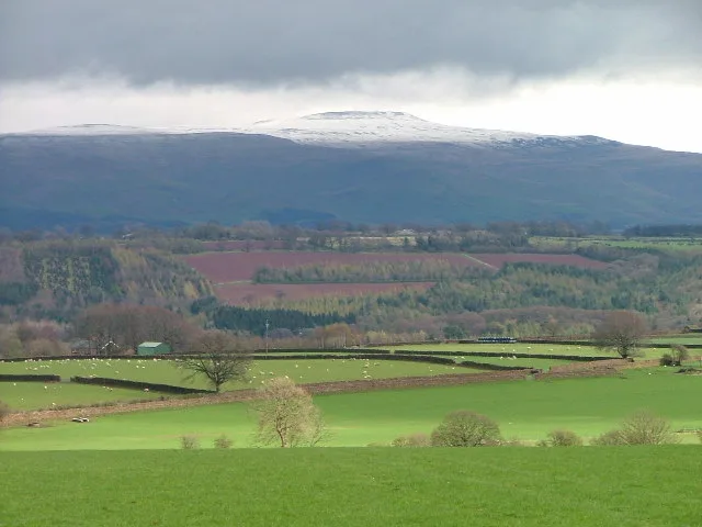 📷 5
📷 5Mountains & hills · North East England
Little Dun Fell
Little Dun Fell — Named summit at 841.6 m.
📷 3Natural landmarks · North East England
Tees Head
Tees Head — a other in scotland-lowlands, United Kingdom.
 📷 3
📷 3Castles · North East England
Howgill Castle
Howgill Castle — a castle in scotland-lowlands, United Kingdom.
 📷 3
📷 3Public art & sculpture · North East England
The Source
The Source — a public art in scotland-lowlands, United Kingdom.
📷 5Historic churches · North East England
St Cuthbert's Church, Dufton
St Cuthbert's Church is situated 3⁄4 mile (1.2 km) north of the village of Dufton, Cumbria, England. It should not be confused with the nearby St Cuthbert's church, Milburn. It is an active Anglican p
 📷 5
📷 5Caves · North East England
Knock Fell Caverns
Knock Fell Caverns — a cave broad in scotland-lowlands, United Kingdom.
📷 5Caravan parks · North East England
Silverband Caravan Park
Silverband Caravan Park — a caravan park in scotland lowlands.
 📷 4
📷 4Literary houses · North East England
Howgill Castle
Howgill Castle — a literary house museum in scotland lowlands.
 📷 5📷 5
Mountains & hills · North East England
Knock Pike
Knock Pike — a hill or mountain in scotland lowlands.
 📷 5
📷 5Mountains & hills · North East England
Burney Hill
Burney Hill — a hill or mountain in scotland lowlands.
 📷 5
📷 5Archaeological sites · North East England
waterwheel pit
waterwheel pit — archaeological in scotland lowlands.
📷 5Mountains & hills · North East England
Brownber Hill
Brownber Hill — mountain in scotland lowlands. Elevation: 519 m.
📷 5Mountains & hills · North East England
Burney Hill
Burney Hill — mountain in scotland lowlands. Elevation: 427.3 m.
📷 5Mountains & hills · North East England
Knock Pike
Knock Pike — mountain in scotland lowlands. Elevation: 398.1 m.
 📷 5
📷 5Mountains & hills · North East England
Hard Hill
Hard Hill — mountain in scotland lowlands. Elevation: 678.2 m.
 📷 5
📷 5Mountains & hills · North East England
Metalband Hill
Metalband Hill — mountain in scotland lowlands. Elevation: 560.2 m.
 📷 5
📷 5Mountains & hills · North East England
Grumply Hill
Grumply Hill — mountain in scotland lowlands. Elevation: 412.1 m.
Nearby
📷 5Caravan parks · North East England
Silverband Caravan Park
Silverband Caravan Park — a caravan park in scotland lowlands.
📷 5Historic churches · North East England
St Cuthbert's Church, Dufton
St Cuthbert's Church is situated 3⁄4 mile (1.2 km) north of the village of Dufton, Cumbria, England. It should not be confused with the nearby St Cuthbert's church, Milburn. It is an active Anglican p
📷 5Mountains & hills · North East England
Knock Pike
Knock Pike — mountain in scotland lowlands. Elevation: 398.1 m.
📷 5Mountains & hills · North East England
Knock Pike
Knock Pike — a hill or mountain in scotland lowlands.
📷 3📷 3Where to eat & stay near Knock
Places to stay
📷 5Caravan parks · North East England
Silverband Caravan Park
Silverband Caravan Park — a caravan park in scotland lowlands.
📷 5📷 5Caravan parks · North East England
Grandie Caravan Park
Grandie Caravan Park — a caravan park in scotland lowlands.
📷 6B&Bs · North East England
Brow Farm
Brow Farm — a bed-and-breakfast in scotland lowlands.
 📷 5
📷 5Caravan parks · North East England
Low Moor Caravan and Campsite
Low Moor Caravan and Campsite — a caravan park in scotland lowlands.
 📷 5
📷 5Caravan parks · North East England
Park House Caravan Park
Park House Caravan Park — a caravan park in england north east.
Places to eat & drink
 📷 5
📷 5Historic pubs · North East England
1, Scattergate
1, Scattergate in England North East, United Kingdom.
 📷 3
📷 3 📷 7
📷 7Historic pubs · North West England
Two Lions public house and integral stables
Two Lions public house and integral stables in Scotland Lowlands, United Kingdom.
 📷 7
📷 7Cafés · North West England
Narrowbar Cafe
Narrowbar Cafe — a café in scotland lowlands.
 📷 6
📷 6Historic pubs · North West England
Gloucester Arms
Gloucester Arms in Scotland Lowlands, United Kingdom.
 📷 7
📷 7Cafés · North West England
The White Hare Cafe
The White Hare Cafe — a café in england north west.
More towns in this region
 Flagship📷 3
Towns & cities · North East England
Newby
Newby — village and civil parish in Hambleton, North Yorkshire, England, UK.
 📷 5
📷 5Towns & cities · North East England
Archdeacon Newton
Archdeacon Newton — village and civil parish in County Durham, England, UK.
 📷 3
📷 3Towns & cities · North East England
Boosbeck
Boosbeck — village in North Yorkshire, England, UK.
 📷 3
📷 3Frequently asked questions
- Where is Knock?
- Knock is in North-East England, United Kingdom (postcode CA16), in the parish of Long Marton.
- What is Knock?
- Knock — village in Cumbria, United Kingdom.
- How do I get to Knock?
- The nearest railway station is Appleby, about 6.3 km away. Drivers can use postcode CA16.
- Is Knock a protected site?
- Yes — Knock is part of the River Eden and Tributaries SSSI Site of Special Scientific Interest and the MOOR HOUSE-UPPER TEESDALE National Nature Reserve.
- Is Knock free to visit?
- Yes, Knock is free to enter.
- How do I get to Knock?
- The nearest railway station is Appleby, about 6.3 km away. Drivers can navigate to postcode CA16.