
Mountains & hills · North East England
Knock Fell
In or near Knock.
Knock Fell — Named summit at 793.7 m.

Wikimedia Commons contributors — see linked file page for photographer and licence licence

Plan your visit
- Typical visit
- 3 h–8 h
- Best time of year
- Late spring – early autumn (May–Oct)
- Free entry
- Dog-friendly
About
Knock Fell is a named summit in the United Kingdom. Wikidata describes it as: "Named summit at 793.7 m.". Coordinates: 54.6666°, -2.4336°.
Photo gallery
Protected designations
- Site of Special Scientific Interest: Appleby Fells SSSI
- Site of Special Scientific Interest: River Eden and Tributaries SSSI
- Site of Special Scientific Interest: Moorhouse and Cross Fell SSSI
- National Nature Reserve: MOOR HOUSE-UPPER TEESDALE
Designations sourced from Natural England open data under OGL v3.
From the Wikipedia article
Knock Fell is a hill in Cumbria, England. It has a height of 794 m (2,605 ft) and a prominence of 50 m (160 ft), and thus is listed as a Hewitt, a Simm and a Nuttall. The summit lies in the civil parish of Long Marton, but the boundary with the parish of Dufton is only a few metres to the south. There is a cairn, named Knock Old Man, a short distance below the summit, to the south west. There is a smaller cairn on the summit. Knock Fell lies on the central watershed of England, in that it drains to the Solway Firth from its western slopes, where water of Swindale Beck and Milburn Beck flows into the River Eden, and into the North Sea from its eastern slopes, where Maize Beck and Trout Beck lead to the River Tees. The Pennine Way National Trail crosses the summit of Knock Fell, en route from Dufton to Cross Fell, the highest point of the Pennines. There is no accommodation or other services between Dufton and Garrigill, and the section has been described as ... the toughest day on the Pennine Way. It’s the longest leg, it includes the highest point and more than 3,000 feet (1,000 metres) of ascent, up to the loftiest ground in England outside the Lake District. Plus route-finding can be tricky and some sections are exposed. Knock Fell is within the Moor House-Upper Teesdale national nature reserve. Knock Hill Caverns, described as "Very confusing maze-cave", is a caving area beneath Knock Fell.
Excerpt from Wikipedia under CC BY-SA 4.0. See the source article linked in Sources below.
- Coordinates
- 54.6666, -2.4336
Sources
- osm: n318497932 (ODbL)
- wikipedia: Knock Fell (CC BY-SA 4.0)
- commons: Knock Fell - geograph.org.uk - 3352227.jpg (CC BY-SA 4.0)
Other places nearby

Knock Fell Caverns
Caves · 0.5 km

Greencastle
Castles · 1.2 km
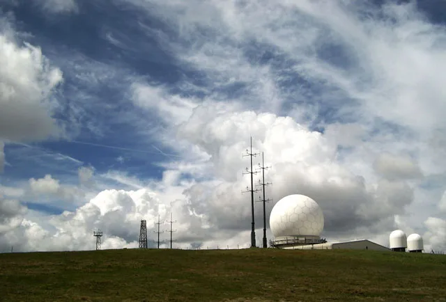
Great Dun Fell
Natural landmarks · 2.2 km
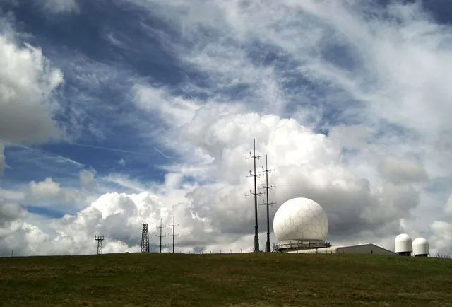
Great Dun Fell
Mountains & hills · 2.3 km

Backstone Edge
Mountains & hills · 2.6 km

Hard Hill
Mountains & hills · 3.1 km

Brownber Hill
Mountains & hills · 3.1 km
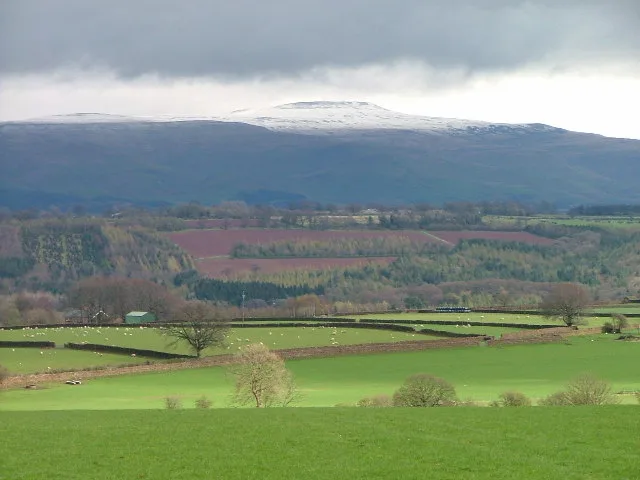
Little Dun Fell
Mountains & hills · 3.2 km

Burney Hill
Mountains & hills · 3.7 km
Burney Hill
Mountains & hills · 3.7 km
Bluethwaite Hill
Mountains & hills · 3.7 km

Knock Pike
Mountains & hills · 4.1 km
Nearby
📷 5Caves · North East England
Knock Fell Caverns
Knock Fell Caverns — a cave broad in scotland-lowlands, United Kingdom.
📷 5📷 3Natural landmarks · North East England
Great Dun Fell
Great Dun Fell — mountain in Cumbria, United Kingdom.
📷 3📷 5Mountains & hills · North East England
Backstone Edge
Backstone Edge — mountain in scotland lowlands. Elevation: 698.6 m.
📷 5Mountains & hills · North East England
Hard Hill
Hard Hill — mountain in scotland lowlands. Elevation: 678.2 m.
Where to eat & stay near Knock Fell
Places to stay
 📷 5
📷 5Caravan parks · North East England
Silverband Caravan Park
Silverband Caravan Park — a caravan park in scotland lowlands.
 📷 6
📷 6B&Bs · North East England
Brow Farm
Brow Farm — a bed-and-breakfast in scotland lowlands.
 📷 5
📷 5 📷 5
📷 5Caravan parks · North East England
Grandie Caravan Park
Grandie Caravan Park — a caravan park in scotland lowlands.
 📷 5
📷 5 📷 5
📷 5Caravan parks · North East England
Park House Caravan Park
Park House Caravan Park — a caravan park in england north east.
Places to eat & drink
 📷 5
📷 5Historic pubs · North East England
1, Scattergate
1, Scattergate in England North East, United Kingdom.
 📷 3
📷 3 📷 7
📷 7Historic pubs · North West England
Two Lions public house and integral stables
Two Lions public house and integral stables in Scotland Lowlands, United Kingdom.
 📷 7
📷 7Cafés · North West England
Narrowbar Cafe
Narrowbar Cafe — a café in scotland lowlands.
 📷 6
📷 6Historic pubs · North West England
Gloucester Arms
Gloucester Arms in Scotland Lowlands, United Kingdom.
 📷 7
📷 7Cafés · North West England
The White Hare Cafe
The White Hare Cafe — a café in england north west.
More mountains in this region
 📷 5
📷 5Mountains & hills · North East England
Danby High Moor
Danby High Moor — a hill or mountain in england yorkshire.
 📷 5
📷 5Mountains & hills · North East England
Arndale Hill
Arndale Hill — mountain in england yorkshire. Elevation: 515.7 m.
 📷 5
📷 5Mountains & hills · North East England
Peat Hill
Peat Hill — mountain in england yorkshire. Elevation: 396 m.
 📷 5
📷 5Mountains & hills · North East England
Cocker Hill
Cocker Hill — mountain in england yorkshire. Elevation: 470 m.
Frequently asked questions
- Where is Knock Fell?
- Knock Fell is in the Scottish Lowlands, United Kingdom.
- What is Knock Fell?
- Knock Fell — Named summit at 793.7 m.
- How do I get to Knock Fell?
- Its coordinates are 54.6666°, -2.4336°.
- Is Knock Fell a protected site?
- Yes — Knock Fell is part of the Appleby Fells SSSI Site of Special Scientific Interest and the River Eden and Tributaries SSSI Site of Special Scientific Interest.
- Is Knock Fell free to visit?
- Yes, Knock Fell is free to enter.