Other places · Mid Wales
Kington Rural District
In or near Kington.
Kington Rural District in Wales Mid, United Kingdom.

Jaggery — CC BY-SA 2.0 via Wikimedia Commons licence
Plan your visit
- Typical visit
- 1 h–2 h
- Nearest railway station
- Titley Junction · 3.5 km
- Family-friendly
About
Kington Rural District is a place of interest in Wales Mid, United Kingdom — drawn from open-data sources for visitor reference. See the linked Wikipedia article for the full description.
Photo gallery
Protected designations
- Site of Special Scientific Interest: River Teme SSSI
Designations sourced from Natural England open data under OGL v3.
From the Wikipedia article
Kington Rural District was a rural district in the administrative county of Herefordshire, England from 1894 to 1974, covering an area in the west of the county.
Excerpt from Wikipedia under CC BY-SA 4.0. See the source article linked in Sources below.
Background
History
The district had its origins in the Kington Poor Law Union, which had been created in 1836, covering the small town of Kington and several surrounding parishes. In 1872 sanitary districts were established, giving public health and local government responsibilities for rural areas to the existing boards of guardians of poor law unions. The Kington Rural Sanitary District therefore covered the area of the poor law union except for the town of Kington, which had improvement commissioners and so became its own urban sanitary district. The Kington Rural Sanitary District was administered from Kington Union Workhouse, which had been built in 1837 on Kingswood Road in Kington. Under the Local…
Sourced from Wikipedia under CC BY-SA 4.0.
- Coordinates
- 52.2030, -3.0310
- District
- Herefordshire, County of
- Parish
- Kington
- Postcode
- HR5 3AL
- Parliamentary constituency
- North Herefordshire
- Nearest railway station
- Titley Junction — 3.5 km
- Official site
- www.kingtonmuseum.co.uk
Sources
- wikidata: Q114196371 (CC0)
- wikipedia: Kington Rural District (CC BY-SA 4.0)
Other places nearby

Market Hall
Historic houses · 0.0 km

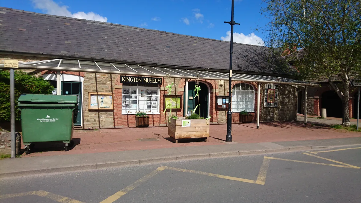
Kington Museum
Museums · 0.1 km
Kington Museum and History Centre
Museums · 0.1 km

32 and 33, Church Street
Historic pubs · 0.1 km

Kington War Memorial
Memorials & monuments · 0.2 km

War Memorial
Memorials & monuments · 0.2 km

Kington Town Hall
Historic houses · 0.2 km

The Royal Oak Public House Including Rubblestone Wing To East
Historic pubs · 0.2 km

Kington Town F.C.
Other places · 0.2 km

Fleece Meadow Campsite
Campsites · 0.3 km
The Recreation Ground, Kington
Stadiums · 0.4 km

Kington Youth Hostel
Hostels · 0.5 km
Nearby
📷 3Historic houses · Mid Wales
Market Hall
Market Hall is a place of interest in the United Kingdom.
📷 3Museums · Mid Wales
Kington Museum
Kington Museum — a museum in wales-mid, United Kingdom.
📷 3Museums · Mid Wales
Kington Museum and History Centre
Kington Museum and History Centre — museum in Herefordshire, England, United Kingdom.
📷 5Historic pubs · Mid Wales
32 and 33, Church Street
32 and 33, Church Street in Wales Mid, United Kingdom.
📷 3Memorials & monuments · Mid Wales
Kington War Memorial
Kington War Memorial — Grade II listed building-listed memorial in wales-mid, United Kingdom.
📷 5Memorials & monuments · Mid Wales
War Memorial
War Memorial is a memorial in the United Kingdom.
Where to eat & stay near Kington Rural District
Places to stay
📷 5📷 5 📷 5
📷 5Caravan parks · Mid Wales
Presteign Holiday Park (E)
Presteign Holiday Park (E) — a caravan park in wales mid.
 📷 5
📷 5Caravan parks · Mid Wales
Presteign Holiday Park (W)
Presteign Holiday Park (W) — a caravan park in wales mid.
 📷 5
📷 5 📷 5
📷 5Places to eat & drink
📷 5Historic pubs · Mid Wales
32 and 33, Church Street
32 and 33, Church Street in Wales Mid, United Kingdom.
📷 5Historic pubs · Mid Wales
The Royal Oak Public House Including Rubblestone Wing To East
The Royal Oak Public House Including Rubblestone Wing To East in Wales Mid, United Kingdom.
 📷 4
📷 4 📷 7
📷 7Historic pubs · Mid Wales
The Old Weymouth Arms And The Wharf
The Old Weymouth Arms And The Wharf in Wales Mid, United Kingdom.
 Flagship📷 6
 📷 7
📷 7More places in this region
 📷 5
📷 5 📷 3
📷 3Other places · Mid Wales
Sheep Music
Sheep Music is a three-day world music festival which takes place during July each year in Presteigne. It has 22 years of history, starting as a party on The Warden in 1991. Since moving to its curren
 📷 2
📷 2 📷 4
📷 4Frequently asked questions
- Where is Kington Rural District?
- Kington Rural District is in Mid Wales, United Kingdom (postcode HR5 3AL), in the parish of Kington.
- What is Kington Rural District?
- Kington Rural District in Wales Mid, United Kingdom.
- How do I get to Kington Rural District?
- The nearest railway station is Titley Junction, about 3.5 km away. Drivers can use postcode HR5 3AL.
- Is Kington Rural District a protected site?
- Yes — Kington Rural District is part of the River Teme SSSI Site of Special Scientific Interest.
- How do I get to Kington Rural District?
- The nearest railway station is Titley Junction, about 3.5 km away. Drivers can navigate to postcode HR5 3AL.