Mountains & hills · Scottish Highlands
King's Cave
King's Cave — cave in North Ayrshire, Scotland, UK.

Wikimedia Commons contributors — see linked file page for photographer and licence licence
Plan your visit
- Typical visit
- 3 h–8 h
- Best time of year
- Late spring – early autumn (May–Oct)
- Free entry
- Dog-friendly
About
King's Cave is a named summit in the United Kingdom. Heritage designation: scheduled monument. Wikidata describes it as: "cave in North Ayrshire, Scotland, UK". Coordinates: 55.5262°, -5.3541°.
Photo gallery
From the Wikipedia article
King's Cave (Scottish Gaelic: Uamh an Rìgh) is the largest of a series of seafront caves north of Blackwaterfoot on the Isle of Arran in Scotland. The caves were formed around 10,000 to 6,000 years ago during an ice age when the weight of an advancing glacier forced the land downward, so the sea was higher relative to the location of the cave, with high tide around 4 metres (13 ft) up from its present level. When the ice melted, the land rose due to the isostatic rebound effect, thus forming a raised shoreline or raised beach with relict sea-cliffs. The hillside above the cliffs has a shallow slope resulting from a much earlier raised beach, nominally 30 metres (98 ft) above present high tide. Kilmory Parish church records suggest the cave may have been used for church meetings in the eighteenth century, and it is also said to have been used as a school. Before being known as the King's Cave it was known as Fingal's Cave after Fionn mac Cumhaill, a figure in Irish mythology. The current name of the cave is linked to the legend of Robert the Bruce seeking refuge in a cave where he is said to have been inspired by watching a spider's numerous and ultimately successful attempts to build a web, but this story is widely considered apocryphal. In January 1909, an archeological dig was conducted within the cave. A 32 foot long trench was dug and examined, but aside from a small bronze ornament and some animal bones, nothing of interest was found, so the dig was halted on the fourth day.
Excerpt from Wikipedia under CC BY-SA 4.0. See the source article linked in Sources below.
- Coordinates
- 55.5262, -5.3541
- District
- North Ayrshire
- Postcode
- KA27 8DX
- Parliamentary constituency
- North Ayrshire and Arran
Sources
- wikidata: Q6410866 (CC0)
- wikipedia: King's Cave (CC BY-SA 4.0)
- commons: King's Cave, Isle of Arran.jpg (CC BY-SA 4.0)
Other places nearby
Loading nearby places…
Nearby
 📷 3
📷 3Caves · Scottish Highlands
King's Cave
King's Cave is a cave in the United Kingdom.
Vineyards · Scottish Highlands
Arran, Drumadoon, The Doon
Arran, Drumadoon, The Doon — a UK vineyard in scotland highlands, producing English or Welsh wine from cool-climate grape varieties.
 📷 3
📷 3Memorials & monuments · Scottish Highlands
Nicol Memorial
Nicol Memorial — a memorial in scotland-highlands, United Kingdom.
 📷 3
📷 3Hill forts · Scottish Highlands
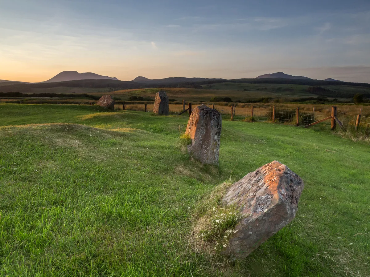
Moss Farm Road Stone Circle
Moss Farm Road Stone Circle — archaeological site in North Ayrshire, Scotland, UK.
 📷 3
📷 3Historic churches · Scottish Highlands
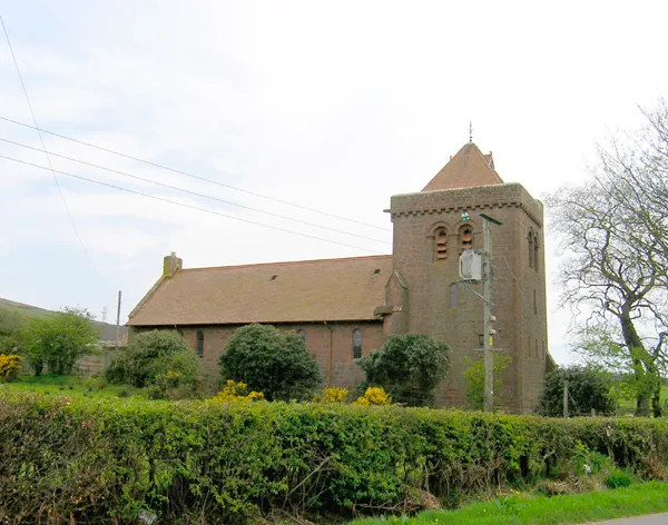
St Molios Church
St Molios Church — church in North Ayrshire, Scotland, UK.
 📷 3
📷 3Stone circles · Scottish Highlands
Machrie Moor Stone Circle 3
Machrie Moor Stone Circle 3 — a stone circle in scotland-highlands, United Kingdom.
More mountains in this region
 📷 3
📷 3Mountains & hills · Scottish Highlands
A' Bhuidheanach Bheag
A' Bhuidheanach Bheag — Named summit at 936 m.
 📷 3
📷 3Mountains & hills · Scottish Highlands
A' Chailleach
A' Chailleach — Named summit at 997 m.
 📷 3
📷 3Mountains & hills · Scottish Highlands
A' Chailleach
A' Chailleach — Named summit at 930 m.
 📷 3
📷 3Mountains & hills · Scottish Highlands
A' Chaoirnich
A' Chaoirnich — Named summit at 875 m.
Frequently asked questions
- Where is King's Cave?
- King's Cave is in the Scottish Highlands, United Kingdom (postcode KA27 8DX).
- Is King's Cave a listed building?
- King's Cave is officially recognised as scheduled monument listed.
- Is King's Cave free to visit?
- Yes, King's Cave is free to enter.
- How do I get to King's Cave?
- Drivers can navigate to postcode KA27 8DX. It sits within the North Ayrshire and Arran parliamentary constituency.