Mountains & hills · North East England
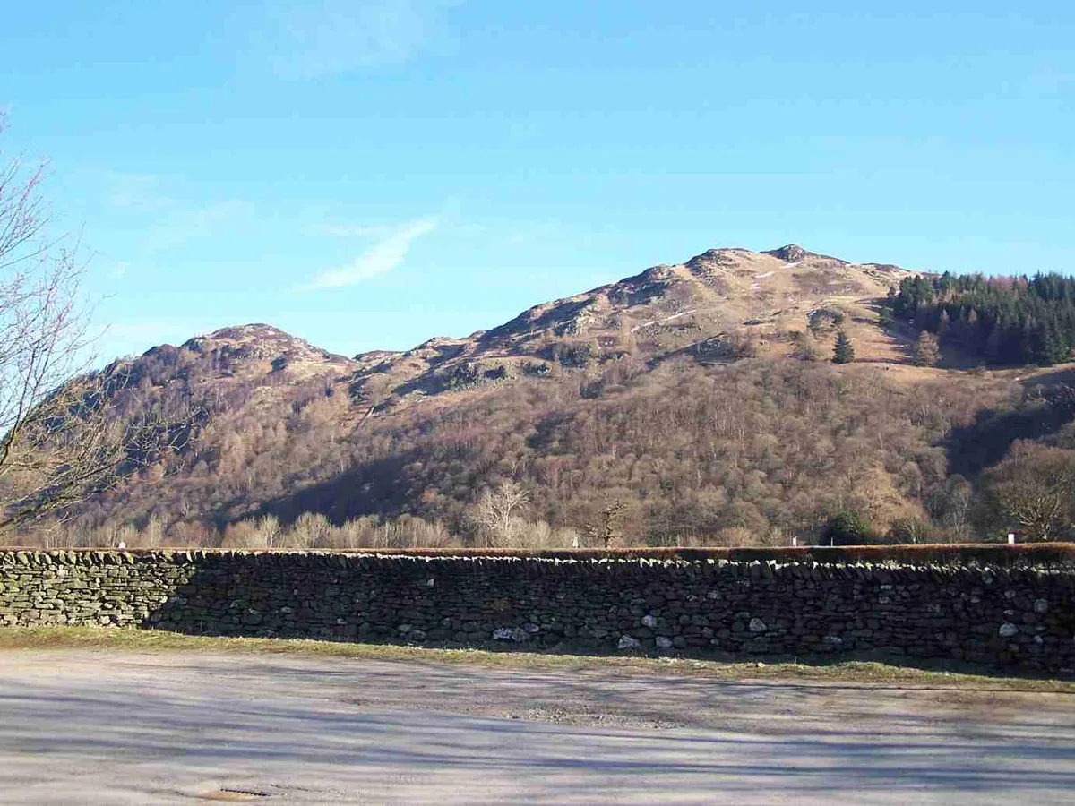
King's How
King's How — mountain in england north east. Elevation: 392 m.

Dreamer — CC BY-SA 2.0 via Wikimedia Commons licence
Plan your visit
- Typical visit
- 3 h–8 h
- Best time of year
- Late spring – early autumn (May–Oct)
About
King's How is a mountain located in england north east. Elevation: 392 m. A named British peak recorded in OpenStreetMap. Peaks are typically named on Ordnance Survey 1:50k mapping.
Photo gallery
Place summary
King's How is a mountain located in North-East England. It offers panoramic views of the surrounding landscape and is a notable landmark in the region. The area is popular for walking and hiking, attracting outdoor enthusiasts. Visitors can expect a rugged terrain with various trails suitable for different skill levels.
AI-generated from the structured facts on this page (operator, designation, listing, era). Not a substitute for visiting.
- Coordinates
- 54.5397, -3.1482
Sources
- osm: n4889542918 (ODbL)
Other places nearby
Loading nearby places…
Nearby
📷 5Mountains & hills · North East England
King's How - Grange Fell
King's How - Grange Fell — a hill or mountain in england north east.
 📷 3
📷 3Natural landmarks · North East England
Bowder Stone
Bowder Stone — a other in england-north-east, United Kingdom.
 📷 3
📷 3Mountains & hills · North East England
Grange Fell (Wainwright)
Grange Fell (Wainwright) — Named summit at 415 m.
 📷 3
📷 3Mountains & hills · North East England
Brund Fell (summit)
Brund Fell (summit) — Named summit at 417.2 m.
 📷 5
📷 5Mountains & hills · North East England
Brund Fell
Brund Fell — a hill or mountain in england north east.
 📷 5
📷 5Mountains & hills · North East England
Holm Crag
Holm Crag — mountain in england north east. Elevation: 124.3 m.
Where to eat & stay near King's How
Places to stay
📷 5Campsites · North East England
Hollows Farm Campsite
Hollows Farm Campsite — a campsite in england north east.
 📷 5
📷 5B&Bs · North East England
Yew Tree Farm
Yew Tree Farm — a bed-and-breakfast in england north east.
 📷 5
📷 5Caravan parks · North East England
Low Manesty Caravan Park
Low Manesty Caravan Park — a caravan park in england north east.
 📷 5
📷 5Hostels · North East England
YHA Borrowdale
YHA Borrowdale — a hostel in england north east.
 📷 5
📷 5Campsites · North East England
Chapel House Farm Campsite
Chapel House Farm Campsite — a campsite in england north east.
 📷 5
📷 5Campsites · North East England
Keswick Scouts Ashness Hut
Keswick Scouts Ashness Hut — a campsite in england north east.
Places to eat & drink
 📷 5
📷 5Cafés · North East England
Grange Bridge Cottage
Grange Bridge Cottage — a café in england north east.
 📷 5
📷 5Cafés · Scottish Lowlands
YHA Cafe
YHA Cafe — a café in scotland lowlands.
 📷 5
📷 5Historic pubs · North West England
The Travellers Rest
The Travellers Rest in England North West, United Kingdom.
 📷 5
📷 5Historic pubs · Scottish Lowlands
The Pheasant Inn
The Pheasant Inn in Scotland Lowlands, United Kingdom.
 📷 5
📷 5Historic pubs · North West England
Golden Rule Hotel
Golden Rule Hotel in England North West, United Kingdom.
 📷 5
📷 5Restaurants · North West England
Holbeck Ghyll Restaurant
Holbeck Ghyll Restaurant — a restaurant in england north west.
More mountains in this region
 📷 3
📷 3Mountains & hills · North East England
Angletarn Pikes
Angletarn Pikes — Named summit at 566 m.
 📷 3
📷 3Mountains & hills · North East England
Angletarn Pikes South Top
Angletarn Pikes South Top — Named summit at 563.6 m.
 📷 3
📷 3Mountains & hills · North East England
Ard Crags
Ard Crags — Named summit at 581 m.
 📷 3
📷 3Mountains & hills · North East England
Arnison Crag
Arnison Crag — Named summit at 433 m.
Frequently asked questions
- Where is King's How?
- King's How is in North-East England, United Kingdom.
- What is King's How?
- King's How — mountain in england north east. Elevation: 392 m.
- How do I get to King's How?
- Its coordinates are 54.5397°, -3.1482°.