Mountains & hills · North East England
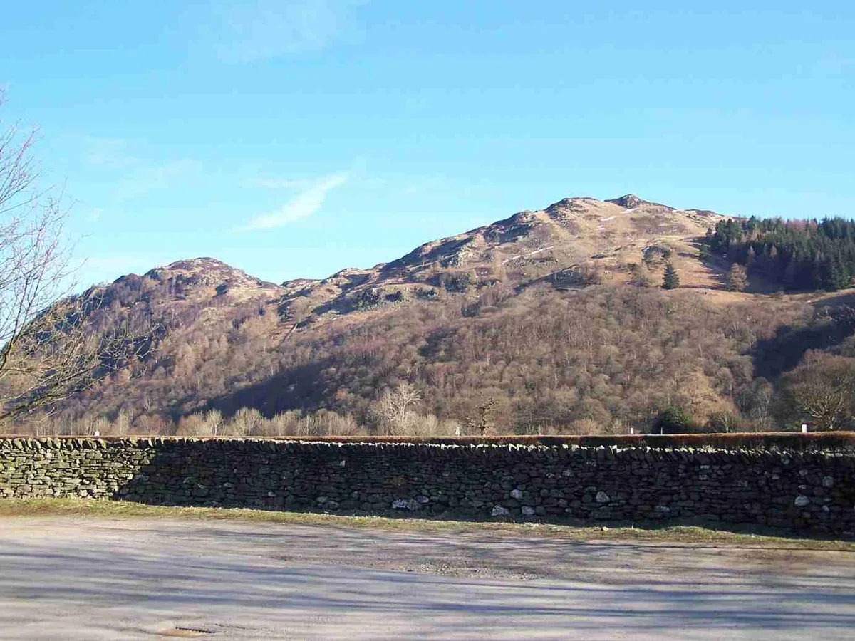
King's How - Grange Fell
King's How - Grange Fell — a hill or mountain in england north east.

Dreamer — CC BY-SA 2.0 via Wikimedia Commons licence
Plan your visit
- Typical visit
- 3 h–8 h
- Best time of year
- Late spring – early autumn (May–Oct)
About
A British hill or mountain, named on Ordnance Survey maps and walked by hill-baggers. King's How - Grange Fell is a named hill or mountain in england north east, recorded in the GeoNames UK gazetteer. British landmarks of this type are typically marked on Ordnance Survey maps and recorded in the national gazetteer for cartographic and navigational reference. Coordinates and feature classification are sourced from the GeoNames open dataset.
Photo gallery
Place summary
King's How is a mountain located in North-East England, part of the Grange Fell area. It offers a range of walking opportunities with varying difficulty levels, making it suitable for both casual walkers and more experienced hikers. The surrounding landscape features scenic views typical of the region, with a mix of woodlands and open moorland. Visitors can expect well-marked trails that provide access to the summit and surrounding areas.
AI-generated from the structured facts on this page (operator, designation, listing, era). Not a substitute for visiting.
- Coordinates
- 54.5397, -3.1482
Sources
- manual: geonames-12612424 (CC BY 4.0)
Other places nearby
Loading nearby places…
Nearby
📷 5Mountains & hills · North East England
King's How
King's How — mountain in england north east. Elevation: 392 m.
 📷 3
📷 3Natural landmarks · North East England
Bowder Stone
Bowder Stone — a other in england-north-east, United Kingdom.
 📷 3
📷 3Mountains & hills · North East England
Grange Fell (Wainwright)
Grange Fell (Wainwright) — Named summit at 415 m.
 📷 3
📷 3Mountains & hills · North East England
Brund Fell (summit)
Brund Fell (summit) — Named summit at 417.2 m.
 📷 5
📷 5Mountains & hills · North East England
Brund Fell
Brund Fell — a hill or mountain in england north east.
 📷 5
📷 5Mountains & hills · North East England
Holm Crag
Holm Crag — mountain in england north east. Elevation: 124.3 m.
Where to eat & stay near King's How - Grange Fell
Places to stay
📷 5Campsites · North East England
Hollows Farm Campsite
Hollows Farm Campsite — a campsite in england north east.
 📷 5
📷 5B&Bs · North East England
Yew Tree Farm
Yew Tree Farm — a bed-and-breakfast in england north east.
 📷 5
📷 5Caravan parks · North East England
Low Manesty Caravan Park
Low Manesty Caravan Park — a caravan park in england north east.
 📷 5
📷 5Hostels · North East England
YHA Borrowdale
YHA Borrowdale — a hostel in england north east.
 📷 5
📷 5Campsites · North East England
Chapel House Farm Campsite
Chapel House Farm Campsite — a campsite in england north east.
 📷 5
📷 5Campsites · North East England
Keswick Scouts Ashness Hut
Keswick Scouts Ashness Hut — a campsite in england north east.
Places to eat & drink
 📷 5
📷 5Cafés · North East England
Grange Bridge Cottage
Grange Bridge Cottage — a café in england north east.
 📷 5
📷 5Cafés · Scottish Lowlands
YHA Cafe
YHA Cafe — a café in scotland lowlands.
 📷 5
📷 5Historic pubs · North West England
The Travellers Rest
The Travellers Rest in England North West, United Kingdom.
 📷 5
📷 5Historic pubs · Scottish Lowlands
The Pheasant Inn
The Pheasant Inn in Scotland Lowlands, United Kingdom.
 📷 5
📷 5Historic pubs · North West England
Golden Rule Hotel
Golden Rule Hotel in England North West, United Kingdom.
 📷 5
📷 5Restaurants · North West England
Holbeck Ghyll Restaurant
Holbeck Ghyll Restaurant — a restaurant in england north west.
More mountains in this region
 📷 3
📷 3Mountains & hills · North East England
Angletarn Pikes
Angletarn Pikes — Named summit at 566 m.
 📷 3
📷 3Mountains & hills · North East England
Angletarn Pikes South Top
Angletarn Pikes South Top — Named summit at 563.6 m.
 📷 3
📷 3Mountains & hills · North East England
Ard Crags
Ard Crags — Named summit at 581 m.
 📷 3
📷 3Mountains & hills · North East England
Arnison Crag
Arnison Crag — Named summit at 433 m.
Frequently asked questions
- Where is King's How - Grange Fell?
- King's How - Grange Fell is in North-East England, United Kingdom.
- What is King's How - Grange Fell?
- King's How - Grange Fell — a hill or mountain in england north east.
- How do I get to King's How - Grange Fell?
- Its coordinates are 54.5397°, -3.1482°.