
Natural landmarks · East Midlands
King Edward VII School, Melton Mowbray
In or near Freeby.
King Edward VII School, Melton Mowbray — a school heritage in england-east-midlands, United Kingdom.

Andrew Tatlow — CC BY-SA 2.0 via Wikimedia Commons licence

Plan your visit
- Typical visit
- 1 h–2 h
- Nearest railway station
- Melton Mowbray · 1.1 km
- Free entry
- Dog-friendly
About
King Edward VII School, Melton Mowbray is a school heritage located in england-east-midlands, United Kingdom. Catalogued from Wikidata's UK heritage register; see the Wikipedia article for further historical and visitor details.
Photo gallery
Place summary
King Edward VII School is located in Melton Mowbray, in the East Midlands. This educational institution is notable for its historical significance and is part of the region's educational heritage.
AI-generated from the structured facts on this page (operator, designation, listing, era). Not a substitute for visiting.
Background
History
In June 1909 the first head-teacher, Dr Fred Hodson was appointed; 93 applications had been received for the position. The School was christened the County Grammar School of King Edward VII. The school's royal authorisation to use the name was challenged, but before proof could be obtained the King died. It took an intervention from MPs before the Board of Education finally confirmed the new King had agreed the use of his father's name. On 13 April 1910 Thomas Cope, Chairman of Leicestershire County Council and, of the Education Committee, was presented with a key to the school by its architect, Mr Shelbourn. Mr Cope was something of a key collector due to all the new schools at the time.…
Sourced from Wikipedia under CC BY-SA 4.0.
- Coordinates
- 52.7538, -0.8757
- County
- Leicestershire
- District
- Melton
- Parish
- Melton, unparished area
- Postcode
- LE13 1FW
- Parliamentary constituency
- Melton and Syston
- Established
- 1910
- Nearest railway station
- Melton Mowbray — 1.1 km
Sources
- wikidata: Q6411504 (CC0)
- wikipedia: King Edward VII School, Melton Mowbray (CC BY-SA 4.0)
Other places nearby

The Boat Inn
Historic pubs · 1.1 km

Sir Malcolm Sargent
Memorials & monuments · 1.2 km

Anne of Cleves
Historic pubs · 1.2 km

Thomas Cromwell
Memorials & monuments · 1.2 km

Site of St. Mary & St. Lazarus Hospital
Archaeological sites · 1.2 km

Melton Carnegie Museum
Museums · 1.3 km
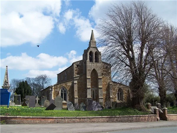
Church of St James
Historic churches · 1.3 km
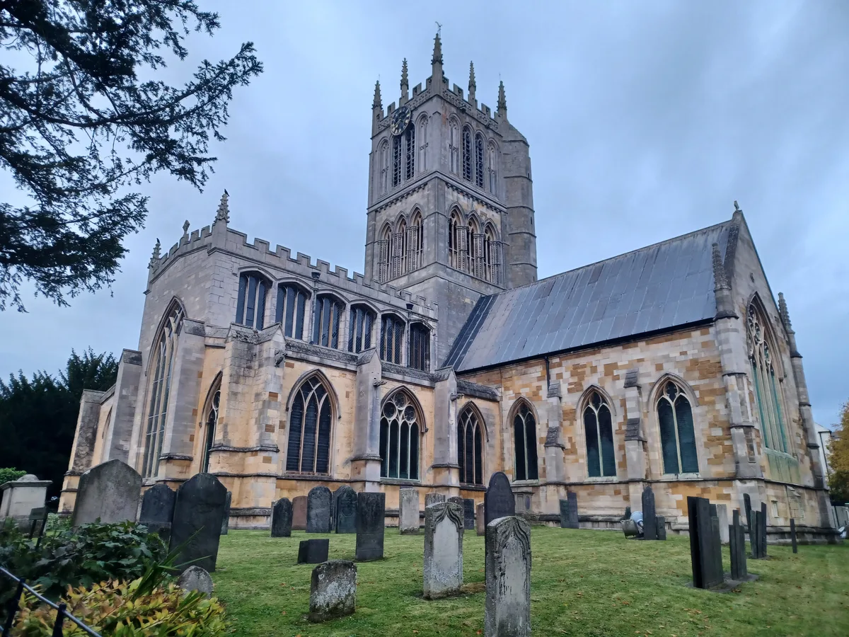
St Mary's Church, Melton Mowbray
Historic churches · 1.3 km

The Storehouse At The Fox
Cafés · 1.4 km

Regal Cinema
Cinemas · 1.4 km
Regal Cinema
Cinemas · 1.5 km

Corn Cross
Memorials & monuments · 1.5 km
Nearby
📷 7📷 3Memorials & monuments · East Midlands
Sir Malcolm Sargent
Sir Malcolm Sargent — a memorial in england-east-midlands, United Kingdom.
📷 7Historic pubs · East Midlands
Anne of Cleves
Anne of Cleves — Historic pub — listed building or notable heritage status.
📷 5Memorials & monuments · East Midlands
Thomas Cromwell
Thomas Cromwell — a memorial in england-east-midlands, United Kingdom.
📷 3Archaeological sites · East Midlands
Site of St. Mary & St. Lazarus Hospital
Site of St. Mary & St. Lazarus Hospital — a archaeological in england-east-midlands, United Kingdom.
📷 3Museums · East Midlands
Melton Carnegie Museum
Melton Carnegie Museum — a museum in england-east-midlands, United Kingdom.
Where to eat & stay near King Edward VII School, Melton Mowbray
Places to stay
 📷 5
📷 5Campsites · East Midlands
Sysonby Acres Leisure Park
Sysonby Acres Leisure Park — a campsite in england east midlands.
 📷 5
📷 5Caravan parks · East Midlands
Greendale Farm Caravan Park
Greendale Farm Caravan Park — a caravan park in england east midlands.
 📷 5
📷 5Campsites · East Midlands
Fair Farm
Fair Farm — a campsite in england east midlands.
 📷 5
📷 5 📷 5
📷 5 📷 7
📷 7Hotels · East Midlands
Wisteria Hotel
Wisteria Hotel — a hotel in england west midlands.
Places to eat & drink
📷 7📷 7Historic pubs · East Midlands
Anne of Cleves
Anne of Cleves — Historic pub — listed building or notable heritage status.
📷 7Cafés · East Midlands
The Storehouse At The Fox
The Storehouse At The Fox — a café in england east midlands.
 📷 7
📷 7Historic pubs · East Midlands
The Blue Bell Public House
The Blue Bell Public House in England East Midlands, United Kingdom.
 📷 5
📷 5Historic pubs · East Midlands
The Stilton Cheese
The Stilton Cheese in England East Midlands, United Kingdom.
 📷 5
📷 5Historic pubs · East Midlands
Three Horse Shoes Public House
Three Horse Shoes Public House in England East, United Kingdom.
More natural landmarks in this region
 📷 5
📷 5Natural landmarks · East Midlands
The Cage
The Cage — a other in england-london, United Kingdom.
 📷 5
📷 5Natural landmarks · East Midlands
Roman Sea Bank
Roman Sea Bank — a other in england-london, United Kingdom.
 📷 5
📷 5Natural landmarks · East Midlands
The Stamford Spa
The Stamford Spa — a other in england-london, United Kingdom.
 📷 5
📷 5Natural landmarks · East Midlands
John Clare's grave
John Clare's grave — a other in england-london, United Kingdom.
Frequently asked questions
- Where is King Edward VII School, Melton Mowbray?
- King Edward VII School, Melton Mowbray is in Leicestershire, the East Midlands, United Kingdom (postcode LE13 1FW), in the parish of Melton, unparished area.
- What is King Edward VII School, Melton Mowbray?
- King Edward VII School, Melton Mowbray — a school heritage in england-east-midlands, United Kingdom.
- How do I get to King Edward VII School, Melton Mowbray?
- The nearest railway station is Melton Mowbray, about 1.1 km away. Drivers can use postcode LE13 1FW.
- When was King Edward VII School, Melton Mowbray built?
- Built or established in 1910.
- Is King Edward VII School, Melton Mowbray free to visit?
- Yes, King Edward VII School, Melton Mowbray is free to enter.
- How do I get to King Edward VII School, Melton Mowbray?
- The nearest railway station is Melton Mowbray, about 1.1 km away. Drivers can navigate to postcode LE13 1FW.