National parks · North East England
Kilham
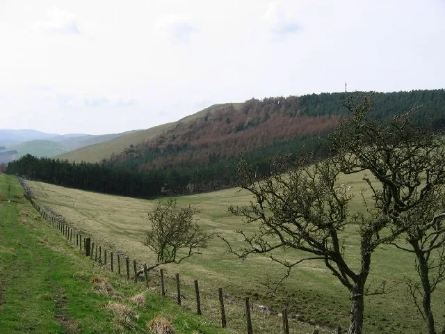
In or near Branxton.
Kilham in England North East, United Kingdom.

Russel Wills — CC BY-SA 2.0 via Wikimedia Commons licence
Plan your visit
- Typical visit
- 4 h–8 h
- Best time of year
- Spring – autumn (Apr–Oct)
- Nearest railway station
- Heatherslaw · 7.7 km
- Free entry
- Family-friendly
- Dog-friendly
Getting there & planning your visit
To visit Kilham in Northumberland, the nearest railway station is Heatherslaw, located 7.7 km away. Entry to the park is free, and the postcode for sat-nav is TD12 4QS.
About
Kilham is a place of interest in England North East, United Kingdom — drawn from open-data sources for visitor reference. See the linked Wikipedia article for the full description.
Photo gallery
Protected designations
- Site of Special Scientific Interest: Tweed Catchment Rivers - England: Till Catchment SSSI
Designations sourced from Natural England open data under OGL v3.
From the Wikipedia article
Kilham is a hamlet and civil parish in the English county of Northumberland, located 8.0 miles (12.9 km) west of Wooler, 12.0 miles (19.3 km) east of Kelso, 17.0 miles (27.4 km) south west of Berwick-upon-Tweed and 38.9 miles (62.6 km) north west of Morpeth. It lies on the northern edge of the Northumberland National Park in Bowmont Valley Northumberland. The hamlet, which consists of a small group of agricultural dwellings, is overlooked by Kilham Hill and the northern limits of the Cheviot Hills. The parish had a population of 131 in 2001, and includes the hamlets of Howtel and Pawston, along with the former upland township of Coldsmouth and Thompson's Walls. falling to less than 100 at the 2011 Census. Details are now included in the parish of Branxton Situated on the border with Scotland, Kilham had a turbulent history. It suffered from repeated Scottish incursions, and was often destroyed and laid waste. The situation was considered serious enough for a report to be made to the Privy Council of England, about a raid in 1597 which had resulted in the death of several villagers. In later, more peaceful times, the area developed into an agricultural backwater, which was gradually opened up by the construction of roads and railways.
Excerpt from Wikipedia under CC BY-SA 4.0. See the source article linked in Sources below.
Background
History
Several well preserved Bronze Age settlements exist in the area around Kilham, and a cairn on Kilham Hill, excavated in 1905, was found to conceal a cist containing burnt bones, thought to date from the period. A bronze rapier blade dating from 1500 to 1000 BC, found near the Bowmont Water in the 19th century, and now in the National Museum of Scotland in Edinburgh, provides further evidence of Bronze Age activity in the parish. Iron Age hillforts are found throughout the Cheviot Hills, and the parish contains examples at Bowmont Hill, Kilham Hill, Pawston Camp, and Wester Hill. Such hillforts were not necessarily defensible, and the small interior area of most suggests they were not…
Sourced from Wikipedia under CC BY-SA 4.0.
- Coordinates
- 55.5860, -2.1850
- District
- Northumberland
- Parish
- Kilham
- Postcode
- TD12 4QS
- Parliamentary constituency
- North Northumberland
- Nearest railway station
- Heatherslaw — 7.7 km
Sources
- wikidata: Q2332036 (CC0)
- wikipedia: Kilham, Northumberland (CC BY-SA 4.0)
Other places nearby

Viewpoint near Thornington
Viewpoints · 1.1 km

Kilham Hill
Mountains & hills · 1.4 km

Castle Hill camp
Vineyards · 1.6 km
Housedon Hill
Natural landmarks · 1.8 km

Housedon Hill
Mountains & hills · 1.9 km

Howtel tower house
Literary houses · 2.1 km

Downham camp
Vineyards · 2.3 km

Howtel
Forests & woodlands · 2.3 km

Cannomill Bog
Vineyards · 2.4 km

Staw Hill defended settlement
Vineyards · 2.4 km

Coldside Hill
Mountains & hills · 2.5 km
Coldside Hill
Mountains & hills · 2.5 km
Nearby
📷 3Viewpoints · North East England
Viewpoint near Thornington
Viewpoint near Thornington is a viewpoint in the United Kingdom.
📷 5Mountains & hills · North East England
Kilham Hill
Kilham Hill — a hill or mountain in scotland central.
Vineyards · North East England
Castle Hill camp
Castle Hill camp — a UK vineyard in scotland central, producing English or Welsh wine from cool-climate grape varieties.
📷 3📷 3📷 5Literary houses · North East England
Howtel tower house
Howtel tower house — a literary house museum in scotland central.
Where to eat & stay near Kilham
Places to stay
 📷 5
📷 5Hostels · North East England
Friends Of Nature House
Friends Of Nature House — a hostel in scotland central.
 📷 7
📷 7Hotels · North East England
Collingwood Arms
Collingwood Arms — a hotel in scotland central.
 📷 7
📷 7B&Bs · North East England
Mill House
Mill House — a bed-and-breakfast in scotland central.
 📷 5
📷 5Caravan parks · North East England
Kirkfield Caravan Site
Kirkfield Caravan Site — a caravan park in scotland central.
 📷 7
📷 7Hotels · North East England
The Plough Hotel
The Plough Hotel — a hotel in scotland central.
 📷 5
📷 5Campsites · Scottish Lowlands
Coldstream Holiday Park
Coldstream Holiday Park — a campsite in scotland central.
Places to eat & drink
 📷 4
📷 4Historic pubs · Scottish Lowlands
Newcastle Arms
Newcastle Arms — Historic pub — listed building or notable heritage status.
 📷 7
📷 7 📷 5
📷 5Historic pubs · Scottish Lowlands
The Masons Arms
The Masons Arms in Scotland Lowlands, United Kingdom.
 📷 7
📷 7Historic pubs · Scottish Lowlands
The Victoria Hotel
The Victoria Hotel in Scotland Lowlands, United Kingdom.
 📷 7
📷 7Historic pubs · North East England
59 And 61, Bridge Street
59 And 61, Bridge Street in Scotland Lowlands, United Kingdom.
 📷 5
📷 5Historic pubs · North East England
The Berwick Arms
The Berwick Arms in Scotland Lowlands, United Kingdom.
More national parks in this region
 📷 4
📷 4 📷 4
📷 4National parks · North East England
Mallerstang
Mallerstang in England North East, United Kingdom.
 📷 4
📷 4National parks · North East England
Kisdon Force
Kisdon Force in England North East, United Kingdom.
 📷 4
📷 4Frequently asked questions
- Where is Kilham?
- Kilham is in North-East England, United Kingdom (postcode TD12 4QS), in the parish of Kilham.
- What is Kilham?
- Kilham in England North East, United Kingdom.
- How do I get to Kilham?
- The nearest railway station is Heatherslaw, about 7.7 km away. Drivers can use postcode TD12 4QS.
- Is Kilham a protected site?
- Yes — Kilham is part of the Tweed Catchment Rivers - England: Till Catchment SSSI Site of Special Scientific Interest.
- Is Kilham free to visit?
- Yes, Kilham is free to enter.
- How do I get to Kilham?
- The nearest railway station is Heatherslaw, about 7.7 km away. Drivers can navigate to postcode TD12 4QS.