
Reservoirs & lochs · North East England
Kielder Water
In or near Falstone.
Kielder Water — reservoir in Northumberland, England, UK, on the River North Tyne.

Wikimedia Commons contributors — see linked file page for photographer and licence licence

Plan your visit
- Typical visit
- 1 h–2.5 h
- Free entry
- Dog-friendly
Getting there & planning your visit
Kielder Water is located in Northumberland, with the postcode NE48 1AU. Admission is free. There is no nearby railway station mentioned, so please plan your visit accordingly.
About
Kielder Water is a reservoir in the United Kingdom. It covers approximately 11 km². Wikidata describes it as: "reservoir in Northumberland, England, UK, on the River North Tyne". Coordinates: 55.1833°, -2.5000°.
Photo gallery
Protected designations
- Site of Special Scientific Interest: Kielder Mires SSSI
Designations sourced from Natural England open data under OGL v3.
From the Wikipedia article
Kielder Water is a large man-made reservoir in Northumberland in North East England. It is the largest artificial lake in the United Kingdom by capacity of water (second-largest by area) and it is surrounded by Kielder Forest, one of the biggest man-made woodlands in Europe. The scheme was planned in the late 1960s to satisfy an expected rise in demand for water to support a booming UK industrial economy. But the decline of traditional heavy industry, together with more water-efficient industrial processes and better control of water supply leakage, served to undermine the original justification for the reservoir and the government-funded project has been criticised as a white elephant. Kielder Water is owned by Northumbrian Water, and holds 200 gigalitres (44 billion imperial gallons), making it the largest artificial reservoir in the UK by capacity (Rutland Water is the largest by surface area). It has a 27.5-mile (44.3 km) shoreline, is 24.6 miles (39.6 km) from the sea, and has a maximum depth of 52 metres (170 ft).
Excerpt from Wikipedia under CC BY-SA 4.0. See the source article linked in Sources below.
Background
Architecture
After the scheme was approved by Parliament in 1974, work to build the reservoir and the dam at the hamlet of Yarrow in the Kielder Valley began in 1975. The reservoir and dam were designed for Northumbrian Water by consulting civil engineers Babtie, Shaw and Morton. Sir Frederick Gibberd and Partners were responsible for architectural aspects. Earth moving and infrastructure construction was undertaken in a joint venture with AMEC and Balfour Beatty. The design meant the loss of numerous farms and a school. About 95 people had been resident in the area prior to its development. The former permanent way of the Border Counties Railway was also taken away through the development of the…
Sourced from Wikipedia under CC BY-SA 4.0.
- Coordinates
- 55.1833, -2.5000
- District
- Northumberland
- Parish
- Falstone
- Postcode
- NE48 1AU
- Parliamentary constituency
- Hexham
- Established
- 1975
Sources
- wikidata: Q1630735 (CC0)
- wikipedia: Kielder Water (CC BY-SA 4.0)
- commons: Kielder Water - geograph.org.uk - 986465.jpg (CC BY-SA 4.0)
Other places nearby

Kielder Water
Reservoirs & lochs · 0.5 km

Wind Hill
Mountains & hills · 1.1 km

Robin's Hut
Natural landmarks · 1.3 km

Wave Chamber
Other places · 1.4 km

The Belling
Mountains & hills · 1.4 km

Freya's Cabin
Public art & sculpture · 1.7 km

The Human Burrow
Public art & sculpture · 1.8 km

Elf Kirk
Natural landmarks · 2.1 km

Kielder Bird Of Prey Centre
Natural landmarks · 2.2 km

Scout Adventures Hawkhirst
Campsites · 2.6 km

Mounces Viewpoint
Viewpoints · 2.8 km

Plashetts railway station
Heritage railway stations · 2.9 km
Nearby
📷 5Reservoirs & lochs · North East England
Kielder Water
Kielder Water — a reservoir in scotland lowlands.
📷 5Mountains & hills · North East England
Wind Hill
Wind Hill — mountain in scotland lowlands. Elevation: 230 m.
📷 3Natural landmarks · North East England
Robin's Hut
Robin's Hut — a place in North East England, United Kingdom.
📷 3Other places · North East England
Wave Chamber
Wave Chamber is a place of interest in the United Kingdom.
📷 5Mountains & hills · North East England
The Belling
The Belling — mountain in scotland lowlands. Elevation: 205 m.
📷 3Public art & sculpture · North East England
Freya's Cabin
Freya's Cabin — a public art in North East England, United Kingdom.
Where to eat & stay near Kielder Water
Places to stay
📷 5Campsites · North East England
Scout Adventures Hawkhirst
Scout Adventures Hawkhirst — a campsite in scotland lowlands.
 📷 5
📷 5Campsites · North East England
Kielder Campsite
Kielder Campsite — a campsite in scotland lowlands.
 📷 5
📷 5Caravan parks · North East England
Ravenshill Forest Park
Ravenshill Forest Park — a caravan park in scotland lowlands.
 📷 5
📷 5Hostels · North East England
Tarset Tor bunkhouse
Tarset Tor bunkhouse — a hostel in scotland lowlands.
 📷 5
📷 5 📷 5
📷 5Campsites · North East England
Stonehaugh Campsite
Stonehaugh Campsite — a campsite in scotland lowlands.
Places to eat & drink
 📷 5
📷 5Historic pubs · North East England
The Redesdale Arms
The Redesdale Arms in Scotland Lowlands, United Kingdom.
 📷 7
📷 7 📷 4
📷 4More places in this region
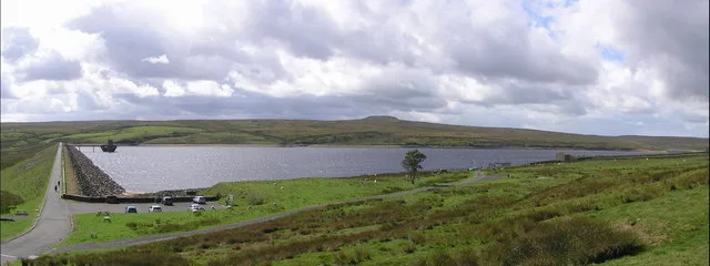 📷 5
📷 5Reservoirs & lochs · North East England
Balderhead Reservoir
Balderhead Reservoir — reservoir in County Durham, England, UK.
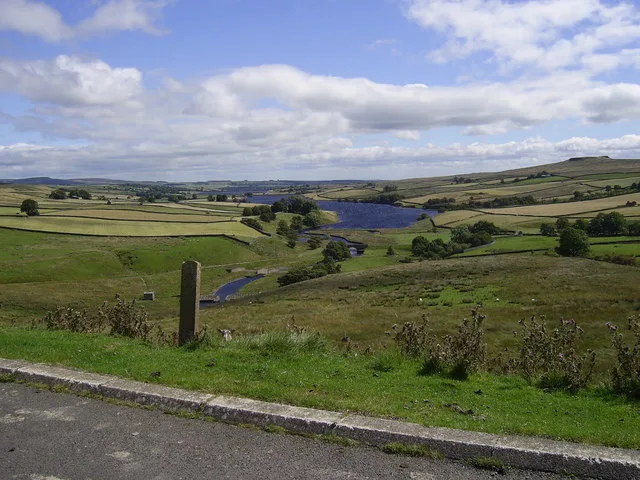 📷 3
📷 3Reservoirs & lochs · North East England
Blackton Reservoir
Blackton Reservoir — reservoir in County Durham, England, UK.
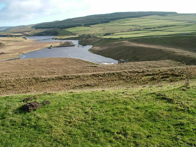 📷 5
📷 5Reservoirs & lochs · North East England
Grassholme Reservoir
Grassholme Reservoir — reservoir in County Durham, England, UK.
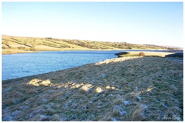 📷 3
📷 3Reservoirs & lochs · North East England
Hury Reservoir
Hury Reservoir — reservoir in County Durham, England, UK.
Frequently asked questions
- Where is Kielder Water?
- Kielder Water is in North-East England, United Kingdom (postcode NE48 1AU), in the parish of Falstone.
- What is Kielder Water?
- Kielder Water — reservoir in Northumberland, England, UK, on the River North Tyne.
- How do I get to Kielder Water?
- The nearest town is Falstone. Drivers can use postcode NE48 1AU.
- When was Kielder Water built?
- Built or established in 1975.
- Is Kielder Water a protected site?
- Yes — Kielder Water is part of the Kielder Mires SSSI Site of Special Scientific Interest.
- Is Kielder Water free to visit?
- Yes, Kielder Water is free to enter.
- How do I get to Kielder Water?
- Drivers can navigate to postcode NE48 1AU. It sits within the Hexham parliamentary constituency.