
Historic bridges · South West England
Kerne Bridge
In or near Welsh Bicknor.
Kerne Bridge — a Grade II*-listed bridge in wales-south, United Kingdom.

Jonathan Billinger — CC BY-SA 2.0 via Wikimedia Commons licence

Plan your visit
- Typical visit
- 15 min–30 min
- Nearest railway station
- Rookwood · 9.5 km
- Free entry
- Dog-friendly
Getting there & planning your visit
To visit Kerne Bridge, the nearest railway station is Rookwood, located 9.5 km away. The postcode for navigation is HR9 6HZ, and entry to the bridge is free.
About
Kerne Bridge is a Grade II*-listed building in wales-south, United Kingdom. Grade II* status is conferred by Historic England (or Cadw, Historic Environment Scotland or NIEA equivalents) on buildings of exceptional national interest. See the linked Wikipedia article for full historical and architectural details.
Photo gallery
360° viewimagery from 2025
Imagery © Mapillary contributors, CC BY-SA 4.0
Heritage listing
Kerne Bridge was built over the River Wye in the County of Herefordshire, England in 1825–28, on the site of an ancient ford crossing known as Flanesford. It is designated as a Scheduled Monument. Carrying the B4229 road, it connects the parishes of Walford on the river's left bank and Goodrich on the right. It is situated in the heart of the Wye Valley Area of Outstanding Natural Beauty and marks the northern end of the Upper Wye Gorge.
From the Historic England List Entry under OGL v3.
Protected designations
- Site of Special Scientific Interest: River Wye SSSI
- Area of Outstanding Natural Beauty: Wye Valley
Designations sourced from Natural England open data under OGL v3.
From the Wikipedia article
Kerne Bridge was built over the River Wye in the County of Herefordshire, England in 1825–28, on the site of an ancient ford crossing known as Flanesford. It is designated as a Scheduled Monument. Carrying the B4229 road, it connects the parishes of Walford on the river's left bank and Goodrich on the right. It is situated in the heart of the Wye Valley Area of Outstanding Natural Beauty and marks the northern end of the Upper Wye Gorge.
Excerpt from Wikipedia under CC BY-SA 4.0. See the source article linked in Sources below.
Background
History
Kerne Bridge was built on the site of a Pre-Roman ford across the River Wye. This ancient crossing came to be known as Flanesford before 1346 when the first stone of Flanesford Priory was laid nearby "in loco Flanesford vulgariter nuncupato" (in the place commonly called Flanesford). The origins of the name Flanesford are obscure. It has been suggested that it was derived from an English-Welsh conjunction, the Welsh llan (church or enclosure) joined to the English ford, or possibly the Welsh ffordd (way) but it is more likely the prefix is the Old English flanes from flan (arrow). The presence of the mill gave the name - The Cweorn - to the small settlement which became established there.…
Architecture
The Kerne Bridge Company was forced to negotiate with no fewer than eight landowners for the sale of parcels of land necessary for the approaches to the bridge. After acquiring them, in July 1825 the Company called for "Persons inclined to contract for building a bridge over the River Wye at a place called The Kerne in the County of Hereford" to provide plans and estimates by 15 August 1825. The Company declared that the bridge could be built of stone or iron. Richard Burton soon withdrew from the project. BD (David) Jones of the Tredegar Ironworks, then in Monmouthshire, now in Blaenau Gwent, took over in 1826 and completed the building. Jones dug two roadside quarries just north of the…
Description
The Act required a company, to be named The Kerne Bridge Company, to be set up to erect and maintain the bridge and to make and maintain the roads connecting to it. Once the bridge was in operation the company would be allowed to charge tolls for the upkeep of it and the connecting roads and for the profit of the company shareholders.
Sourced from Wikipedia under CC BY-SA 4.0.
- Coordinates
- 51.8700, -2.6103
- District
- Herefordshire, County of
- Parish
- Goodrich
- Postcode
- HR9 6HZ
- Parliamentary constituency
- Hereford and South Herefordshire
- Established
- 1828
- Nearest railway station
- Rookwood — 9.5 km
- Opening
- {{start-date|1828}}
Sources
- wikidata: Q17642880 (CC0)
- wikipedia: Kerne Bridge (River Wye crossing) (CC BY-SA 4.0)
Other places nearby

Dry Arch Bridge 300yds (270m) NE of St Giles' Church
Historic bridges · 0.5 km

Goodrich
Villages · 0.6 km

Goodrich War Memorial
Memorials & monuments · 0.6 km

Goodrich, Herefordshire
Museums · 0.6 km
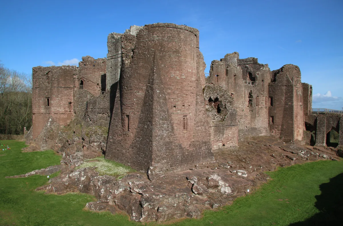
Goodrich Castle
Castles · 0.8 km

Fisher Monument Approximately 10 Metre North-East Of East End Of Church Of St Giles
Memorials & monuments · 0.9 km
Harper Monument Approximately 10 Metres South-East Of Chancel Of Church Of St Giles
Memorials & monuments · 0.9 km

Gritton Monument approximately 30 metres south-west of west tower of Church of St Giles
Memorials & monuments · 0.9 km

Coppett Hill Butterfly Site
Zoos & aquariums · 1.0 km

Coppett Hill
Mountains & hills · 1.1 km

Coppet Hill
Mountains & hills · 1.2 km
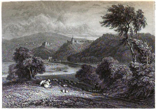
Goodrich Court
Castles · 1.4 km
Nearby
📷 4Historic bridges · South West England
Dry Arch Bridge 300yds (270m) NE of St Giles' Church
Dry Arch Bridge 300yds (270m) NE of St Giles' Church — scheduled monument-listed bridge in wales-south, United Kingdom.
📷 5📷 3Memorials & monuments · South West England
Goodrich War Memorial
Goodrich War Memorial — Grade II listed building-listed memorial in wales-south, United Kingdom.
📷 5Museums · South West England
Goodrich, Herefordshire
Goodrich is a village and civil parish in south Herefordshire, England close to Gloucestershire and the Forest of Dean, situated near the River Wye at grid reference SO574193. It is known for its Norm
📷 3Castles · South West England
Goodrich Castle
Goodrich Castle — Grade I listed castle in Goodrich, Herefordshire, England, UK.
📷 3Memorials & monuments · South West England
Fisher Monument Approximately 10 Metre North-East Of East End Of Church Of St Giles
Fisher Monument Approximately 10 Metre North-East Of East End Of Church Of St Giles — Grade II listed building-listed memorial in wales-south, United Kingdom.
Where to eat & stay near Kerne Bridge
Places to stay
 📷 5
📷 5 📷 5
📷 5Campsites · South Wales
Elmsdale Touring and Camping Site
Elmsdale Touring and Camping Site — a campsite in wales south.
 📷 5
📷 5Campsites · South West England
River Wye Camping & Caravan Park
River Wye Camping & Caravan Park — a campsite in wales south.
 📷 5
📷 5Caravan parks · South West England
Sterrett’s Caravan and Camping Park
Sterrett’s Caravan and Camping Park — a caravan park in wales south.
 📷 5
📷 5 📷 5
📷 5B&Bs · South West England
The Saracens Head
The Saracens Head — a bed-and-breakfast in wales south.
Places to eat & drink
 📷 7
📷 7 📷 5
📷 5 📷 5
📷 5Historic pubs · West Midlands
The Man of Ross
The Man of Ross — Historic pub — listed building or notable heritage status.
 📷 5
📷 5 📷 7
📷 7 📷 7
📷 7Historic pubs · South West England
The Lough Pool Inn
The Lough Pool Inn in Wales South, United Kingdom.
More bridges in this region
 📷 5
📷 5Historic bridges · South West England
Avoncliff Aqueduct
Avoncliff Aqueduct is a historic bridge in the United Kingdom.
📷 5Historic bridges · South West England
Avoncliff Aqueduct
Avoncliff Aqueduct is a historic bridge in the United Kingdom.
 📷 5
📷 5Historic bridges · South West England
Bradford Viaduct
Bradford Viaduct is a historic bridge in the United Kingdom.
 📷 5
📷 5Historic bridges · South West England
Chippenham Viaduct
Chippenham Viaduct is a historic bridge in the United Kingdom.
Frequently asked questions
- Where is Kerne Bridge?
- Kerne Bridge is in South Wales, United Kingdom (postcode HR9 6HZ), in the parish of Goodrich.
- What is Kerne Bridge?
- Kerne Bridge — a Grade II*-listed bridge in wales-south, United Kingdom.
- How do I get to Kerne Bridge?
- The nearest railway station is Rookwood, about 9.5 km away. Drivers can use postcode HR9 6HZ.
- When was Kerne Bridge built?
- Built or established in 1828.
- Who owns Kerne Bridge?
- Kerne Bridge is owned by Herefordshire Council.
- Is Kerne Bridge a listed building?
- Kerne Bridge is officially recognised as Grade II* listed.
- Is Kerne Bridge a protected site?
- Yes — Kerne Bridge is part of the River Wye SSSI Site of Special Scientific Interest and the Wye Valley National Landscape (AONB).
- Is Kerne Bridge free to visit?
- Yes, Kerne Bridge is free to enter.