
Archaeological sites · South East England
Iron Age Shrine and Roman Temple
In or near Purbrook.
Iron Age Shrine and Roman Temple — a archaeological in england-south-east, United Kingdom.

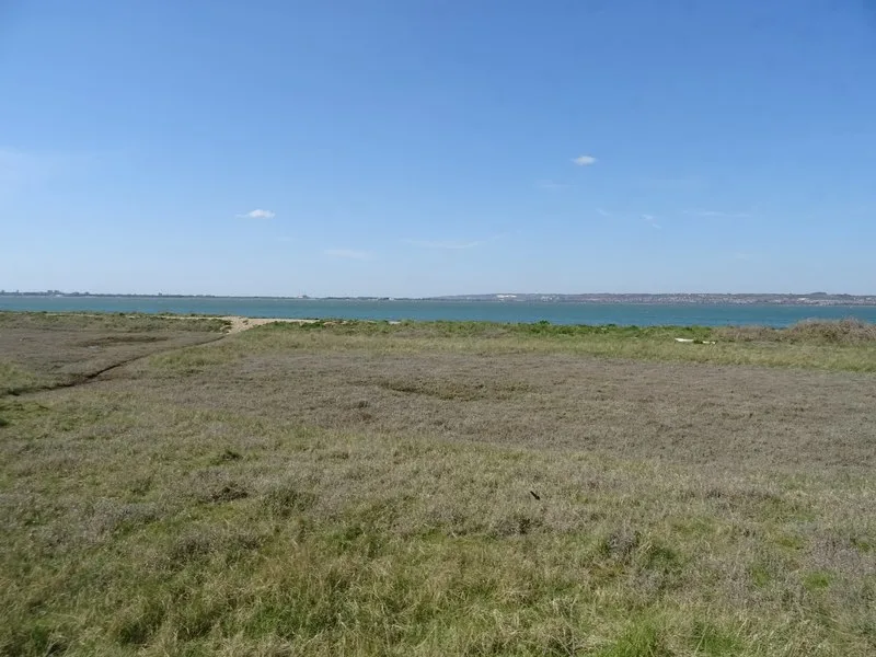
Basher Eyre — CC BY-SA 2.0 via Wikimedia Commons licence

Plan your visit
- Typical visit
- 45 min–1.5 h
- Nearest railway station
- Warblington · 3.5 km
- Free entry
- Dog-friendly
About
Iron Age Shrine and Roman Temple is a archaeological located in england-south-east, United Kingdom. Sourced from OpenStreetMap (ODbL licence); see local listings for visitor information, opening hours and admission details.
Photo gallery
Protected designations
- Site of Special Scientific Interest: Chichester Harbour SSSI
- Area of Outstanding Natural Beauty: Chichester Harbour
- Ramsar wetland: Chichester and Langstone Harbours
Designations sourced from Natural England open data under OGL v3.
Place summary
The Iron Age Shrine and Roman Temple is an archaeological site located in South-East England. This site features remains from both the Iron Age and Roman periods, highlighting the region's historical significance. It provides insights into the religious practices of ancient cultures in Britain.
AI-generated from the structured facts on this page (operator, designation, listing, era). Not a substitute for visiting.
- Coordinates
- 50.8221, -0.9726
- County
- Hampshire
- District
- Havant
- Parish
- Havant, unparished area
- Postcode
- PO11 0LY
- Parliamentary constituency
- Havant
- Nearest railway station
- Warblington — 3.5 km
Sources
- osm: way/837542494 (ODbL)
Other places nearby

North Hayling
Villages · 0.7 km

Tye Caravan Park
Caravan parks · 1.1 km

HMS Northey 1
Memorials & monuments · 1.2 km

Hayling Billy railway signal
Archaeological sites · 1.2 km

Fleet Farm
Caravan parks · 1.3 km

Old Fleet Manor
Manor houses · 1.4 km

Langstone Bridge
Historic bridges · 1.4 km
Hayling Billy
Wildlife reserves · 1.5 km

Wadeway
Archaeological sites · 1.5 km

Wadeway
Archaeological sites · 1.5 km

Hayling Billy Off Road Cycle Trail
Mountain bike trails · 1.6 km

Bembridge - Langstone Ferry dock (remains)
Archaeological sites · 1.6 km
Nearby
📷 5📷 5Caravan parks · South East England
Tye Caravan Park
Tye Caravan Park — a caravan park in england south east.
📷 5Memorials & monuments · South East England
HMS Northey 1
HMS Northey 1 — a memorial in england-south-east, United Kingdom.
📷 5Archaeological sites · South East England
Hayling Billy railway signal
Hayling Billy railway signal — a archaeological in england-south-east, United Kingdom.
📷 5📷 5Manor houses · South East England
Old Fleet Manor
Old Fleet Manor — Grade II listed building-listed manor in england-south-east, United Kingdom.
Where to eat & stay near Iron Age Shrine and Roman Temple
Places to stay
📷 5Caravan parks · South East England
Tye Caravan Park
Tye Caravan Park — a caravan park in england south east.
📷 5 📷 5
📷 5Caravan parks · South East England
Mill Rythe Creek
Mill Rythe Creek — a caravan park in england south east.
 📷 5
📷 5Caravan parks · South East England
Mill Rythe Coastal Village
Mill Rythe Coastal Village — a caravan park in england south east.
 📷 5
📷 5Campsites · South East England
The Oven Campsite
The Oven Campsite — a campsite in england south east.
📷 5Caravan parks · South East England
Hayling Island Holiday Park
Hayling Island Holiday Park — a caravan park in england south east.
Places to eat & drink
 📷 5
📷 5Historic pubs · South East England
The Old House At Home Public House
The Old House At Home Public House in England South East, United Kingdom.
 📷 5
📷 5Historic pubs · South East England
The Black Dog Public House, Including Boundary Walls
The Black Dog Public House, Including Boundary Walls in England South East, United Kingdom.
 📷 7
📷 7Historic pubs · South East England
Sussex Brewery Public House
Sussex Brewery Public House in England South East, United Kingdom.
 📷 5
📷 5Historic pubs · South East England
The Golden Lion
The Golden Lion in England South East, United Kingdom.
 📷 7
📷 7Historic pubs · South East England
The Shades Public House
The Shades Public House in England South East, United Kingdom.
 📷 5
📷 5Historic pubs · South East England
The Stag's Head Public House
The Stag's Head Public House in England South East, United Kingdom.
More archaeological sites in this region
 📷 5
📷 5Archaeological sites · South East England
Chatham Dockyard, site of South Mast Pond
Chatham Dockyard, site of South Mast Pond — archaeological site in Medway, Kent, England, UK.
 📷 5
📷 5Archaeological sites · South East England
Open areas within Roman, Saxon and medieval town
Open areas within Roman, Saxon and medieval town — archaeological site in Medway, Kent, England, UK.
 📷 5
📷 5Archaeological sites · South East England
Oxmoor Copse
Oxmoor Copse — woodland in Surrey, England.
 📷 5
📷 5Frequently asked questions
- Where is Iron Age Shrine and Roman Temple?
- Iron Age Shrine and Roman Temple is in Hampshire, South-East England, United Kingdom (postcode PO11 0LY), in the parish of Havant, unparished area.
- What is Iron Age Shrine and Roman Temple?
- Iron Age Shrine and Roman Temple — a archaeological in england-south-east, United Kingdom.
- How do I get to Iron Age Shrine and Roman Temple?
- The nearest railway station is Warblington, about 3.5 km away. The nearest town is Purbrook. Drivers can use postcode PO11 0LY.
- Is Iron Age Shrine and Roman Temple a protected site?
- Yes — Iron Age Shrine and Roman Temple is part of the Chichester Harbour SSSI Site of Special Scientific Interest and the Chichester Harbour National Landscape (AONB).
- Is Iron Age Shrine and Roman Temple free to visit?
- Yes, Iron Age Shrine and Roman Temple is free to enter.
- How do I get to Iron Age Shrine and Roman Temple?
- The nearest railway station is Warblington, about 3.5 km away. Drivers can navigate to postcode PO11 0LY.