
Historic churches · East of England
Ipswich Blackfriars
In or near Belstead.
Ipswich Blackfriars — church in Ipswich, UK.

Wikimedia Commons contributors — see linked file page for photographer and licence licence

Plan your visit
- Typical visit
- 30 min–1 h
- Nearest railway station
- Ipswich · 1.1 km
- Free entry
Getting there & planning your visit
Ipswich Blackfriars is located at postcode IP4 1DY and is approximately 1.1 km from Ipswich railway station. Entry to the church is free.
About
Ipswich Blackfriars is a historic church in the United Kingdom. Records date its origin to 1201. Heritage designation: scheduled monument. Wikidata describes it as: "church in Ipswich, UK". Coordinates: 52.0548°, 1.1584°.
Photo gallery
See it from the streetimagery from 2025
Imagery © Mapillary contributors, CC BY-SA 4.0
Heritage listing
Ipswich Blackfriars was a medieval religious house of Friars-preachers (Dominicans) in the town of Ipswich, Suffolk, England, founded in 1263 by King Henry III and dissolved in 1538. It was the second of the three mendicant communities established in the town, the first (before 1236) being the Greyfriars, a house of Franciscan Friars Minors, and the third the Ipswich Whitefriars of c. 1278–79. The Blackfriars were under the Visitation of Cambridge. The Blackfriars church, which was dedicated to St Mary, disappeared within a century after the Dissolution, but the layout of the other conventual buildings, including some of the original structures, survived long enough to be illustrated and planned by Joshua Kirby in 1748.
From the Historic England List Entry under OGL v3.
Official information
Ipswich Mosque serves as a community center for the Bangladeshi Muslim community, offering a variety of services including daily prayers, religious counseling, and educational programs for both children and adults. The mosque, which was formerly a Victorian Fire Station, accommodates a growing number of visitors, especially during significant religious events.
Protected designations
- Area of Outstanding Natural Beauty: Suffolk Coast & Heaths
Designations sourced from Natural England open data under OGL v3.
From the Wikipedia article
Ipswich Blackfriars was a medieval religious house of Friars-preachers (Dominicans) in the town of Ipswich, Suffolk, England, founded in 1263 by King Henry III and dissolved in 1538. It was the second of the three mendicant communities established in the town, the first (before 1236) being the Greyfriars, a house of Franciscan Friars Minors, and the third the Ipswich Whitefriars of c. 1278–79. The Blackfriars were under the Visitation of Cambridge. The Blackfriars church, which was dedicated to St Mary, disappeared within a century after the Dissolution, but the layout of the other conventual buildings, including some of the original structures, survived long enough to be illustrated and planned by Joshua Kirby in 1748. By that time later uses had supervened and their interpretation had become confused. The last of the monastery buildings, the former sacristy, chapter house and dormitory, continued in use as a schoolroom for the Ipswich School until 1842 before finally being demolished in 1849. In 1898 Nina Layard had some success in locating buried footings. A modern understanding of the site emerged during the 1970s and 1980s, through scholarly interpretation and in excavations by the Suffolk County Council team, by which the position of the lost Blackfriars church was recognized and revealed, much of the original plan was clarified or confirmed, and former misapprehensions were corrected. The site of the Blackfriars church, between Foundation Street and Lower Orwell Street, is preserved as an open grassed recreation area where the footings of the building and a surviving fragment of the wall of the sacristy can be seen, and are explained by interpretative panels. A modern housing development covers the site of the lost conventual buildings.
Excerpt from Wikipedia under CC BY-SA 4.0. See the source article linked in Sources below.
Background
History
Contrary to earlier antiquarian tradition, in 1887 it was shown decisively that King Henry III established the Dominican friars at Ipswich in 1263. Henry purchased land in Ipswich from Hugh son of Gerard de Langeston and gave it to the friars for them to live there, instructing John de Vallibus (de Vaux), Keeper of the Peace, to go in person to give them seisin. On 26 November 1265 he augmented this grant with other land purchased from the same Hugh. In the same founding phase Robert Kilwardby, who was appointed Provincial prior of the Dominicans in England in 1261 and became Archbishop of Canterbury in 1272, acquired a messuage on behalf of the friars in 1269. In April 1277 when visiting…
Description
The Ipswich town rampart, reconstructed c.1200 on the line of a Viking-age defence, lay in its south-eastern quarter on the east side of the Blackfriars site within the line of Lower Orwell Street. The priory lands accrued within this sector, with Foundation Street on its west side, and St Mary at Key to the south, within which parish it principally lay. In 1307 Alice Harneis (wife of the leading townsman and coroner Philip Harneis, who led the group for the re-writing of the Town Custumal, and to whom the town Farm was committed), assigned to the friars a plot of 200 ft by 36 ft which she held from Sir Payn de Tibetot, 1st Baron Tibetot (c. 1279–1314), (of the patron family of the…
Sourced from Wikipedia under CC BY-SA 4.0.
- Coordinates
- 52.0548, 1.1584
- County
- Suffolk
- District
- Ipswich
- Parish
- Ipswich, unparished area
- Postcode
- IP4 1DY
- Parliamentary constituency
- Ipswich
- Phone
- +44 1473 226879
- Established
- 1201
- Nearest railway station
- Ipswich — 1.1 km
- Official site
- www.ipswichmosque.org
Sources
- wikidata: Q6065515 (CC0)
- wikipedia: Ipswich Blackfriars (CC BY-SA 4.0)
- commons: Ipswich Blackfriars.jpg (CC BY-SA 4.0)
Other places nearby
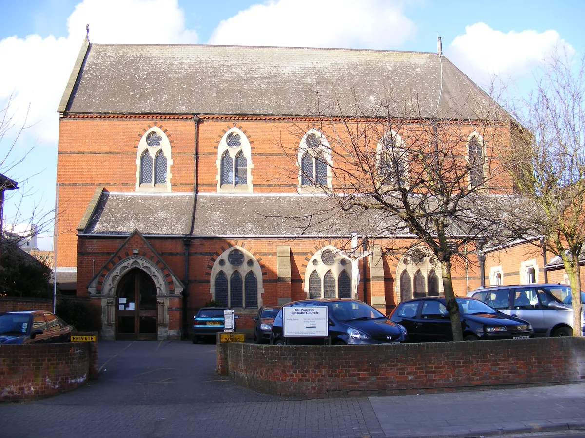
Saint Pancras Church
Historic churches · 0.1 km

Cor Visser
Memorials & monuments · 0.1 km

Jewish Cemeterty
Cemeteries · 0.2 km

Ipswich & Suffolk Bangladeshi Muslim Community Centre and Mosque
Historic churches · 0.2 km
.jpg?width=1200)
The Old Custom House
Historic houses · 0.2 km
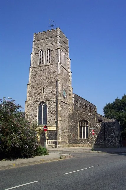
St Mary at the Quay Church
Historic churches · 0.3 km

Cluetopia - Ipswich Escape Rooms
Escape rooms · 0.3 km

Isaacs
Historic pubs · 0.3 km

86, Fore Street
Gardens · 0.3 km

Microshops Ipswich
Farmers’ markets · 0.3 km

The Major
Public art & sculpture · 0.3 km

Regent Theatre
Open-air theatres · 0.3 km
Nearby
📷 3Historic churches · East of England
Saint Pancras Church
Saint Pancras Church — church in Ipswich, Suffolk, England, UK.
📷 4Memorials & monuments · East of England
Cor Visser
Cor Visser — a memorial in East of England, United Kingdom.
📷 4Cemeteries · East of England
Jewish Cemeterty
Jewish Cemeterty is a cemetery in the United Kingdom.
📷 5Historic churches · East of England
Ipswich & Suffolk Bangladeshi Muslim Community Centre and Mosque
Ipswich & Suffolk Bangladeshi Muslim Community Centre and Mosque — a church in East of England, United Kingdom.
📷 3Historic houses · East of England
The Old Custom House
The Old Custom House — house in Ipswich, Suffolk, England, UK.
📷 5Historic churches · East of England
St Mary at the Quay Church
St Mary at the Quay Church — church in Ipswich, Suffolk, UK.
Where to eat & stay near Ipswich Blackfriars
Places to stay
 📷 5
📷 5 📷 7
📷 7Hotels · East of England
Belstead Brook Hotel
Belstead Brook Hotel — a hotel in england east.
 📷 5📷 5
Campsites · East of England
Hallowtree Scout Activity Centre
Hallowtree Scout Activity Centre — a campsite in england east.
 📷 5
📷 5Hotels · East of England
Ipswich Hotel
Ipswich Hotel — a hotel in england east.
 📷 5
📷 5Campsites · East of England
Toad Hall Caravan Site
Toad Hall Caravan Site — a campsite in england east.
Places to eat & drink
📷 5 📷 7
📷 7 📷 5
📷 5Historic pubs · East of England
16, St Nicholas Street
16, St Nicholas Street in England East, United Kingdom.
 📷 7
📷 7Historic pubs · East of England
Half Moon and Star
Half Moon and Star in England East, United Kingdom.
 📷 7
📷 7Historic pubs · East of England
The Margaret Catchpole Public House
The Margaret Catchpole Public House in England East, United Kingdom.
 📷 5
📷 5Historic pubs · East of England
The Suffolk Punch
The Suffolk Punch in England East, United Kingdom.
Other places from this era
 📷 5
📷 5Historic churches · London
All Hallows Staining
All Hallows Staining — church in City of London, UK.
 📷 5
📷 5Historic churches · London
All Hallows' Church, Tottenham
All Hallows' Church, Tottenham — church in Tottenham, London.
 📷 5
📷 5Historic churches · London
All Saints Church, Kingston upon Thames
All Saints Church, Kingston upon Thames — church in Kingston upon Thames, London.
 📷 5
📷 5Historic churches · London
All Saints' Church, Edmonton
All Saints' Church, Edmonton — church in Edmonton, London.
More places in this region
 📷 5
📷 5Historic churches · East of England
All Saints Church
All Saints Church — church on Jesus Lane in central Cambridge, England.
 📷 5
📷 5Historic churches · East of England
All Saints Church, Conington
All Saints Church, Conington — church in Conington, Huntingdonshire, Cambridgeshire, England, UK.
 📷 5
📷 5Historic churches · East of England
All Saints Church, Vange
All Saints Church, Vange — church in Basildon, Essex, England, UK.
 📷 5
📷 5Historic churches · East of England
All Saints Parish Church, Kirtling
All Saints Parish Church, Kirtling — church in East Cambridgeshire, England, UK.
Frequently asked questions
- Where is Ipswich Blackfriars?
- Ipswich Blackfriars is in Suffolk, East of England, United Kingdom (postcode IP4 1DY), in the parish of Ipswich, unparished area.
- What is Ipswich Blackfriars?
- Ipswich Blackfriars — church in Ipswich, UK.
- How do I get to Ipswich Blackfriars?
- The nearest railway station is Ipswich, about 1.1 km away. The nearest town is Belstead. Drivers can use postcode IP4 1DY.
- When was Ipswich Blackfriars built?
- Built or established in 1201.
- Is Ipswich Blackfriars a listed building?
- Ipswich Blackfriars is officially recognised as scheduled monument listed.
- Is Ipswich Blackfriars a protected site?
- Yes — Ipswich Blackfriars is part of the Suffolk Coast & Heaths National Landscape (AONB).
- Is Ipswich Blackfriars free to visit?
- Yes, Ipswich Blackfriars is free to enter.
- How do I get to Ipswich Blackfriars?
- The nearest railway station is Ipswich, about 1.1 km away. Drivers can navigate to postcode IP4 1DY.