
Reservoirs & lochs · Scottish Highlands
Inverness-shire
In or near Fort Augustus.
Inverness-shire in Scotland Islands, United Kingdom.

Chris Wimbush — CC BY-SA 2.0 via Wikimedia Commons licence

Plan your visit
- Typical visit
- 1 h–2.5 h
- Free entry
- Dog-friendly
About
Inverness-shire is a place of interest in Scotland Islands, United Kingdom — drawn from open-data sources for visitor reference. See the linked Wikipedia article for the full description.
Photo gallery
Official information
The Inverness Lieutenancy is an administrative area covering Inverness and its surroundings, including Fort William and the Small Isles. It is represented by the Lord Lieutenant and Deputy Lieutenants who assist with various ceremonial duties and community matters.
From the Wikipedia article
Inverness-shire (Scottish Gaelic: Siorrachd Inbhir Nis) or the County of Inverness, is a historic county in Scotland. It is named after Inverness, its largest settlement, which was also the county town. Covering much of the Highlands and some of the Hebrides, it is Scotland's largest county by land area. It is generally rural and sparsely populated, containing only three towns which held burgh status, being Inverness, Fort William and Kingussie. The county is crossed by the Great Glen, which contains Loch Ness and separates the Grampian Mountains to the south-east from the Northwest Highlands. The county also includes Ben Nevis, the highest mountain in both Scotland and the United Kingdom. The county ceased to be used for local government purposes in 1975. Since then, the parts of the county on the mainland and in the Inner Hebrides have been part of the Highland region, which was redesignated a council area in 1996. The Outer Hebrides parts of the county became part of the Western Isles, which since 1998 has used only the Scots Gaelic version of its name, Na h-Eileanan an Iar. The neighbouring counties prior to the 1975 reforms were (clockwise from north) Ross and Cromarty, Nairnshire, Moray, Banffshire, Aberdeenshire, Perthshire and Argyll. The mainland part of the county had a coast to the east onto the Moray Firth, and a much longer coast to the west onto the Sea of the Hebrides. The historic county boundaries of Inverness-shire are still used for certain functions, being a registration county. There is also an Inverness lieutenancy area which covers the mainland part of the pre-1975 county and the Small Isles, as well as the parts of the historic counties of Argyll and Moray that were transferred to Highland.
Excerpt from Wikipedia under CC BY-SA 4.0. See the source article linked in Sources below.
Background
History
The mainland part of Inverness-shire was anciently part of the Province of Moray, ruled by the Earls or Mormaers of Moray, sometimes as a vassal of the Scottish crown, and at other times effectively as a separate kingdom. The province was finally brought fully into the Kingdom of Scotland during the 12th century. In order to secure the Scottish crown's authority over the area, it was divided into shires, being areas administered by a sheriff. The old province of Moray was broadly split into the three shires of Elginshire, Nairnshire, and Inverness-shire, with Inverness-shire including the areas of the provincial lordships of Badenoch and Lochaber which were subordinate to Moray. Around the…
Sourced from Wikipedia under CC BY-SA 4.0.
- Coordinates
- 57.0833, -4.6667
- Official site
- www.invernesslieutenancy.org.uk
Sources
- wikidata: Q1247390 (CC0)
- wikipedia: Inverness-shire (CC BY-SA 4.0)
Other places nearby

Carn Bad na Circe
Mountains & hills · 1.1 km

Liath Dhoire
Mountains & hills · 1.6 km

Allt Coire Uchdachan Bridge
Historic bridges · 2.1 km

Meallan Odhar
Mountains & hills · 2.5 km

Fuaran Doire Cluig
Mountains & hills · 2.7 km

Mullach a' Ghlinne
Mountains & hills · 2.7 km
Mullach a' Ghlinne
Mountains & hills · 2.8 km

Carn a' Chuilinn South Top
Mountains & hills · 2.9 km

Càrn a' Chuilinn
Mountains & hills · 3.3 km
Carn a' Chuilinn
Mountains & hills · 3.4 km

Carn Doire Chaorach
Mountains & hills · 3.4 km

Meall a' Cholumain
Mountains & hills · 3.5 km
Nearby
📷 5Mountains & hills · Scottish Highlands
Carn Bad na Circe
Carn Bad na Circe — a hill or mountain in scotland highlands.
📷 5Mountains & hills · Scottish Highlands
Liath Dhoire
Liath Dhoire — a hill or mountain in scotland highlands.
📷 5Historic bridges · Scottish Highlands
Allt Coire Uchdachan Bridge
Allt Coire Uchdachan Bridge — part of a Scheduled Monument-listed bridge in scotland-highlands, United Kingdom.
📷 5Mountains & hills · Scottish Highlands
Meallan Odhar
Meallan Odhar — mountain in scotland highlands. Elevation: 605 m.
📷 5Mountains & hills · Scottish Highlands
Fuaran Doire Cluig
Fuaran Doire Cluig — a hill or mountain in scotland highlands.
📷 5Mountains & hills · Scottish Highlands
Mullach a' Ghlinne
Mullach a' Ghlinne — a hill or mountain in scotland highlands.
Where to eat & stay near Inverness-shire
Places to stay
 📷 5
📷 5 📷 5
📷 5Campsites · Scottish Highlands
Leitirfearn Trailblazer Rest
Leitirfearn Trailblazer Rest — a campsite in scotland highlands.
 📷 5
📷 5Hotels · Scottish Highlands
Caledonian Hotel
Caledonian Hotel — a hotel in scotland highlands.
 📷 5
📷 5Hotels · Scottish Highlands
Glengarry Castle Hotel
Glengarry Castle Hotel — a hotel in scotland highlands.
 📷 5
📷 5Hostels · Scottish Highlands
Morag’s Lodge
Morag’s Lodge — a hostel in scotland highlands.
 📷 7
📷 7Hotels · Scottish Highlands
Invergarry Hotel
Invergarry Hotel — a hotel in scotland highlands.
Places to eat & drink
 📷 5
📷 5Historic pubs · Scottish Highlands
The Lovat Hotel
The Lovat Hotel in Scotland Highlands, United Kingdom.
More places in this region
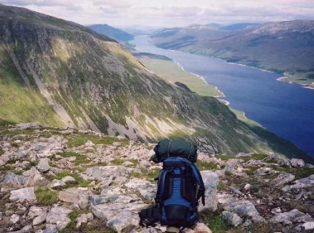 Flagship📷 3
Reservoirs & lochs · Scottish Highlands
Loch Ericht
Loch Ericht — lake in Perth and Kinross, and Highland, Scotland, UK, outflows to River Ericht.
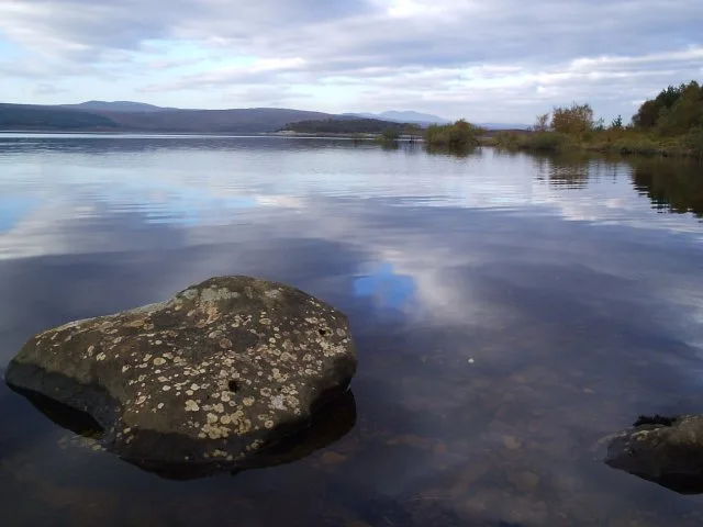 Flagship📷 3
Reservoirs & lochs · Scottish Highlands
Loch Shin
Loch Shin — reservoir in Highland, Scotland, UK, outflows to the River Shin.
 📷 4
📷 4Reservoirs & lochs · Scottish Highlands
Backwater Reservoir
Backwater Reservoir — lake in Angus, Scotland, UK.
 📷 3
📷 3Reservoirs & lochs · Scottish Highlands
Blackwater Reservoir
Blackwater Reservoir — reservoir in Highland, Scotland, UK, outflows to the River Leven.
Frequently asked questions
- Where is Inverness-shire?
- Inverness-shire is in the Scottish Highlands, United Kingdom.
- What is Inverness-shire?
- Inverness-shire in Scotland Islands, United Kingdom.
- How do I get to Inverness-shire?
- The nearest town is Fort Augustus. Its coordinates are 57.0833°, -4.6667°.
- Is Inverness-shire free to visit?
- Yes, Inverness-shire is free to enter.