
Wildlife reserves · London
Ingrebourne Marshes
In or near Havering-atte-Bower.
Ingrebourne Marshes is a wildlife reserve in the United Kingdom.

Wikimedia Commons contributors — see linked file page for photographer and licence licence

Plan your visit
- Typical visit
- 2 h–4 h
- Best time of year
- Autumn & winter (migration & wildfowl)
- Nearest railway station
- Rainham · 1.9 km
- Free entry
- Dog-friendly
Getting there & planning your visit
Ingrebourne Marshes is located in Havering, London, with the postcode RM13 9QY. The nearest railway station is Rainham, which is 1.9 km away. Entry to the reserve is free.
About
Ingrebourne Marshes is a wildlife reserve in the United Kingdom. Heritage designation: Site of Special Scientific Interest. Coordinates: 51.5296°, 0.2096°.
Photo gallery
Official information
Ingrebourne Marshes is a Site of Special Scientific Interest (SSSI) located in Greater London, specifically in the Havering district. It is recognized for its biological interest and features a variety of habitats that support diverse wildlife.
Protected designations
- Site of Special Scientific Interest: Ingrebourne Marshes SSSI
Designations sourced from Natural England open data under OGL v3.
From the Wikipedia article
Ingrebourne Marshes are a 74.8 hectare biological Site of Special Scientific Interest in Hornchurch in the London Borough of Havering. Ingrebourne Valley Local Nature Reserve includes a small part of the SSSI west of the River Ingrebourne. The Marshes run along both sides of the river, the northern portion next to Hornchurch Country Park and stretching south to Rainham. This is almost all closed to the public, but part of it can be viewed from the Park. A long narrow strip stretches east from the river to Berwick Pond Road, incorporating Berwick Pond, a reservoir which is used for fishing. This is open to the public. The site also includes an irrigation reservoir east of Berwick Pond Road. The site is the largest area of freshwater marsh in Greater London. It is very diverse, with large areas of reed sweet-grass, common reed swamp, wet neutral grassland and tall fen. These habitats have a wide variety of invertebrates and breeding birds. Invertebrates include sixteen nationally scarce fly, beetle dragonfly and cricket species. There are two nationally rare Red Data Book species, the hoverfly Anasimyia interpuncta and the scarce emerald damselfly Lestes dryas. 61 species of bird regularly breed on the site, such as the common redshank and the northern lapwing. Common cuckoos exploit the nests of reed warblers and sedge warblers. Havering Council has raised the water level and reintroduced grazing to protect the wetland. Access to the site is from Hornchurch Country Park and Berwick Pond Road.
Excerpt from Wikipedia under CC BY-SA 4.0. See the source article linked in Sources below.
- Coordinates
- 51.5296, 0.2096
- District
- Havering
- Parish
- Havering, unparished area
- Postcode
- RM13 9QY
- Parliamentary constituency
- Dagenham and Rainham
- Nearest railway station
- Rainham — 1.9 km
Sources
- wikidata: Q6033074 (CC0)
- wikipedia: Ingrebourne Marshes (CC BY-SA 4.0)
- commons: Ingrebourne Marshes, Berwick Pond.JPG (CC BY-SA 4.0)
Other places nearby

Ingrebourne Marshes SSSI
Forests & woodlands · 0.2 km

Rainham Cemetery
Cemeteries · 0.8 km

Ingrebourne Hill Mountain Bike Course
Mountain bike trails · 0.9 km
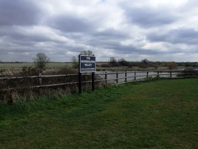
Ingrebourne Valley
Wildlife reserves · 0.9 km

Hornchurch Country Park
Parks · 1.1 km

Flightway
Public art & sculpture · 1.2 km

Will Perrin Court
Hostels · 1.2 km

Rainham Jewish Cemetery
Cemeteries · 1.3 km

Hacton
Chapels · 1.5 km

The Chafford School
Natural landmarks · 1.6 km

Rainham
Chapels · 1.7 km

South Hornchurch
Chapels · 1.7 km
Nearby
📷 5Forests & woodlands · London
Ingrebourne Marshes SSSI
Ingrebourne Marshes SSSI is a forest or woodland in the United Kingdom.
📷 5📷 5Mountain bike trails · London
Ingrebourne Hill Mountain Bike Course
Ingrebourne Hill Mountain Bike Course — a mtb trail in england london.
Flagship📷 10Wildlife reserves · London
Ingrebourne Valley
Ingrebourne Valley — Essex Wildlife Trust Nature reserve.
📷 5📷 5Public art & sculpture · London
Flightway
Flightway — a public art in england-london, United Kingdom.
Where to eat & stay near Ingrebourne Marshes
Places to stay
📷 5 📷 5
📷 5Hotels · London
Devonshire Hotel
Devonshire Hotel — a hotel in england london.
 📷 5
📷 5Campsites · London
Cherrywood Campsite
Cherrywood Campsite — a campsite in england london.
 📷 7
📷 7 📷 5
📷 5Caravan parks · London
Abbey Wood Caravan Club Site
Abbey Wood Caravan Club Site — a caravan park in england london.
 📷 5
📷 5Hotels · London
DoubleTree by Hilton Hotel Dartford Bridge
DoubleTree by Hilton Hotel Dartford Bridge — a hotel in england london.
Places to eat & drink
 📷 7
📷 7 📷 5
📷 5 📷 7
📷 7 📷 5
📷 5 📷 5
📷 5 📷 5
📷 5More places in this region
 Flagship📷 10
Wildlife reserves · London
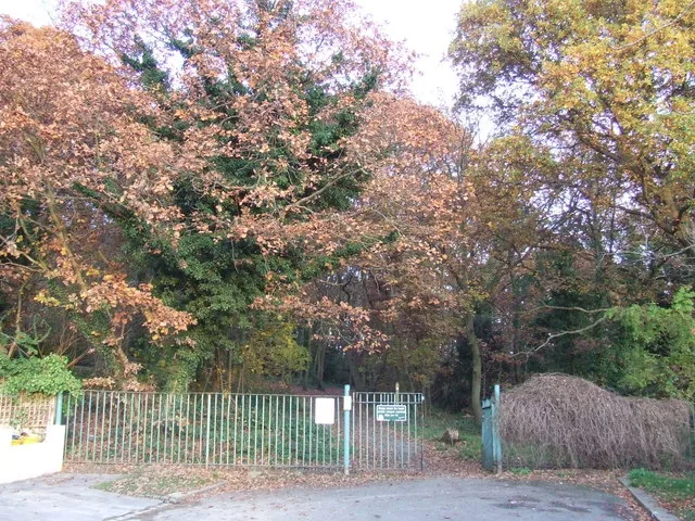
Bedfords Park
Bedfords Park — Havering London Borough green landscape, also an Essex Wildlife Trust Nature reserve.
 Flagship📷 10
 Flagship📷 10
Wildlife reserves · London
Bramley Bank
Bramley Bank — Nature reserve in Upper Shirley.
 Flagship📷 10
Wildlife reserves · London
Chafford Gorges Nature Park
Chafford Gorges Nature Park — Essex Wildlife Trust Nature reserve.
Frequently asked questions
- Where is Ingrebourne Marshes?
- Ingrebourne Marshes is in London, United Kingdom (postcode RM13 9QY), in the parish of Havering, unparished area.
- What is Ingrebourne Marshes?
- Ingrebourne Marshes is a wildlife reserve in the United Kingdom.
- How do I get to Ingrebourne Marshes?
- The nearest railway station is Rainham, about 1.9 km away. The nearest town is Havering-atte-Bower. Drivers can use postcode RM13 9QY.
- Is Ingrebourne Marshes a listed building?
- Ingrebourne Marshes is officially recognised as Site of Special Scientific Interest listed.
- Is Ingrebourne Marshes a protected site?
- Yes — Ingrebourne Marshes is part of the Ingrebourne Marshes SSSI Site of Special Scientific Interest.
- Is Ingrebourne Marshes free to visit?
- Yes, Ingrebourne Marshes is free to enter.
- How do I get to Ingrebourne Marshes?
- The nearest railway station is Rainham, about 1.9 km away. Drivers can navigate to postcode RM13 9QY.
- Are dogs allowed at Ingrebourne Marshes?
- Most wildlife reserves allow dogs on lead only, with restrictions during ground-nesting bird season (March-July). Check signage at the reserve.