
Forests & woodlands · South East England
Hurley Chalk Pit
In or near Medmenham.
Hurley Chalk Pit is a forest or woodland in the United Kingdom.
.jpg?width=1200)
Wikimedia Commons licence
Plan your visit
- Typical visit
- 1 h–3 h
- Nearest railway station
- Shiplake · 4.3 km
- Free entry
- Family-friendly
- Dog-friendly
Getting there & planning your visit
To visit Hurley Chalk Pit, the nearest railway station is Shiplake, located 4.3 km away. The postcode for sat-nav is SL6 5PB. Entry to the site is free.
About
Hurley Chalk Pit is a named forest, woodland or nature reserve in the United Kingdom. Coordinates: 51.5314°, -0.8297°. This entry is part of The Great Britain Guide, a free, ad-free, open-data tourist directory.
Photo gallery
Official information
Hurley Chalk Pit is a small nature reserve featuring a mix of beech woodland and chalk grassland. It is home to diverse wildlife, including 15 species of butterflies and various wild orchids, making it a great spot for nature enthusiasts.
Protected designations
- Area of Outstanding Natural Beauty: Chilterns
Designations sourced from Natural England open data under OGL v3.
From the Wikipedia article
Hurley Chalk Pit is a 1-hectare (2.5-acre) nature reserve west of Maidenhead in Berkshire. It is managed by the Berkshire, Buckinghamshire and Oxfordshire Wildlife Trust. This chalk pit, which was dug more than 150 years ago, is warm and sheltered and it has 15 species of butterfly, including common blues and gatekeepers. There are varied habitats, with woodland, scrub, grassland and hedges. There is access from a footpath which runs north from Warren Row.
Excerpt from Wikipedia under CC BY-SA 4.0. See the source article linked in Sources below.
- Coordinates
- 51.5314, -0.8297
- District
- Windsor and Maidenhead
- Parish
- Hurley
- Postcode
- SL6 5PB
- Parliamentary constituency
- Maidenhead
- Nearest railway station
- Shiplake — 4.3 km
- Opening
- Open at all times
- Official site
- www.bbowt.org.uk
Sources
- osm: w90279681 (ODbL)
- wikipedia: Hurley Chalk Pit (CC BY-SA 4.0)
Other places nearby
Hurley Chalk Pit
Wildlife reserves · 0.1 km

Ashley Hill
Mountains & hills · 1.5 km

Cayton Park House
Castles · 1.6 km

BCA Picnic Site
Natural landmarks · 1.8 km

Medmenham Abbey Folly
Follies · 1.9 km
.jpg?width=1200)
Medmenham Abbey, Abbey House and Wall with Arch to Forecourt
Historic houses · 1.9 km

Bowsey Hill
Mountains & hills · 1.9 km

Hurley Riverside Park
Caravan parks · 2.0 km

BCA Zoo
Zoos & aquariums · 2.0 km

Berkshire College of Agriculture
Zoos & aquariums · 2.1 km

The Olde Bell
Hotels · 2.1 km
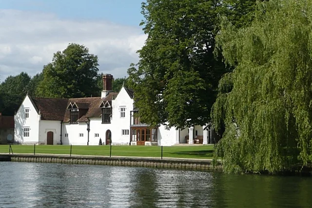
Medmenham Abbey
Abbeys & priories · 2.3 km
Nearby
📷 5Wildlife reserves · South East England
Hurley Chalk Pit
Hurley Chalk Pit is a wildlife reserve in the United Kingdom.
📷 5Mountains & hills · South East England
Ashley Hill
Ashley Hill — a hill or mountain in england south east.
📷 5Castles · South East England
Cayton Park House
Cayton Park House — a castle in South East England, United Kingdom.
📷 5Natural landmarks · South East England
BCA Picnic Site
BCA Picnic Site — a place in South East England, United Kingdom.
📷 5📷 5Historic houses · South East England
Medmenham Abbey, Abbey House and Wall with Arch to Forecourt
Medmenham Abbey, Abbey House and Wall with Arch to Forecourt — Grade II* listed building in Medmenham, Buckinghamshire, England, UK.
Where to eat & stay near Hurley Chalk Pit
Places to stay
📷 5Caravan parks · South East England
Hurley Riverside Park
Hurley Riverside Park — a caravan park in england south east.
📷 5Hotels · South East England
The Olde Bell
The Olde Bell — a hotel in england south east.
 📷 5
📷 5Hotels · South East England
Danesfield House Hotel and Spa
Danesfield House Hotel and Spa — a hotel in england south east.
 📷 5
📷 5 📷 7
📷 7 📷 5
📷 5Hotels · South East England
The Catherine Wheel
The Catherine Wheel — a hotel in england south east.
Places to eat & drink
 📷 5
📷 5Historic pubs · South East England
Seven Stars Public House And Attached Stables
Seven Stars Public House And Attached Stables in England South East, United Kingdom.
 📷 5
📷 5Restaurants · South East England
Bird in Hand
Bird in Hand — a restaurant in england south east.
 📷 7
📷 7 📷 7
📷 7Historic pubs · South East England
The Little Angel
The Little Angel in England South East, United Kingdom.
 📷 5
📷 5Restaurants · South East England
Villa Marina
Villa Marina — a restaurant in england south east.
 📷 7
📷 7Historic pubs · South East England
The Red Cross Public House
The Red Cross Public House in England South East, United Kingdom.
More forests in this region
 📷 5
📷 5Forests & woodlands · South East England
Darland Banks
Darland Banks is a forest or woodland in the United Kingdom.
.jpg?width=1200) 📷 5
📷 5Forests & woodlands · South East England
Inholms Lane Clay Pit Nature Reserve
Inholms Lane Clay Pit Nature Reserve is a forest or woodland in the United Kingdom.
 📷 5
📷 5Forests & woodlands · South East England
Jeskyns Community Woodland
Jeskyns Community Woodland is a forest or woodland in the United Kingdom.
 📷 5
📷 5Forests & woodlands · South East England
Oxmore Copse
Oxmore Copse is a forest or woodland in the United Kingdom.
Frequently asked questions
- Where is Hurley Chalk Pit?
- Hurley Chalk Pit is in South-East England, United Kingdom (postcode SL6 5PB), in the parish of Hurley.
- What is Hurley Chalk Pit?
- Hurley Chalk Pit is a forest or woodland in the United Kingdom.
- How do I get to Hurley Chalk Pit?
- The nearest railway station is Shiplake, about 4.3 km away. The nearest town is Medmenham. Drivers can use postcode SL6 5PB.
- Who owns Hurley Chalk Pit?
- Hurley Chalk Pit is owned by Berkshire, Buckinghamshire and Oxfordshire Wildlife Trust.
- Is Hurley Chalk Pit a protected site?
- Yes — Hurley Chalk Pit is part of the Chilterns National Landscape (AONB).
- Is Hurley Chalk Pit free to visit?
- Yes, Hurley Chalk Pit is free to enter.
- How do I get to Hurley Chalk Pit?
- The nearest railway station is Shiplake, about 4.3 km away. Drivers can navigate to postcode SL6 5PB.