
Historic houses · North West England
Huntroyde Hall
In or near Whalley.
Huntroyde Hall — a Grade II*-listed historic house in england-north-west, United Kingdom.

Ian Greig — CC BY-SA 2.0 via Wikimedia Commons licence

Plan your visit
- Typical visit
- 1 h–2 h
- Nearest railway station
- Hapton · 3.4 km
- Family-friendly
- Limited wheelchair access
Getting there & planning your visit
To visit Huntroyde Hall, the nearest railway station is Hapton, located 3.4 km away. The postcode for sat-nav is BB12 7QX. Please note that wheelchair accessibility is limited.
About
Huntroyde Hall is a Grade II*-listed building in england-north-west, United Kingdom. Grade II* status is conferred by Historic England (or Cadw, Historic Environment Scotland or NIEA equivalents) on buildings of exceptional national interest. See the linked Wikipedia article for full historical and architectural details.
Photo gallery
From the Wikipedia article
Huntroyde Hall is a grade II listed, 16th-century house in the civil parish of Simonstone in the Borough of Ribble Valley, Lancashire, England. Its estate, Huntroyde Demesne (known locally as 'Huntroyde'), once extended to over 6,500 acres. Huntroyde Hall is reputed to stand on the site of a hunting lodge once owned by John O' Gaunt. The Huntroyde Hall Estate came to the Starkie family by marriage in circa.1464. The first recorded house was constructed on an H-shaped plan in 1576 for the Starkie family and re-built in the Georgian style in the mid-19th century. Wings added to the west side in 1777 and 1850 have since been demolished. The remaining part of the house was re-faced in ashlar sandstone in 1885. Huntroyde Hall features a Grade II listed Ha-Ha, one of the longest in the North of England.
Excerpt from Wikipedia under CC BY-SA 4.0. See the source article linked in Sources below.
- Coordinates
- 53.8121, -2.3263
- County
- Lancashire
- District
- Ribble Valley
- Parish
- Simonstone
- Postcode
- BB12 7QX
- Parliamentary constituency
- Pendle and Clitheroe
- Nearest railway station
- Hapton — 3.4 km
Sources
- wikidata: Q5945733 (CC0)
- wikipedia: Huntroyde Hall (CC BY-SA 4.0)
Other places nearby

The Cellar
Restaurants · 1.3 km

Town Hall
Open-air theatres · 1.6 km

Padiham
Museums · 2.0 km

Burnley Training Ground
Natural landmarks · 2.1 km

Stubbins Vale Caravan Park
Caravan parks · 2.3 km

Gawthorpe Textiles Collection
Museums · 2.3 km

Gawthorpe Hall
Manor houses · 2.3 km

Sabden
Villages · 2.5 km

Sabden War Memorial
Memorials & monuments · 2.5 km
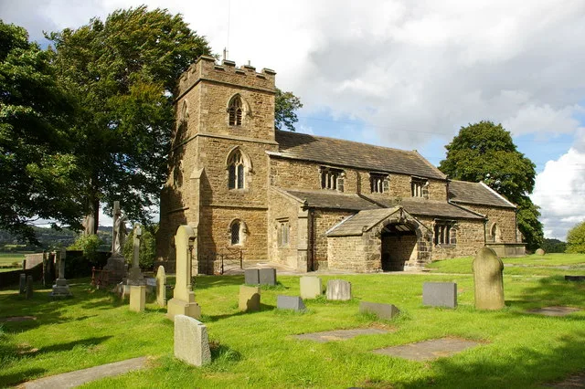
St James' Church, Altham
Historic churches · 2.5 km

Four Alls Inn
Historic pubs · 2.6 km

The Pinfold
Archaeological sites · 2.7 km
Nearby
📷 5📷 5Open-air theatres · North West England
Town Hall
town hall, now council offices, with theatre and ball-room in Padiham, Burnley, Lancashire, England, UK
📷 5📷 3Natural landmarks · North West England
Burnley Training Ground
Burnley Training Ground — a other in england-north-west, United Kingdom.
📷 5Caravan parks · North West England
Stubbins Vale Caravan Park
Stubbins Vale Caravan Park — a caravan park in england north west.
📷 3Museums · North West England
Gawthorpe Textiles Collection
Gawthorpe Textiles Collection — a museum in england-north-west, United Kingdom.
Where to eat & stay near Huntroyde Hall
Places to stay
📷 5Caravan parks · North West England
Stubbins Vale Caravan Park
Stubbins Vale Caravan Park — a caravan park in england north west.
 📷 5
📷 5Caravan parks · North West England
Bridge Heywood Caravan Park
Bridge Heywood Caravan Park — a caravan park in england north west.
 📷 5
📷 5Caravan parks · North West England
Harwood Bar Caravan Park
Harwood Bar Caravan Park — a caravan park in england north west.
 📷 5
📷 5Campsites · North West England
Wiswell Shay Farm CC Site
Wiswell Shay Farm CC Site — a campsite in england north west.
 📷 5
📷 5Hotels · North West England
Travelodge
Travelodge — a hotel in england north west.
 📷 5
📷 5Campsites · North West England
Bowley International Scout Centre
Bowley International Scout Centre — a campsite in england north west.
Places to eat & drink
📷 5📷 5 📷 5📷 5
Restaurants · North West England
Fence Gate Inn
Fence Gate Inn — a restaurant in england north west.
 📷 5
📷 5Historic pubs · North West England
Swan with Two Necks
Swan with Two Necks in England North West, United Kingdom.
 📷 7
📷 7Historic pubs · North West England
The Town Mouse Public House
The Town Mouse Public House in England North West, United Kingdom.
More historic houses in this region
 📷 3
📷 3Historic houses · North West England
116 Hospital Street, Nantwich
116 Hospital Street, Nantwich — substantial townhouse in Nantwich, Cheshire, England, UK.
 📷 3
📷 3Historic houses · North West England
140–142 Hospital Street, Nantwich
140–142 Hospital Street, Nantwich — grade II listed building in Nantwich, Cheshire East, Cheshire, England, UK.
 📷 3
📷 3Historic houses · North West England
46 High Street, Nantwich
46 High Street, Nantwich — house in Nantwich, Cheshire, England, UK.
 📷 3
📷 3Historic houses · North West England
64, St Ann's Road
64, St Ann's Road — Grade II* listed house in Middlewich, Cheshire East, England, UK.
Frequently asked questions
- Where is Huntroyde Hall?
- Huntroyde Hall is in Lancashire, North-West England, United Kingdom (postcode BB12 7QX), in the parish of Simonstone.
- What is Huntroyde Hall?
- Huntroyde Hall — a Grade II*-listed historic house in england-north-west, United Kingdom.
- How do I get to Huntroyde Hall?
- The nearest railway station is Hapton, about 3.4 km away. Drivers can use postcode BB12 7QX.
- Who owns Huntroyde Hall?
- Huntroyde Hall is owned by | designation1 = Grade II Listed Building.
- Is Huntroyde Hall a listed building?
- Huntroyde Hall is officially recognised as Grade II* listed.
- How do I get to Huntroyde Hall?
- The nearest railway station is Hapton, about 3.4 km away. Drivers can navigate to postcode BB12 7QX.