
Islands · Scottish Islands
Hunda
In or near St Margaret's Hope.
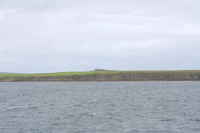
Hunda — island in Orkney Islands, Scotland, UK.

Wikimedia Commons contributors — see linked file page for photographer and licence licence

Plan your visit
- Typical visit
- 4 h–12 h
- Free entry
- Dog-friendly
Getting there & planning your visit
Hunda is an island located in the Scottish Islands, with coordinates 58.8542 latitude and -2.9775 longitude. There is no nearest railway station or postcode provided, and entry to the island is free.
About
Hunda is a island in the United Kingdom. It covers approximately 1 km². Part of Orkney Islands. Wikidata describes it as: "island in Orkney Islands, Scotland, UK". Coordinates: 58.8542°, -2.9775°.
Photo gallery
From the Wikipedia article
Hunda is an uninhabited island in the Orkney archipelago in Scotland. It is 100 hectares (0.39 sq mi) in extent and rises to 42 metres (138 ft) above sea level. It is situated in Scapa Flow and connected to the nearby island of Burray by a causeway built in 1941 to stop passage of small surface craft as part of the boom defences, and thence to the Orkney Mainland via the Churchill Barriers. The name is derived from the Old Norse for 'dog island'. The Vikings made the Orkney Islands their headquarters for their expeditions against Scotland and Norway, and the islands were under the rule of Norse earls until 1231. The island is rich in bird life, and contains a disused quarry. A small inlet in the northern cliffs is known as 'Sunless Geo'. Hunda is currently used to raise sheep and goats for wool.
Excerpt from Wikipedia under CC BY-SA 4.0. See the source article linked in Sources below.
- Coordinates
- 58.8542, -2.9775
Sources
- wikidata: Q2720148 (CC0)
- wikipedia: Hunda (CC BY-SA 4.0)
- commons: Bar Taing, Hunda - geograph.org.uk - 1314419.jpg (CC BY-SA 4.0)
Other places nearby

The Cairn Head, Broch
Burial mounds & barrows · 0.6 km

Gill Bay
Natural landmarks · 2.2 km
Dam of Hoxa
Natural landmarks · 2.3 km
Burray
Islands · 2.5 km

St Margaret's Hope Port
Harbours & ports · 2.6 km
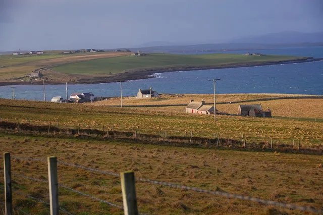
Dam of Hoxa
Mountains & hills · 2.8 km

Little Howe Of Hoxa Settlement
Archaeological sites · 3.0 km
Howe of Hoxa, Broch site
Archaeological sites · 3.0 km

Nevi Skerry
Islands · 3.1 km

Hoxa Hill
Mountains & hills · 3.2 km

The Wart
Archaeological sites · 3.2 km

Brough of Ontoft, site
Archaeological sites · 3.2 km
Nearby
📷 3Burial mounds & barrows · Scottish Islands
The Cairn Head, Broch
The Cairn Head, Broch — a burial mound in Scottish Islands, United Kingdom.
📷 5📷 5Natural landmarks · Scottish Islands
Dam of Hoxa
Dam of Hoxa — a natural feature in scotland islands.
Flagship📷 5📷 3Harbours & ports · Scottish Islands
St Margaret's Hope Port
St Margaret's Hope Port — harbour in Orkney Islands, Scotland, UK.
📷 3Mountains & hills · Scottish Islands
Dam of Hoxa
Dam of Hoxa — bay in Orkney Islands, Scotland, UK.
Where to eat & stay near Hunda
Places to stay
 📷 5
📷 5 📷 7
📷 7 📷 5📷 5
 📷 5
📷 5Hostels · Scottish Islands
Lynnfield Hotel and Resturant
Lynnfield Hotel and Resturant — a hostel in scotland islands.
 📷 5
📷 5More places in this region
 📷 5
📷 5Islands · Scottish Islands
Bac Beag
Bac Beag — Scottish island, part of the Treshnish Isles in the Inner Hebrides.
 📷 5
📷 5Islands · Scottish Islands
Bac Mòr
Bac Mòr — island in Argyll and Bute, Scotland, UK, one of the Treshnish Isles.
 Flagship📷 3
Islands · Scottish Islands
Baleshare
Baleshare — flat tidal island in the Outer Hebrides, Scotland, UK.
 Flagship📷 5
Islands · Scottish Islands
Barra
Barra — island in Outer Hebrides, Scotland, UK.
Frequently asked questions
- Where is Hunda?
- Hunda is in the Scottish Islands, United Kingdom.
- What is Hunda?
- Hunda — island in Orkney Islands, Scotland, UK.
- How do I get to Hunda?
- The nearest town is St Margaret's Hope. Its coordinates are 58.8542°, -2.9775°.
- Is Hunda free to visit?
- Yes, Hunda is free to enter.